Quote: Originally posted by cupcake  |
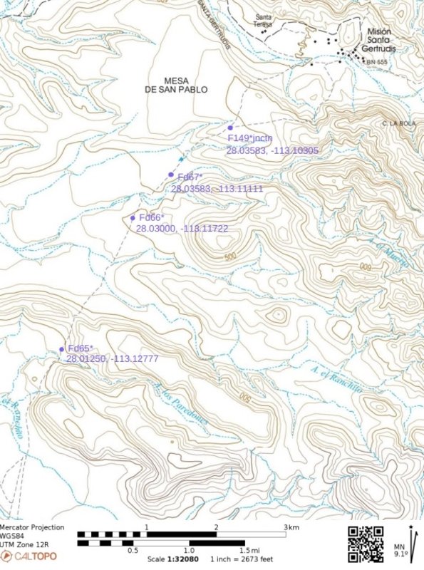
Harald, You cared enough to check, thank you. I just spot checked a few of my map waypoints and found they are as I intended. I used the Caltopo
website:
https://caltopo.com/map.html#ll=28.03475,-113.11094&z=14...
I was not too concerned about having my waypoints right on the ECR, and being off by 500 feet or so was ok with me; just being near enough to use for
navigation was what I wanted. When you say they are "way off" what kind of distances are you meaning?
My approach to this, because of the nature of my experience, is that my reading of the topo map and the actual terrain when I am on the ground, is the
most important, then compass direction, then GPS coordinates. So, for instance, if I think I see where I am on the map (the surrounding ground
features match my map), and direction of travel looks right (compass), and then the given GPS waypoint on my map is within 500 feet of what my GPS
device reads on the ground, then I am satisfied that this is my location, or nearly so. I would make any corrections to my GPS map waypoints in the
field, as I move.
Now, if you were to tell me that my waypoints are off by a mile, then that would alarm me.
I have no history of using GPS for navigation, so perhaps I will become more concerned with pinpoint GPS accuracy as I work with the technology.
|
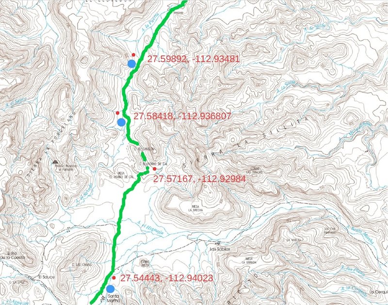
only one of the waypoints was on the trail.
You WILL get lost if the waypoints are not on the trail
even though this is an easy section of the trail - it is not that easy
28.04123, -113.10245 260ft off
28.00683, -113.13309 380ft off
27.97242, -113.13892 350ft off
27.93876, -113.12124 340ft off
27.91161, -113.12450 on trail
27.89507, -113.04159 488ft off
27.83437, -113.02683 on trail
27.82875, -113.00486 225ft off
27.81281, -112.97238 640ft off
27.80947, -112.96108 100ft off
starting at 27.745832°, -112.902059° you'll be on a real, recent road until Santa Marta - so no danger there.
[Edited on 10-20-2024 by 4x4abc] |