BajaNomad

Estimating steepest grade a vehicle can handle without stalling

RICHARDH - 1-4-2007 at 05:09 PM

I've now studied a few Baja travel guides, especially for the area between Guerrero Negro and C. Constitution (and over to the Sea of Cortez), and I'm ready to think more specifically of backroad access to wilderness areas.

In particular, Walt Peterson's book gives lots of information about backroads, including maximum grades (as specific numerical percentages). Many of those numerical percentages seem rather surprising. So I'm wondering if he is using the same measurement scale that, say, Caltrans uses for signs along (Alta) California highways. For example, Peterson says the grades on the way from Mex 1 to San Francisco de la Sierra are "no more that 14 percent" (gasp). From descriptions I've read, that road is an example of one I'd like to drive just to see the scenery and perhaps to do some hiking as well. The typical maximum grade I've seen posted on California highways is something like 6 percent. That's quite a big difference numerically from 14 percent. So I'm wondering if Peterson is using the same scale.

In particular, I would also like to drive my pickup/camper on one or more relatively steep grades in order to find a quantitative limit that I can compare to Peterson's values.

Does anyone have any good ideas on how I could conduct such a test? If stalling is necessary for testing purposes, the roadway should be fairly wide and straight -- no-stalling on steep, narrow, hairpin turns -- very dangerous. I know of some fairly steep grades that my pickup/camper will handle reasonably well, but I have no idea what the numerical percentages are for the grades.

Any ideas on how to get a handle on this?

bajalou - 1-4-2007 at 05:22 PM

Some paved well used highways in Utah are 12 percent - so 14 for a Baja Calif road would not be out of line. And I don't think I'd stall on 14%.

comitan - 1-4-2007 at 05:26 PM

Yes if its a road that is traveled you can go up it no matter what someone assigns a percentage to.

woody with a view - 1-4-2007 at 05:39 PM

you can always go up it in reverse. better gear ratio. go already!

Hook - 1-4-2007 at 05:41 PM

Is your cabover camper (fully loaded) actually overloading your truck? This is actually pretty common. Generally, any non-popup camper over 9-6 is actually over the laden weight limit of all the 3/4 ton pickups on the market. Of course, the seller wont usually tell you this. If it isn't, there's probably very little you cant conquer if you have traction.

What are the specifics on your rig?

If you're even close to being legal, there should be almost nothing you cant take in Baja except for some of the steepest dirt roads in remote areas. And there, it's probably not the best thing for your camper with that much stress on the frame.

I did do the La Vibora grade south of El Rosario with a 9-4 Lance Squire on the back of an F350 4x4 diesel with a 3.73 rear end, auto-tranny. Tires were simple M & S rated tires, not gnarly offroaders. Didnt come close to stalling in high range 4wd. Maybe Peterson refers to that grade for reference?

[Edited on 1-5-2007 by Hook]

Skipjack Joe - 1-4-2007 at 06:30 PM

RICHARDH,

Have you ever taken Hwy 108 over Sonora Pass? I don't know the exact numbers but it's close to 17%.

To my mind a lot of it has to do with your lowest gear. Years ago I drove a 3-speed 6 cyl dodge van over La Cuesta from El Arco to San Francisquito and managed to stall it several times. First gear was just inadequate.

A few years later I came back with an automatic chevy 3/4 ton truck with a low granny gear and that thing went everywhere (on firm ground). The problem with a steep uphill is that all of your pots and pans end up sliding to the back door. What a surprise when you open it.

A 4WD is really comforting though. But not necessary.

Glad you're into Peterson's book. He gives a lot of valuable information for backcountry exploration.

[Edited on 1-5-2007 by Skipjack Joe]

RICHARDH - 1-4-2007 at 06:33 PM

Hook, mechanics tell me that my cab-over camper is too much weight for my 1984 Ford Ranger mini-pickup -- I've gone through two transmissions, two right-rear axles, and a set of U-joints on this vehicle.

So basically I'm trying to take an engineering aproach to this question.

Also, the drive is two-wheel with 5-speed standard transmission, an apparently oversize differential, and a V6, 2.8 liter engine.

I'd like to get an accurate idea of what my physical limits are.

TacoFeliz - 1-4-2007 at 06:53 PM

RICHARDH

As good a job as you can do 'armchair engineering', the map is still not the territory. In most cases, simple dirt roads will take you anywhere you want to go in Baja. Pucker factor will often dictate what is and what isn't an acceptable angle of travel. Many times I have found that my truck was capable of going places I wasn't comfortable going.

More important is that you take care not to drive into anything you don't know for sure that you can drive out of, and travel with another vehicle, particularly when you are way out in the weeds. Several of the areas you have noted in your posts are remote and not frequently traveled, so sitting around waiting for help might be a really long wait.

My two cents worth is that you'll see plenty of wide open spaces without any death defying off-roading. Trails are all over the place, and ranchos and fish camps and great campsites. You'll have a great time - - just pay attention.

RICHARDH - 1-4-2007 at 06:54 PM

Quote:
Originally posted by Skipjack Joe
RICHARDH,

Have you ever taken Hwy 108 over Sonora Pass? I don't know the exact numbers but it's close to 17%.


Thanks, Joe. I usually take Hwy 88 over the Sierra Nevada (both ways). Are you talking about the eastern approach to Sonora Pass? Or would that be the western approach? I seem to recall that I may have chickened out for fear of not being able to get back the same way. Or perhaps I may have even chickened out on the western approach. That was some time ago. I was towing a Mitsubishi Mirage then and probably took the pass both ways with the Mirage.

I guess I may try Hwy 108 on my way down to Baja.

David K - 1-4-2007 at 07:06 PM

Hi Richard,

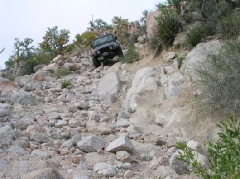
Don't worry... You should have seen Hook master his big camper up the La Vibora Grade!

Hook's camper is just rounding a switchback in the background... We just climbed up from the Rosario riverbed (way down)...


Hook's BIG camper is the third in this line up following my '01 Tacoma and Bob H's Ford 4X4...


A really, really steep Baja grade is the 'widowmaker' just over a mile from Mision Santa Maria...


The steepest paved roads in Baja are the Cuesta del Infierno outside of Santa Rosalia and the recently paved road to the observatory with a steep pitch west of the Meling Ranch.

In the old Baja days, the road between Puertecitos and Gonzaga had the steepest 4WD grades... Now a well graded dirt highway is in its place... although the surface is currently very rough!

Skipjack Joe - 1-4-2007 at 07:08 PM

Both ways are steep. From the west the stretch right after the turnoff to Kennedy Meadows is really something. The road from the east above Leavitt Meadows varies considerably but there is one stretch with a beautiful overlook below that's just amazing. It's hard walking up that thing. That's beautiful country though. Right at timberline. Lots of glacial polish.

Trouble is, it's winter now and all snowed in until Memorial Day.

Hook - 1-4-2007 at 07:38 PM

RichardH, an oversized differential? Do you mean that a rebuild increased your rear axle ratio (which would be a good thing for climbing).

Skippy Joe, do you venture into the Leavitt Meadows area much? The wife and I did a horse packing trip into that area two summers ago and really liked it. It was about my 6th or 7th multiday packer trip. We had them drop us 12 miles in for five day in a remote location with all our own gear. Great day hiking from there. Also did a day ride through Leavitt Meadows a couple years before.

Frank - 1-4-2007 at 10:36 PM

Quote:
Originally posted by RICHARDH
Hook, mechanics tell me that my cab-over camper is too much weight for my 1984 Ford Ranger mini-pickup -- I've gone through two transmissions, two right-rear axles, and a set of U-joints on this vehicle.

So basically I'm trying to take an engineering aproach to this question.

Also, the drive is two-wheel with 5-speed standard transmission, an apparently oversize differential, and a V6, 2.8 liter engine.

I'd like to get an accurate idea of what my physical limits are.


The mechanics are telling you the camper is too heavy for your truck. Your truck is telling you the camper is too heavy for it too. You have gone through 2 transmissions, 2 right rear axels {thats the drive side btw} 2 sets of u joints. These items are what puts the power to the ground.

My engineering instincts tell me you need a bigger truck{read more beef} or a smaller camper.

jerry - 1-4-2007 at 11:13 PM

i f it was me i would be more worried about going down those steep grades
if your over loaded so are your brakes if you stall going up your stopped and can jump out
brakes hold a lot better going forward then in reverse sepecaly overloaded brakes

you gotta be good to back down those hill with brakes failing

AmoPescar - 1-5-2007 at 01:41 AM

THIS HILL MIGHT BE TO STEEP


http://www.youtube.com/watch?v=Pk7mozEpa2o

Amo :yes:

Ford Ranger Capabilities...

Cameron - 1-5-2007 at 10:46 AM

Hi Richard!

I'm with Frank (And your Mechanic.) on this one. The '84 Ranger is rated for 1260 to 1500 lbs. payload, and I believe you're probably asking too much of your truck.

If I remember correctly from reading some of your previous posts, you've got a cabover camper and occasionally you tow a trailer as well. The camper alone is probably putting your truck at or over the safe operating limit, and I'm not surprised to hear you've had a problem on steep grades.

If you want to keep hauling your camper (..And maybe a trailer too.) around without blowing up your truck on a regular basis, I think it's time to start looking for a full-sized replacement for your Ranger.

If you're looking for more ideas or advice about your truck's limits, and/or possible upgrades to your (Ford) engine/transmission/suspension , check out the Ford Truck Enthusiast website at: http://www.ford-trucks.com, or "The Ranger Station" at: http://therangerstation.com. The FTE site is especially good, with model-specific forums packed with helpful info.

Suerte!.. Cameron

David K - 1-5-2007 at 11:07 AM

Good video Amo!

Do you have that one taken at Moab... SUV going down the granite face and no brakes!?

Its all about Gear ratio

Geronimo - 1-5-2007 at 09:20 PM

You need to find your gear ratio; Tire size, Trans Gears, and rear axle ratio. Trany Gears should be somewhere on the internet, I believe that you have a Mazda 5 speed in there. You might have a tag on your dif cover that has your ratio, if not. Jack your truck up(both rear tires). Mark your drive shaft and turn the tire one time, count the revs of the drive shaft. 4lo.com and others have calculators for RPM and other usefull info. You might be able to figure something out for the asphalt, dirt is another topic all together. Best of luck on this trip, you have a lot more courage than I.

AmoPescar - 1-5-2007 at 10:14 PM

LION’S BACK CRASH...MAYBE TOO STEEP????

David K. - This might be what you are talking about…at The Lion’s Back, Moab, Utah.

http://www.youtube.com/watch?v=fpbkTncjEOs


Here’s another video of the same hill….quite a view looking over the hood coming down!
http://www.youtube.com/watch?v=ablhrZw0h3I

Seems like this hill was TOO steep to climb!!!
http://www.youtube.com/watch?v=ouWJa6FC7-E

David K. amd all you Toyota owners will like this one…
http://www.youtube.com/watch?v=-2fflm4B950


Hope you enjoy the videos!

Amo :D

David K - 1-6-2007 at 10:40 AM

Yah, that first video was it!

The others are good too... Thanks!

RICHARDH - 1-6-2007 at 04:11 PM

Quote:
Originally posted by RICHARDH
... and probably took the pass both ways with the Mirage.


That is, I drove the Mitsubishi up to Sonora Pass from the Kennedy Meadows area, and probably did so several times. I remember hiking (a loop) south up Blue Canyon, then east over to the Pacific Crest Trail, then north to Sonora Pass, and then west down the highway back to the car, and I also remember hiking northeast up an apparently unnamed canyon just northwest from Blue Canyon and then east out to the highway. As you say, that's beautiful country. Very!! I may have driven the Mitsubishi over to the eastern side maybe as far as US 395 and then back to Sonora Pass and the Kennedy Meadows area. (But I probably didn't drive the pickup/camper up to Sonora Pass.)

Thanks for reminding me, Joe! As you point out, the highway will probably be snowed in and closed when I head out for Baja, and, besides, Sonora Pass is a bit out of my way.

Do you happen to know what the (maximum) percentage grade is for Hwy 88 leading up to Carson Pass from the east? I'm pretty familiar with that one?

RICHARDH - 1-6-2007 at 04:26 PM

Quote:
Originally posted by Hook
RichardH, an oversized differential? Do you mean that a rebuild increased your rear axle ratio (which would be a good thing for climbing).


The radiator, the differential, and the rear bumper are apparently special, heavy-duty stuff; everything else is apparently standard. The pickup belonged to a county transportation department before I bought it. I think the pickup was probably special-ordered from the factory with that differential.

When the last transmission was installed, no care was taken to match the speedometer gear ratio to the existing differential. So now my odometer reads 20 percent in excess of the actual distance traveled. In other words, the engine probably turns over 20 percent more than it would with a standard differential covering the same distance traveled.

bajaguy - 1-6-2007 at 05:54 PM

Drove northbound on 395 last Saturday....Sonora, Monitor and Ebbetts passes are all closed

mtgoat666 - 1-6-2007 at 06:34 PM

Quote:
Originally posted by RICHARDH

Does anyone have any good ideas on how I could conduct such a test? If stalling is necessary for testing purposes, the roadway should be fairly wide and straight -- no-stalling on steep, narrow, hairpin turns -- very dangerous. I know of some fairly steep grades that my pickup/camper will handle reasonably well, but I have no idea what the numerical percentages are for the grades.


Measuring grade as percent is a matter of measuring rise over a horizontal distance (rise/run) -- look it up on the internet and I'm sure you can find a diagram.

To measure slope of a road, you can probably use an inclinometer (a level with a slope-scale apparatus). I have an architctural tool that does it (you can probably find in any good hardware store [maybe not home depot]). I have seen off-road shops sell chaep tilt meters that you can mount in vehicle cabs.

Seems to me not worth worrying about. If you find a paved road that you cant drive up, then back down. If your truck can't handle the steeperst paved street you find in your local hilly town, and you are losing sleep over the matter, then you better get another truck if you want to haul a camper. Or ditch the camper and take a tent!

Skipjack Joe - 1-6-2007 at 06:35 PM

Quote:
Originally posted by RICHARDH
Do you happen to know what the (maximum) percentage grade is for Hwy 88 leading up to Carson Pass from the east? I'm pretty familiar with that one?


The steepest part is climbing up from Red Lake to the pass itself. I would say it's around 9-12%. It's very similar to hwy 120 going east towards Tioga pass.

Regarding Leavitt meadows: I've hiked around there in the fall along the trails that the horsepacker's use but didn't run across any great fishing lakes. It's my understanding that if you hike in way back there you eventually cross the great western divide and into yosemite national park. I believe that there is a Dorothy Lake in there where the rainbows average 16" and there are lots of 20 inchers waiting for you fly.

That's too much hiking for my old legs. Have you ever been to Kirman Lake, Hook? It's one ridge south from Leavitt Meadows. There is a drop off point from hwy 108 and a 2 1/2 mile hike through sagebrush country to this little gem. It has trophy brook trout and a few cutthroats. The time to get them is Oct 1-15, when they are spawning. A size 18 pheasant tail stripped in on a slow sinking line. 20-25 fish a day is normal. You need to carry in your float tube. This picture was taken from there.

P.S. tenting in baja is a drag in my opinion. Setting it up and then taking it down. Wind blowing so hard you can't sleep at night.

[Edited on 1-7-2007 by Skipjack Joe]

brook_trout.jpg - 38kB

mtgoat666 - 1-6-2007 at 06:38 PM

Also, after you find the diagram on the internet and figure out how to measure grade -- you could build a slope meter using a weighted string, a level, and a plastic protractor -- and hang the contraption in the cab of your truck and always know the grade at any time.

RICHARDH - 1-7-2007 at 02:15 AM

Many thanks, Skipjack and mtgoat666.

What was puzzling me about what the definition could be is that percentage is usually a percentage of something, but discussion of grades usually do not specify what the percentage is a percentage of.

It turns out that the percentage is the percentage that rise is of run. (So a 45 degree slope is a 100 percent grade.)

Here's a URL.

http://www.bookrags.com/research/grades-highway-mmat-02/

ElGato - 1-24-2007 at 07:45 PM

:cool: The Grade or Percent grade may not be the most important consideration when climbing. My friend who lived in the Santa Cruz Mtns by San Jose,Ca. kept blowing engines going home. He couldn't understand why until he started talking with his mechanic and found out that the grade to his house was steep enough that the oil pump couldn't suck the oil due to the incline and as a result the engine wasn't being lubricated. Just passing along what happened to my friend.:?: