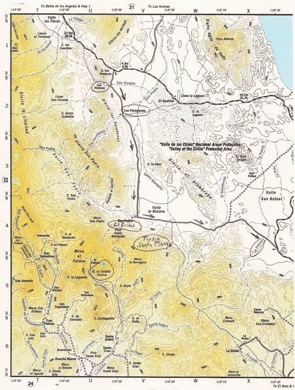
Originally posted by David K
A new Pemex was U.C. just east of Tecate near where you join the toll highway. If El Hongo is out, then try La Rumorosa... But remamber the Baja 1000
is running the 21 & 22 and all the support and spectator vehicles will likely be draining the Pemex storage tanks since the 1000 passes through La
Rumorosa and San Felipe!
Caravans that big may take a half hour to fill up!
Gas is now in the $2.70's per gallon around here, perhaps topping off in El Cajon before entering at Tecate... or going straight to Calexico (fill up
there) for a far easier and faster jump on San Felipe to avoid the mobs and gas lines along Hwy. 2 ??? Hope for gas at San Felipe... if not, or too
long lines, then Puertecitos, Gonzaga Bay, L.A. Bay have Pemex and no Baja 1000 mobs... |