Originally posted by Taco de Baja
| Quote: | Originally posted by TW
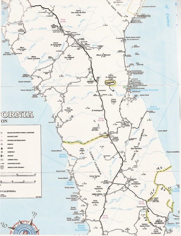
The road south of Chapala from hwy1 into San Antonio is a through road to the coast. It connects to the road going east from whats labeled as the
well. There are a couple of ranchos on the way. Makes for an interesting loop of about 80+ miles using this road and the one at Chapala.
|
How good is that road through the Sierra Columbia heading west from Rancho San Antonio to Blanca? I was last on it back in the late 1980's with my dad
and mom, and it was so bad we never went back. There is a reason why the map shows the road ending at Antonio  . Very pretty country, but it was a long slow trip. There were some nasty stair climbing sections that were almost
too steep and off camber to get up, plus deep ruts, potholes, boulders, etc., etc., etc. Some of the Jeepers would love it, but a full size
pickup....not.
. Very pretty country, but it was a long slow trip. There were some nasty stair climbing sections that were almost
too steep and off camber to get up, plus deep ruts, potholes, boulders, etc., etc., etc. Some of the Jeepers would love it, but a full size
pickup....not. |