BajaNomad

Puertecitos to Hwy 1

jedtimesaz - 12-8-2010 at 09:25 AM

I'm departing from Phoenix and I'm interested in crossing at Mexicali and traveling south to San Felipe and Puertecitos. What's the road like from Puertecitos to Hwy 1 junction? I'm driving a 31 foot Bluebird Bus (Wanderlodge). Thanks!

John

[Edited on 12-10-2010 by jedtimesaz]

David K - 12-8-2010 at 09:41 AM

The pavement ends in 20 miles, the next section is ready to open and may be (6 more miles), but the remaining 20 miles to Gonzaga Bay are WAY too rough for a motorhome... then there is 36 miles more of washboard graded road to Highway 1. It won't be a fun drive for you, I don't think. Maybe in a few more years? It took them 3 years to build the 20 miles of highway from Puertecitos to El Huerfanito.

See photos and road log posted earlier in this forum (I drove it last in July and others reported back last month following the Baja 1000 which used it).

Photos of the road and sites, and road log with travel time (in a Tacoma): http://forums.bajanomad.com/viewthread.php?tid=46887

[Edited on 12-8-2010 by David K]

David K - 12-8-2010 at 09:46 AM

Here are some photos:

The highway between San Felipe and Puertecitos was built in 1982-83 and pavement was added starting about 8 years later, but took a long time to reach Puertecitos. Because the job was done so poorly, with too little asphalt, the road was pretty torn up in just a few years. Total repaving occurred by 2008, however the roadbed is still full of sharp, sudden dips and high speed driving is not possible. The new highway south from Puertecitos is a different story!

Here are some photos north of Puertecitos, as we head south…


Now, the brand new section south from Puertecitos that was started in late 2008 and has taken a year and a half to get 20 miles, through some very difficult terrain…


There are two big, paved parking areas to enjoy the view between Puertecitos and El Huerfanito.


Beyond the sand piles marking the place to detour off the highway, is this warning.


Then, a mile past the sand piles is the unfinished bridge at the absolute end of new highway pavement.


The older road has been regarded along the 6.6 miles where the highway work is progressing, south of the bridge.


We have a lunch break with a view of the Enchanted Islands.


On south we go, 5-15 MPH.


This monument was located south of the Punta Bufeo road.


Bahia San Luis Gonzaga comes into view.


Rancho Grande’s new store… has most everything. The Pemex station was closed for siesta (2-4 pm). We arrived at 2:30… However, I could easily make it to Cataviña and probably to El Rosario on the tank I filled in San Felipe. It is just a good rule to always top your tank when you come to an open Pemex in the remote parts of Baja California.

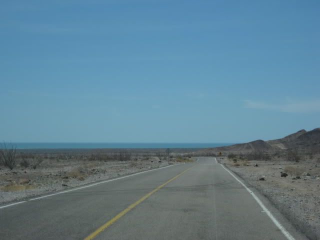
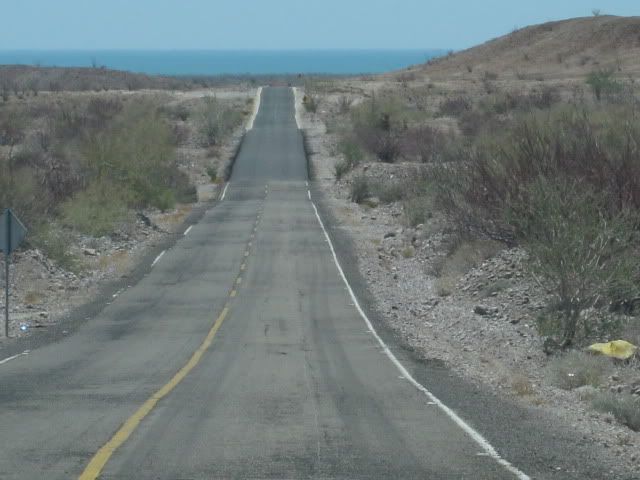
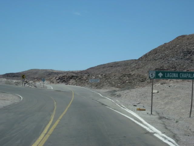
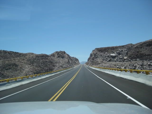
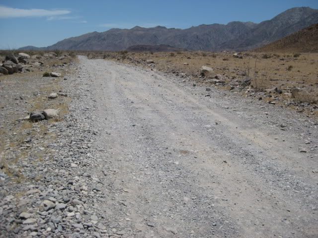
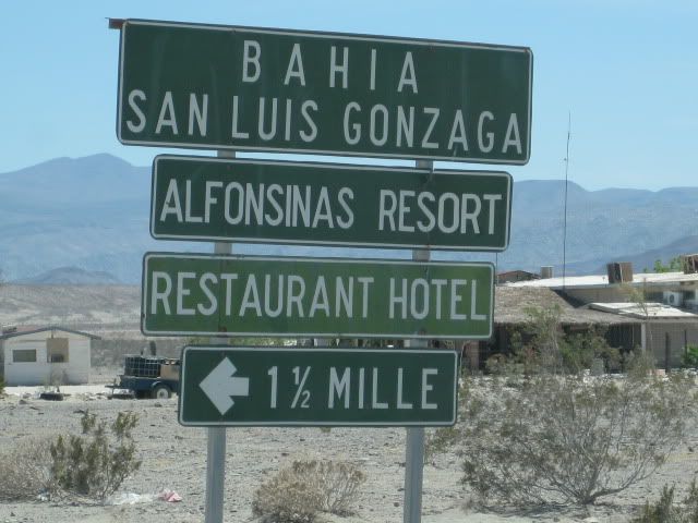
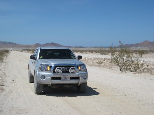
1.3 miles south of the Pemex and Rancho Grande store is the road to Campo Beluga and Sacrificio.


We drive away from Gonzaga Bay with the goal of reaching Baja Cactus in El Rosario, before dark!


The first boojum trees come onto view.


South of Coco's Corner, the road climbs over a mountain to reach Hwy. 1 at Laguna Chapala... 4WD not needed, but good tires are!


[Edited on 12-8-2010 by David K]

jedtimesaz - 12-8-2010 at 10:11 AM

Hi David, Thanks for the great photos! Does the ungraded road get much worse than depicted in your photos? My 1978 bus is a tank and has very high clearance and these roads are nothing worse than what I have driven in Arizona. The miles of undeveloped beach and lack of big trucks makes this an attractive, if very slow, route.
Thanks again

David K - 12-8-2010 at 10:16 AM

Quote:
Originally posted by jedtimesaz
Hi David, Thanks for the great photos! Does the ungraded road get much worse than depicted in your photos? My 1978 bus is a tank and has very high clearance and these roads are nothing worse than what I have driven in Arizona. The miles of undeveloped beach and lack of big trucks makes this an attractive, if very slow, route.
Thanks again


Okay, good... I didn't want you to think that it was all paved or smoothed over. It is rougher than it looks, even in a 4WD Tacoma... 5-15 mph for me (and I like driving fast off road) for the 20 miles north from Gonzaga Bay.

As long as you know what to expect, go for it! Please tell us about your trip when you return!

Have a great time! Campo Beluga is a nice campground (Baja-wise) if you are looking for a place to stay at Gonzaga Bay.


[Edited on 12-8-2010 by David K]

jedtimesaz - 12-8-2010 at 10:23 AM

Will do!

David K - 12-8-2010 at 11:20 AM

Oh, and welcome to Baja Nomad...!!!:biggrin:

Just so you know you are not getting 'special' treatment from me... it is PUERTECITOS :wow: but we all knew what you meant and more people spell it wrong than right, I think! :lol:

There are many things to see around Gonzaga Bay beside the water, if you have a 4WD toad or motorbike... Go to this index page of links to Baja sites centered around various destinations: http://vivabaja.com/tours/index.html

jedtimesaz - 12-9-2010 at 08:20 PM

Thanks for the correct spelling on Puertecitos! Might grab a dirt bike for side trips. Very much looking forward to exploring the upper eastern coast.
Onward!

mcfez - 12-9-2010 at 10:25 PM

jedtimesaz ...next time you spell Puertecitos incorrectly...David will use a rubber hose on you! Watch this guy......


Funny DavidK, each one of these pictures you posted...I can recognize the spot with ease. Guess I have been down that road way too many times :-) Great photo essay u did here

Before Puertecitos....stop by and grab a beer n dog at the Cow Patty. Mention my name in there and they will treat you "real well" :no:

bryanmckenzie - 12-10-2010 at 09:07 AM

Excellent photo-inventory, David. Provides a nice reference link for future questions.

David K - 12-10-2010 at 09:09 AM

Thanks... I like your map-photo posts as well!:bounce::light:

BajaBros - 12-10-2010 at 09:43 PM

David, whenever you are at Alfonsina's stop by lot 57. I would really like to meet you.

David K - 12-10-2010 at 11:04 PM

Thank you... it may be awhile before the economy lets us have too much fun, so if you are around north San Diego County drop me a u2u or email... beer/ sodas in fridge and Baja books, movies, talk anytime!

"I can see the road. We can go a little further."

Mulegena - 12-10-2010 at 11:25 PM

From those photos, David, the road really changed since I crossed it in 1996.

Everybody in San Felipe and all the guidebooks said it was for 4x4 high-clearance trucks, but there was a need for a wild and beautiful adventure which motivated me.

That drive provided it.

The roof provided lunch al fresco and a most-excellent vantage to view the miles of purple wildflowers in February.

A couple of unexpected big bumps-- and all the cupboard doors flew open as La Borega nosed into the earth. When we parted with the '65 Dodge 318 there was still oatmeal in the carpets.

Its Baja.
Its Beautiful

[Edited on 12-11-2010 by Mulegena]

PT9Baja - 12-28-2010 at 09:32 AM

I drove up 5 last March. The washboard sections really get annoying and can rattle parts off any vehicle.We exploded 2 shocks in our F250 and I thought I was taking it easy. I carry a DR 650 in the back for side trips and going for help if needed. Washboard ,washboard and washboard are your 3 biggest problems on the lower part of the road. Hidden sharp vados on the old pavement can get you. The new stuff is great.

desertcpl - 12-28-2010 at 10:09 AM

my 2 cents,, I wouldnt take a motorhome thru that section, your just asking for problems,, not that you cant make it,, but things will come apart, and yes its is alot worst than the pixs show

MoFish - 12-29-2010 at 10:06 AM

the new section is open, Be careful the end is not marked well. it has caused it's first tragedy.

David K - 12-29-2010 at 10:13 AM

Quote:
Originally posted by MoFish
the new section is open, Be careful the end is not marked well. it has caused it's first tragedy.


How about some more details, please?

How long is the next, new section (10 km./ 6 miles) and does it include going over the bridge at the former end of pavement?

What was the 'first tragedy'?

Thank you!!:bounce:

redhilltown - 12-30-2010 at 12:49 AM

David K...from your pics...I just can't BELIEVE there is a sign that says "Laguna Chapala" on that road!!!! Just doesn't seem right ;D 
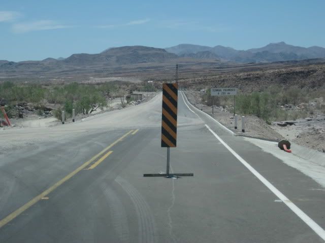
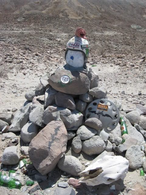
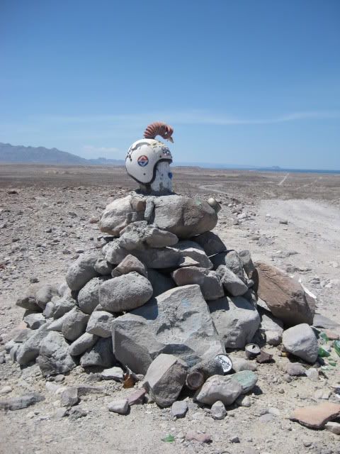
The final sign of the Apocalypse.

David K - 12-30-2010 at 08:55 AM

Actually, there is also a sign for Laguna Chapala (or was) at Km. 0 near San Felipe... where you turn off the airport road. I think it had three places: Puertecitos, El Huefanito 100 km., and Laguna Chapala.

Yah... the end of an era for sure...

When they built the graded road from Chapala in to Puerto Calamajue in the early 80's and specially when they built the graded road south from Puertecitos in '86, was the big change. For the first time allowed easy access with a passenger car to Gonzaga.

redhilltown - 1-3-2011 at 11:53 PM

I still say in the wonderful and nutty tradition of Mexico the road will never be finished. It has taken years to get this far and even with that, there is still the huge stretch between the end of pavement now to Gonzaga...much less all the way out to Chapala. Even IF that is done, they will still have to build or completely repave the road from San Felipe to Puertecitos....can you even imagine the "Oh S#*% Dip" with many big rigs and heavy traffic? The deep deep grooves in the asphalt tell quite a story there.

David K - 1-4-2011 at 08:09 AM

Quote:
Originally posted by redhilltown
I still say in the wonderful and nutty tradition of Mexico the road will never be finished. It has taken years to get this far and even with that, there is still the huge stretch between the end of pavement now to Gonzaga...much less all the way out to Chapala. Even IF that is done, they will still have to build or completely repave the road from San Felipe to Puertecitos....can you even imagine the "Oh S#*% Dip" with many big rigs and heavy traffic? The deep deep grooves in the asphalt tell quite a story there.


Right you are, and it has been reported that a new direct Hwy. 5 will shoot straight south from near the San Felipe arches (so avoiding cross town traffic and stops) and probably be running the same route as the original Puertecitos road via the sulfur mine?

redhilltown - 1-5-2011 at 12:03 AM

That would certainly make more sense. As we all know the current road from San Felipe south is not an engineering marvel and chunks will be lost in the first hurricane/flash flood. Yet, the new road south of Puertecitos IS amazing! I can just see 30 years from now people coming south for the first time wondering what is the history of this incredible 20 mile stretch of road in the middle of washboard and rocks as far as the eye can see!

David K - 1-5-2011 at 12:38 PM

I think the contractor that built the highway to Puertecitos in the 1980's-90's ended up in jail for cheating the government.

He didn't grade the road for highway speed and he used so little asphalt that it was 50% gone in less than 10 years.

The new contractor finished repaving the whole thing about 3 years ago, but didn't fix the crazy dips!

The government inspector okayed the final check for the first contractor after FLYING over the road to Puertecitos to verify it was completed... Never checking the road itself or doing core samples to check thickness of asphalt. :o

2009 oh sh dip - xmas 175-r.JPG - 42kB

mcpuitar - 1-5-2011 at 02:08 PM

Quote:
Originally posted by MoFish
the new section is open, Be careful the end is not marked well. it has caused it's first tragedy.


Has anyone heard more information about this first accident at the new end of pavement? Guessing it must have been on a moonless night at fairly high speed, since there's a pretty long straight-stretch of roadway leading up to the end that makes it easily visible in daylight. But it'd be a pretty gnarly drop-off if someone were to be dozing or driving without high-beams on at night. Hope they lived to tell about it.

MoFish - 1-5-2011 at 07:49 PM

the end of the road had a steep drop of about 10 feet at a 40 degree angle a car had flipped over don't no about the people, didn't look good. ive heard the encroachment has been improved since.

redhilltown - 1-6-2011 at 12:32 AM

Quote:
Originally posted by David K
I think the contractor that built the highway to Puertecitos in the 1980's-90's ended up in jail for cheating the government.

He didn't grade the road for highway speed and he used so little asphalt that it was 50% gone in less than 10 years.

The new contractor finished repaving the whole thing about 3 years ago, but didn't fix the crazy dips!

The government inspector okayed the final check for the first contractor after FLYING over the road to Puertecitos to verify it was completed... Never checking the road itself or doing core samples to check thickness of asphalt. :o


Great pic David K! I wonder if anyone has one of the gouges in the road AFTER the dip! If the Chapala road DOES ever go thru and traffic increases, I think I'd invest in an axle shop 'bout in that vicinity! But it ain't gonna happen...we are talking millions to finish the Chapala road and then millions to refinish the road south of San Felipe. I wonder what the general feeling is for the residents of Gonzaga? Happy for a new road and a bumpy-less ride home or sad for the end of their quiet retreat?

CortezBlue - 1-6-2011 at 07:38 AM

Quote:
Originally posted by jedtimesaz
I'm departing from Phoenix and I'm interested in crossing at Mexicali and traveling south to San Felipe and Puertecitos. What's the road like from Puertecitos to Hwy 1 junction? I'm driving a 31 foot Bluebird Bus (Wanderlodge). Thanks!

John

[Edited on 12-10-2010 by jedtimesaz]


John
Welcome. I live in Mesa as well. I go to San Felipe about twice a month. If you want to bypass the Mexicali experience, there is a new road that you can exit Araby Rd. to Hwy 195, a very nice, mainly, 4 lane road. It will drop you on Hwy 95 and you can cross at San Luis. Once you are across the border you turn right at Cuota 2 or 2d. This is a toll road that will take you to Hwy 5 south of Mexicali. If you want to meet to discuss u2u me your phone number and I will give you a call.

bonanza bucko - 1-6-2011 at 08:52 AM

I drove THAT ROAD in my 2010 F150 4X4 three weeks ago. There are two or three places that a motor home will not be able to go through IMHO. Both are draws with big and sharp rocks that can't be avoided...you gotta drive over them. You could make it through if you jacked the thing up a couple of times. The rest of the road is just rough!....big washboard, some sharp rocks. Be especially wary of any hill....down or up...you will find that they turn really bad fast.

Don't be enticed into a lousy trip by the pretty pictures.....this "road" is not a road but a tough trail.

BB

BajaDave - 1-6-2011 at 12:18 PM

Quote:
Originally posted by MoFish
the end of the road had a steep drop of about 10 feet at a 40 degree angle a car had flipped over don't no about the people, didn't look good. ive heard the encroachment has been improved since.


I'm pretty sure this accident you are thinking of happened at the end of the previous section, where they were building the long bridge at Huerfanitos. I was down there at that time, and right after that happened is when they put the big pile of dirt on the pavement where you were supposed to exit.

It was back in May... a carload of guys drove off the end of the pavement at the bridge's north approach. I think it happened at night. At least one of the guys was hurt and in a real bad way, and was picked up by ambulance. I don't believe anyone died.

The end of the newest paved section does not drop off very far, maybe 4 or 5 feet, but there's a big pile of dirt that would ruin your day if you hit it.

Can you confirm this is not the accident you're thinking of?

[Edited on 1-6-2011 by BajaDave]

MoFish - 1-7-2011 at 11:15 AM

the accident i was making reference to was on Dec. 24 they have graded the encroachment since