After resting up from the big hike, later Saturday afternoon we took a drive to see the La Olvidada (The Forgotten) Barite Mine. Along the way and on
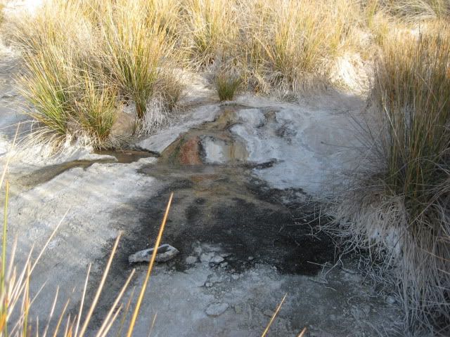
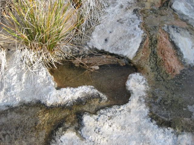
the return we take a look at the White Slope of springs just east of Arroyo El Volcan.
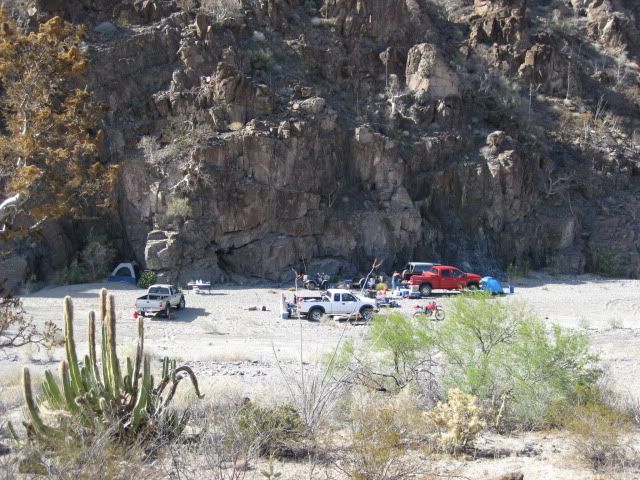
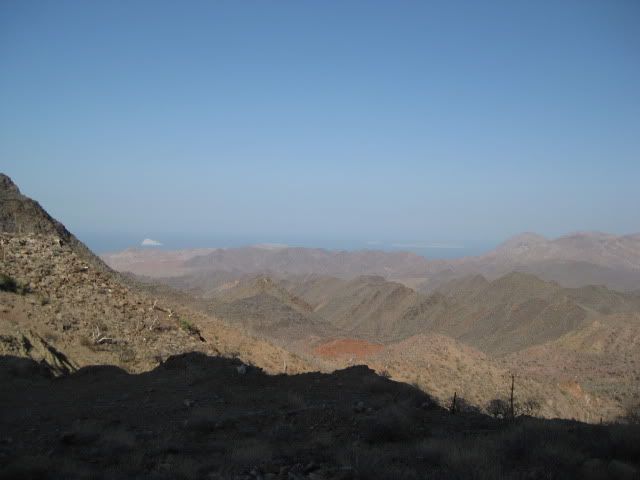
Looking down at our camp area, as we drive east.
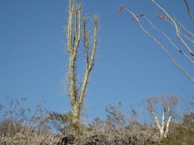
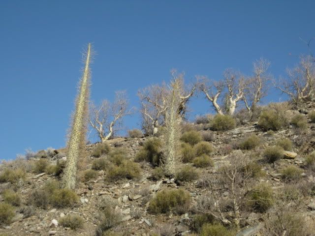
We see some boojum trees as we get close to the mine area.
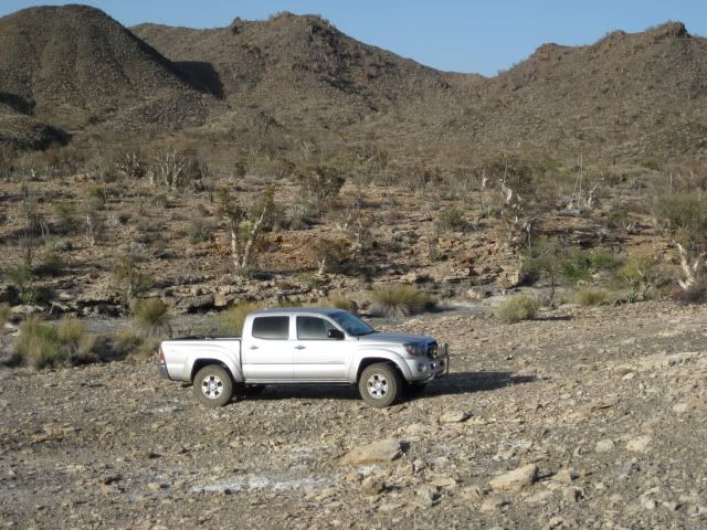
The road to the mine from El Marmol has been recently graded and is 2WD friendly.
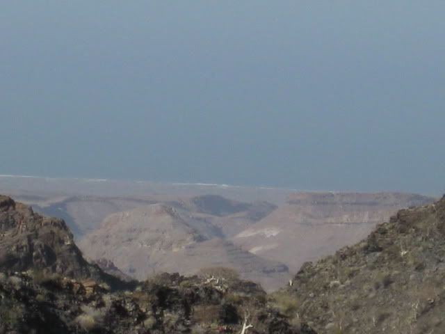
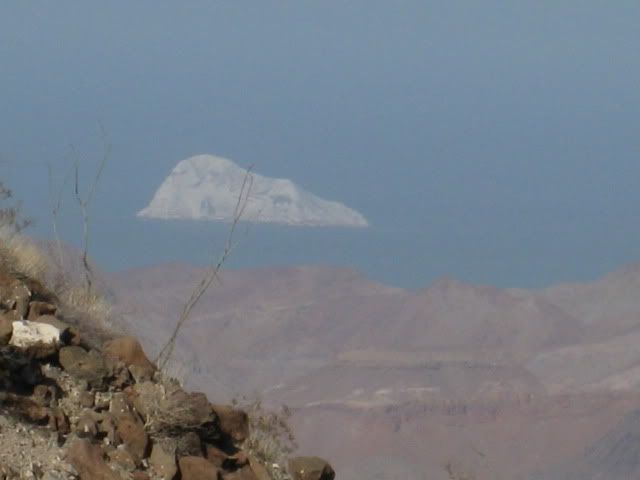
Our first view of the Sea of Cortez (Gulf of California) from the road.
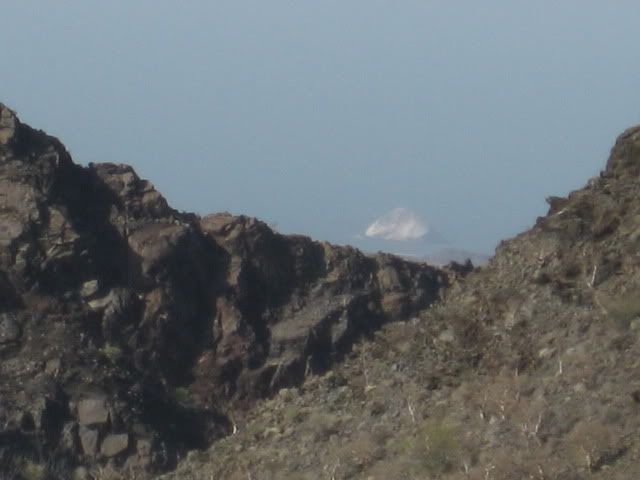
That is Isla El Huerfanito (The Little Orphan).
Other islands come into view from the end of the road, 6 miles from Arroyo El Volcan.
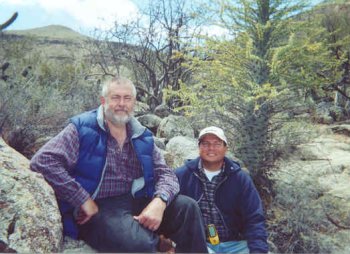
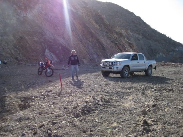
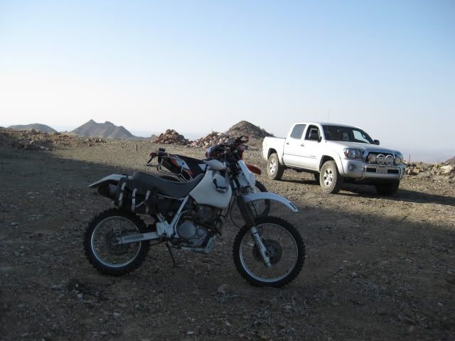
Phil (XRPhlang) and David (dtbushpilot) also ride up to the mine with us.
More boojum trees as we head back.
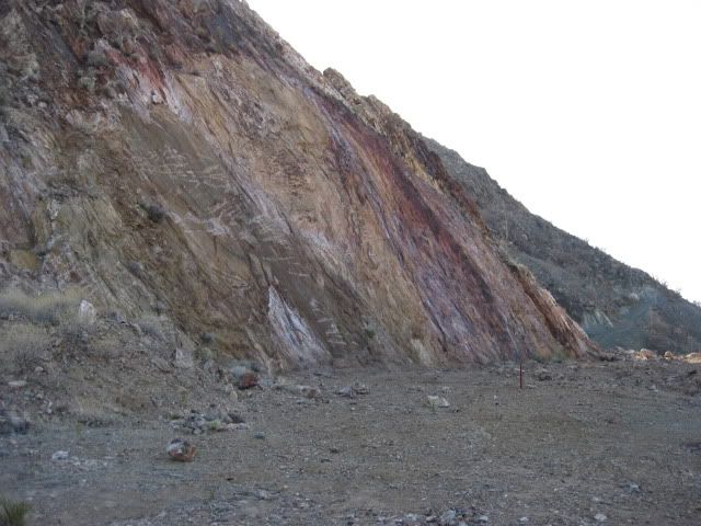
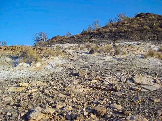
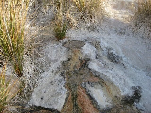
The white slope of tiny springs.
Coming next... EL VOLCAN, BAJA'S COLD WATER GEYSER!
[Edited on 5-12-2011 by David K]woody with a view - 5-7-2011 at 09:04 AM
that tent tucked up into the rock face looks perfectly situated to catch a falling rock or rockslide.David K - 5-7-2011 at 09:16 AM
Quote:
Originally posted by woody with a view
that tent tucked up into the rock face looks perfectly situated to catch a falling rock or rockslide.
Those motorcycle riding guys live dangerously!
===================================================
OKAY, who wants to know what barite is? (from Wikipedia)
Baryte, or barite, (BaSO4) is a mineral consisting of barium sulfate.[2] The baryte group consists of baryte, celestine, anglesite and anhydrite.
Baryte itself is generally white or colorless, and is the main source of barium. Baryte and celestine form a solid solution (Ba,Sr)SO4.[1]
The name baryte is derived from the Greek word βαρύς (heavy). The American spelling barite[2] is used by the USGS[7] and more
often used in modern Scientific journals including those published by the Netherlands-based Elsevier journals. The International Mineralogical
Association adopted "barite" as the official spelling when it formed in 1959[citation needed], but recommended adopting the older "baryte" spelling in
1978,[8] notably ignored by the Mineralogical Society of America. The American Petroleum Institute specification API 13/ISO 13500 which governs baryte
for drilling purposes does not refer to any specific mineral, but rather a material that meets that specification, in practice this is usually the
mineral baryte.
The term "primary baryte" refers to the first marketable product, which includes crude baryte (run of mine) and the products of simple beneficiation
methods, such as washing, jigging, heavy media separation, tabling, flotation. Most crude baryte requires some upgrading to minimum purity or density.
Baryte that is used as an aggregate in a "heavy" cement is crushed and screened to a uniform size. Most baryte is ground to a small, uniform size
before it is used as a filler or extender, an addition to industrial products, or a weighting agent in petroleum well drilling mud
UsesSome 77% worldwide is used as a weighting agent for drilling fluids in oil and gas exploration to suppress high formation pressures and prevent
blowouts. As a well is drilled, the bit passes through various formations, each with different characteristics. The deeper the hole, the more barite
is needed as a percentage of the total mud mix. An additional benefit of barite is that it is non-magnetic and thus does not interfere with magnetic
measurements taken in the borehole, either during logging-while-drilling or in separate drill hole logging. Barite used for drilling petroleum wells
can be black, blue, brown or gray depending on the ore body. The barite is finely ground so that at least 97% of the material, by weight, can pass
through a 200-mesh (75-μm) screen, and no more than 30%, by weight, can be less than 6 μm diameter. The ground barite also must be dense
enough so that its specific gravity is 4.2 or greater, soft enough to not damage the bearings of a tricone drill bit, chemically inert, and containing
no more than 250 milligrams per kilogram of soluble alkaline salts.[7]
Other uses are in added-value applications which include filler in paint and plastics, sound reduction in engine compartments, coat of automobile
finishes for smoothness and corrosion resistance, friction products for automobiles and trucks, radiation-shielding cement, glass ceramics and medical
applications (for example, a barium meal before a contrast CAT scan). Baryte is supplied in a variety of forms and the price depends on the amount of
processing; filler applications commanding higher prices following intense physical processing by grinding and micronising, and there are further
premiums for whiteness and brightness and color.[7]
Historically baryte was used for the production of barium hydroxide for sugar refining, and as a white pigment for textiles, paper, and paint.[2]
Although baryte contains a "heavy" metal (barium), it is not considered to be a toxic chemical by most governments because of its extreme
insolubility.
===========================================
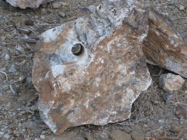
I got a chunk of rock piled up outside the mine, and it is strangely heavy for its size... like metal would be. TMW - 5-7-2011 at 09:21 AM
Phil had moved the tent there because of the high winds knocking it down when it was closer to his truck. However on Saturday night the winds took it
down again and he wound up sleeping in his truck. Several comments and jokes were made about the rocks overhead on that wall. With the high winds I'm
surprised none fell while we were there.David K - 5-7-2011 at 09:33 AM
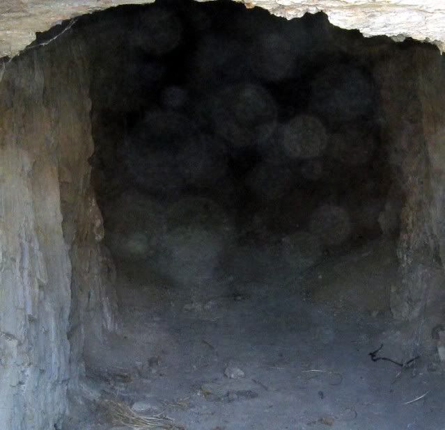
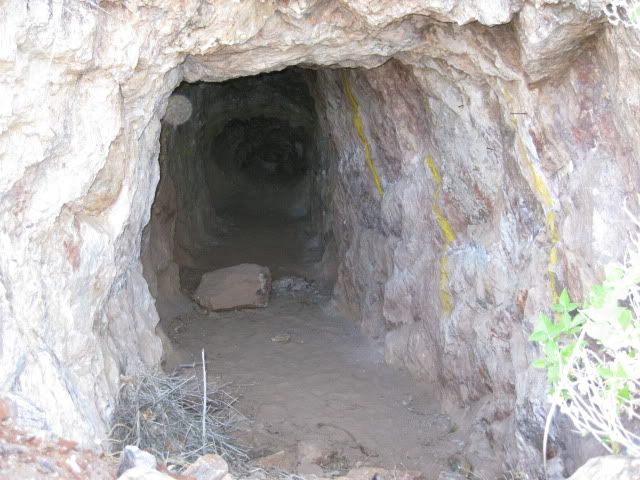
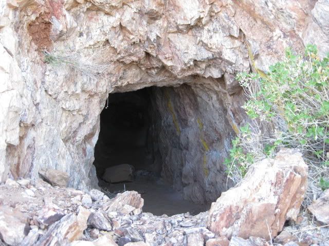
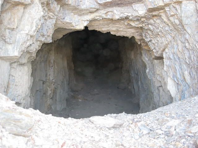
Here are two more photos looking into mine shafts at La Olvidada barite mine:
(a high number of 'spirit globes' are in the photos, not well seen in these reduced for Nomad images)
[Edited on 5-7-2011 by David K]woody with a view - 5-7-2011 at 10:04 AM
i can see them. how far did the shaft go? was it blocked or did it seem they just left it?Cypress - 5-7-2011 at 10:27 AM
David K., Thanks for the adventure sharing. The old mine is probably a haven for
bats.David K - 5-7-2011 at 10:55 AM
Quote:
Originally posted by woody with a view
i can see them. how far did the shaft go? was it blocked or did it seem they just left it?
Here is a close up to maybe see the globes better... I believe they are just a dust reflection, but ELINVESTIG8R (who has shown his photos of globes
before at El Metate) believes they are spirits...
El Vergel went into one of the shafts... I will let him tell you more... but, I think the two shafts at the end of the new road are new and not very
deep. The older mine (down below?) that ELINVESTIG8R photographed a couple years ago has a door on the entrance and I think he said goes 70 some feet
back into the mountain.ELINVESTIG8R - 5-7-2011 at 11:29 AM
JUST TO AUGMENT MINA LA OLVIDADA PICTURES PROVIDED]
PLEASE SCROLL DOWN TOWARD THE BOTTOM TO SEE MINA LA OLVIDADADavid K - 5-7-2011 at 09:32 PM
Thanks David... They have done a lot of work since you were last there... the road is all rebuilt/ graded from El Marmol (10 miles), with a big level
area scraped off the side of the mountain with new mine shafts... not very deep. The ore is super heavy, like iron...Ken Cooke - 5-7-2011 at 09:40 PM
keep the photos coming, David!David K - 5-7-2011 at 10:07 PM
Yes... will do Ken... Lot's at El Volcan... See also Vern's (El Vergel's) thread 'Santa Isabel' where I am posting some of his photos and video clips
(soon)!AmoPescar - 5-7-2011 at 11:54 PM
So much cool stuff to see in Baja!
Thanks for sharing with those of us who are stuck at home!
Michael David K - 5-8-2011 at 06:21 AM
Quote:
Originally posted by AmoPescar
So much cool stuff to see in Baja!
Thanks for sharing with those of us who are stuck at home!
Michael
Happy to share!
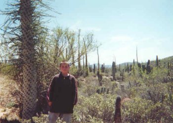
Remember where we were exploring 10 years ago? Here's a photo of Amo Pescar and David K (hiking with Neal Johns and Chris K) on the Golfo Camino Real
at Rancho San Gregorio (April, 2001):


 The old mine is probably a haven for
bats.
The old mine is probably a haven for
bats.