BajaNomad

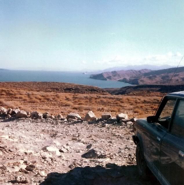
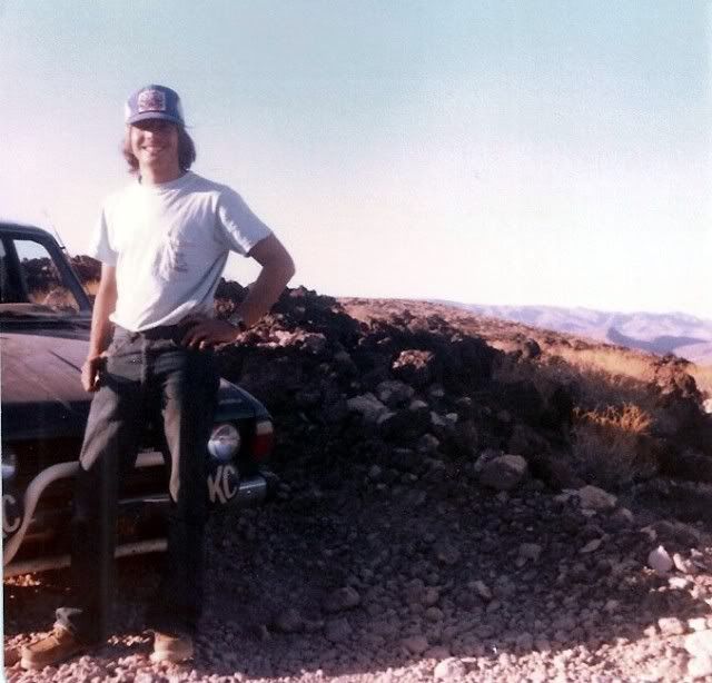
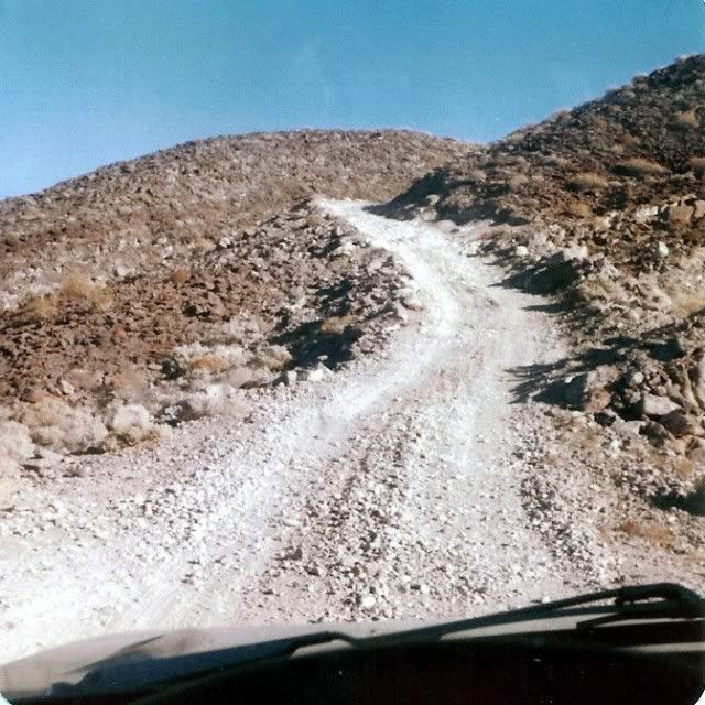
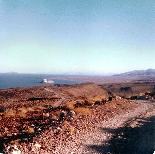
Does anyone remember, "THAT ROAD"? Add a photo if you have one!

Ken Cooke - 4-2-2012 at 09:02 PM

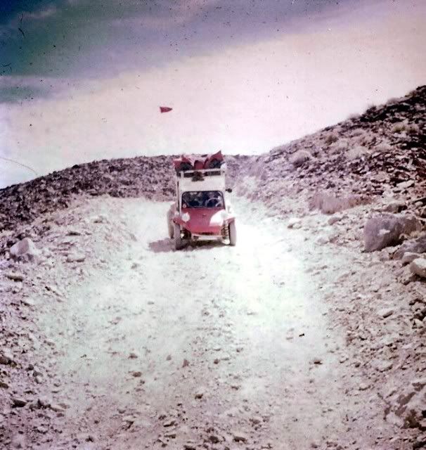
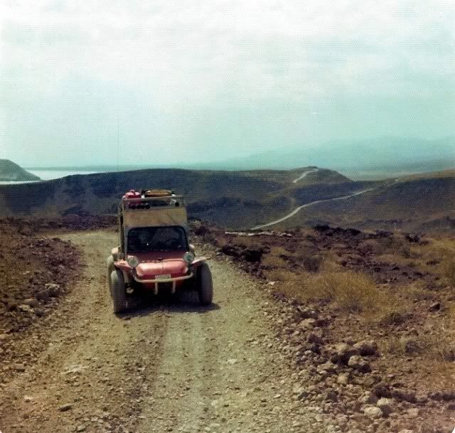
Travel down, "That Road" requires lots of friends and spare parts!

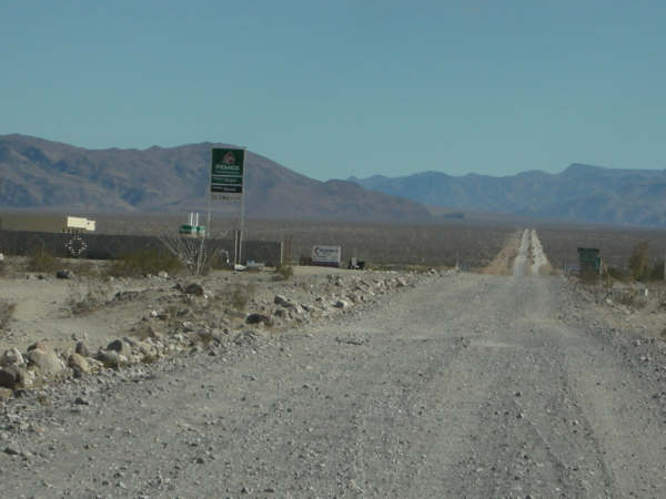
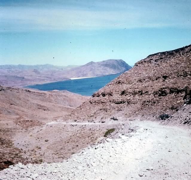
"That Road" north of Puertecitos


Looking North along, "THAT ROAD"


The old road sign - TOWN LIMITS - PUERTECITOS


Reassessing our readiness to travel past Puertecitos


Taking the plunge - driving south along "THAT ROAD"


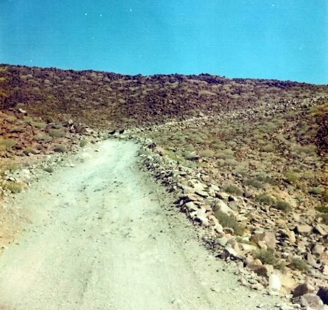
Before the road was reconstructed, the scenery was much better along, "THAT ROAD"


Ateo - 4-2-2012 at 09:12 PM

Perfect.

THAT ROAD provided excellent opportunities for beach camping and cross country bicycling

Ken Cooke - 4-2-2012 at 09:23 PM

'CG's Ford Explorer


Bicyclists


Catching up with Mike the Baja Explorer and a group of bicyclists!


Sturdy tires are a must for THAT ROAD


The back of Mike's Toyota Tacoma - As shown in the film DUST TO GLORY!:bounce:


Talking with the bicyclists who bicycled to CABO SAN LUCAS!:wow:


Before a superhighway was built here, you could take all day talking to new Baja travelers. Que lastima...


The drive into Gonzaga Bay won't look like this much longer...:(


Fernweh - 4-2-2012 at 10:13 PM

Jan 2009 going back home.....


Somewhere on "This Road", my friend James thought he had a transmission failure.......
but he only kicked the transfer case into neutral, due to "The Road"

[Edited on 4-3-2012 by Fernweh]

David K - 4-2-2012 at 11:40 PM

2005... north to Gonzaga and Puertecitos:


2006:


2007:


2008... Shell Island to Gonzaga and beyond:


The new highway south of Puertecitos had begun, only about 2 miles paved in Sept., '08...


Fernweh - 4-3-2012 at 01:03 AM

Nice pics David K, but too much air in the tires - then:yes:

David K - 4-3-2012 at 01:32 AM

Quote:
Originally posted by Fernweh
Nice pics David K, but too much air in the tires - then:yes:


Huh, really? I seem to be floating on the sand just fine at 15 psi... :light:


(or are you following me on TW? :lol: )

bufeo - 4-3-2012 at 07:20 AM

Ken, I thought you meant that road. You know, the one before the 1984 improvements. Sheesh, the '84 was an Interstate compared to the real road.

I do have photos of the real road, but I don't let them hang out on the internet. :biggrin:

Allen R

bonanza bucko - 4-3-2012 at 07:21 AM

We are going to miss THAT ROAD! It was without doubt the absolute worst road that ever existed....well, kinda existed since it wasn't really a road. There will be tall tales and lies told about it by old timers who drove it for years and years. It will get worse as the stories get told and retold.

I spent 25 years flying over it into Alfonsina's before I had to drive it the first time. I thought I had some idea about it after all those hours looking down on it. I was completely astounded at how really bad it was....and how really good it was too!

Here's my first contribution to the tall tales to come:

The Tres Marias will live in my memory forever....you can't forget them. When we drive now...at about 50 MPH...past the spot where the Ray Grove memorial was we still look over the edge of the cliff...he's down there still. He went over the side sometime in the distant past...some say it was in 1973 others say in the '60s. I don't know. But there was an old Cross on the edge of the cliff made of lath sometimes and sometimes Ocotillo branches with a sign "RIP Ray Grove" and an old hat stuck on top. It was always there....must have been restored about every six months by somebody. Maybe somebody needs to resurrect it along the new pavement. I'm sure Ray...whoever he was...would like that. It's alleged that he has found down there a thousand feet below the top of the Tres Marias in the spring with a bottle of Jim Beam in his boney hands....the place was called "Jim Beam Hill" after that...at least according to legend.

I'm sure there are Chupacabras hiding along that road...have to be there!

BB

mcfez - 4-3-2012 at 07:42 AM

That road.......the worst for me was when the paved road outside of San Felipe had potholes.....millions(!).......for miles. Took three birthdays to get down to Puertecitos. But it will be missed.......sort of :-)

bufeo - 4-3-2012 at 08:31 AM

Quote:
Originally posted by mcfez
That road.......the worst for me was when the paved road outside of San Felipe had potholes.....millions(!).......for miles. ...


I remember someone saying "...those potholes were big enough to have their own ZIP codes".

We thought so too.

Allen R

baitcast - 4-3-2012 at 08:41 AM

posted on 11-22-2003 at 10:30 PM

Gonzaga Bay 1964.....My first date with three sisters


This was a trip report I made a year or so ago on the old Amigos board and thought maybe some of you nomads might get a kick out of it.

A friend of mine asked me if I wanted to know a good spot to go fishing,you bet I said where?....a place in mexico on something called the sea of cortez,lived in huntington bch in those days,jest a hop skip and jump and I would be there great!!!

My friend drew up a map for me,just bought a 64 vw bus and he said I was ready to ,all I had to do was drive down to a bay called Gonzaga and meet a old guy by the name of papa he would show me where to fish,so I packed up the bus,wife two kids and a friend......

He also said I might have a problem or 2 on the road but everything should be fine,I thanked him.
I have always thought that stupidity must be blessful,for in those days I was my late 20,s and still stupid but happy and was always game to try anything if it had anything to do with fishing!!.....

My friend had also mentioned it might get a little hot it was july and I should plan on it ,no problem I borrowed one of those window coolers you hang on the outside of the rig,there I took care of the heat problem,went out and bought a map which gave mileage and some other stuff,we were ready to go.

The trip........

left huntington bch late on night ,should be in san felipe by morning, puertecitos a couple of hours later ,Gonzaga for lunch,everything went smoothly,arrived in san felipe on time , and now the dirt I can,t wait finally the trip starts,not 10 min,s later we were stuck in a sand pit,I could still see san felipe,this is not what I had in mind,I did bring a shovel,half hour later we were on our way again........

the going was a little slower than I had planned but no matter we were headed south,finally puertecitos dead ahead,getting a little tired,the kids are a bit loud,my wife is talking to herself not loud something about this #$%^ road

I couldn,t make out the other things ,my friend is saying nothing by now,stopped for some gas in town,while there a gringo came by and asked where we were going I said Gonzaga Bay its just down the road a ways from here!!!
Left the window cooler at the station,does,nt work going 10 15 miles anyway,he thanked me.......

Not2 mins out of town I lost track of the road saw nothing but rock,know its here somewhere.....

going is slow ,its very hot,my oldest daughter is getting sick.......

and my wife ...I can hear her now she is getting mad it me,how could I do this to to her and the kids.......

I was very reasurring and told her the bay was just over the next rise,having no idea what I was talking about,the map I just bought mentions something about three hills that must be climbed and we are in them....

God help us.....

the first two we just made,we are at the bottom of the last and my wife wan,ts to go home,she wan,ts to get out and walk,no problem dear we will get over this we,ll have it made,I put my foot in it and up we go,going slower I see a rock ledge dead ahead must slow down,now stopped can,t make it over,put my foot on the brakes and start to slide back down the hill.....

at the bottom of the canyon my spots several wrecks,poor souls never made it,we are now backing down the hill,my hands are shaking,kids are crying,my friend is white faced,tried once more but could not get over the ledge.....

one thing left to do back down to the bottom,told everyone to get out and walk,just what my wife wanted to do in the first place.......

Well this time I made it ,felt like rocky on top of that mountion.......

flat lands dead ahead,I am numb between the ears but know we are getting close.....

No sooner than we get to the bottom of the hills and I,m stuck again in the sand,will this never end???


Digging and more digging,starting to get pretty good at this though...can,t be to far,daughters temp. is still up,monster headache,finally arrive at papa,s late in the day but find just a couple of old house,s and a shack or two and no trees,

I check my map my friend gave me,I,m suppose to go down the canyon just before papa,s,he said the fishing was best there and a nice beach so I turned around and made for the canyon,found a set of tracks to follow,you guessed it stuck again only this time no amount of digging is going to get us out,

my friend said he would watch the family for me so now I,m walking back to papa,s,sometime later I arrive in camp and this little old man come,s up to me smiling and said something,he already knew what the problem was ,

first thing you know chichi his son and a man with a big rig shows up ,things appeared to be a little slow in camp anyway this would everyone something to do ......

Didn,t take long for them to get us out.......Guess we will stay at papa,s place,the ground looks firm and I,m not moving,the wife got the kids in the water for a cool down and I and my friend enjoyed the best and the coldest beer we have ever drank to this day.

After a wonderful nites sleep we got up and started looking for shade,no trees what do you do for shade I asked he smiled and pointed toward his front porch........

Lucky for us papa had started to build a big cabana all it needed was a roof,so my first day of vacation we finished the roof.....still lots to this vacation but you get the idea,lots to learn but having fun,going home no problem all the up hills were now down hills and I knew what firm ground looks like,when we hit the highway at san felipe we all smiled and my wife leaned over and gave me a big kiss and said when we come down next vacation maybe we should go a month or so sooner,might not be so hot.

must be a road in there somewhere:lol: the last climb.


[Edited on 4-3-2012 by baitcast]

BEFORE 1986!!!

David K - 4-3-2012 at 09:41 AM

Oh, okay... for those who think the bulldozed graded road built from 1985 to 1987 was bad... Like Baitcast shows and tells, it was the 'Jeep Trail' built in the 1950's that was a real adventure... Then after Highway One was finished in 1973, all traffic for Gonzaga Bay came in from the south and the road below Puertecitos stopped getting any traffic (except for the Baja 1000)... and a few loco gringos (like me in '74, '75, and '79 when it was nearly impassable).

5 hours to drive the 45 miles to Gonzaga from Puertecitos was rushing it!

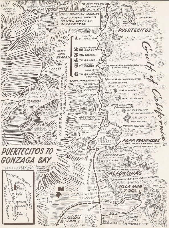
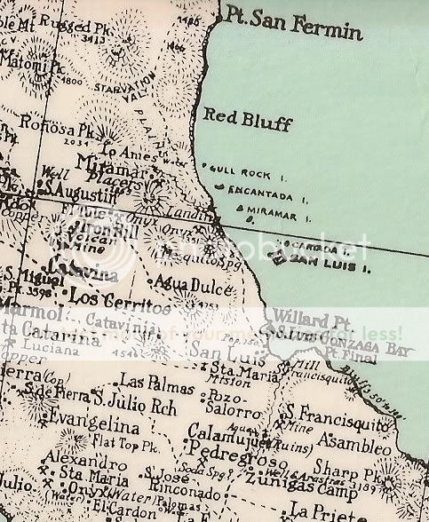
Cliff Cross's 1970 Baja Guide Map spells out each grade:


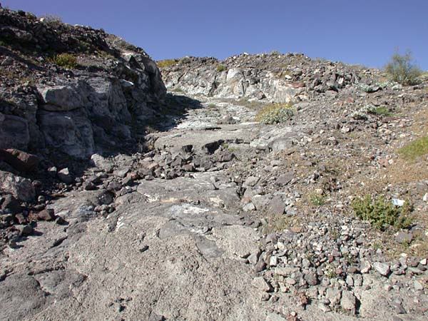
They were long or they were crazy steep... and by '79, they were just chunks of broken and unbroken lava!


See the two burros?


1979:


Yes, the 1970's and 1960's over 'The Road' were really something... and it made the destination of Gonzaga Bay all that more special! It is too bad that Ken Cooke never got to experience it... but maybe through our photos and stories, he and other Nomads can! :light:


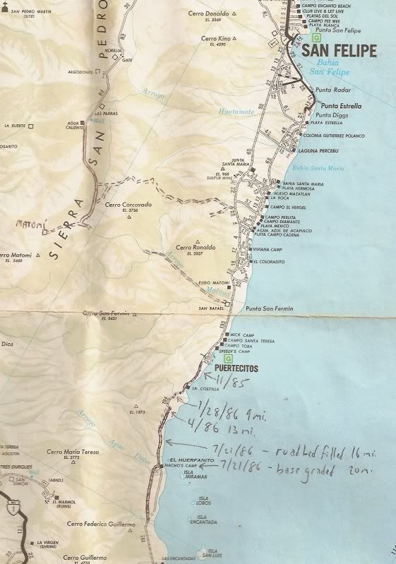
On this Auto Club map, I made notes each trip in the '80's as to how far the NEW graded road had reached, south of Puertecitos:


While some call this new highway a blessing, others will call it a curse...

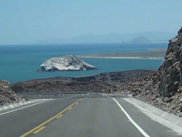
Highway 5 approaching EL HUERFANITO (July, 2010):


willardguy - 4-3-2012 at 10:03 AM

david, cliff cross's map shows the area of punta final as "villa mar y sol". do you recall this?

David K - 4-3-2012 at 10:18 AM

Quote:
Originally posted by willardguy
david, cliff cross's map shows the area of punta final as "villa mar y sol". do you recall this?


Yes indeed... What happened was that Villa Mar Y Sol was developed there, but THEY DIDN'T OWN THE LAND! :lol:

Sound familiar? The property was owned by Josefina of Rancho Santa Ynez... and once they got the Villa Mar Y Sol people out, they changed the name to Punta Final (for the nearby point)... Josefina wanted a road to connect her two places via Mision Santa Maria... Fred Hampe built the road to a point 2 miles from the mission towards Punta Final, and stopped at the edge of the great canyon. Highway 1 was soon finished and the need for the road ended. Josefina had asked President Echeverria to build it, but all she got was the paved driveway to her ranch. Engineers put the new road east from Laguna Chapala.

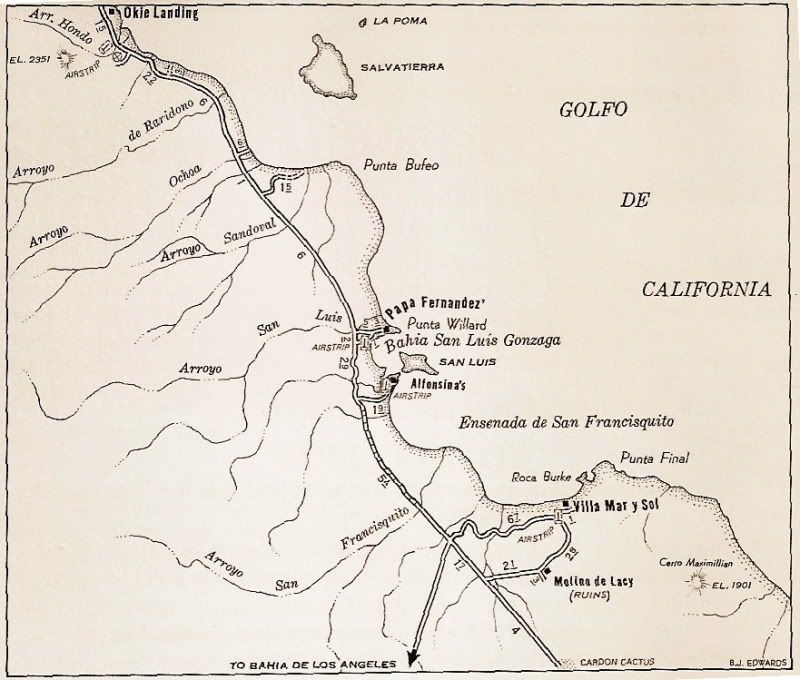
The location was originally 'Puerto de San Francisquito', where supplies for the nearby gold mines and mill (Molino de Lacy) were off loaded. Molino de Lacy was originally 'Molino de San Francisquito', run by William Lacy who is burried there.

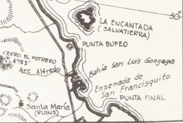
The big bay most call Gonzaga is actually 'Ensenada de San Francisquilto' (Bahia San Luis Gonzaga is the bay between Papa Fernandez' and Alfonsina's... some call 'Willard Bay' ... which is named for Willard Point). Even the modern topo maps have it all wrong or mixed up. :wow:

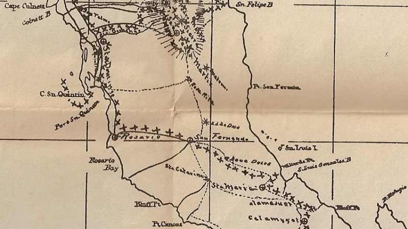
Howard Gulick's map of 1962 has it correct:


[Edited on 4-3-2012 by David K]

bacquito - 4-3-2012 at 01:15 PM

So much history, Thanks

bufeo - 4-3-2012 at 01:33 PM

Quote:
Originally posted by David K...Howard Gulick's map of 1962 has it correct...


So, how do you know Gulick got it correct?

The pilot I have ("corrected and printed in 1928") printed by the U.S. Navy indicates that the larger bay is "Gonzaga (San Luis Gonzaga) Bay" and the smaller of the two as "Willard Bay".

Allen R

P.S. You needn't post all the Gulick maps.

[Edited on 4-3-2012 by bufeo]

Ken Bondy - 4-3-2012 at 01:42 PM

South of Puertecitos:

woody with a view - 4-3-2012 at 03:16 PM

ATTABOY Rob!!!!

i knew you were for real! i got some trails just like that on the other side and there is this little beach where the fish grow REALLY big.......

David K - 4-3-2012 at 03:22 PM

Quote:
Originally posted by bufeo
Quote:
Originally posted by David K...Howard Gulick's map of 1962 has it correct...


So, how do you know Gulick got it correct?

The pilot I have ("corrected and printed in 1928") printed by the U.S. Navy indicates that the larger bay is "Gonzaga (San Luis Gonzaga) Bay" and the smaller of the two as "Willard Bay".

Allen R

P.S. You needn't post all the Gulick maps.

[Edited on 4-3-2012 by bufeo]


It has nothing to do with Gulick, other than he got it right (as did Cliff Cross, if you look at his 1970 map)...

The bay was named by the Spanish Jesuits who explored the Gulf of California and provided many of the place names we still use today. Padre Fernando Consag even returned to Bahia San Luis Gonzaga in 1753 to baptize some native children there... and assigned them to the distant, 2 year old mission of Santa Gertrudis.

The bay of importance, where ships could anchor was the north or smaller bay. The Spanish built a warehouse to store supplies offloaded for their new mission of San Fernando... and perhaps earlier for the nearby mission of Santa Maria. This was the San Luis Gonzaga of history. The ruins outline can still be seen on the shore of the smaller, north Bay of San Luis Gonzaga, midway between Papa's and Alfonsina's.

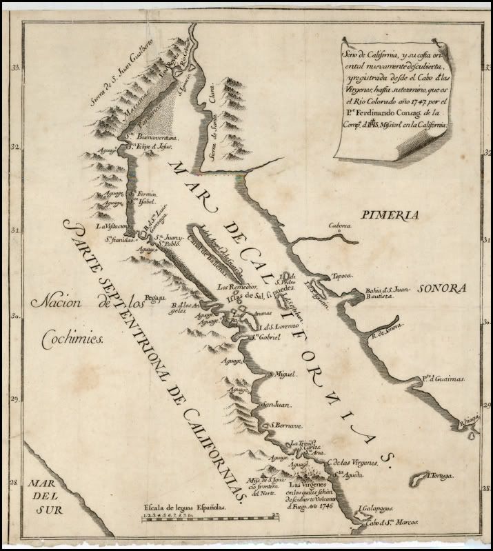
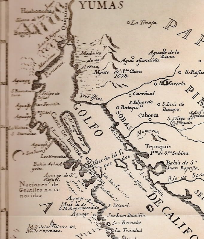
On this 1747 map, is the oldest I have with San Luis Gonzaga shown (that year, the northernmost mission was San Ignacio)


On the 1757 Jesuit map... again San Luis Gonzaga is named and it is the bay with an island in the middle.


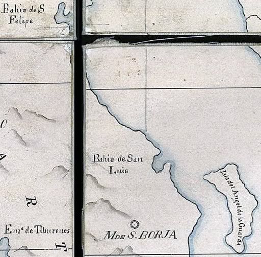
1823 map, the bay name is shortened to San Luis:


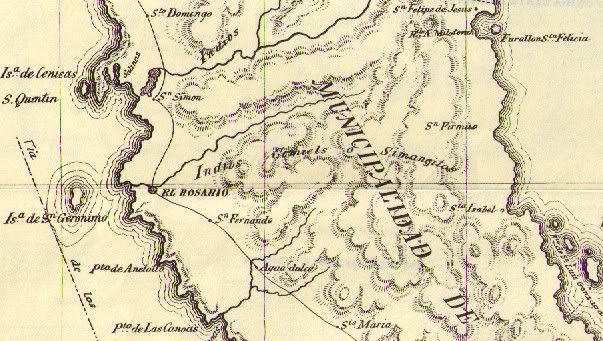
On this 1864 map:


Now, the U.S. Navy came along and assigned their own names to many places in Baja..

On 10-11-2010, Baja Nomad Steve in Oro Valley posted this:

Quote:
Originally posted by Steve in Oro Valley
Hi everybody:

Willard, If I am not mistaken, was a surveyor, plant explorer with the Mexican boundary survey in about 1855?

His name is part of the scientific name for the Sonoran palo blanco tree which is commonly seen on the slopes of Tetas de Cabra hill near San Carlos Bay in Sonora. That name would be Acacia willardiana (Willard's Acacia). Other plants from Sonora may contain reference to his name....

The Sonoran palo blanco is not to be confused with the palo blanco of Baja California Sur which is Lysiloma candida....

Willard's name may show on American made maps of long ago but newer Mexican maps use their own local and often Mexican names for place names...


Steve in Oro valley


In 1907, we see the first use of 'Willard Point' assigned to the north entrance to the bay:


In 1905, we see the bay name shortened to San Luis by this map maker, and shows the mill of San Francisquito (Molino de Lacy):


On Goldbaum's 1919 map, we see the first time the two bays are switched:


But in 1930, just the point is again called Willard:


as it also is in 1941:


So when Gulick started making his excellent maps in the 1950's, he went with the historic name of the bay.


But, I cannot fault anyone for using the term 'Gonzaga Bay' to apply to both halves... afterall 'Ensenada de San Francisquito' IS a mouthfull! :light::yes:

willardguy - 4-3-2012 at 03:33 PM

david, are all your maps available on a site?

David K - 4-3-2012 at 03:37 PM

Yup, right here on Baja Nomad!:light: See the Historic Intersts forum... You can also go directly to my Photobucket Maps Album, I believe Baja is good for your mind and health... check your u2u!

bufeo - 4-3-2012 at 07:06 PM

I have all those maps...and more (including Spanish pilots from the 18th century and none places the name of Ensenada de San Francisquito on that bay), but while they're nice to look at they don't answer my question, and, quite frankly, an answer really doesn't matter except you're such a pedant for "historical" accuracy.

Here I quote from a letter to me from Pete Gerhard dated July 1971, "Quite right, Allen, we sometimes used (or misused [and he inserted a question mark here]) other names for places in an effort to thwart copyright enfringement [sic]" This was in reference to a question I raised with PG regarding names for a rancho, spring, and nearby arroyo on one of their maps. His explanation was reasonable and since the specific names I questioned would not lead some unsuspecting expeditioner astray they were harmless. This was a common practice, as you know, of cartographers.

My point is, and I'm not trying to impugn your sources, that often these names we find in Baja California are, in a word, arbitrary. After all, Consag, himself, spelled his name Konscak, Konsag and Konschak on separate documents, so it should not be a surprise that the little bight between Punta Final and Punta Willard might possess another name, perhaps even a pseudonym. What's "correct" is open to discussion.

The more important issue is that folks are interested in the past, and, specifically for us here on Baja Nomad, the past of Baja California.

One of my most cherished possessions is a map that I acquired in a little antique shop in northern Florida about fifty years ago. I had just been introduced to the land that lay south of California, and my wife and I were on a trip to the east. I found in this little shop an original Isaac Tirion (1765) map of Arizona and Baja California. Unfortunately, it offers us no hint about the little bay we're discussing.

It's an engaging little map and on it are myriad spelling differences from the modern, and even other historical maps of the period. The different spellings (e.g. "St. Quintins Baay") are wonderful view into the past. The mixture of Dutch, Spanish, German, and the gross misplacement of islands and land fixtures are simply a look at one cartographer's attempt at an expeditioner's aid.

They're all good.

Oh, and by the way while we're at it ("Just for fun", of course. :D)

Quote:
Originally posted by David K...The big bay most call Gonzaga is actually 'Ensenada de San Francisquilto' ...


It's Ensenada de San Francisquito without the 'l'. Just thought you'd like to correct that.

Allen R.

[Edited on 4-4-2012 by bufeo]

David K - 4-3-2012 at 11:23 PM

Oh yes, thank you... that was indeed a typo...

I love the research and no matter what the outcome, none of us were there when the names were applied... well, I do take an exception for at least two in Baja (Shell Island and The Widowmaker) ;D

Cool you exchanged with Peter Gerhard... I did meet Howard Gulick back in 1966 or so and we (with my dad) discussed our route to La Paz and Cabo from Tijuana. He autographed my Lower California Guidebook, then.

I am working on a new mission book with another author, and I have cited Gerhard and Gulick as one of my references...

Have you ever researched the meaning of Punta Bufeo?

bufeo - 4-4-2012 at 07:24 AM

Quote:
Originally posted by David K...Have you ever researched the meaning of Punta Bufeo?


Yes.

Allen R

David K - 4-4-2012 at 07:27 AM

Quote:
Originally posted by bufeo
Quote:
Originally posted by David K...Have you ever researched the meaning of Punta Bufeo?


Yes.

Allen R


Does it take a Pacifico to learn of your findings? ;D

bufeo - 4-4-2012 at 08:41 AM

Quote:
Originally posted by David K...Does it take a Pacifico to learn of your findings? ;D


"A" Pacifico??? My time is worth much, much more than that.

Anyway, I didn't find what one might say is "unimpeachable" information.

One source (our landowner, Francisca Fernandez-Romero, daughter of Papa Fernandez) told me that the playa and point were named thusly owing to the frequent sightings of orcas and finback whales in the channel.

That makes some sense. Bufar in Spanish means "snort" or "blow", and in some cases "fume".

However, with Isla Encantada being a volcanic cone (caldera still easy to see) that has had activity well within the times of Spanish explorers volcanologists I spoke with said they thought the name might have come at a time when "fuming" from the island was evident.

Without some strong evidence, i.e. a journal or diary entry from an expeditioner, I'm reluctant to make a judgement about it.

The folks at Campo Punta Bufeo use an orca on their t-shirts, so I think they're convinced.

Geographic naming is a game of "first in time, first in line" I think. Of course, then there's the "Renaming" to commemorate some person or event.

This brings to mind an anecdote, so I digress.

June 1986 my wife, daughter, and I were on a river trip through Desolation Canyon, that part of the Green River in Utah. We were with the Grand Canyon Dories, and it was Martin Litton's last trip on that river. He was selling his commercial permit to another group in order to focus on other rivers.

It was a small group of guests along, twelve or so I think, and most of us were there for the geology, the history, and the experience of accompanying Litton on this last float through the canyon.

I was in a dory on one day with a chatty guest who could not stop asking names of places along the river. The guest did not appear to have any interest in knowing just where we were on the river, or on the globe, for that matter, just wanted to know "What's that called"?

As were rounding one bluff on a particularly quiet stretch of the river the guest asked once more about the name of the bluff.

The patient guide looked at it for a few seconds then asked, "Well, what does it remind you of"?

The guest replied, "Sort of looks like a duck's head".

"You got it," the guide with an absolutely straight face answered. "The Spanish named it Cabezo de Patito"

"Ahhh, cool," the guest said.

I looked long and hard at that bluff, and for the life of me I couldn't see a duckling, so that evening in camp I eased over near the guide with my gin and tonic and quietly asked, "You made that up about the name of that point this afternoon, didn't you"?

The guide looked at me with a most engaging twinkle in her eye. "Whatever works."

So there you have it. There's a point now along the Green River between Rock Horse Rapid and Stampede Flat that is called "Duckling's Head" or maybe it's "Ducky's Head" or maybe...?

Allen R

[Edited on 4-4-2012 by bufeo]

David K - 4-4-2012 at 09:51 AM

Wonderful story Allen!

I like your answer for Punta Bufeo... much like La Bufadora over at Punta Banda by Ensenada.

David K - 4-4-2012 at 10:09 AM

Of interest, the maps in the Lower California Guidebook were drawn by Howard Gulick, an engineer with the City of Glendale, CA. Following WWII, he traveled extensively on the peninsula making road logs and maps. Andy Anderson, a friend of Howard's (and my father), often traveled with Gulick. Andy told us that Howard was so precise with his map making, that every bend in the road, he would note the mileage, take out his compass on a tripod, walk 20 feet from his Willys Jeep and note the new heading.

Since Peter Gulick was a published historian and had much knowledge about the southern half of the peninsula, it seemed like a good partnership for the book!

I have only seen a couple of 'errors' on Howard's maps, and they are on roads that he or Gerhard never traveled (and they say so in the book). Mainly in the Magdalena Plain to Magdalena Bay region.

The visita of San Pablo is also placed slighty too far north, and again it was not visited by the authors.

Unpublished were Howard Gulick's notes and maps of the El Camino Real from Loreto to El Rosario (1954)... I have 'published' the maps on my web site for all to enjoy... Harry Crosby was greatly aided by Gulick's work for Harry's 'King's Highway in Baja California' adventure book.

The 1954 E.C.R. maps by Howard Gulick: http://www.vivabaja.com/ECR/page12.html

[Edited on 4-4-2012 by David K]

1970 Auto Club Guide to Baja CA del norte

David K - 4-24-2012 at 08:58 AM

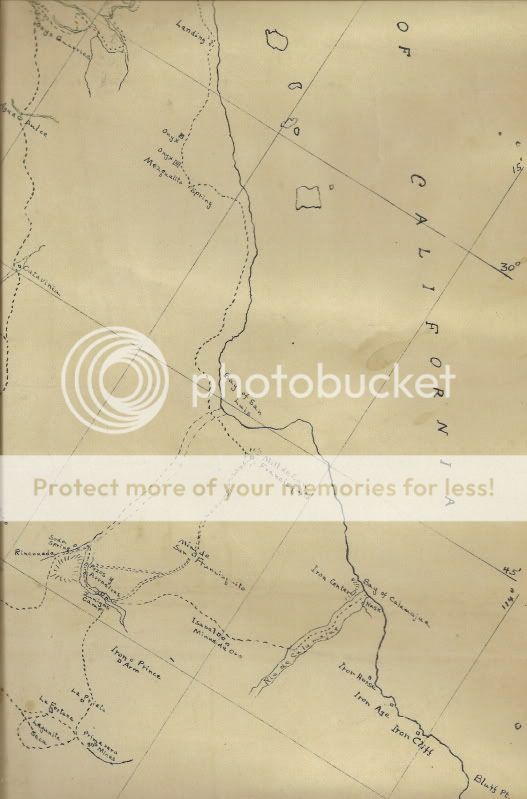
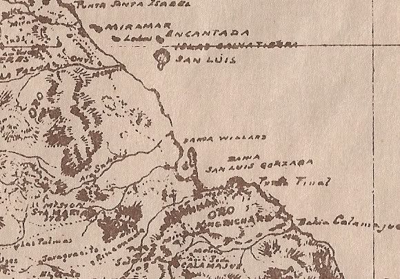
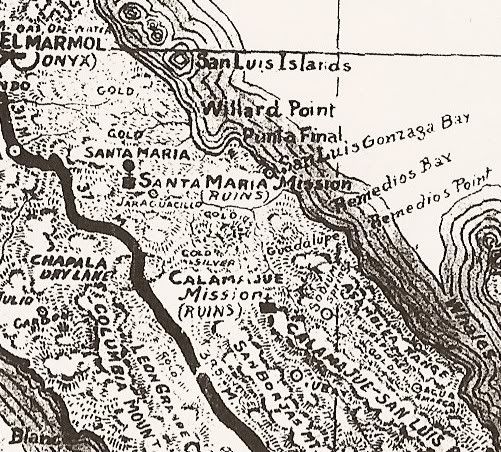
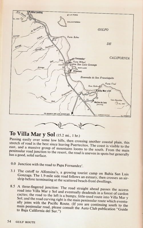
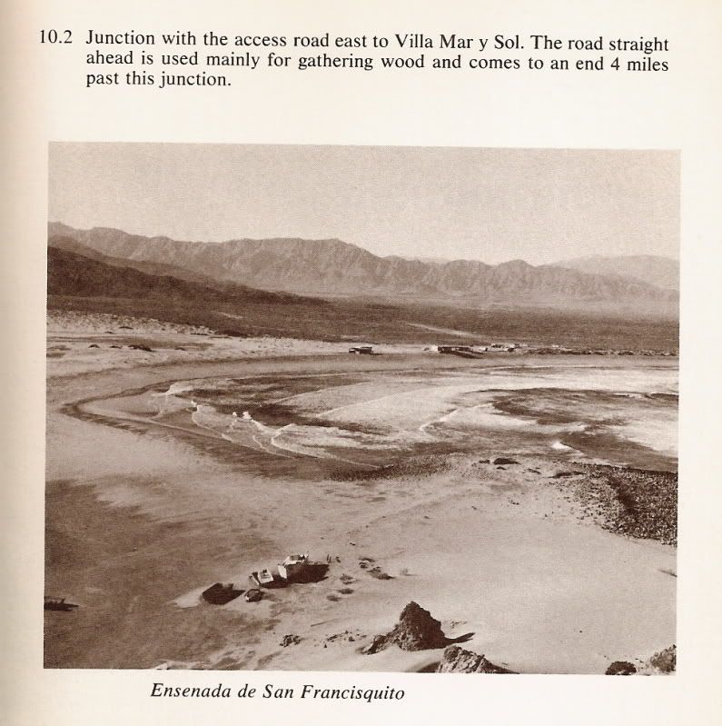
Some more maps and photo that show Ensenada de San Francisquito (the larger half of 'Gonzaga Bay') and the Villa Mar Y Sol illegal resort... (now called Punta Final)


Arroyo San Francisquito is actually the branch that turns south (called Arroyo Las Arrastras in the topo maps)... most of what is labled above is actually Arroyo Santa Maria.


Photo taken from Snoopy at Punta Final.

[Edited on 4-24-2012 by David K]

Oso - 4-24-2012 at 01:30 PM

Been there, done that. Had a couple pix of my old and new trucks across from birdsh*t island but lost the digitals when my last PC crashed. Couple flats, front driveshaft popped loose, but the "worst" was losing a camper shell between Puertecitos and Gonzaga. Lucky it was a cheap one. Some passing Chicano tourists helped me get it out of the road. Everyone was joking about how it would become a taco stand the next day. Met Mike a couple times for the Baja Mil.

David K - 4-25-2012 at 11:29 AM

Ah, the memories! On the old road (1979) I lost my exhaust on the rocks; On the newer graded road had a couple of flats (too much air and driving too fast).

Ken Cooke - 4-25-2012 at 04:41 PM

Quote:
Originally posted by David K
Ah, the memories! On the old road (1979) I lost my exhaust on the rocks; On the newer graded road had a couple of flats (too much air and driving too fast).


David K driving too fast??? I don't believe it.

David K - 4-25-2012 at 05:46 PM

Quote:
Originally posted by Ken Cooke
Quote:
Originally posted by David K
Ah, the memories! On the old road (1979) I lost my exhaust on the rocks; On the newer graded road had a couple of flats (too much air and driving too fast).


David K driving too fast??? I don't believe it.


Umm, no... the road was not what you would think is a road or even think is a bad road... it was more of a goat trail. Having a 4WD Subaru with 13" tires didn't give me a ton of ground clearance either.... :lol:

Ken Cooke - 4-25-2012 at 06:13 PM

I remember watching you let the hammer down on the accelerator on Hwy 5 after a weekend at Shell Island with the kids crammed into your gold Tacoma. You drove that thing like Ivan Stewart!

David K - 4-25-2012 at 06:18 PM

Okay, sure... if you say so Ken! :biggrin::rolleyes:

bigboy - 4-25-2012 at 07:19 PM

I drove that road many times in the early 70's! I drove a 1971 Ford F250 4X4 with a granny low and a two speed transfer case. I would crawl up those grades at walking speed with that setup.

I had a cab high Gem Top shell with a 13' Gregor straped to the top of the camper. One tuff rig that took me to Cabo three times before the highway was punched through the mid section of Baja!

No photos, but lots of memories

thebajarunner - 4-25-2012 at 07:50 PM

We raced that road, and it was brutal!
Did it north bound in the 1972 500 and south bound in the fall 1000.

My vivid memory is a buggy broke down on one of the steep grades and all the other drivers congregated and pushed it over the side and down the cliff- hey, ya gotta do what ya gotta do.

Pre-running north bound (my first ever) we used a stick shift Ford pickup and peeled all the tread off the rear tires as we spun, sputtered and chattered up those grades! It was auto/trans from that moment on.

David K - 7-13-2012 at 09:38 AM

Good thread from Ken Cooke!:bounce:

Good times along THAT ROAD

Ken Cooke - 7-13-2012 at 09:50 AM

Taking a bath before leaving for San Felipe:light:


The Jeeps on the ready (all RUBICONs)


JEEPS JEEPS EVERYWHERE!


The "old road"


PUERTECITOS (gringo english: POERTOCITOUS)


Here comes a JEEP!:bounce:


...AND ANOTHER!:bounce:

Sunman - 7-13-2012 at 11:56 AM

Not too sure how happy Kiko was to see me at his car wash in El Rosario at the end of this trip...


[Edited on 7-13-2012 by Sunman]

[Edited on 7-13-2012 by Sunman]

Cypress - 7-13-2012 at 12:20 PM

The car wash!:biggrin:

2005

Ken Cooke - 7-13-2012 at 12:37 PM


Look, IT'S A JEEP!:yes:


Some things will (hopefully) never change:yes:


THAT ROAD WAS MADE OF DIRT


Letting the dogs go for a walk


'CG's Ford Explorer


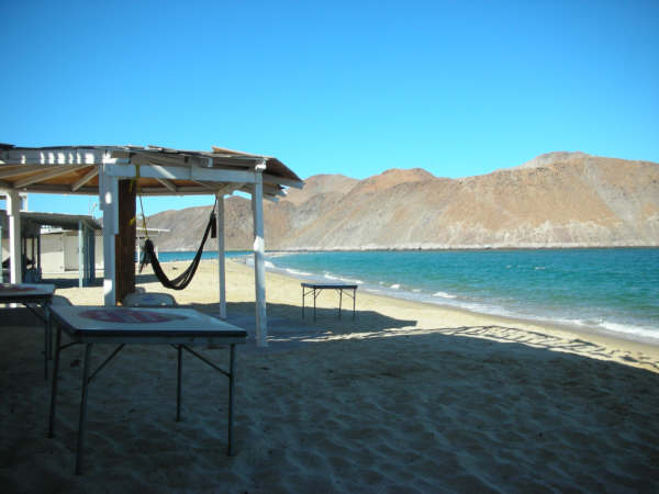
This fishing camp is still accessible with the new high-speed road


As long as the winds aren't blowing, this is a prime camping spot.


Ken Cooke - 7-13-2012 at 12:42 PM


motoged - 7-13-2012 at 01:44 PM

Roads????? We don't need no roads...:biggrin:


But they come in handy...


[img]http://motoged.smugmug.com/Other/Mulege-09/June-Aug-08-038/480452004_9WSPR-M.jpg[/img

[img]httphttp://motoged.smugmug.com/Other/Mulege-09/IMG1807/480486226_58iEE-M.jpg[/img]


[Edited on 7-13-2012 by motoged]

David K - 7-13-2012 at 04:37 PM

Very cool photos Ken and Ged... I am packing up the Tacoma now... A 'La Baja' en la maņana!

Ken Cooke - 7-13-2012 at 07:48 PM

Quote:
Originally posted by David K
Very cool photos Ken and Ged... I am packing up the Tacoma now... A 'La Baja' en la maņana!


Next summer, Leidys and I will have the means to join you. So, be ready for political banter, and comparisons of Jeeps and Toyotas in '13!

David K - 7-13-2012 at 11:19 PM

No worries, Ken... I will be happy to explain why your guy lost ;)

See you on the flip side!

Seriously, any of you who know me, knows politics takes a way back seat while on a Baja trip... and Jeeps are just as cool as Toyotas... on a Baja trip.

It's only here on Nomad do things sort of go to hell, on occasion!

See you all soon!!;)

scouse - 9-5-2012 at 08:59 PM

Excellent thread, great stories and photos. I didn't take it last time heading south because I'd heard the road from Puertecitos between Gonzaga to the junction at Chapala was washed out in several places.

How bad is that section? Inquiring minds need to know!

scouse - 9-5-2012 at 09:11 PM

The only road I could compare (imagine) to that these days, is the one going north from Punta Pescadero. After Cardonal it gets a little gnarly, my wife 'mentioned' that her butt had 300ft of cool cliff air below it along parts of the road.

Some pretty spots where it cuts in along the river bed, cacti and flowers. Met a couple of guys on motorbikes there coming south.

It took a good lunch with a couple of margaritas in the cafe at Ensenada de los Muertos to bring her pulse back near normal.

Spent a couple of days with Rowdy in the Downwiner Inn at El Sargento.

David K - 9-6-2012 at 08:17 AM

Quote:
Originally posted by scouse
Excellent thread, great stories and photos. I didn't take it last time heading south because I'd heard the road from Puertecitos between Gonzaga to the junction at Chapala was washed out in several places.

How bad is that section? Inquiring minds need to know!


Don't listen to those reports if you have 4WD, the reports here on Nomad are much more accurate. I drove from Chapala north about 5 weeks ago and it was passable, the road surface was rougher than the year before, so deflate to 20-25 psi and take it easy. Pavement began 12.5 miles north of the Pemex (Rancho Grande/Alfonsina's road)... and new road construction began just 2.5 miles north (Papa Fernandez' road).

David K - 9-6-2012 at 08:21 AM

Quote:
Originally posted by scouse
The only road I could compare (imagine) to that these days, is the one going north from Punta Pescadero. After Cardonal it gets a little gnarly, my wife 'mentioned' that her butt had 300ft of cool cliff air below it along parts of the road.

Some pretty spots where it cuts in along the river bed, cacti and flowers. Met a couple of guys on motorbikes there coming south.

It took a good lunch with a couple of margaritas in the cafe at Ensenada de los Muertos to bring her pulse back near normal.

Spent a couple of days with Rowdy in the Downwiner Inn at El Sargento.


Did that road last July in BajaTripper's 4Runner... Very scenic!


scouse - 9-6-2012 at 07:37 PM

Thanks for the road report from Chapala up. I didn't know of Baja Nomad when I took the trip.

That was a fun trip up from Los Barrillos along the coast. I might/should have know you had done it. :)

Certainly save a few miles backtracking when heading up to El Sargento or La Paz.

David K - 9-6-2012 at 11:54 PM

It was a neat road on the edge of a sea cliff... a bit slow and rough to make an effective short cut from Los Barriles to Los Muertos, IMO.

dizzyspots - 9-7-2012 at 06:58 AM

Joining in here..our 1st trip to Baja came via a thread over at www.4wdtrips.net....mind you we were in my wifes NEW 07 FJ Cruiser...her only foray into 4wd was a local off trip of about 20 miles.'
...and we had never met anyone that was going, prior to our Quik Mart rendezvous...we left Tucson w/ 3 vehicles, picked up 2 more in Yuma and headed south (prior to this, we hadn't ventured south of the border past Rocky Point).
So, our happy band of travelers heads south, thru Algodones...we're headed to San Ignacio for the whales...mixed messages: you need a tourist pass, you dont need a pass...we head south without a pass...
THE ROAD: the paved part south of San Felipe...just a LOT of no-warning BIG dips...then we get to Puertecitios...gonna air down...whats that? we didnt...on we go....holy smokes!! this road sucks! and it "teases" you...as soon as you get to the point of wanting to turn around.."a peek from a peak" of the beautiful Sea of Cortez...spurs a bit of "we can do this energy"...then you get an opportunity to hit a little cove..and touch...feel...smell..the Sea
Our trip took almost 5 hours to go from Puertecitos to Gonzaga Bay (yeah, I also didnt know that 25 mph on the washboard was WAY better than 5).
Return trip...we get to the Chapala junction and my wife says..."I am NOT going back down that road!!!" Well after discussing the options....San Diego...Mikes Sky Ranch....both of us have to get back for jobs....we returned via THAT road, but made much better time..enough to spend a day and a half at Gonzaga...
Been back 6 times since..we were hooked!

[Edited on 9-7-2012 by dizzyspots]