| Pages:
1
2
3 |
Ken Cooke
Elite Nomad
     
Posts: 8970
Registered: 2-9-2004
Location: Riverside, CA
Member Is Offline
Mood: Pole Line Road postponed due to injury
|
|
Does anyone remember, "THAT ROAD"? Add a photo if you have one!
Travel down, "That Road" requires lots of friends and spare parts!
"That Road" north of Puertecitos

Looking North along, "THAT ROAD"

The old road sign - TOWN LIMITS - PUERTECITOS

Reassessing our readiness to travel past Puertecitos

Taking the plunge - driving south along "THAT ROAD"


Before the road was reconstructed, the scenery was much better along, "THAT ROAD"


|
|
|
Ateo
Elite Nomad
     
Posts: 5928
Registered: 7-18-2011
Member Is Offline
|
|
Perfect.
|
|
|
Ken Cooke
Elite Nomad
     
Posts: 8970
Registered: 2-9-2004
Location: Riverside, CA
Member Is Offline
Mood: Pole Line Road postponed due to injury
|
|
THAT ROAD provided excellent opportunities for beach camping and cross country bicycling
'CG's Ford Explorer

Bicyclists


Catching up with Mike the Baja Explorer and a group of bicyclists!


Sturdy tires are a must for THAT ROAD

The back of Mike's Toyota Tacoma - As shown in the film DUST TO GLORY!

Talking with the bicyclists who bicycled to CABO SAN LUCAS!


Before a superhighway was built here, you could take all day talking to new Baja travelers. Que lastima...

The drive into Gonzaga Bay won't look like this much longer...


|
|
|
Fernweh
Nomad
 
Posts: 444
Registered: 2-24-2011
Location: Centenario, BCS
Member Is Offline
|
|
Jan 2009 going back home.....


Somewhere on "This Road", my friend James thought he had a transmission failure.......
but he only kicked the transfer case into neutral, due to "The Road"
[Edited on 4-3-2012 by Fernweh]
|
|
|
David K
Honored Nomad
        
Posts: 65361
Registered: 8-30-2002
Location: San Diego County
Member Is Offline
Mood: Have Baja Fever
|
|
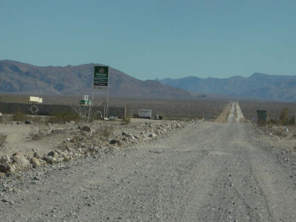
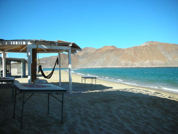
2005... north to Gonzaga and Puertecitos:


2006:


2007:


2008... Shell Island to Gonzaga and beyond:
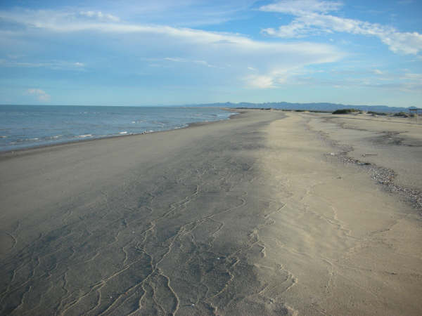
The new highway south of Puertecitos had begun, only about 2 miles paved in Sept., '08...
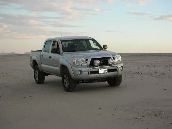


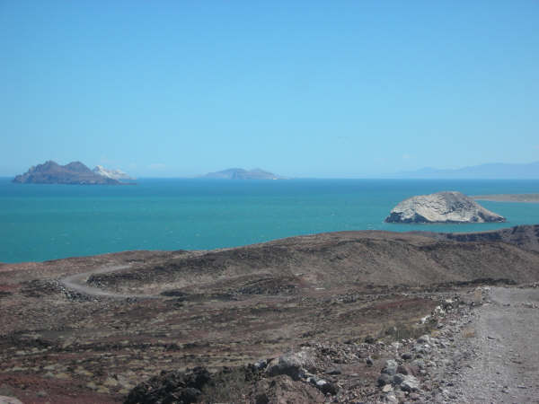


|
|
|
Fernweh
Nomad
 
Posts: 444
Registered: 2-24-2011
Location: Centenario, BCS
Member Is Offline
|
|
Nice pics David K, but too much air in the tires - then
|
|
|
David K
Honored Nomad
        
Posts: 65361
Registered: 8-30-2002
Location: San Diego County
Member Is Offline
Mood: Have Baja Fever
|
|
| Quote: | Originally posted by Fernweh
Nice pics David K, but too much air in the tires - then |
Huh, really? I seem to be floating on the sand just fine at 15 psi... 

(or are you following me on TW?  ) )
|
|
|
bufeo
Senior Nomad
  
Posts: 793
Registered: 11-16-2003
Location: Santa Fe New Mexico
Member Is Offline
|
|
Ken, I thought you meant that road. You know, the one before the 1984 improvements. Sheesh, the '84 was an Interstate compared to the
real road.
I do have photos of the real road, but I don't let them hang out on the internet. 
Allen R
|
|
|
bonanza bucko
Senior Nomad
  
Posts: 587
Registered: 8-31-2003
Location: San Diego
Member Is Offline
Mood: Airport Bum
|
|
We are going to miss THAT ROAD! It was without doubt the absolute worst road that ever existed....well, kinda existed since it wasn't really a road.
There will be tall tales and lies told about it by old timers who drove it for years and years. It will get worse as the stories get told and retold.
I spent 25 years flying over it into Alfonsina's before I had to drive it the first time. I thought I had some idea about it after all those hours
looking down on it. I was completely astounded at how really bad it was....and how really good it was too!
Here's my first contribution to the tall tales to come:
The Tres Marias will live in my memory forever....you can't forget them. When we drive now...at about 50 MPH...past the spot where the Ray Grove
memorial was we still look over the edge of the cliff...he's down there still. He went over the side sometime in the distant past...some say it was
in 1973 others say in the '60s. I don't know. But there was an old Cross on the edge of the cliff made of lath sometimes and sometimes Ocotillo
branches with a sign "RIP Ray Grove" and an old hat stuck on top. It was always there....must have been restored about every six months by somebody.
Maybe somebody needs to resurrect it along the new pavement. I'm sure Ray...whoever he was...would like that. It's alleged that he has found down
there a thousand feet below the top of the Tres Marias in the spring with a bottle of Jim Beam in his boney hands....the place was called "Jim Beam
Hill" after that...at least according to legend.
I'm sure there are Chupacabras hiding along that road...have to be there!
BB
|
|
|
mcfez
Elite Nomad
     
Posts: 8678
Registered: 12-2-2009
Location: aka BN yankeeirishman
Member Is Offline
|
|
That road.......the worst for me was when the paved road outside of San Felipe had potholes.....millions(!).......for miles. Took three birthdays to
get down to Puertecitos. But it will be missed.......sort of :-)
Old people are like the old cars, made of some tough stuff. May show a little rust, but good as gold on the inside.
|
|
|
bufeo
Senior Nomad
  
Posts: 793
Registered: 11-16-2003
Location: Santa Fe New Mexico
Member Is Offline
|
|
| Quote: | Originally posted by mcfez
That road.......the worst for me was when the paved road outside of San Felipe had potholes.....millions(!).......for miles. ...
|
I remember someone saying "...those potholes were big enough to have their own ZIP codes".
We thought so too.
Allen R
|
|
|
baitcast
Super Nomad
   
Posts: 1785
Registered: 8-31-2003
Location: kingman AZ.
Member Is Offline
Mood: good
|
|
posted on 11-22-2003 at 10:30 PM
Gonzaga Bay 1964.....My first date with three sisters
This was a trip report I made a year or so ago on the old Amigos board and thought maybe some of you nomads might get a kick out of it.
A friend of mine asked me if I wanted to know a good spot to go fishing,you bet I said where?....a place in mexico on something called the sea of
cortez,lived in huntington bch in those days,jest a hop skip and jump and I would be there great!!!
My friend drew up a map for me,just bought a 64 vw bus and he said I was ready to ,all I had to do was drive down to a bay called Gonzaga and meet a
old guy by the name of papa he would show me where to fish,so I packed up the bus,wife two kids and a friend......
He also said I might have a problem or 2 on the road but everything should be fine,I thanked him.
I have always thought that stupidity must be blessful,for in those days I was my late 20,s and still stupid but happy and was always game to try
anything if it had anything to do with fishing!!.....
My friend had also mentioned it might get a little hot it was july and I should plan on it ,no problem I borrowed one of those window coolers you hang
on the outside of the rig,there I took care of the heat problem,went out and bought a map which gave mileage and some other stuff,we were ready to go.
The trip........
left huntington bch late on night ,should be in san felipe by morning, puertecitos a couple of hours later ,Gonzaga for lunch,everything went
smoothly,arrived in san felipe on time , and now the dirt I can,t wait finally the trip starts,not 10 min,s later we were stuck in a sand pit,I could
still see san felipe,this is not what I had in mind,I did bring a shovel,half hour later we were on our way again........
the going was a little slower than I had planned but no matter we were headed south,finally puertecitos dead ahead,getting a little tired,the kids are
a bit loud,my wife is talking to herself not loud something about this #$%^ road
I couldn,t make out the other things ,my friend is saying nothing by now,stopped for some gas in town,while there a gringo came by and asked where we
were going I said Gonzaga Bay its just down the road a ways from here!!!
Left the window cooler at the station,does,nt work going 10 15 miles anyway,he thanked me.......
Not2 mins out of town I lost track of the road saw nothing but rock,know its here somewhere.....
going is slow ,its very hot,my oldest daughter is getting sick.......
and my wife ...I can hear her now she is getting mad it me,how could I do this to to her and the kids.......
I was very reasurring and told her the bay was just over the next rise,having no idea what I was talking about,the map I just bought mentions
something about three hills that must be climbed and we are in them....
God help us.....
the first two we just made,we are at the bottom of the last and my wife wan,ts to go home,she wan,ts to get out and walk,no problem dear we will get
over this we,ll have it made,I put my foot in it and up we go,going slower I see a rock ledge dead ahead must slow down,now stopped can,t make it
over,put my foot on the brakes and start to slide back down the hill.....
at the bottom of the canyon my spots several wrecks,poor souls never made it,we are now backing down the hill,my hands are shaking,kids are crying,my
friend is white faced,tried once more but could not get over the ledge.....
one thing left to do back down to the bottom,told everyone to get out and walk,just what my wife wanted to do in the first place.......
Well this time I made it ,felt like rocky on top of that mountion.......
flat lands dead ahead,I am numb between the ears but know we are getting close.....
No sooner than we get to the bottom of the hills and I,m stuck again in the sand,will this never end???
Digging and more digging,starting to get pretty good at this though...can,t be to far,daughters temp. is still up,monster headache,finally arrive at
papa,s late in the day but find just a couple of old house,s and a shack or two and no trees,
I check my map my friend gave me,I,m suppose to go down the canyon just before papa,s,he said the fishing was best there and a nice beach so I turned
around and made for the canyon,found a set of tracks to follow,you guessed it stuck again only this time no amount of digging is going to get us out,
my friend said he would watch the family for me so now I,m walking back to papa,s,sometime later I arrive in camp and this little old man come,s up to
me smiling and said something,he already knew what the problem was ,
first thing you know chichi his son and a man with a big rig shows up ,things appeared to be a little slow in camp anyway this would everyone
something to do ......
Didn,t take long for them to get us out.......Guess we will stay at papa,s place,the ground looks firm and I,m not moving,the wife got the kids in the
water for a cool down and I and my friend enjoyed the best and the coldest beer we have ever drank to this day.
After a wonderful nites sleep we got up and started looking for shade,no trees what do you do for shade I asked he smiled and pointed toward his front
porch........
Lucky for us papa had started to build a big cabana all it needed was a roof,so my first day of vacation we finished the roof.....still lots to this
vacation but you get the idea,lots to learn but having fun,going home no problem all the up hills were now down hills and I knew what firm ground
looks like,when we hit the highway at san felipe we all smiled and my wife leaned over and gave me a big kiss and said when we come down next vacation
maybe we should go a month or so sooner,might not be so hot.
must be a road in there somewhere the last climb. the last climb.
[Edited on 4-3-2012 by baitcast]
Anyone can catch fish in a boat but only \"El Pescador Grande\" can get them from the beach.
I hope when my time comes the old man will let me bring my rod and the water will be warm and clear.
|
|
|
David K
Honored Nomad
        
Posts: 65361
Registered: 8-30-2002
Location: San Diego County
Member Is Offline
Mood: Have Baja Fever
|
|
BEFORE 1986!!!
Oh, okay... for those who think the bulldozed graded road built from 1985 to 1987 was bad... Like Baitcast shows and tells, it was the 'Jeep Trail'
built in the 1950's that was a real adventure... Then after Highway One was finished in 1973, all traffic for Gonzaga Bay came in from the south and
the road below Puertecitos stopped getting any traffic (except for the Baja 1000)... and a few loco gringos (like me in '74, '75, and '79 when it was
nearly impassable).
5 hours to drive the 45 miles to Gonzaga from Puertecitos was rushing it!
Cliff Cross's 1970 Baja Guide Map spells out each grade:
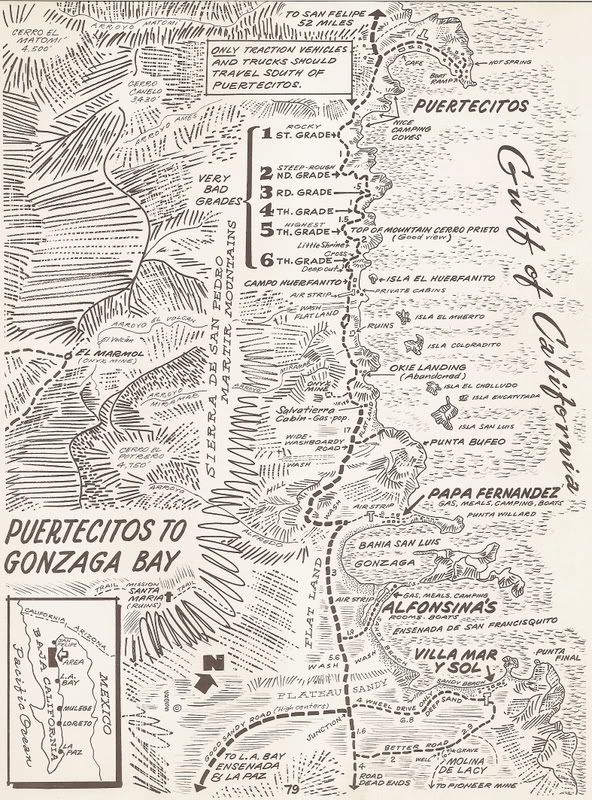
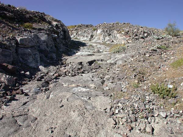
They were long or they were crazy steep... and by '79, they were just chunks of broken and unbroken lava!
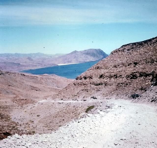
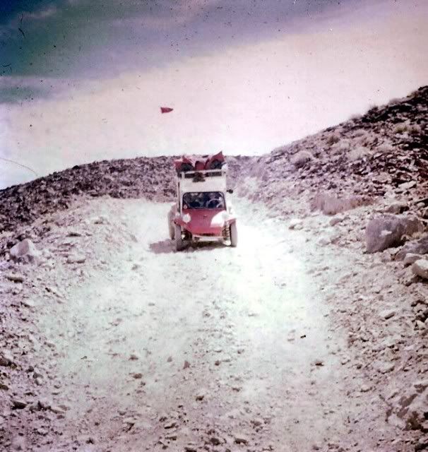
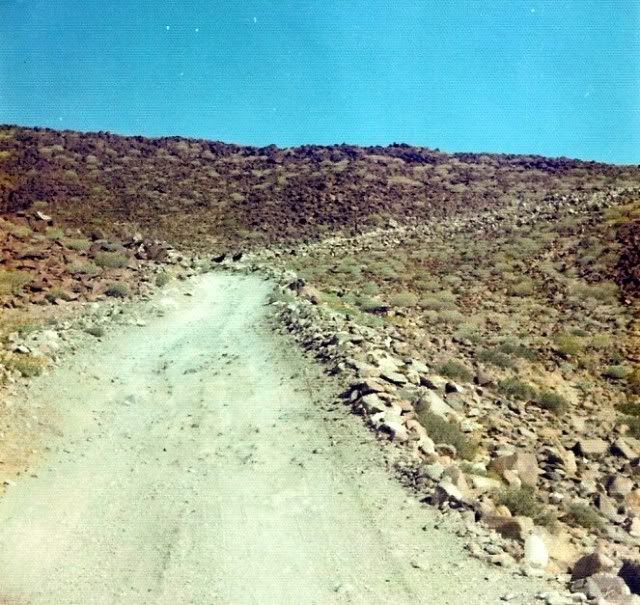
See the two burros?
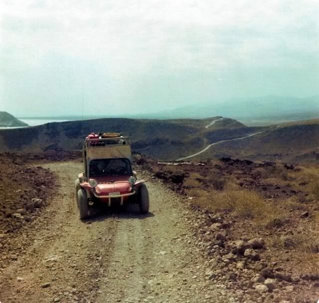
1979:
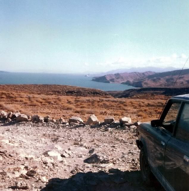
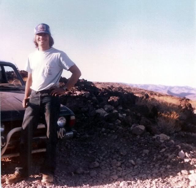
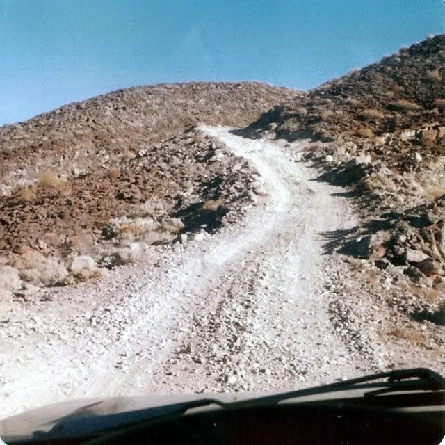
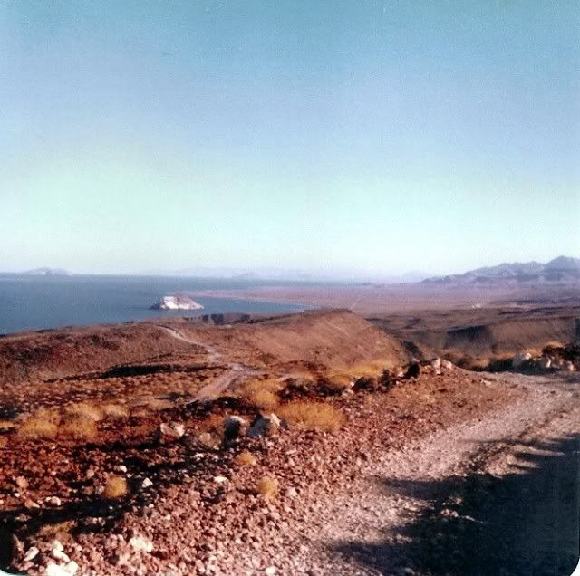
Yes, the 1970's and 1960's over 'The Road' were really something... and it made the destination of Gonzaga Bay all that more special! It is too bad
that Ken Cooke never got to experience it... but maybe through our photos and stories, he and other Nomads can! 
On this Auto Club map, I made notes each trip in the '80's as to how far the NEW graded road had reached, south of Puertecitos:
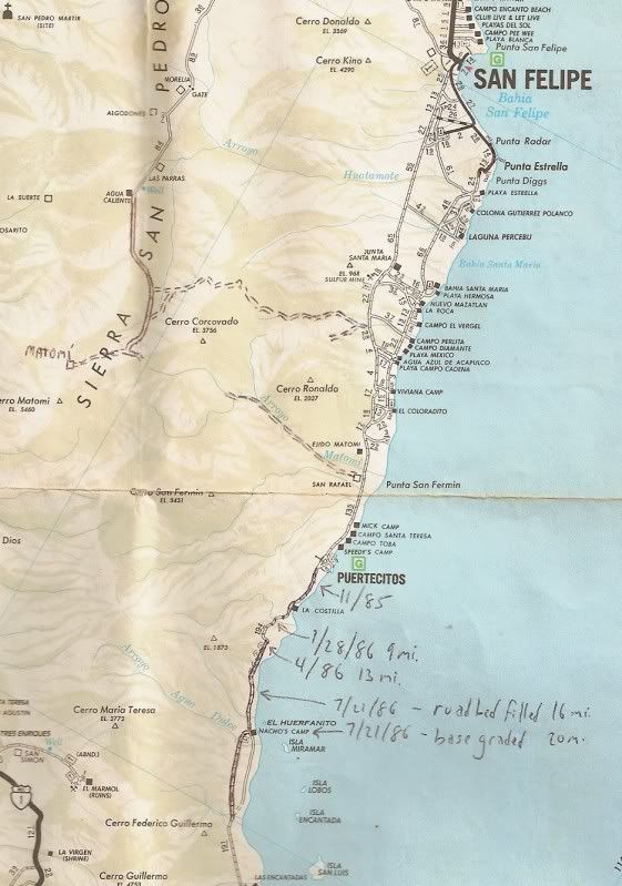
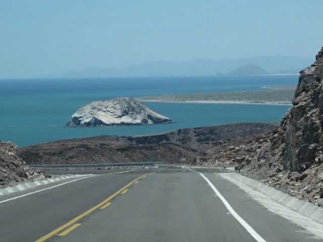
While some call this new highway a blessing, others will call it a curse...
Highway 5 approaching EL HUERFANITO (July, 2010):
|
|
|
willardguy
Elite Nomad
     
Posts: 6451
Registered: 9-19-2009
Member Is Offline
|
|
david, cliff cross's map shows the area of punta final as "villa mar y sol". do you recall this?
|
|
|
David K
Honored Nomad
        
Posts: 65361
Registered: 8-30-2002
Location: San Diego County
Member Is Offline
Mood: Have Baja Fever
|
|
| Quote: | Originally posted by willardguy
david, cliff cross's map shows the area of punta final as "villa mar y sol". do you recall this? |
Yes indeed... What happened was that Villa Mar Y Sol was developed there, but THEY DIDN'T OWN THE LAND! 
Sound familiar? The property was owned by Josefina of Rancho Santa Ynez... and once they got the Villa Mar Y Sol people out, they changed the name to
Punta Final (for the nearby point)... Josefina wanted a road to connect her two places via Mision Santa Maria... Fred Hampe built the road to a point
2 miles from the mission towards Punta Final, and stopped at the edge of the great canyon. Highway 1 was soon finished and the need for the road
ended. Josefina had asked President Echeverria to build it, but all she got was the paved driveway to her ranch. Engineers put the new road east from
Laguna Chapala.
The location was originally 'Puerto de San Francisquito', where supplies for the nearby gold mines and mill (Molino de Lacy) were off loaded. Molino
de Lacy was originally 'Molino de San Francisquito', run by William Lacy who is burried there.
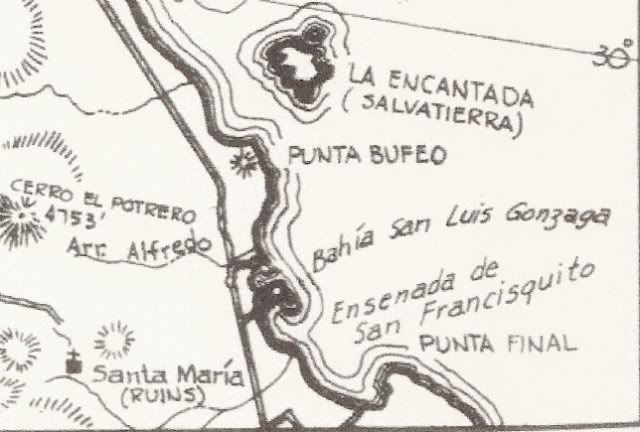
The big bay most call Gonzaga is actually 'Ensenada de San Francisquilto' (Bahia San Luis Gonzaga is the bay between Papa Fernandez' and
Alfonsina's... some call 'Willard Bay' ... which is named for Willard Point). Even the modern topo maps have it all wrong or mixed up. 
Howard Gulick's map of 1962 has it correct:
[Edited on 4-3-2012 by David K]
|
|
|
bacquito
Super Nomad
   
Posts: 1615
Registered: 3-6-2007
Member Is Offline
Mood: jubilado
|
|
So much history, Thanks
bacquito
|
|
|
bufeo
Senior Nomad
  
Posts: 793
Registered: 11-16-2003
Location: Santa Fe New Mexico
Member Is Offline
|
|
| Quote: | | Originally posted by David K...Howard Gulick's map of 1962 has it correct... |
So, how do you know Gulick got it correct?
The pilot I have ("corrected and printed in 1928") printed by the U.S. Navy indicates that the larger bay is "Gonzaga (San Luis Gonzaga) Bay" and the
smaller of the two as "Willard Bay".
Allen R
P.S. You needn't post all the Gulick maps.
[Edited on 4-3-2012 by bufeo]
|
|
|
Ken Bondy
Ultra Nomad
    
Posts: 3326
Registered: 12-13-2002
Member Is Offline
Mood: Mellow
|
|
South of Puertecitos:

carpe diem!
|
|
|
woody with a view
PITA Nomad
      
Posts: 15940
Registered: 11-8-2004
Location: Looking at the Coronado Islands
Member Is Offline
Mood: Everchangin'
|
|
ATTABOY Rob!!!!
i knew you were for real! i got some trails just like that on the other side and there is this little beach where the fish grow REALLY big.......
|
|
|
David K
Honored Nomad
        
Posts: 65361
Registered: 8-30-2002
Location: San Diego County
Member Is Offline
Mood: Have Baja Fever
|
|
| Quote: | Originally posted by bufeo
| Quote: | | Originally posted by David K...Howard Gulick's map of 1962 has it correct... |
So, how do you know Gulick got it correct?
The pilot I have ("corrected and printed in 1928") printed by the U.S. Navy indicates that the larger bay is "Gonzaga (San Luis Gonzaga) Bay" and the
smaller of the two as "Willard Bay".
Allen R
P.S. You needn't post all the Gulick maps.
[Edited on 4-3-2012 by bufeo] |
It has nothing to do with Gulick, other than he got it right (as did Cliff Cross, if you look at his 1970 map)...
The bay was named by the Spanish Jesuits who explored the Gulf of California and provided many of the place names we still use today. Padre Fernando
Consag even returned to Bahia San Luis Gonzaga in 1753 to baptize some native children there... and assigned them to the distant, 2 year old mission
of Santa Gertrudis.
The bay of importance, where ships could anchor was the north or smaller bay. The Spanish built a warehouse to store supplies offloaded for their new
mission of San Fernando... and perhaps earlier for the nearby mission of Santa Maria. This was the San Luis Gonzaga of history. The ruins outline can
still be seen on the shore of the smaller, north Bay of San Luis Gonzaga, midway between Papa's and Alfonsina's.
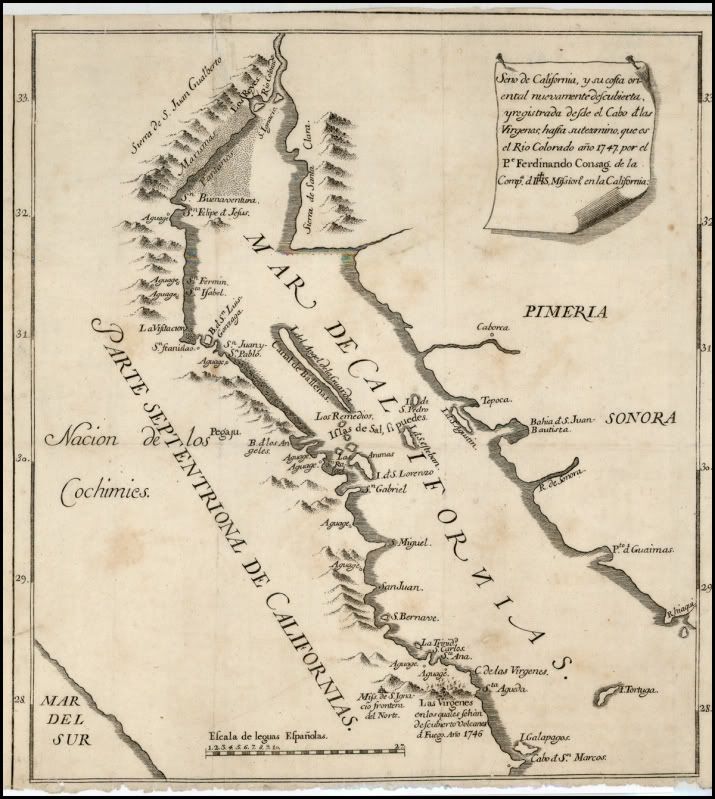
On this 1747 map, is the oldest I have with San Luis Gonzaga shown (that year, the northernmost mission was San Ignacio)
On the 1757 Jesuit map... again San Luis Gonzaga is named and it is the bay with an island in the middle.
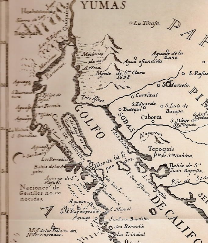
1823 map, the bay name is shortened to San Luis:
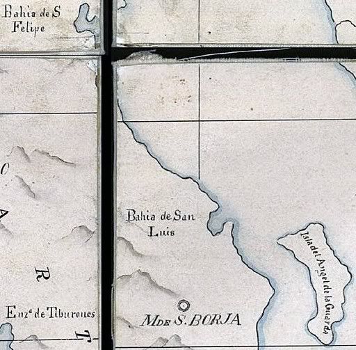
On this 1864 map:
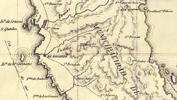
Now, the U.S. Navy came along and assigned their own names to many places in Baja..
On 10-11-2010, Baja Nomad Steve in Oro Valley posted this:
| Quote: | Originally posted by Steve in Oro Valley
Hi everybody:
Willard, If I am not mistaken, was a surveyor, plant explorer with the Mexican boundary survey in about 1855?
His name is part of the scientific name for the Sonoran palo blanco tree which is commonly seen on the slopes of Tetas de Cabra hill near San Carlos
Bay in Sonora. That name would be Acacia willardiana (Willard's Acacia). Other plants from Sonora may contain reference to his name....
The Sonoran palo blanco is not to be confused with the palo blanco of Baja California Sur which is Lysiloma candida....
Willard's name may show on American made maps of long ago but newer Mexican maps use their own local and often Mexican names for place names...
Steve in Oro valley |
In 1907, we see the first use of 'Willard Point' assigned to the north entrance to the bay:
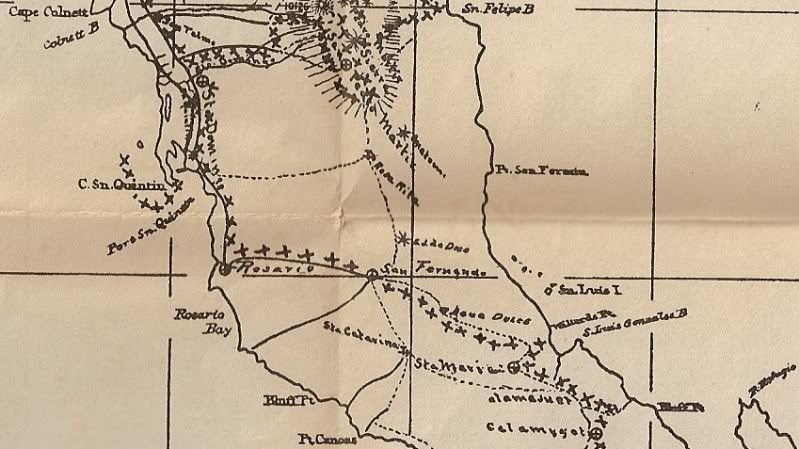
In 1905, we see the bay name shortened to San Luis by this map maker, and shows the mill of San Francisquito (Molino de Lacy):
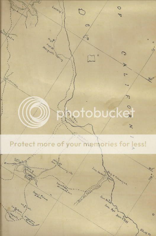
On Goldbaum's 1919 map, we see the first time the two bays are switched:
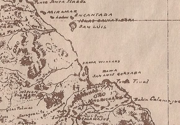
But in 1930, just the point is again called Willard:
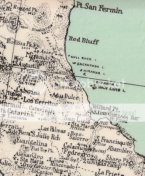
as it also is in 1941:
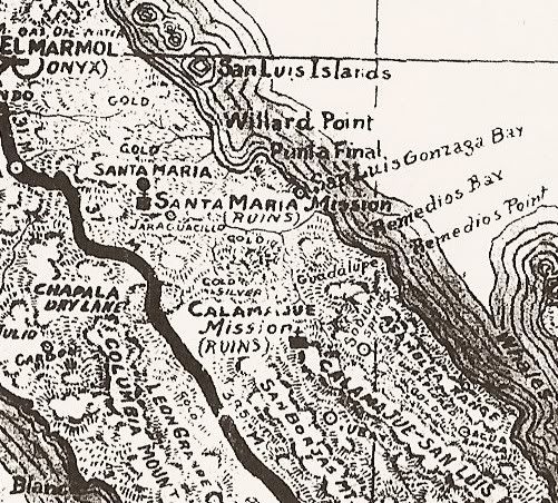
So when Gulick started making his excellent maps in the 1950's, he went with the historic name of the bay.
But, I cannot fault anyone for using the term 'Gonzaga Bay' to apply to both halves... afterall 'Ensenada de San Francisquito' IS a mouthfull!  
|
|
|
| Pages:
1
2
3 |
|

