Drove the ridgeroute from Rumorosa past Laguna Hanson
and eventually hooked up to the Canon El Mano Road which drops down into the desert. Camped up on top and got soaked by freezing rain and
wind.brrrrrr
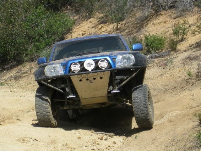
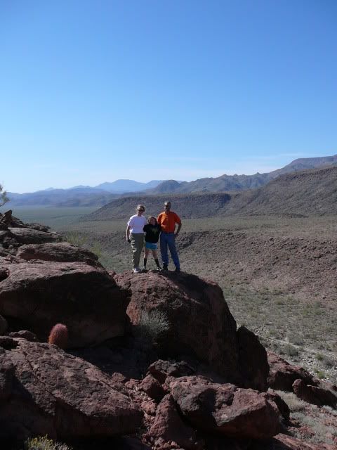
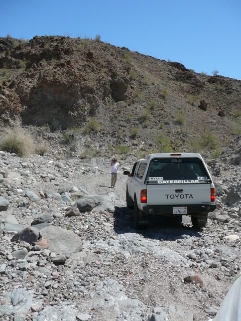
Heading down El Mano:
Brooks, Trinity, and Libby---we made it down El Mano:
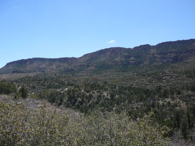
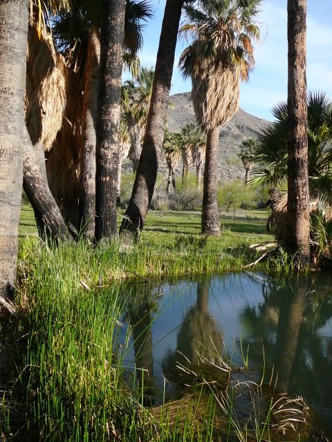
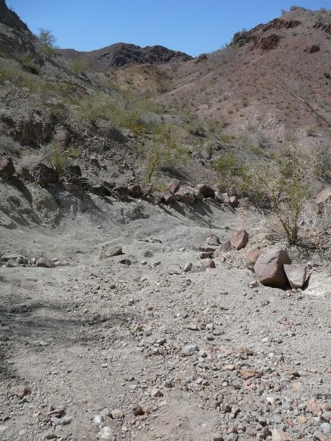
Heading up to Agua Caliente:
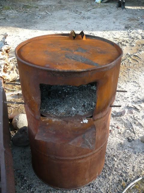
Cool stove:
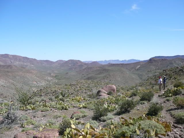
Hiking up Agua Caliente Canyon:
desertcpl - 4-7-2012 at 04:48 PM
Beautiful,, thanks for sharingMula - 4-7-2012 at 04:49 PM
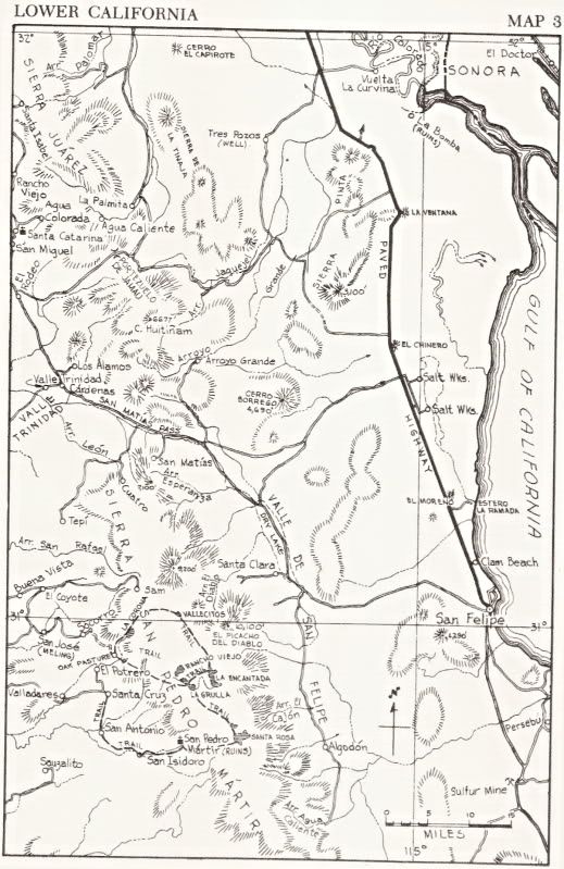
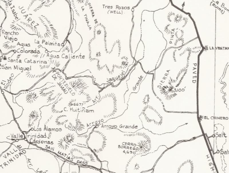
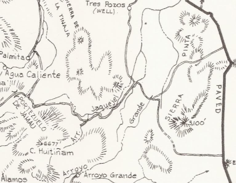
Map of the route, David K?Mexitron - 4-7-2012 at 04:49 PM
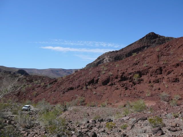
Next we hook up with the old road from Valle de Trinidad into
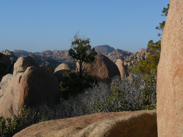
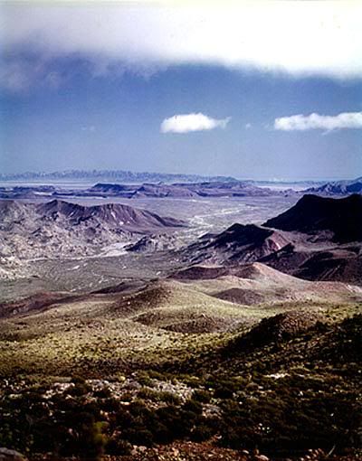
the Sierra Tinajas, which can be seen in the distance:
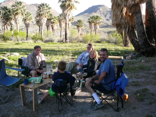
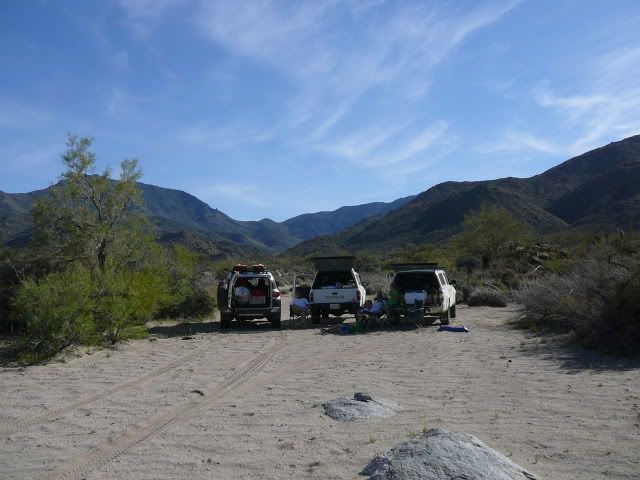
Nice camp spot:
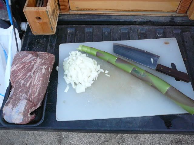
BBQed Tri-tip and sauteed Agave spear for dinner:
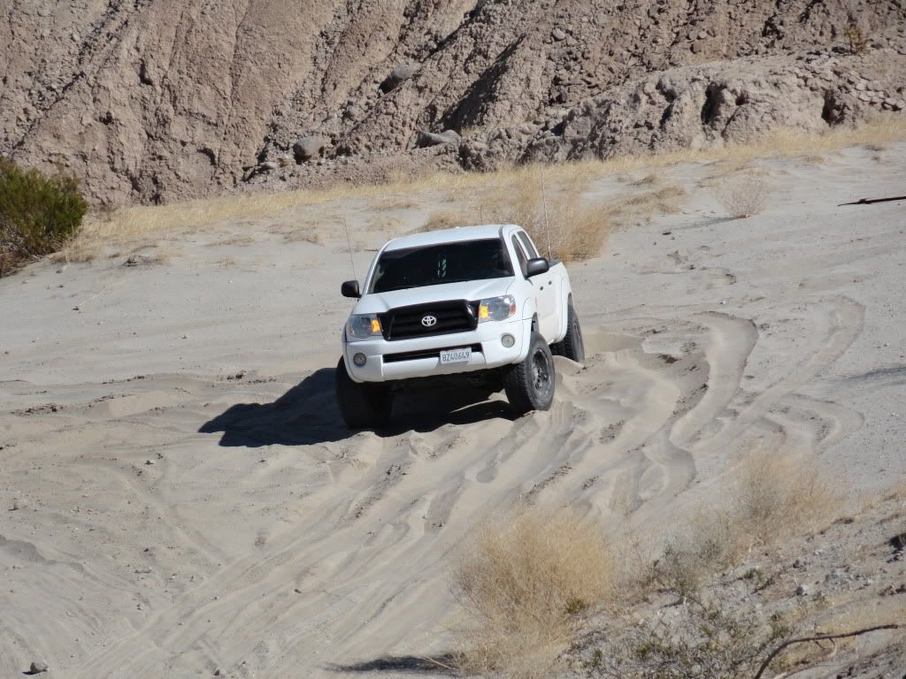
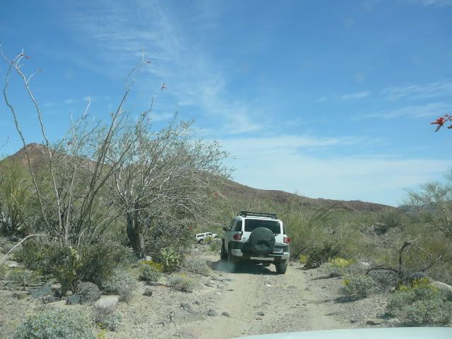
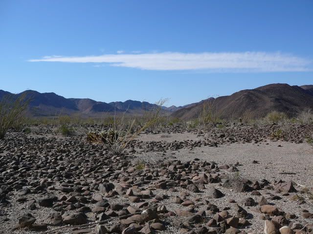
Off we go:
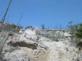
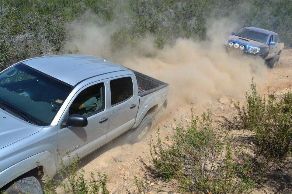
The road gets bad:
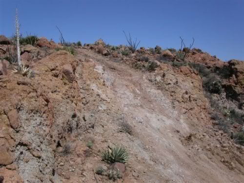
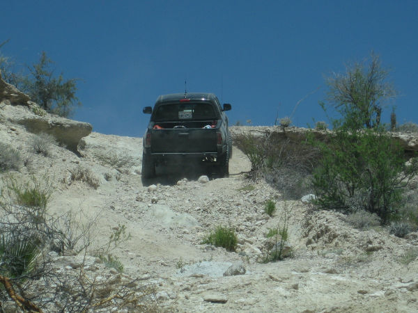
And then this high pucker factor section---steep, slippery, and high consequence of misstep...as Brooks said, approaching the limit of stock 4x4s like
ours:
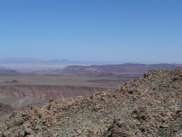
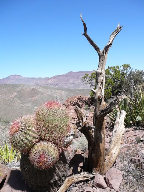
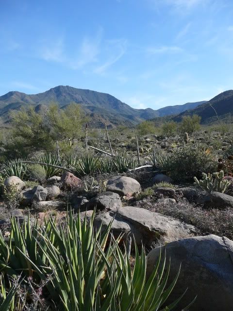
Parched but beautiful Sierra Tinaja:
Got through and camped out on the Laguna Salada somewhere, headed home next day...awesome fun time!Mexitron - 4-7-2012 at 04:51 PM
Quote:
Originally posted by Mula
Map of the route, David K?
Brooks has all the GPS map data and he'll likely post another report about it, but the route can be seen on the Baja topos or atlas.Mula - 4-7-2012 at 04:52 PM
Great photos. Thanks.Mexitron - 4-7-2012 at 04:53 PM
BTW there were some old poles toward the east side of the Tinajas---maybe this is an old pole line road??/TMW - 4-7-2012 at 05:05 PM
I think you were on the pole line road. But I would like to know how you made the turn to Basketball hill from the wash unless you had the GPS
coordinates. You had to go up BB hill because the road past it is a motorcycle only road or trail and even then you have to carry the bikes over some
rocks unless the rains have really changed the place. Would like to see the GPS data.Neal Johns - 4-7-2012 at 05:27 PM
TW,
They were not on the Pole Line Road as we know it. El Mano goes from the top of the mountains to the bottom. It is about 11 miles north of "Summit"
(A. Alamito). Nice trip.
Great pics, Mexitron!bajalou - 4-7-2012 at 05:47 PM
Great stuff Steve, thanks.
Nice to see a couple familiar faces also.
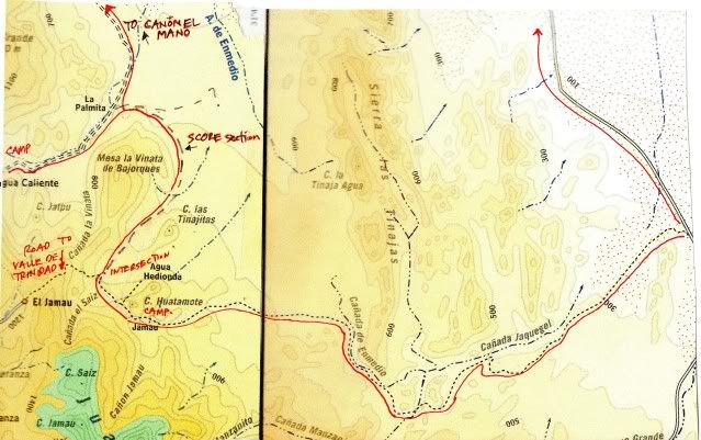
1962 Maps
Ken Cooke - 4-7-2012 at 05:48 PM
Howard Gulick (Lower California Guidebook) mapped and made a road log of the Pole Line Road for his 1962 edition...
David K - 4-8-2012 at 12:37 AM
Neal, they went south from El Mano Canyon past Agua Caliente, then on to the Pole Line??... (at least that's what I think from what I just read?)
[Edited on 4-8-2012 by David K]goldhuntress - 4-8-2012 at 07:25 AM
Great photos. Looks like loads of fun! Thanks for sharing your trip.TMW - 4-8-2012 at 08:09 AM
DK that is what I thought too. That they came down El Mano and went to Agua Caliente then found the pole line road. Maybe they found the summit road
up over the mountains and out to hwy 1 NW of Trinidad. Need to see the GPS data.David K - 4-8-2012 at 08:12 AM
Quote:
Originally posted by TW
DK that is what I thought too. That they came down El Mano and went to Agua Caliente then found the pole line road. Maybe they found the summit road
up over the mountains and out to hwy 1 NW of Trinidad. Need to see the GPS data.
I edited my reply from late last night... I realized that Agua Caliente is before the Pole Line Road, when coming south from Mano Canyon...
Mexitron... we love the photos, but some more directional details please!
THANKS!TMW - 4-8-2012 at 09:26 AM
Here is a picture from top of the summit taken by Bob Bower BFG.
Bajaboy - 4-8-2012 at 09:32 AM
Thanks for the report....DianaT - 4-8-2012 at 09:47 AM
Looks like you had a great time. Also looks a little like you just winged it as you went finding your own way----we often find this is the most fun
and leaves one with a real sense of adventure.
Thanks for the report and the really nice photos.Mexitron - 4-8-2012 at 10:03 AM
Sorry for the vague directions, still in my post Baja haze ---we came down
El Mano Canyon then headed south to Agua Caliente. After leaving Agua Caliente on the closest road hugging the base of the Sierra Juarez going south
we drove about 10 miles---BTW this part of the road was a SCORE course---and we intersected the old road which runs to Jamau/Valle de Trinidad to the
west. This portion of the road seemed to be in decent shape as some ranchers who were building a fence had attested to. We then proceeded to turn to
the southeast section of that road which Ken Cooke's map correctly shows as running through the Jaquejel Arroyo drainage (heh, before jumping
through several other drainages).
The road appeared to be fairly old with some sections of nice roadwork still intact while others completely washed out.David K - 4-8-2012 at 10:13 AM
Quote:
Originally posted by Mexitron
Sorry for the vague directions, still in my post Baja haze ---we came down
El Mano Canyon then headed south to Agua Caliente. After leaving Agua Caliente on the closest road hugging the base of the Sierra Juarez going south
we drove about 10 miles---BTW this part of the road was a SCORE course---and we intersected the old road which runs to Jamau/Valle de Trinidad to the
west. This portion of the road seemed to be in decent shape as some ranchers who were building a fence had attested to. We then proceeded to turn to
the southeast section of that road which Ken Cooke's map correctly shows as running through the Jaquejel Arroyo drainage (heh, before jumping
through several other drainages).
The road appeared to be fairly old with some sections of nice roadwork still intact while others completely washed out.
That is the Pole Line Road, built in 1941 to install/ check on the phone line between Ensenada and our tiny San Felipe base, where we had installed a
radar station to watch for Japanese (or German?) invasion coming up the Gulf of California.David K - 4-8-2012 at 10:45 AM
Quote:
Originally posted by Mula
Map of the route, David K?
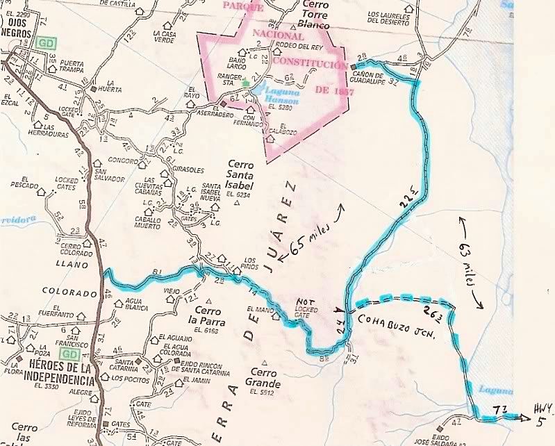
I will need to work on that... The AAA map doesn't go past Cohabuzo Jcn much more than the 3.1 mile road shown....
The highligted road(s) include the Mano Canyon one (mentioned in the trip report) that I have been on... and the dashed one is the 'short cut' to Hwy.
5 (at the sand dunes).
Mexitron's route went south on that 3.1 mi. road... or a parallel one... but kept going south (not shown on AAA, but is shown on the Gulick maps that
Ken posted above).
Mexitron - 4-8-2012 at 11:35 AM
Here's a cut and paste from the Baja Almanac:
Barry A. - 4-8-2012 at 11:36 AM
Wow, great trip, Mexitron, and great trip-report & pics also. It is good to know that stock vehicles can still get thru on the Pole Line
road-------you guys did good!!!!
BarryMexitron - 4-8-2012 at 11:39 AM
Barry---had no idea that was the road we were on---we were just exploring!
Sorry for the map not being oriented correctly, Photobucket won't rotate the image when copied to this site.David K - 4-8-2012 at 11:45 AM
Map looks fine Steve... Thanks...
The pole line came down the summit (Jamau) and right along your route and crossed Arroyo Grande and headed pretty straight for San Felipe.Mexitron - 4-8-2012 at 02:09 PM
Quote:
Originally posted by David K
Map looks fine Steve... Thanks...
The pole line came down the summit (Jamau) and right along your route and crossed Arroyo Grande and headed pretty straight for San Felipe.
I gather the section going from Arroyo Grande to San Felipe is the more popular portion I often read about here? Jonathan Smith, one of our friends
on this trip, remembered riding the Pole Line Road on his bike but said it was a straighter route...
Meant to say we did see some CA fan palms in one of the Arroyo crossings---maybe the water is from the source of the "tinajas" that the Sierra is
named after. Be fun to explore again.David K - 4-8-2012 at 06:17 PM
Actually, the 'famous' Pole Line Road is the part you drove... with a few poles still up (I hope) and a cobble stone paved roadbed in places.TMW - 4-8-2012 at 07:15 PM
Mexitron how did you know when or where to turn up basketball hill? That turn is almost hidden unless you know the GPS coordinates. I've ridden that
route twice on a MC but never knew there was a right turn out of the wash until Ken Cooke had us on one of his trips. Was there tire tracks from other
vehicles you followed? I'm not questioning if you were on the PL Rd it's just the turn is something you just can't see unless there were other tire
tracks to follow or someone had a GPS and knew where to turn otherwise you go straight to a water falls and cow trail up the side of a hill, not
something a 4 wheel vehicle could make.David K - 4-8-2012 at 07:19 PM
Mexitron and Taco de Baja are old hands on the Baja trails... Have you seen the web page I made of the climbing of Matomi Mountain and hiking up
Matomi Canyon?
[Edited on 4-9-2012 by David K]Taco de Baja - 4-8-2012 at 08:08 PM
Quote:
Originally posted by David K
Actually, the 'famous' Pole Line Road is the part you drove... with a few poles still up (I hope) and a cobble stone paved roadbed in places.
We passed over several sections of the cobble stone paving. We were amazed someone went to the trouble of doing that on a dirt road in the midfle of
nowhere.
The pole line road explains it, thanks.Mexitron - 4-8-2012 at 08:13 PM
Quote:
Originally posted by TW
Mexitron how did you know when or where to turn up basketball hill? That turn is almost hidden unless you know the GPS coordinates. I've ridden that
route twice on a MC but never knew there was a right turn out of the wash until Ken Cooke had us on one of his trips. Was there tire tracks from other
vehicles you followed? I'm not questioning if you were on the PL Rd it's just the turn is something you just can't see unless there were other tire
tracks to follow or someone had a GPS and knew where to turn otherwise you go straight to a water falls and cow trail up the side of a hill, not
something a 4 wheel vehicle could make.
There were a few tracks (3?) we could follow so it wasn't too hard. There were some red spray paint marks along the whole route as well so I imagine
an off-road club went through there sometime this year.Ken Cooke - 4-8-2012 at 09:46 PM
Quote:
Originally posted by Mexitron
There were a few tracks (3?) we could follow so it wasn't too hard. There were some red spray paint marks along the whole route as well so I imagine
an off-road club went through there sometime this year.
We traveled through in November - 3 vehicles. If I see the spray paint, I will make sure it is erased. I am sure the spray painters don't know about
the hidden Suzuki Samurai.
Tinaja Mountains
Three Jeeps heading to Pole Line Road
From Summit, this landmark can be seen along with the split road where you turn right, heading up the steep hill.
Steep, paved dropoff
Rocky canyon leading to Basketball Hill
Blocked section of Basketball Hill
Traveling up Basketball Hill
Top of Basketball Hill leading immediately to Cowboy Canyon and Cañon Jaquegel Neal Johns - 4-8-2012 at 11:24 PM
Wow! You guys were on the hard part of the Pole Line Road! And also got to the beautiful Agua Caliente Spring past La Palmita! Few Nomads have posted
going to that Agua Caliente. You did not have any fun at all, did you?
Nealwoody with a view - 4-9-2012 at 03:44 AM
more details on the agave spear, please!Mexitron - 4-9-2012 at 07:12 AM
Ken Cooke said: "We traveled through in November - 3 vehicles. If I see the spray paint, I will make sure it is erased. I am sure the spray painters
don't know about the hidden Suzuki Samurai."
Hey Ken---Yep, I recognize all those spots! Didn't mean the spray paint as a criticism---actually it was quite helpful in a couple spots! That's
amazing if those were your tracks we were following--no one else has been through for 5 months, wow. I don't think there's been enough rain to erase
tracks either---very dry out there.Mexitron - 4-9-2012 at 07:18 AM
Quote:
Originally posted by woody with a view
more details on the agave spear, please!
Actually we didn't mean to eat it in the first place but one of the kids was playing with a stick and knocked it over. Brooks suggested eating it---I
knew the Indians baked them in pits like asparagus but Brooks was eating a bit of it even without cooking...so we all gave it a try and decided to
cook it like chayote squash----cut it up and steam it, then add onions and olive oil for a quick fry, S&P, maybe a little butter and there you
have it---tastes about the same as chayote with a slight slime factor like okra.Taco de Baja - 4-9-2012 at 07:36 AM
Quote:
Originally posted by woody with a view
more details on the agave spear, please!
I was showing my 8 year old nephew how Los Indios used stone tools.
Two whacks with a stone chopper and the agave flower spear was severed .
Not wanting it to go to waste, I remembered that Los Indios in Baja and California used to roast and eat Agave and Yucca, so I took a tiny bite....and
found it to be surprisingly good, took more bites and shared it with the other campers. It's kind of like a cross between a chayote and an apple. With
its squash like qualities we decided to save it and cook it up that night with dinner. There is enough moisture and sweetness, that if you were dying
of thirst (dehydration) in the desert, these things might save your life.
My guess is that you have to "harvest them when they are young and tender, just like asparagus. If you wait too long they might be tough.
In several areas of Baja I have seen where the ranchers have cut 100s of the flower stocks; I always assumed they did it for livestock feed, but maybe
they cut a few for themselves..... woody with a view - 4-9-2012 at 11:31 AM
got it. gonna give it a try next time we're "out there"!bacquito - 4-9-2012 at 06:27 PM
Quote:
Originally posted by Mexitron
Quote:
Originally posted by Mula
Map of the route, David K?
Brooks has all the GPS map data and he'll likely post another report about it, but the route can be seen on the Baja topos or atlas.
Great, look forward to it. Thanks, sounds like you had a great timeKen Cooke - 4-9-2012 at 08:10 PM
Quote:
Originally posted by Mexitron
Ken Cooke said: "We traveled through in November - 3 vehicles. If I see the spray paint, I will make sure it is erased. I am sure the spray painters
don't know about the hidden Suzuki Samurai."
Hey Ken---Yep, I recognize all those spots! Didn't mean the spray paint as a criticism---actually it was quite helpful in a couple spots! That's
amazing if those were your tracks we were following--no one else has been through for 5 months, wow. I don't think there's been enough rain to erase
tracks either---very dry out there.
Those were most likely our tracks from 4 1/2 months ago. The spray paint was more than likely the white residue left from standing rain (Calcium)
deposits on the rocks that lined the Pole Line Road. We did a chemical evaluation of the rocks, and it was due to a form of Calcium deposits over
time (70 yrs.).pappy - 4-10-2012 at 05:24 PM
awesome! wish i was there!Mexitron - 4-10-2012 at 07:24 PM
Quote:
Originally posted by pappy
awesome! wish i was there!
Us too! I was flashing back on the "skyledge" ramp we drove up on the Mesa Avion trip.pappy - 4-12-2012 at 01:39 PM
exactly what i wash flashing back on. pretty sketchy and slick-off camber as well.David K - 4-12-2012 at 05:09 PM
Quote:
Originally posted by Mexitron
Quote:
Originally posted by pappy
awesome! wish i was there!
Us too! I was flashing back on the "skyledge" ramp we drove up on the Mesa Avion trip.
Originally posted by pappy
exactly what i wash flashing back on. pretty sketchy and slick-off camber as well.
Hook - 4-13-2012 at 06:25 AM
You guys went up THAT in a stock Toyota 4x4?Mexitron - 4-13-2012 at 09:41 AM
Quote:
Originally posted by Hook
You guys went up THAT in a stock Toyota 4x4?
In our stock 4x4 Chevys, so a little more clearance---but I did manage to crunch the floorboard on the way down--high centered them on the rocks
protruding on the side David K - 4-13-2012 at 12:15 PM
Quote:
Originally posted by Hook
You guys went up THAT in a stock Toyota 4x4?
Piece of cake... for a Tacoma!
First pic is 'hbmurphy's Tacoma...
So many climbs don't get photographed, but the Mision Santa Maria road is done with friends, so some pictures get taken of my truck climbing.
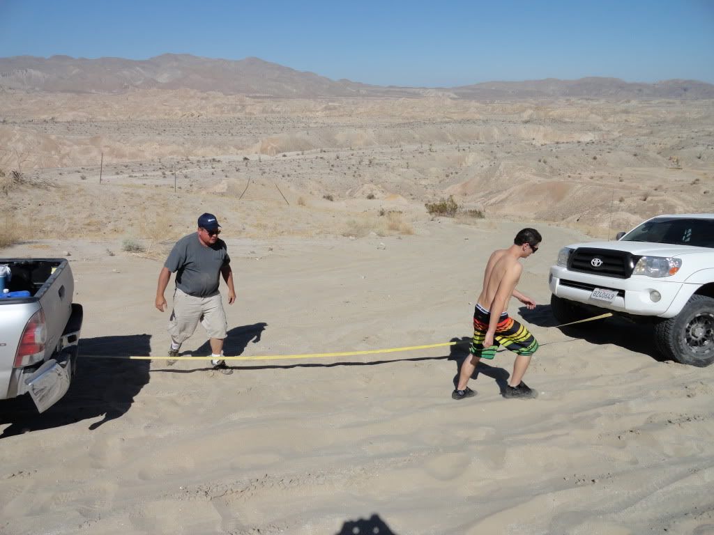
Have you seen the You Tube of me pulling a 2WD Tacoma out of the sand then up the Diablo Dropoff (not too far from your old place in Canebrake)?
Fun stuff!
[Edited on 4-13-2012 by David K]Barry A. - 4-13-2012 at 12:23 PM
David-------how do we access that U-tube about the "Diablo Dropoff" (between Fish Creek Wash and Arroyo Seco Del Diablo in the western Carrizo Bad
Lands area of Anza-Borrego)?David K - 4-13-2012 at 12:38 PM
Quote:
Originally posted by Barry A.
David-------how do we access that U-tube about the "Diablo Dropoff" (between Fish Creek Wash and Arroyo Seco Del Diablo in the western Carrizo Bad
Lands area of Anza-Borrego)?
There are many... but here is the one where I pulled 'James' (in a 2WD double cab Tacoma) out of the sand (between the two drop offs) then on to the
top... 41 seconds, with sound:
He was backing up to take another run at the climb, and backed into a sand dune...
Hooking him up...
It was a great run, the kids with SoCalTacomas are all very cool to do runs with... No drinking, good manners, many are military, and they have a lot
invested in their new-ish Tacomas. Off all of us on this run, about 4 were 2WD, and only James couldn't climb the upper part of the Diablo Dropoff.
There was a Jeep club that climbed to the top while we were hooking up, and about laughed when they heard I was going to pull him up... as if that was
impossible!
Well, as you saw, nothing is impossible with a 4WD Off Road Tacoma... with locking differential and A-TRAC! Barry A. - 4-13-2012 at 12:55 PM
Awesome!!!!!!! Thanks, David. I would not have believed it if I had not just seen it!!!
After seeing that video, and the pics of the Pole line road stuff, and the Widowmaker pics and videos, I know that I have to stay away from you wild
and crazy guys or I will be in BIG trouble, and my wife will leave me.
BarryDavid K - 4-13-2012 at 01:23 PM
You will do fine Barry.. (even if you only have a Nissan)!
Seriously, it is more about driving skill... and people like us who have been four wheeling in the desertand Baja since we were teenagers have an
advantage!
Here is another video clip from the Diablo Dropoff, that same day... showing first a 4WD Tacoma easily climbing it, followed by a 2WD Tacoma... and
you can hear the difference...
Barry A. - 4-13-2012 at 02:28 PM
Hmmmmmmmm-----------all I can say is the ground-moisture must have been ideal that day. I have been at the dropoff several times when IMO there is no
way any 2-wheel drive vehicle could have made it up (maybe, just maybe, with posi-traction!?!?!? huge tires, and low air-pressure). However, I must
admit that I have never even seen anybody try to climb it since it use to be closed to vehicles going that direction. (I know that now it isn't
closed anymore---as learned on NOMAD'S). I remember it as being very steep and sandy, with big whoop-de-doos. It has been 2 years since I went down
it, tho, and I have never tried to go the other way.
Great video---------proof that I am mistaken.
BarryKen Cooke - 4-13-2012 at 05:54 PM
The whoop-de-dos made it more difficult, but since the dirt has been packed in, it really isn't too challenging. But, my question is, why were 2WD
vehicles on this run???David K - 4-13-2012 at 09:29 PM
Because Tacoma World/ SoCalTacos doesn't discriminate!
In all seriousness, I prefer just 4WDs on a run, as there is usually one issue where I need to pull someone... but I don't mind... people helping
people and all that.
Many of the 2WDs are full-out pre-runners with lifts and big tires, etc. As I said only that one stock 2WD truck (without a locker) needed help... all
the other 4x2's did fine... and it was fun to quiet down the Jeepers who were shaking their heads earlier at the bottom, that any 2WD could climb the
Dropoff, and that the one that couldn't do it would be rescued by me in a truck... Seriously, he said to me: "you're going to pull him with that
(looking at my stock truck)?"
What arrogance... Ken Cooke - 4-13-2012 at 09:46 PM
In Calico, a run took place with the Rubicon Owners of CA where a simple tire-placement took a wrong turn, and a new Rubicon was reduced to a twisted
metal ornament - at the beginning of the 4WD run! This Jeep had a strong rollcage, etc.
On "When Vacations Attack" a well-built Jeep rolled up in Barstow, and the same outcome. These things can happen in a split second. That's why I
wonder the logic of someone who could get into trouble - it's not arrogance, just wariness. Think about it.David K - 4-13-2012 at 09:50 PM
Well, a Tacoma is a world safer than a Jeep Wrangler... Not as nimble, but being longer wheel based... far more stable. Too many unexperienced city
folks buy a Jeep and then think it will go anywhere... But ignore that driving skill off road plays a BIG HAND.
Have you seen the rolling Jeep on Heart Attack Hill?
[Edited on 4-14-2012 by David K]Ken Cooke - 4-13-2012 at 10:05 PM
Quote:
Originally posted by David K
Well, a Tacoma is a world safer than a Jeep Wrangler... Not as nimble, but being longer wheel based... far more stable. Too many unexperienced city
folks buy a Jeep and then think it will go anywhere... But ignore that driving skill off road plays a BIG HAND.
Have you seen the rolling Jeep on Heart Attack Hill?
[Edited on 4-14-2012 by David K]
Actually, when you lift both vehicles, the Jeep Wrangler has a much LOWER COG than does a Toyota Tacoma. Pickup trucks are not as safe as SUVs in
side impact crashes. I researched this when I had the Ford Ranger (1996-2003). Sure, the short wheelbase Wrangler is less stable on hillclimbs, but
the Unlimited TJ has a similar wheelbase to a previous-generation Tacoma, but a center of gravity close to that of a stock Tacoma. I wonder if the
BFG AT/KO tires (narrow width) played any role in that mishap on Heart Attack Hill?David K - 4-13-2012 at 10:11 PM
It was pretty dramatic, and that poor lady... I guess it was her husband guiding her... and I am sure he never meant for her to turn into the slope,
but the last thing he did before jumping out of the way was pointing her to turn right (which was wrong)!Ken Cooke - 4-13-2012 at 10:13 PM
Mexitron - 4-14-2012 at 10:34 AM
Quote:
Originally posted by David K
Well, a Tacoma is a world safer than a Jeep Wrangler... Not as nimble, but being longer wheel based... far more stable. Too many unexperienced city
folks buy a Jeep and then think it will go anywhere... But ignore that driving skill off road plays a BIG HAND.
Have you seen the rolling Jeep on Heart Attack Hill?
[Edited on 4-14-2012 by David K]
Just watched that video-----sick!!!!David K - 4-14-2012 at 11:22 AM
Quote:
Originally posted by Mexitron
Quote:
Originally posted by David K
Well, a Tacoma is a world safer than a Jeep Wrangler... Not as nimble, but being longer wheel based... far more stable. Too many unexperienced city
folks buy a Jeep and then think it will go anywhere... But ignore that driving skill off road plays a BIG HAND.
Have you seen the rolling Jeep on Heart Attack Hill?
Just watched that video-----sick!!!!
The ultra slow motion with screems are pretty intense... this video has both and is followed by the helicopter rescue (this is the same model Jeep
Rubicon that Ken has, silver, too):
The husband in the last direction given is pointing to her to turn right, and he isn't even looking at what is happening.David K - 4-14-2012 at 11:26 AM
A Nissan Xterra almost suffers the same fate in NorCal... but this drive wisely turns left and not right!
David K - 4-14-2012 at 12:07 PM
Last Saturday, north of Escondido...
Those with 4WD help those without.
[Edited on 4-14-2012 by David K]Mexitron - 4-14-2012 at 12:28 PM
Quote:
Originally posted by David K
Quote:
Originally posted by Mexitron
Quote:
Originally posted by David K
Well, a Tacoma is a world safer than a Jeep Wrangler... Not as nimble, but being longer wheel based... far more stable. Too many unexperienced city
folks buy a Jeep and then think it will go anywhere... But ignore that driving skill off road plays a BIG HAND.
Have you seen the rolling Jeep on Heart Attack Hill?
Just watched that video-----sick!!!!
The ultra slow motion with screems are pretty intense... this video has both and is followed by the helicopter rescue (this is the same model Jeep
Rubicon that Ken has, silver, too):
The husband in the last direction given is pointing to her to turn right, and he isn't even looking at what is happening.
I'm thinking that guy's gonna be in the doghouse for quite a while with those directions...
Jonathan Smith, aka the "Colonel", who was along with us on the Pole Line adventure, did a really nice job of spotting for us---he stopped me just
before I was about to can opener my fender at the bottom of Basketball Hill (my longbed wheelbase made that one extra special)
Speaking of which---where did the name Basketball Hill come from? From all the BB-sized boulders that roll backwards under your truck during the
climb? David K - 4-14-2012 at 01:31 PM
I think it is named after the rock size, yes.
The best spotter I ever met is HB Murphy, from Tacoma World who joined us in 2010 going to Mision Santa Maria... There was a ton of spotting that
trip, and no roll-overs (but no Jeeps either)! pappy - 4-16-2012 at 08:55 AM
mexitron- oh that ledge! what that pic does not show is the length and steepness of that little climb, nor the problematic part-the 2 foot or so
verticle ledge at the very top. just when we though we had it made that "wall" presented itself at the most inopportune time.
the ledge i was thinking about was the stretch of narrow, slick rock that was sloped toward the canyon below, with sheer cliff going up on the other
side. not a lot of wiggle room. i think there was some h2o seepage on part of it as well making it that much more fun(or intense on the pucker factor
depending how one looks at it).
how did this become a mine is better than yours thread anyway??Ken Cooke - 4-16-2012 at 04:37 PM
Quote:
Originally posted by David K
I think it is named after the rock size, yes.
Correct - This is explained in the Jan-Feb 2000 Newsletter of Discover Baja by author Neal Johns.Mexitron - 4-16-2012 at 07:09 PM
Quote:
Originally posted by pappy
mexitron- oh that ledge! what that pic does not show is the length and steepness of that little climb, nor the problematic part-the 2 foot or so
verticle ledge at the very top. just when we though we had it made that "wall" presented itself at the most inopportune time.
the ledge i was thinking about was the stretch of narrow, slick rock that was sloped toward the canyon below, with sheer cliff going up on the other
side. not a lot of wiggle room. i think there was some h2o seepage on part of it as well making it that much more fun(or intense on the pucker factor
depending how one looks at it).
how did this become a mine is better than yours thread anyway??
I wonder if that road is even still there---a good rainstorm would have washed it out. I want to go back to the area and explore some more!pappy - 4-19-2012 at 11:00 AM
no doubt. that is a great zone to poke around in.David K - 10-11-2012 at 06:00 PM


 ---we came down
El Mano Canyon then headed south to Agua Caliente. After leaving Agua Caliente on the closest road hugging the base of the Sierra Juarez going south
we drove about 10 miles---BTW this part of the road was a SCORE course---and we intersected the old road which runs to Jamau/Valle de Trinidad to the
west. This portion of the road seemed to be in decent shape as some ranchers who were building a fence had attested to. We then proceeded to turn to
the southeast section of that road which Ken Cooke's map correctly shows as running through the Jaquejel Arroyo drainage (heh, before jumping
through several other drainages).
---we came down
El Mano Canyon then headed south to Agua Caliente. After leaving Agua Caliente on the closest road hugging the base of the Sierra Juarez going south
we drove about 10 miles---BTW this part of the road was a SCORE course---and we intersected the old road which runs to Jamau/Valle de Trinidad to the
west. This portion of the road seemed to be in decent shape as some ranchers who were building a fence had attested to. We then proceeded to turn to
the southeast section of that road which Ken Cooke's map correctly shows as running through the Jaquejel Arroyo drainage (heh, before jumping
through several other drainages).