| Pages:
1
2
3
4 |
Mexitron
Ultra Nomad

Posts: 3397
Registered: 9-21-2003
Location: Fort Worth, Texas
Member Is Offline
Mood: Happy!
|
|
Sierra Juarez to Sierra Tinajas Trip Report
Drove the ridgeroute from Rumorosa past Laguna Hanson
and eventually hooked up to the Canon El Mano Road which drops down into the desert. Camped up on top and got soaked by freezing rain and
wind.brrrrrr
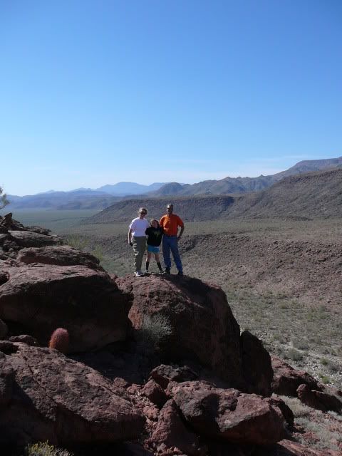
Heading down El Mano:

Brooks, Trinity, and Libby---we made it down El Mano:
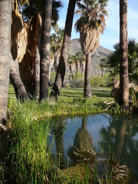
Heading up to Agua Caliente:

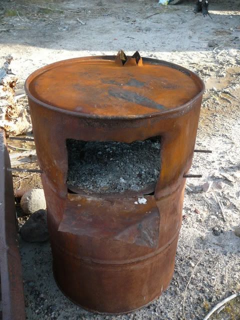
Cool stove:
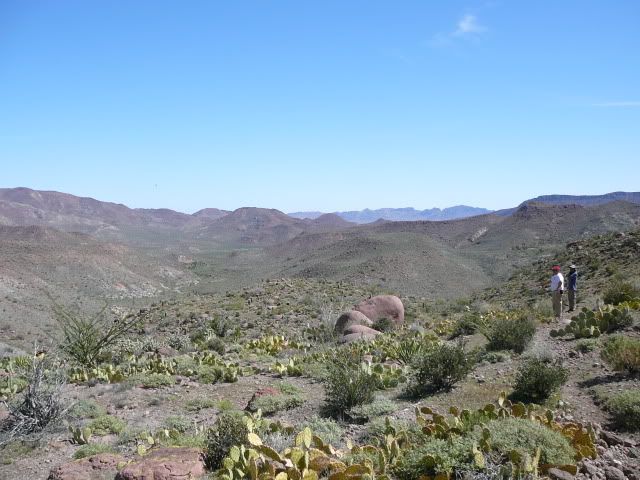
Hiking up Agua Caliente Canyon:
|
|
|
desertcpl
Super Nomad
Posts: 2400
Registered: 10-26-2008
Location: yuma,az
Member Is Offline
|
|
Beautiful,, thanks for sharing
|
|
|
Mula
Super Nomad
Posts: 1656
Registered: 8-16-2011
Location: San Nicolas y Lopez Mateos
Member Is Offline
|
|
Map of the route, David K?
|
|
|
Mexitron
Ultra Nomad
Posts: 3397
Registered: 9-21-2003
Location: Fort Worth, Texas
Member Is Offline
Mood: Happy!
|
|
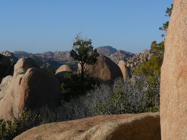
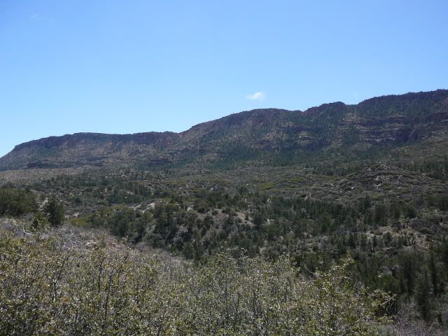
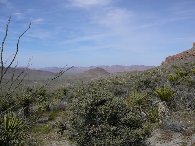
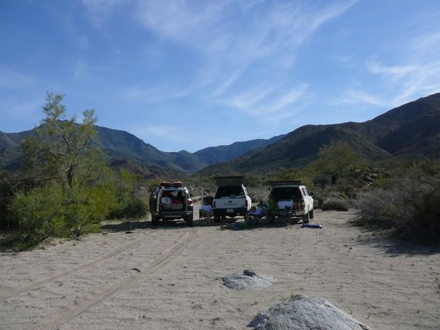
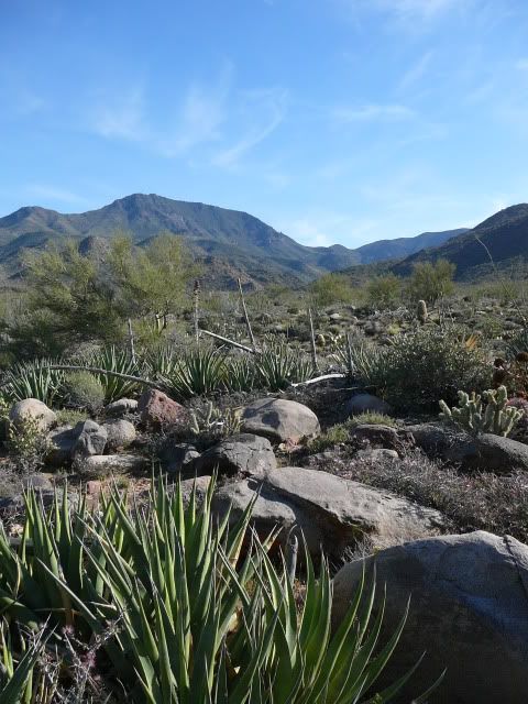
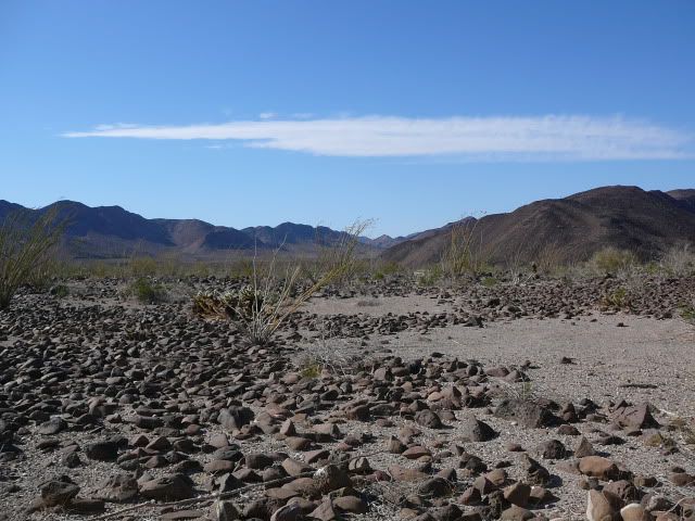
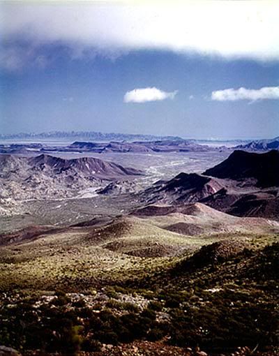
Next we hook up with the old road from Valle de Trinidad into
the Sierra Tinajas, which can be seen in the distance:
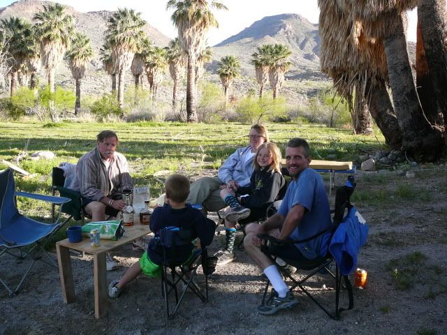
Nice camp spot:
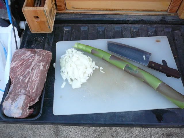
BBQed Tri-tip and sauteed Agave spear for dinner:
Off we go:
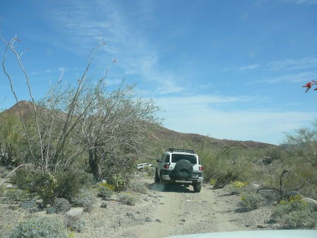
The road gets bad:
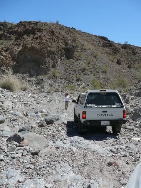
And then this high pucker factor section---steep, slippery, and high consequence of misstep...as Brooks said, approaching the limit of stock 4x4s like
ours:

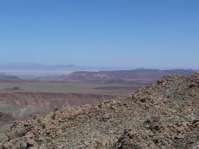
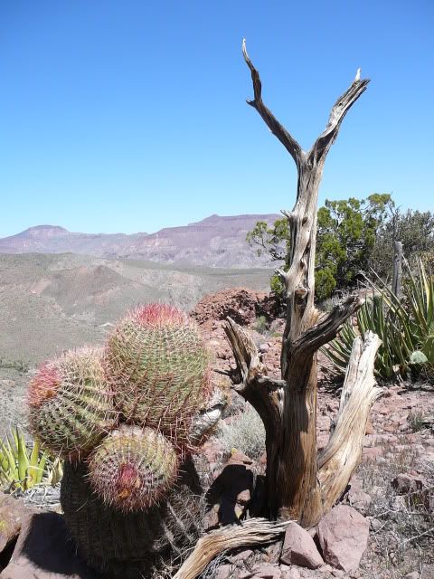
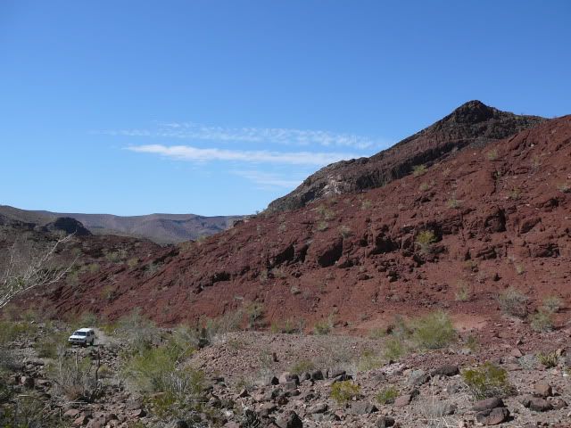
Parched but beautiful Sierra Tinaja:
Got through and camped out on the Laguna Salada somewhere, headed home next day...awesome fun time!
|
|
|
Mexitron
Ultra Nomad
Posts: 3397
Registered: 9-21-2003
Location: Fort Worth, Texas
Member Is Offline
Mood: Happy!
|
|
| Quote: | Originally posted by Mula
Map of the route, David K? |
Brooks has all the GPS map data and he'll likely post another report about it, but the route can be seen on the Baja topos or atlas.
|
|
|
Mula
Super Nomad
Posts: 1656
Registered: 8-16-2011
Location: San Nicolas y Lopez Mateos
Member Is Offline
|
|
Great photos. Thanks.
|
|
|
Mexitron
Ultra Nomad
Posts: 3397
Registered: 9-21-2003
Location: Fort Worth, Texas
Member Is Offline
Mood: Happy!
|
|
BTW there were some old poles toward the east side of the Tinajas---maybe this is an old pole line road??/
|
|
|
TMW
Select Nomad
Posts: 10659
Registered: 9-1-2003
Location: Bakersfield, CA
Member Is Offline
|
|
I think you were on the pole line road. But I would like to know how you made the turn to Basketball hill from the wash unless you had the GPS
coordinates. You had to go up BB hill because the road past it is a motorcycle only road or trail and even then you have to carry the bikes over some
rocks unless the rains have really changed the place. Would like to see the GPS data.
|
|
|
Neal Johns
Super Nomad
Posts: 1687
Registered: 10-31-2002
Location: Lytle Creek, CA
Member Is Offline
Mood: In love!
|
|
TW,
They were not on the Pole Line Road as we know it. El Mano goes from the top of the mountains to the bottom. It is about 11 miles north of "Summit"
(A. Alamito). Nice trip.
Great pics, Mexitron!
My motto:
Never let a Dragon pass by without pulling its tail!
|
|
|
bajalou
Ultra Nomad
Posts: 4459
Registered: 3-11-2004
Location: South of the broder
Member Is Offline
|
|
Great stuff Steve, thanks.
Nice to see a couple familiar faces also.
No Bad Days
\"Never argue with an idiot. People watching may not be able to tell the difference\"
\"The trouble with doing nothing is - how do I know when I\'m done?\"
Nomad Baja Interactive map
And in the San Felipe area - check out Valle Chico area |
|
|
Ken Cooke
Elite Nomad
Posts: 8961
Registered: 2-9-2004
Location: Riverside, CA
Member Is Offline
Mood: Pole Line Road postponed due to injury
|
|
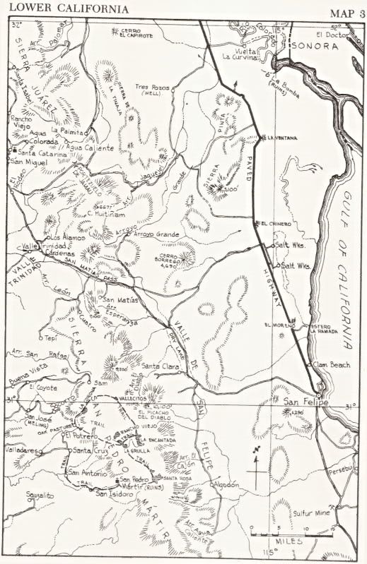
1962 Maps
Howard Gulick (Lower California Guidebook) mapped and made a road log of the Pole Line Road for his 1962 edition...
|
|
|
David K
Honored Nomad
Posts: 65175
Registered: 8-30-2002
Location: San Diego County
Member Is Offline
Mood: Have Baja Fever
|
|
Neal, they went south from El Mano Canyon past Agua Caliente, then on to the Pole Line??... (at least that's what I think from what I just read?)
[Edited on 4-8-2012 by David K]
|
|
|
goldhuntress
Senior Nomad
Posts: 663
Registered: 1-28-2010
Member Is Offline
|
|
Great photos. Looks like loads of fun! Thanks for sharing your trip.
|
|
|
TMW
Select Nomad
Posts: 10659
Registered: 9-1-2003
Location: Bakersfield, CA
Member Is Offline
|
|
DK that is what I thought too. That they came down El Mano and went to Agua Caliente then found the pole line road. Maybe they found the summit road
up over the mountains and out to hwy 1 NW of Trinidad. Need to see the GPS data.
|
|
|
David K
Honored Nomad
Posts: 65175
Registered: 8-30-2002
Location: San Diego County
Member Is Offline
Mood: Have Baja Fever
|
|
| Quote: | Originally posted by TW
DK that is what I thought too. That they came down El Mano and went to Agua Caliente then found the pole line road. Maybe they found the summit road
up over the mountains and out to hwy 1 NW of Trinidad. Need to see the GPS data. |
I edited my reply from late last night... I realized that Agua Caliente is before the Pole Line Road, when coming south from Mano Canyon...
Mexitron... we love the photos, but some more directional details please! 
THANKS!
|
|
|
TMW
Select Nomad
Posts: 10659
Registered: 9-1-2003
Location: Bakersfield, CA
Member Is Offline
|
|
Here is a picture from top of the summit taken by Bob Bower BFG.
|
|
|
Bajaboy
Ultra Nomad
Posts: 4375
Registered: 10-9-2003
Location: Bahia Asuncion, BCS, Mexico
Member Is Offline
|
|
Thanks for the report....
|
|
|
DianaT
Select Nomad
Posts: 10020
Registered: 12-17-2004
Member Is Offline
|
|
Looks like you had a great time. Also looks a little like you just winged it as you went finding your own way----we often find this is the most fun
and leaves one with a real sense of adventure.
Thanks for the report and the really nice photos.
|
|
|
Mexitron
Ultra Nomad
Posts: 3397
Registered: 9-21-2003
Location: Fort Worth, Texas
Member Is Offline
Mood: Happy!
|
|
Sorry for the vague directions, still in my post Baja haze  ---we came down
El Mano Canyon then headed south to Agua Caliente. After leaving Agua Caliente on the closest road hugging the base of the Sierra Juarez going south
we drove about 10 miles---BTW this part of the road was a SCORE course---and we intersected the old road which runs to Jamau/Valle de Trinidad to the
west. This portion of the road seemed to be in decent shape as some ranchers who were building a fence had attested to. We then proceeded to turn to
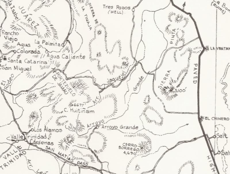
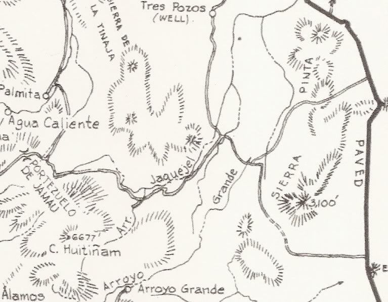
the southeast section of that road which Ken Cooke's map correctly shows as running through the Jaquejel Arroyo drainage (heh, before jumping
through several other drainages). ---we came down
El Mano Canyon then headed south to Agua Caliente. After leaving Agua Caliente on the closest road hugging the base of the Sierra Juarez going south
we drove about 10 miles---BTW this part of the road was a SCORE course---and we intersected the old road which runs to Jamau/Valle de Trinidad to the
west. This portion of the road seemed to be in decent shape as some ranchers who were building a fence had attested to. We then proceeded to turn to
the southeast section of that road which Ken Cooke's map correctly shows as running through the Jaquejel Arroyo drainage (heh, before jumping
through several other drainages). 
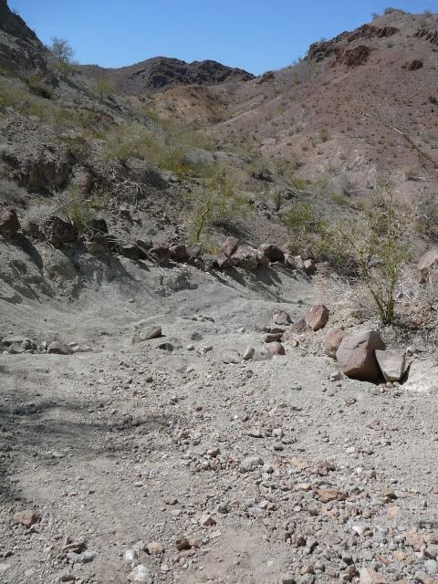
The road appeared to be fairly old with some sections of nice roadwork still intact while others completely washed out.
|
|
|
David K
Honored Nomad
Posts: 65175
Registered: 8-30-2002
Location: San Diego County
Member Is Offline
Mood: Have Baja Fever
|
|
| Quote: | Originally posted by Mexitron
Sorry for the vague directions, still in my post Baja haze ---we came down
El Mano Canyon then headed south to Agua Caliente. After leaving Agua Caliente on the closest road hugging the base of the Sierra Juarez going south
we drove about 10 miles---BTW this part of the road was a SCORE course---and we intersected the old road which runs to Jamau/Valle de Trinidad to the
west. This portion of the road seemed to be in decent shape as some ranchers who were building a fence had attested to. We then proceeded to turn to
the southeast section of that road which Ken Cooke's map correctly shows as running through the Jaquejel Arroyo drainage (heh, before jumping
through several other drainages).
The road appeared to be fairly old with some sections of nice roadwork still intact while others completely washed out. |
That is the Pole Line Road, built in 1941 to install/ check on the phone line between Ensenada and our tiny San Felipe base, where we had installed a
radar station to watch for Japanese (or German?) invasion coming up the Gulf of California.
|
|
|
| Pages:
1
2
3
4 |