BajaNomad

Another geoglyph image

vandy - 10-30-2012 at 05:03 AM

Location location location.
Thank you for reminding me to get my flu shot.

tripledigitken - 10-30-2012 at 05:51 AM

GPS coordinates?

Marc - 10-30-2012 at 06:41 AM

Quote:
Originally posted by tripledigitken
GPS coordinates?


Really cool pics! (smugmug)

Marc - 10-30-2012 at 06:42 AM

To small. Can't see it. GPS??

tripledigitken - 10-30-2012 at 07:15 AM

Quote:
Originally posted by Marc
Quote:
Originally posted by tripledigitken
GPS coordinates?


Really cool pics! (smugmug)


Thanks Marc!

Taco de Baja - 10-30-2012 at 07:15 AM

Runways?, roads?, cow trails?, water courses?, dozer track?

Hard to tell at that small image scale and I'd need to see more of the surrounding terrain to get a feel of the environmental context.

Some coordinates would help; or using a larger photo linked from a photo hosting site like Photobucket or Imageshack.

David K - 10-30-2012 at 07:58 AM

Just inland from Faro de San Jose (San Jose de la Piedra)?

Thank you... and if you set your photo resizer to 800 pixels wide, you don't exceed the page width on Nomad but you provide the biggest photo without stretching the screen...

Mavin Patchen shared with me his Geoglyph discovery near El Marmol... you can find the photos if you do a Nomad search

David K - 10-30-2012 at 08:14 AM

If you would like help posting the images here at max. size, drop me a u2u... I will be back on Nomad this afternoon... off to install some sprinklers in Valley Center now!

TacoFeliz - 10-30-2012 at 09:13 AM

GPS coordinates 2 and 3 show the marks well on GE.

Can you give any specifics on the eight sites around Los Sauces coordinates #1? Not seeing much in that neighborhood.

Thanks.

Here we go..........

mcfez - 10-30-2012 at 09:24 AM


google.jpg - 48kB

Another

mcfez - 10-30-2012 at 09:28 AM


goo2.jpg - 37kB

vandy - 10-30-2012 at 10:16 AM

Direction of Summer solstice sunset?

At 30 degrees North Latitude, the summer solstice sun sets at 297 degrees true.

[Edited on 10-30-2012 by vandy]

bacquito - 10-30-2012 at 01:20 PM

Really interesting! How did you come across these geoglyphs? I look forward to more information thanks

mtgoat666 - 10-30-2012 at 01:56 PM

Quote:
Originally posted by Lancesf
29 21'17.91N 114 44'4.03"W
There are 8 of them in this area


i glanced at your loc on google earth. i saw a lot of game/cattle trails in area, did not see what you saw, but only spent a moment looking...

when you post pic of your alien runways, post a scale bar too. google earth allows you to embed scale.

where is our resident remote sensing imagineer? i think his name was "elbow?"

mcfez - 10-30-2012 at 03:20 PM

Quote:
Originally posted by mtgoat666

where is our resident remote sensing imagineer? i think his name was "elbow?"


:lol::lol::lol::lol:

David K - 10-30-2012 at 08:14 PM

You want to start another lost mission search?:smug::rolleyes:

vandy - 10-31-2012 at 06:31 AM

It would be interesting to see the view from one end at ground level.
My GPS is in Cabo, however.

bacquito - 10-31-2012 at 08:30 AM

Quote:
Originally posted by Lancesf
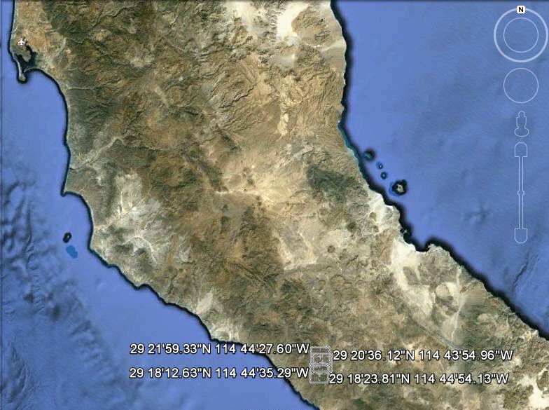
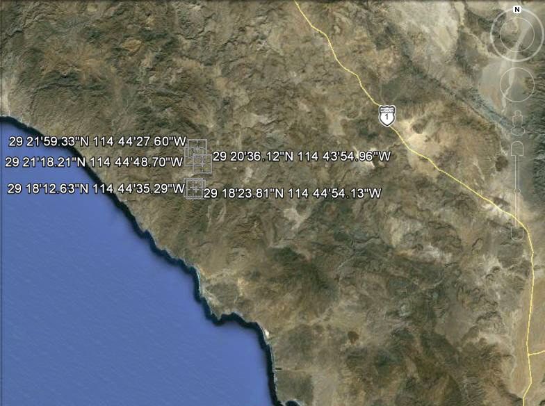
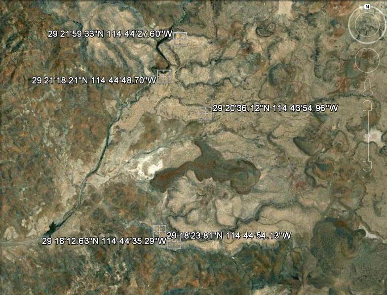
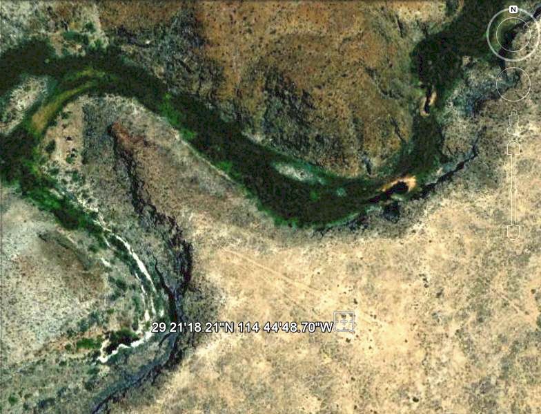
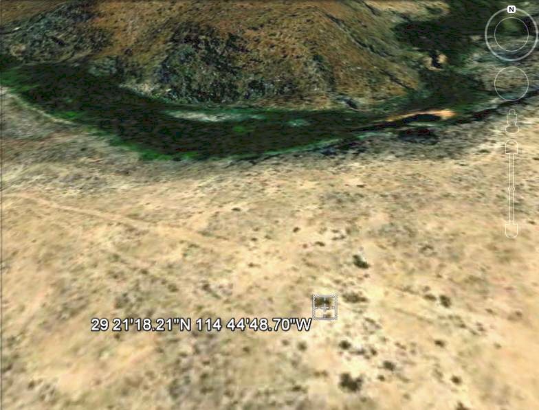
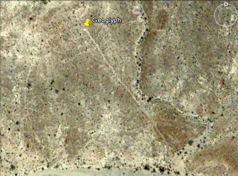
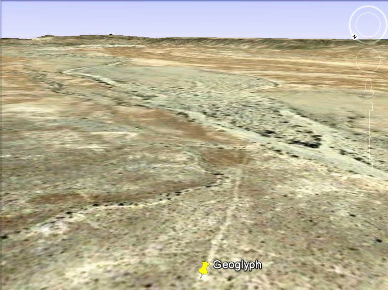
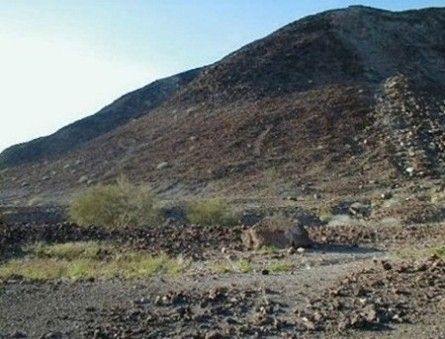
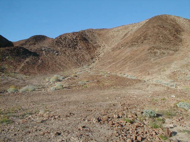
bacquito, I came across these on accident while researching routes to take on a trip next fall. At first I thought maybe they were from the colonial era and had something to do with cattle. When I searched more I found a bunch of remote ones and noticed the alignment.

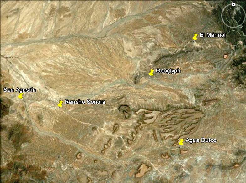
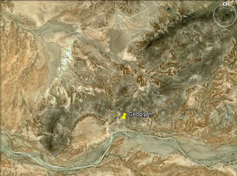
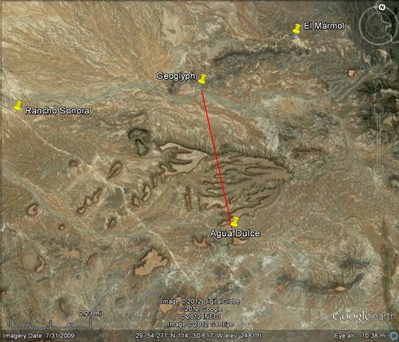
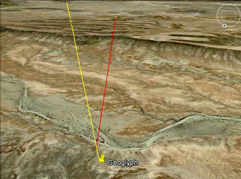
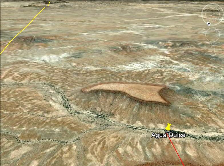
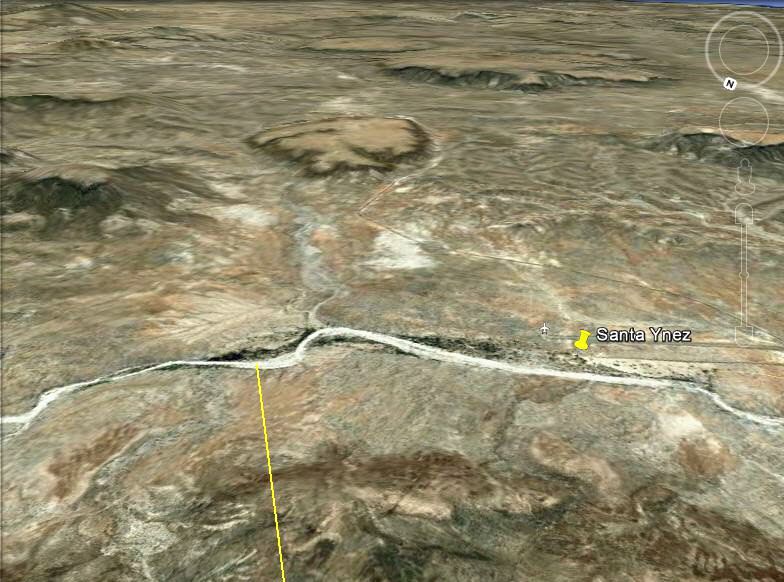
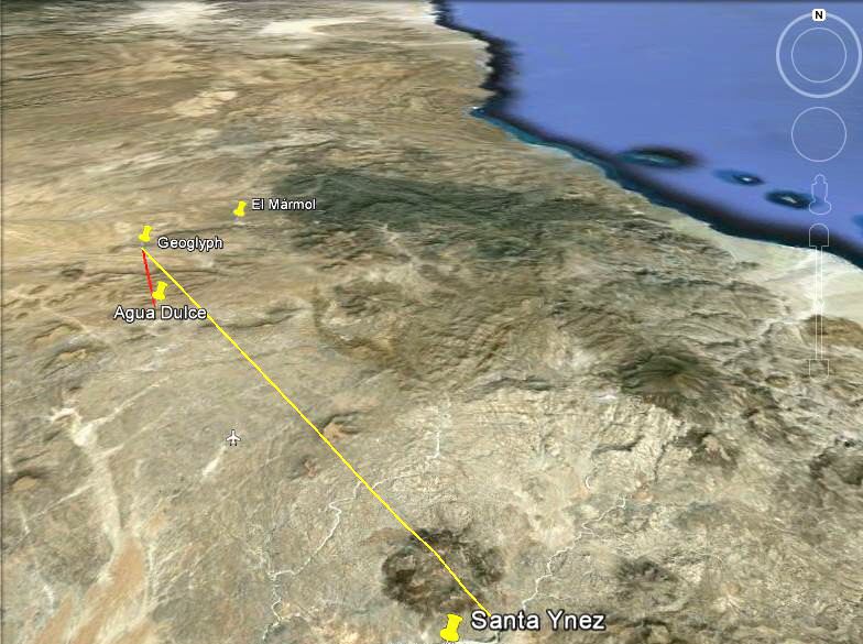
They do raise alot of interesting questions. They seem to all be in only one small part of Cochimi territory. The farthest distance between two is only about 20 miles. I have searched North and South of there and no luck, no luck on the East coast of Baja either.
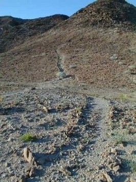
Was this only practiced by one band of Cochima? Or maybe it was a central gathering area of religious importance for different bands?
Also why are there so many? Did they have to make a new one at each ceremony? maybe creating them was the ceremony?

Thanks, keep us informed please.

[Edited on 10-31-2012 by Lancesf]

David K - 10-31-2012 at 09:26 AM

Quote:
Originally posted by Lancesf
Here are some coordinates again for Los Sauces.

29 21'18.21"N 114 44'48.70"W Three clustered together, if you follow the river west you will find two more.

29 21'59.33"N 114 44'27.60"W Two faded ones together.

29 20'36.12"N 114 43'54.96"W an older looking and smaller one

Here are two more nearby

29 18'23.81"N 114 44'54.13"W (edited W for N)

29 18'12.63"N 114 44'35.29"W

[Edited on 10-31-2012 by Lancesf]


29 21'18.21"N 114 44'48.70"W is at Rancho San José, lots of water in the arroyo, so a good sign for finding old Indian activity. A couple of them could very well be natural... but the ones by the arroyo are very convincing!

So that everyone has an idea of where in Baja this is, I will start from high up, then zoom in on the pair near Rancho San José...


[Edited on 6-6-2022 by David K]

bajaguy - 10-31-2012 at 09:34 AM

DK..........when were the sat photos taken???

David K - 10-31-2012 at 10:43 AM

Quote:
Originally posted by bajaguy
DK..........when were the sat photos taken???


July 26, 2007

David K - 11-1-2012 at 07:18 AM

El Marmol glyph is a straight line on a hill slope. I will post what I have here.... stay tuned!

El Marmol geoglyph

John M - 11-1-2012 at 02:58 PM

We have visited the El Marmol geoglyph a couple of years ago, photographed it - walked it - one of them anyway. I'll dig up details tomorrow.

John M

David K - 11-1-2012 at 06:09 PM

Here is Neal John's quote from his Trip Report of April, 2009 (I bumped up the four part trip report):

We had lunch at a taco stand south of Ensenada and went onward to camp at a wide spot off the El Marmol road. The next morning we found an old road previously spotted on Google Earth and drove to a geoglyph site found by old Baja hands Marv Patchen and Eve Ewing. This was a small knoll with a straight path leading several hundred feet down to an arroyo. The rock circles at the top of the knoll were in some disarray and there was little else to see but is was interesting to find. The narrow old road we found was as interesting and exciting as the geoglyph. Creosote bushes put exotic pinstriping on the sides of our Toyotas and no one cared. This is what we bought them for!

That's the trip

John M - 11-1-2012 at 08:08 PM

I had forgotten Neal wrote it up a bit...I'll look over what he wrote and add other stuff I think. John

David K - 11-1-2012 at 09:30 PM

Please do John. I have the published paper and thought I had posted more including Google earth images but I only found Neal's posts.

El Mármol Geoglyph

David K - 11-1-2012 at 11:34 PM

First three images with north at top, pin at top of hill, end of glyph:


Looking down the glyph:


Looking up the glyph is John M:


Could it be a direction sign to the nearest water?


Almost, but the heading from top to bottom is slightly more east than the line to Agua Dulce...


Still, it is pretty close, and Agua Dulce has year-round sweet water!


The direct line of the geoglyph meets the arroyo we cross going to Santa María from Santa Ynez.


What do you think?


[Edited on 6-6-2022 by David K]

El Marmol geoglyphs

John M - 11-2-2012 at 05:19 AM

I believe I'll take a step back and let others complete the El Marmol data and information. My info is pretty limited. John

David K - 11-2-2012 at 08:10 AM

Just playing with Google Earth John, I wasn't there in person... and Neal did a trip report in 2009. I would love to hear your observations and guesses as to its purpose. Thank you!

wilderone - 11-2-2012 at 08:34 AM

There is also an altar near the glyph, a bit before Agua Dulce. It is the same type of altar that Mike Younghusband encountered elsewhere in southern Baja.

David K - 11-4-2012 at 12:45 AM

A mile west of Hwy. 5, between Km. 113 and 114 (between Mexicali and San Felipe) is a valley of geoglyphs... I reported on it here on Nomad in 2005 after our San Felipe 250 Race weekend trip...

I recorded the GPS: GPS: N 31°40.53', W 115°04.64' (NAD 27).Google Earth uses map datum WGS84, but NAD27 is close if you want to have a look.


Pretty weird, right?

[Edited on 6-6-2022 by David K]

David K - 11-23-2012 at 09:36 AM

Very cool... Baja is a treasure chest full of wonders!

David K - 11-24-2012 at 05:12 PM

Quote:
Originally posted by Lancesf
Here is an attempt at posting a google earth image of the anthropomorphic figure. Much easier to see if you go to google earth itself. The arrow points to the upside down figure under the left arm.
Again, the coordinates for the upside down figure are
29 27'22.30 'N 114 37"22.30"W. Best way to view is by turning page so top is due south.
Can you see it?

[Edited on 11-24-2012 by Lancesf]


You need a small edit on your GPS number to this: 29 27' 22.30" N 114 37' 22.30" W for it to work. Not needed, but the degree symbol fyi is created with Alt 248 °

[Edited on 6-6-2022 by David K]

David K - 1-20-2017 at 06:08 PM

Another way to make the degree symbol is Hold down the Alt key and enter 248
°

[Edited on 6-6-2022 by David K]