BajaNomad

Wayno shares pics of Coco, Gonzaga Pavement, etc.

David K - 8-17-2013 at 10:09 AM

Just received photos from Wayno of BB Bait in Blythe...


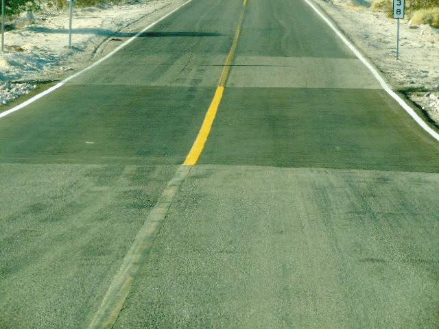
Vados south of San Felipe being filled in (not all, yet... so keep your speed down until Puertecitos)!


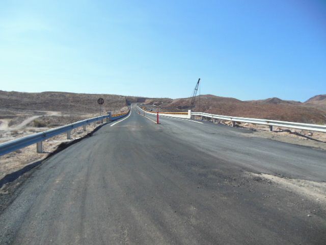
New bridge just north of Papa Fernandez' turnoff.


End of Pavement, south side of new bridge... No new work south of here, road getting very rough from lack of grading.


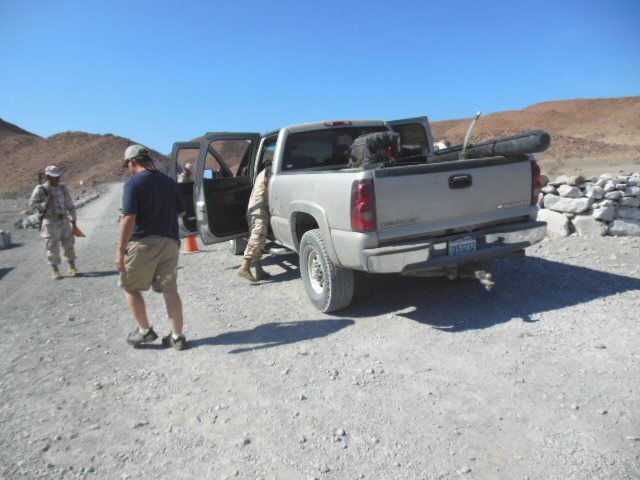
Military Checkpoint south of Papa Fernandez' road.


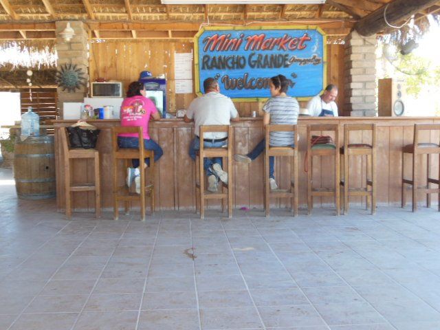
Rancho Grande Bar


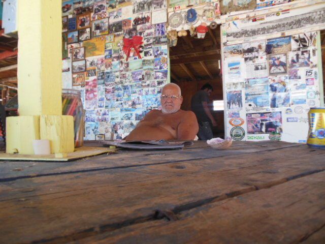
Coco


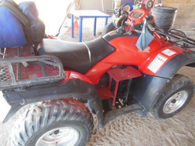
Coco's Quad

woody with a view - 8-17-2013 at 10:20 AM

basically identical to how we found it 2 weeks ago. from just before Coco's to H1 it is getting bumpy. from the Pemex south about 10 miles it is mostly 35-40mph.

BajaNomad - 8-17-2013 at 10:31 AM

Quote:
Originally posted by woody with a view
from just before Coco's to H1 it is getting bumpy.


I was copied on the emails. He noted that he felt they hadn't graded the road between Coco's and H1 for quite some time.

bajacalifornian - 8-17-2013 at 11:16 AM

Nice post. Nomad style . . .

cocoscabana - 8-17-2013 at 01:46 PM

We travel to Mulege every october, and are interested in travelling thru Gonzaga to Lake Chapala this year (we always go Mex1). Picture #4 shows a fairly level surface with rocks. How much worse than this does it get? Chevy dually, 4x4 with 11ft camper (fully loaded by the wife). We are familiar with Baja side roads, as we take an annual trip from San Ignacio thru El Datil down pacific coast to San Juanico. How does this compare to the Gonzaga road, in regard to the road surface?

bajaguy - 8-17-2013 at 02:28 PM

Without a culvert that vado will last about 5 minutes during the first storm

Barry A. - 8-17-2013 at 02:49 PM

Quote:
Originally posted by bajaguy
Without a culvert that vado will last about 5 minutes during the first storm


In my experience, if they built those "Texas crossings" (no culvert) correctly, they would last indefinitely and they would save the price (and maintenance) of a "culvert". But "texas crossings" are not often for "high-speed" roads, which none of us expect in Baja anyway------right??? :tumble:

If you remember, or have travelled the Imperial County section of Highway 78 between Ocotillo Wells and Highway 86 (southwest of the Salton Sea) you might have noticed that it has a half-dozen + "Texas Crossings" (no culverts) and they have lasted for years with minimal repair and much over-flooding, and the road is fairly 'high-speed'. There are examples of these 'texas crossings' all over the Mojave Desert and the Southwest USA deserts. Culverts, unless they are huge, are a real pain in the A-- to maintain in the desert, and they almost always plug-up and overflow in flash-flood conditions, often ruining the road bed above them.

Just my 2-cents.

Barry

David K - 8-17-2013 at 02:53 PM

Quote:
Originally posted by cocoscabana
We travel to Mulege every october, and are interested in travelling thru Gonzaga to Lake Chapala this year (we always go Mex1). Picture #4 shows a fairly level surface with rocks. How much worse than this does it get? Chevy dually, 4x4 with 11ft camper (fully loaded by the wife). We are familiar with Baja side roads, as we take an annual trip from San Ignacio thru El Datil down pacific coast to San Juanico. How does this compare to the Gonzaga road, in regard to the road surface?
:coolup::coolup:

It is a 2wd graded dirt road. 38 miles from the pavement to Chapala. Washboard surface to rough rocky surface so slow driving. Any car except low sportscars can get through. I would suggest no motorhomes or trailers until it is regraded or paved.

bajaguy - 8-17-2013 at 03:09 PM

Quote:
Originally posted by Barry A.
In my experience, if they built those "Texas crossings" (no culvert) correctly, they would last indefinitely and they would save the price (and maintenance) of a "culvert". But "texas crossings" are not often for "high-speed" roads, which none of us expect in Baja anyway------right??? :tumble: Barry


Yup, no doubt they built those vados correctly.......just like the one immediately south of Cataviņa.

woody with a view - 8-17-2013 at 04:13 PM

Quote:
Originally posted by David K
Quote:
Originally posted by cocoscabana
We travel to Mulege every october, and are interested in travelling thru Gonzaga to Lake Chapala this year (we always go Mex1). Picture #4 shows a fairly level surface with rocks. How much worse than this does it get? Chevy dually, 4x4 with 11ft camper (fully loaded by the wife). We are familiar with Baja side roads, as we take an annual trip from San Ignacio thru El Datil down pacific coast to San Juanico. How does this compare to the Gonzaga road, in regard to the road surface?
:coolup::coolup:

It is a 2wd graded dirt road. 38 miles from the pavement to Chapala. Washboard surface to rough rocky surface so slow driving. Any car except low sportscars can get through. I would suggest no motorhomes or trailers until it is regraded or paved.


now that the master has spoken..... forget the drama. if you can make the salt flats to SJ then this road is a dream!:light:

Barry A. - 8-17-2013 at 05:32 PM

Quote:
Originally posted by woody with a view
Quote:
Originally posted by David K
Quote:
Originally posted by cocoscabana
We travel to Mulege every october, and are interested in travelling thru Gonzaga to Lake Chapala this year (we always go Mex1). Picture #4 shows a fairly level surface with rocks. How much worse than this does it get? Chevy dually, 4x4 with 11ft camper (fully loaded by the wife). We are familiar with Baja side roads, as we take an annual trip from San Ignacio thru El Datil down pacific coast to San Juanico. How does this compare to the Gonzaga road, in regard to the road surface?
:coolup::coolup:

It is a 2wd graded dirt road. 38 miles from the pavement to Chapala. Washboard surface to rough rocky surface so slow driving. Any car except low sportscars can get through. I would suggest no motorhomes or trailers until it is regraded or paved.


now that the master has spoken..... forget the drama. if you can make the salt flats to SJ then this road is a dream!:light:


-------and "SJ" would be what???

----and if you mean by "master" one of the most Baja-educated individuals on the board, and the most helpful, then I heartily agree. :spingrin:

------what "drama"??? :?:

---by the way, I have never personally met DavidK.

Barry

David K - 8-17-2013 at 06:57 PM

Yah, Woody... what did I say in that post that isn't accurate or contained drama?

woody with a view - 8-17-2013 at 07:48 PM

cocoscabanas said something to the effect "we travel thru Datil to SAN JUANICO" = SJ... sorry if it wasn't clearer than your vision.

the master said, " I would suggest no motorhomes or trailers until it is regraded or paved." perhaps i read something into his post where he "SUGGESTS" a dually might want to heed his commands.

i know, i'm reading WAAAY too much into it.:rolleyes:

David K - 8-17-2013 at 09:31 PM

Correct. If a motorhome or travel trailer uses that road as a shortcut, it won't be without a mess or breakage as it is not a smooth, saltflat road. Better to plan on rough and find it smooth than the other way around, yes?

cocoscabana - 8-17-2013 at 09:49 PM

Appreciate the two points of view. When we travel San Ignacio/Datil/San Juanico it is not all salt flats. Having said that, we do not have the Lance camper on when we do that trip. Do not wish to shake the camper to pieces, however. We have a air compressor, so would be able to air down for the 40 miles.

Big decision. We will be coming down this year from Santa Fe, not California, so the shortcut is very tempting!

mtgoat666 - 8-17-2013 at 10:09 PM

Quote:
Originally posted by Barry A.
"Texas Crossings" (no culverts) and they have lasted for years with minimal repair and much over-flooding, and the road is fairly 'high-speed'. There are examples of these 'texas crossings' all over the Mojave Desert and the Southwest USA deserts. Culverts, unless they are huge, are a real pain in the A-- to maintain in the desert, and they almost always plug-up and overflow in flash-flood conditions, often ruining the road bed above them.

Just my 2-cents.

Barry


"texas crossing?"

i have always called them "arizona crossings"

just my 4 cents!

p.s you can also call them a "concrete paved ford" and thereby avoid thinking about unpleasant places like arizona and texas :lol::lol:

woody with a view - 8-18-2013 at 07:06 AM

it took us 1 1/2 hours in a loaded tundra. didn't air down. just go.....

edit: BTW, it is nothing like the middle or upper roads.

[Edited on 8-18-2013 by woody with a view]

watizname - 8-18-2013 at 08:10 AM

Or call them "fair weather crossings". Highway 101 has one just North of Ventura where the highway crosses the Ventura river. When the river really gets going, and washes out the campground there, the water actually comes up over the highway and crosses it. Big long low spot, kinda hard to see, but it's there. Seen it happen.

TMW - 8-18-2013 at 11:51 AM

Quote:
Originally posted by cocoscabana
Appreciate the two points of view. When we travel San Ignacio/Datil/San Juanico it is not all salt flats. Having said that, we do not have the Lance camper on when we do that trip. Do not wish to shake the camper to pieces, however. We have a air compressor, so would be able to air down for the 40 miles.

Big decision. We will be coming down this year from Santa Fe, not California, so the shortcut is very tempting!


If you decide to take this route just be careful as I'm sure you will be. Last Nov. I came upon a guy pulling a trailer and he buckled his trucks frame rails and broke one of the trailers leaf spring shackles. Here is my trip report. I wound up pulling his trailer with my full size truck and I just took it easy. He did not think the rough road did the damage but the dips before Puertecitos. He was not aware of the dips until too late going too fast. Another thing to remember is there are several holes on the side of the road from Cocos to hwy 1, don't get too close. Watch for the 18 wheelers too. Trip report below.

http://forums.bajanomad.com/viewthread.php?tid=64258

DianaT - 8-18-2013 at 01:04 PM

Quote:
Originally posted by TW
Watch for the 18 wheelers too.


Some of the trucks are REAL big.


Fortunately, the pilot truck stopped us and the other vehicle before we entered the narrow mountain part of the road. We had to wait quite a while as they were REALLY slow, but we were really happy that we did not cross paths with them on the main highway. :yes:

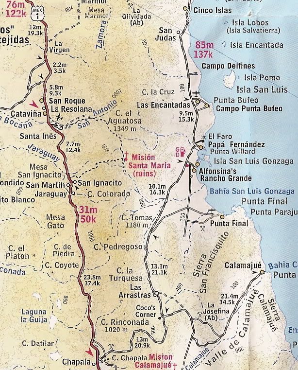
Could someone post Maps of these places? (Dave K?)

Whale-ista - 8-18-2013 at 02:14 PM

Thanks for the discussion. I'm curious, and not familiar w/the areas discussed.

Could someone apply the "picture worth 1000 words" theory, and post a map to illustrate where the new/under construction paved areas are?

Mil gracias!

[Edited on 8-18-2013 by Whale-ista]

David K - 8-18-2013 at 04:02 PM

Quote:
Originally posted by Whale-ista
Thanks for the discussion. I'm curious, and not familiar w/the areas discussed.

Could someone apply the "picture worth 1000 words" theory, and post a map to illustrate where the new/under construction paved areas are?

Mil gracias!

[Edited on 8-18-2013 by Whale-ista]


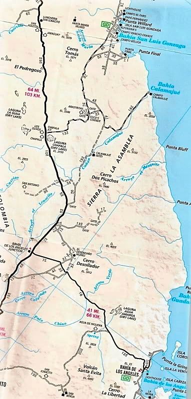
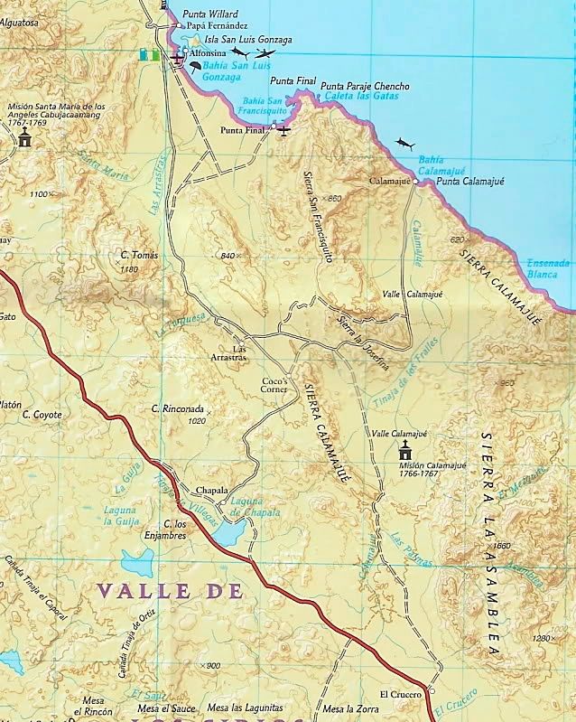
Let me know if these help... Gonzaga Bay to Hwy. 1 via Coco's Corner:


thank you, the images helped...

Whale-ista - 8-18-2013 at 04:31 PM

and I was able to match info up on my BC Almanac. Unfortunately it's pretty sliced/diced on 3 pages (6-7-8).

The Autoclub map makes it more understandable

Thanks!

David K - 8-18-2013 at 04:33 PM

Always happy to help!

Small portions of the overall maps shown for educational purposes...

The top map is the AAA map from 2007.

The middle map is the NAT GEO map from 2008.

The bottom map is the folding topo map from 2003, sold by The Baja CA Almanac publisher...

[Edited on 8-18-2013 by David K]

David K - 8-18-2013 at 04:54 PM

Here are maps of the Gonzaga Bay region starting in 1746, when Padre Consag named the fine harbor for San Luis Gonzaga: http://forums.bajanomad.com/viewthread.php?tid=45819