Originally posted by David K
Not so old history question that it belongs in the Baja History & Literature forum, but was thinking of what towns didn't exist before 1972 (the
year pavement reached north to Santa Rosalia from La Paz, and south to Colonia V. Guerrero/San Quintin from Ensenada.
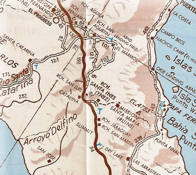
Things really sprung up once the transpeninsular highway was opened (Dec. 1, 1973). The town of Cataviña did not exist before the pavement, for
example. It began as a 'Parador' facility to serve the new traffic and included a Pemex station Cafeteria with a sunken lounge, showers and restrooms.
Across the highway was an El Presidente hotel and just north, a trailer park campground. In July, 1973 there was none of that here and no road
construction had reached the spot yet. My next trip was in April, 1974 and all of the parador was in operation. Naturally these services needed people
to operate them, and the nearby ranchos of San Luis and Santa Ynez did not have people for hire.
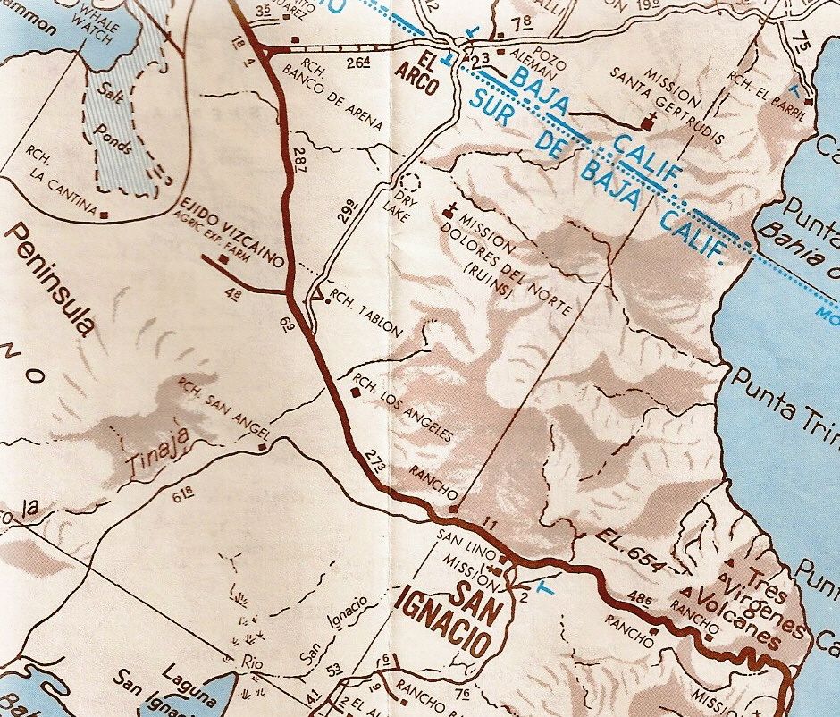
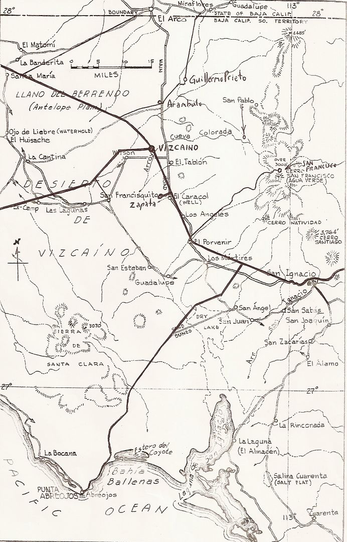
The other 'new' town I can think of is Vizcaino (El Vizcaino)... It sprung up from the desert just before the new highway arrived. Nearby, the pilot
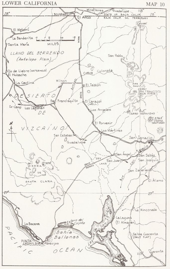
test farm project known as Rancho de Wilson was successful in using 'fossil water' to turn the desert into a food producing oasis. Rancho de Wilson
was started about 1959. On today's topo map, it is called 'Pueblo Viejo'. The name of a town or ejido of 'Vizcaino' first began about 2 miles east of
where it is today. The business opportunity from truck, bus and auto traffic on Hwy. 1 was just too great. The original Ejido Vizcaino became Ejido
Diaz Ordaz and a new Highway One 'Vizcaino' exploded with growth.
In the 1972 Auto Club guide to Baja California Sur, the pavement going north had reached midway between Santa Rosalia and San Ignacio with roadbed
construction on to San Ignacio and beyond an additional 10 miles west (or northbound). In that guide, El Vizcaino is first mentioned as being a
recently developed agricultural community, 5 miles west of Rancho El Tablon.
On these 1974 Auto Club maps of the two areas it is clear that Cataviña is just a minor point along the highway and Vizcaino was well west of the
highway and didn't exist at the junction with the Asuncion/ Tortugas road as of yet.
Here is the 1962 Gulick Map showing Rancho de Wilson:
Now here is that map with new additions drawn in to show the location comparison:
What are any other 'new' towns that popped up?
[Edited on 1-15-2014 by David K] |


