BajaNomad

Rock canyon pictures??

Corky1 - 9-12-2014 at 09:20 AM

Does anyone have any pictures of the rock canyon short cut between what is now the intersection of Hwy 1 and Hwy 5 ??

This was a short cut between Hwy 1 (before the pavement) and the area of Cocos used by the motorcycles during the NORRA races. By passing the silt of Chapala.

The canyon was to narrow and rocky for the buggies and other vehicles.

The canyon was later bulldozed out to get the trucks from fish camps on the gulf to Hwy 1.

The area is now Hwy 5 between Cocos and Hwy 1.

Thanks
Corky

David K - 9-12-2014 at 11:34 AM

Quote:
Originally posted by Corky1
Does anyone have any pictures of the rock canyon short cut between what is now the intersection of Hwy 1 and Hwy 5 ??

This was a short cut between Hwy 1 (before the pavement) and the area of Cocos used by the motorcycles during the NORRA races. By passing the silt of Chapala.

The canyon was to narrow and rocky for the buggies and other vehicles.

The canyon was later bulldozed out to get the trucks from fish camps on the gulf to Hwy 1.

The area is now Hwy 5 between Cocos and Hwy 1.

Thanks
Corky


Hi Corky,

TW recently posted satellite images and old maps of that road between Chapala and Coco's (Las Arrastras area) in the Coco's thread... scroll down past my photos of Coco and us: http://forums.bajanomad.com/viewthread.php?tid=75108

The rock canyon and 1969-1973 NORRA Baja 500 course used the road built by Arturo Grosso about 1955-56. It was so bad, that most traffic used Calamajué Canyon instead. In 1983 a new graded road was built through the canyon over the top of much of Grosso's road to go to Puerto Calamajué fish camp. Later about 1987, the graded road from Gonzaga Bay going south reached it, and that intersection became Coco's Corner.

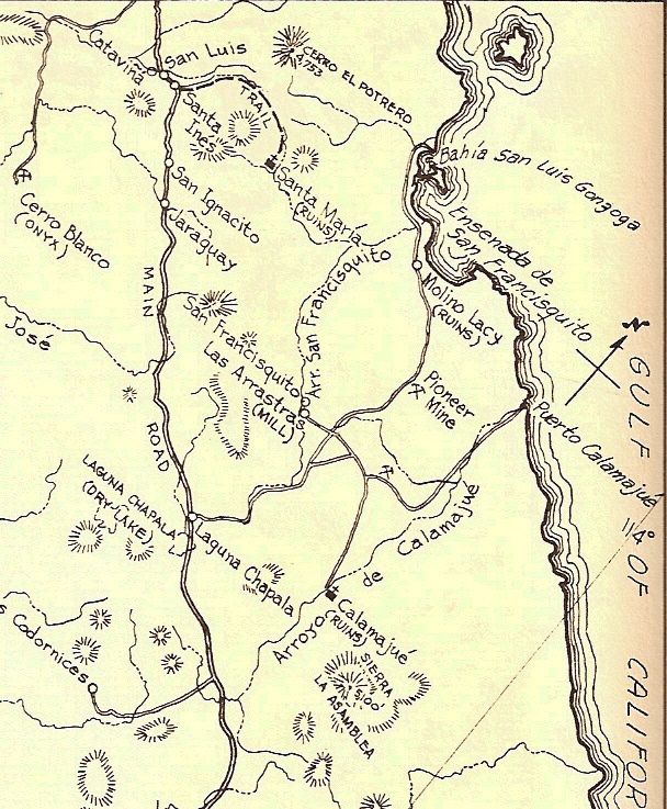
Here is a map close up published in 1956 (by Howard Gulick) during the construction of the road north, ending at Gonzaga Bay. The road south from Calamajué mission was not yet opened... cars were pretty rare in this part of Baja!


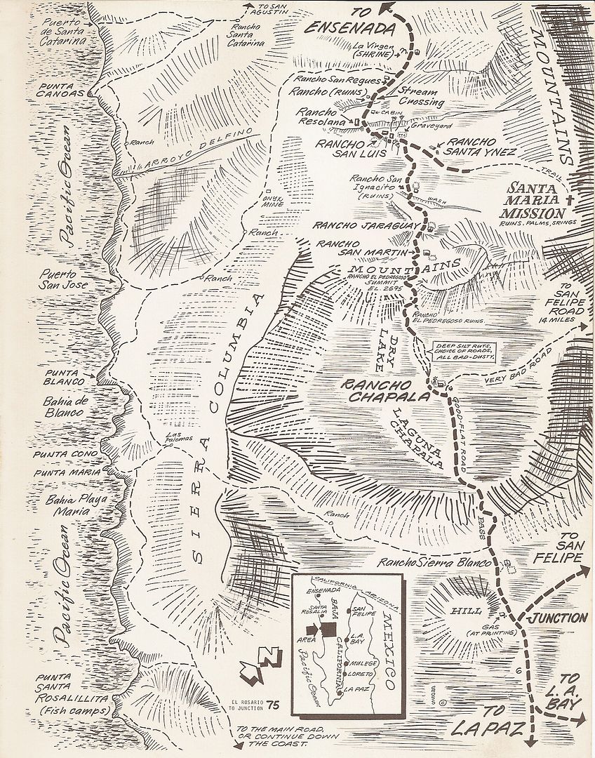
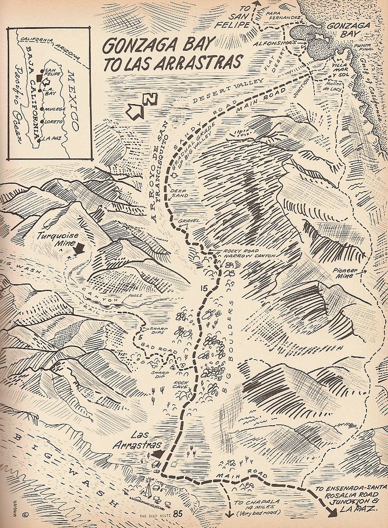
Note on the following 1970 Cliff Cross maps "Very Bad Road" from Chapala to Las Arrastras...


David K - 9-13-2014 at 09:35 AM

I would like to see photos of the old road north from Chapala to Las Arrastras... I cannot recall any photos in any of my books of it. Most avoided it and went through Calamajué.

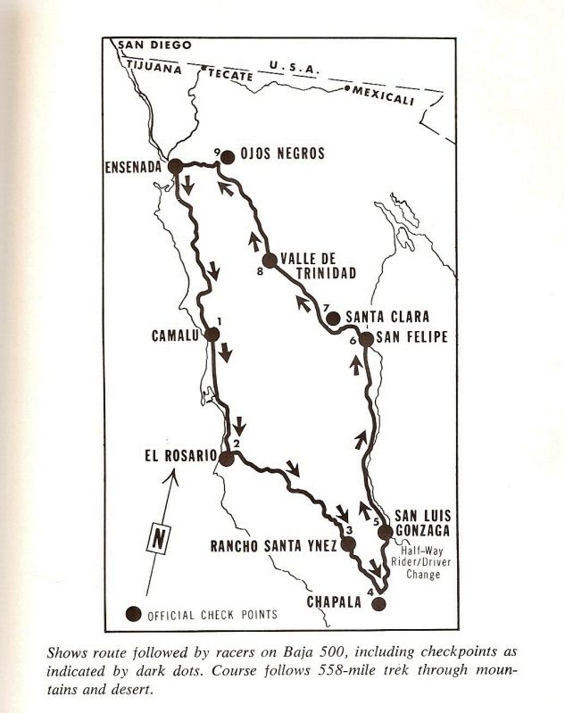
Original (1969-1972) Baja 500 course Map

David K - 9-15-2014 at 04:55 PM