
elfbrewery - 12-4-2014 at 02:28 PM
First of all, please read this from the link http://forums.bajanomad.com/viewthread.php?tid=76359
-----------------------------------------------------------------------------------
posted on 11-15-2014 at 16:57 by AKgringo
drove it today
I made a day trip to San Evaristo today, if you have driven it in the last few years expect it to be about the same, or slightly better if you were
there shortly after the storm in Oct of 2012.
From the Pemex at the junction with hiway 1, it was 67 miles, and driving moderately it took three hours, about half of that was on the last 15 miles!
The paved road to San Carlos is in pretty good shape, with the few burroorted potholes and washed out shoulders like most of the roads around here. Do
not follow the arrow on the highway sign pointing the way to
San Evaristo, it dead ends a few hundred yards later where there used to be culverts. Even mud boggers haven't been using it lately.
Right after the river crossing, turn right then keep left on the dirt road headed toward the beach and cross through the mine's ore loading facility
and follow the coast parallel to the mine road. The road has been
recently graded and is in better shape than most of the dirt roads I have driven this trip, but there are always a few surprises!
From about mile 50 on, there are rough spots and good road, becoming progressively more challenging heading north. The places where the road runs
across or up the arroyos are soft, but I never had to put my
hubs in. There are long stretches in the last 15 miles that are one lane, so I don't recommend pulling a trailer past the Portugese camp until you
have checked out the road.
In 2012, I took the road through the mountains back to Hiway 1, so I knew where to find the road to see what it was like. I expected to reach a choke
point about five miles up the pass, but where I was still in 2wd
drive last trip, I was in first and second low range 4wd for about a half mile until I found a place I could safely make a three point U-turn!
I got out and looked for tracks, but mine were the only ones there. I don't know if the road is passable, but I know I wasn't equipped to go find out
alone!
If anyone goes through there in a quad or dirt bike, I would sure appreciate a report.
The trip to San Evaristo is certainly worth your while, and early morning is the best light. I'm glad I went!
-----------------------------------------------------------------------------------
Great directions and conditions report, just some additions.
-- The paved section of highway from El Centenario to San Juan de la Costa wasn't bad, just some of the coastal side was washed away. Keep a look
out from Km 27 onward.
-- As you approach SJ de la Costa, the sign for San Evaristo points to the beach, stay straight on the pavement. Then, IMMEDIATELY after crossing
the stream, turn right and head diagonally across the clearing
towards the coast. (Try to remember on the way back to turn right at this point to get to the road.) If you stay on the paved road heading north you
will have to turn around at the mine. Also, on the way back, as
soon as you come down towards town, take the right fork, unless you want to view houses along the beach (don't know where that road ends).
-- Portuguese Camp is at Km 51, for what it's worth. The km markers aren't prevalent. There is a sign 11 Km from San Evaristo, but that's about it.
It's about 70 miles by my GPS from the Pemex to San Evaristo,
but I don't have a lot of faith in my GPS these days.
-- The road is a little rough and narrow along the beach, but then you reach the graded section. It's good, but washboard and dusty.
-- Coming up on Punta el Mechudo, you will head inland with lots of ups and downs. According to my GPS track downloaded to Google Earth, it's about
a 17% grade in places. It's rough and steep. Lots of
cemented sections, which indicate that. Nothing was down right dangerous, just needed to go cautiously. We were tempted to go into 4wd, but never did.
After the mountains, it's still another 13km into San Evaristo
on rough dirt.
-- We (3 couples travelling in a Jeep, 4Runner and Tundra) took about 4 hours going up (a few breaks and then a breakdown, it's best to have friends
along). Then 3 hours back to Campestre Marantha (high marks!)
for the night.
The ride is the best we have done in Baja. The scenery is fantastic! Go early in the morning to get the best light. We left the Pemex in El Centenario
around 8 a.m. We couldn't, but if you can, start earlier.
As I said, Campestre Marantha is a great place to stay. My husband and I and another couple stayed in the bungalows (in the back, very quiet) the
night before and the night after. We asked that the hot water
heater be turned on for our return (the pilot light had blown out). Man, was that hot shower wonderful (bring your own soap). If you can't call ahead
for a reservation, U2U me for the personal email address of the
manager.
Hope you get a chance to drive this colorful stretch of road.
Cheers!
[Edited on 12-5-2014 by elfbrewery]
motoged - 12-4-2014 at 02:33 PM
Thanks a ton, EB. I hope to camp up that way for a few days just after Xmas....hope the plan comes to fruition  I will add a report.
David K - 12-4-2014 at 02:41 PM
I would like to see the photos... if you can't get them to post, please send them and I will post them here for you. email: info AT vivabaja.com
TMW - 12-4-2014 at 03:14 PM
We went in April of 2013. Glad to know the road is as good or better now. Thanks for the report.
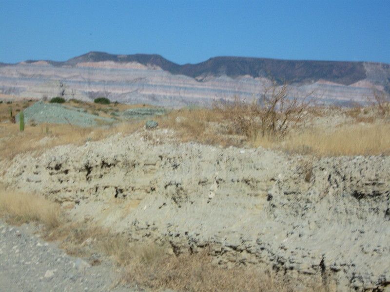
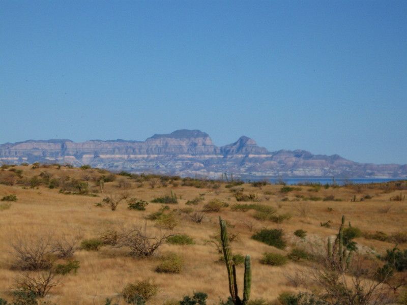
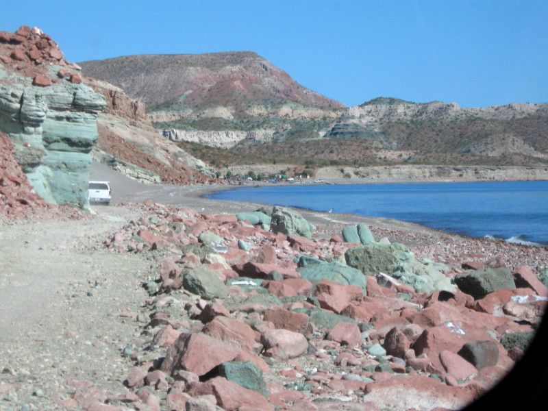
Photos from elfbrewery
David K - 12-4-2014 at 03:32 PM
Here are the three he emailed me...
AKgringo - 12-4-2014 at 03:46 PM
Thanks for posting, it is good to read trip reports from happy people!
Thanks to David K for pointing out that I can stop trying to find a way to view the photos.
Also thanks for the kind words about Campestre Maranatha, Jose and Cindy have been working their burros off repairing storm damage and making
upgrades. That sentence only makes sense to Nomads, but burro is now part of our lexicon, so I'm going to use it!
If you haven't been there before, and time permits, consider a side trip into Auga Verde on your way north. There have been recent posts and photos
about it on this website. You will remember that side trip!
fishbuck - 12-5-2014 at 11:29 AM
Nice photos. I have been as far as the abandoned mine. Always wondered about
San Evaristo for fishing and diving.


