BajaNomad

Bahia Concepcion roads

sd2hi - 8-15-2015 at 08:50 PM

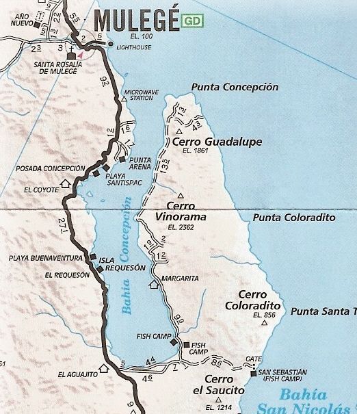
Any of you Nomads know if it's possible to access the East side of Bay of Concepcion with a rental car. Or is it 4WD only. Looking for a little solitude this October. Kind of hard finding a good road map online.

dtbushpilot - 8-15-2015 at 09:36 PM

Quote: Originally posted by sd2hi  
Any of you Nomads know if it's possible to access the East side of Bay of Concepcion with a rental car. Or is it 4WD only. Looking for a little solitude this October. Kind of hard finding a good road map online.


It depends on whether or not you have the "walk away" insurance on the rental...

Seriously, you can go out there a ways in a 2wd car, even further in a high clearance vehicle and pretty much anywhere you want in 4wd. It is remote, take lots of water and basic supplies, a shovel would be a good idea. Let someone responsible know you are going out there and when you plan to return so that they can come and look for you if you don't show up. I've been out there several times, fun place. Don't go in the summer, it's too hot to enjoy....

sd2hi - 8-16-2015 at 12:57 AM

Thinking of mid October

chuckie - 8-16-2015 at 05:25 AM

AND! DO NOT leave your car out of your sight for even a minute...

bajabuddha - 8-16-2015 at 06:54 AM

I wouldn't recommend using a 'normal' rental car for the east cape road at all; too many rocks and humps, you'll lose your oil pan for sure. If you rent a Cross-over with some clearance, you should be ok if you're careful.

Also, if there has been any moisture whatsoever in the last week before your trip, the south mud flats are no-man's land. They start less than a mile off the Highway just past the old Gov't RV Park ruins, and run a couple of miles. There've been lots of 4x4's buried to the frame trying to get across when wet, so watch the preceding weather.

AguaDulce - 8-16-2015 at 07:27 AM

First thing you do is take off the hubcaps. Put them on when you get back. On a good road you will find a pothole. The little rental cars are just too low for any extended dirt road . The dirt road can be smooth. but it has a crown in it and the plastic undercarriage will find the rock, in the high part of the road. The rock can hit the engine or trans also. The tires on them are not the best, I rent 3 times a year and have always had some damage to my car.

BigBearRider - 8-16-2015 at 07:54 AM

The airport rental car companies in Loreto have 4x4 Jeeps for rent. I've rented from Fox a couple of times. Ive gotten the best rents from their website directly, as opposed to expedia, kayak, etc.

AguaDulce - 8-16-2015 at 09:49 AM

get your Jeep well in advance. They are usually rented out quickly. And most expensive to rent. Fox is cheaper than Alamo last time I used it.

David K - 8-16-2015 at 03:08 PM

Make sure the 4WD is not disabled by the rental company! I read of that happening in Cabo so you couldn't go off roading in their Jeeps!

The poster asked about the East Side of Bahia Concepcion, not East Cape. The one road on the east side of the bay is not a graded road like the East Cape road is.

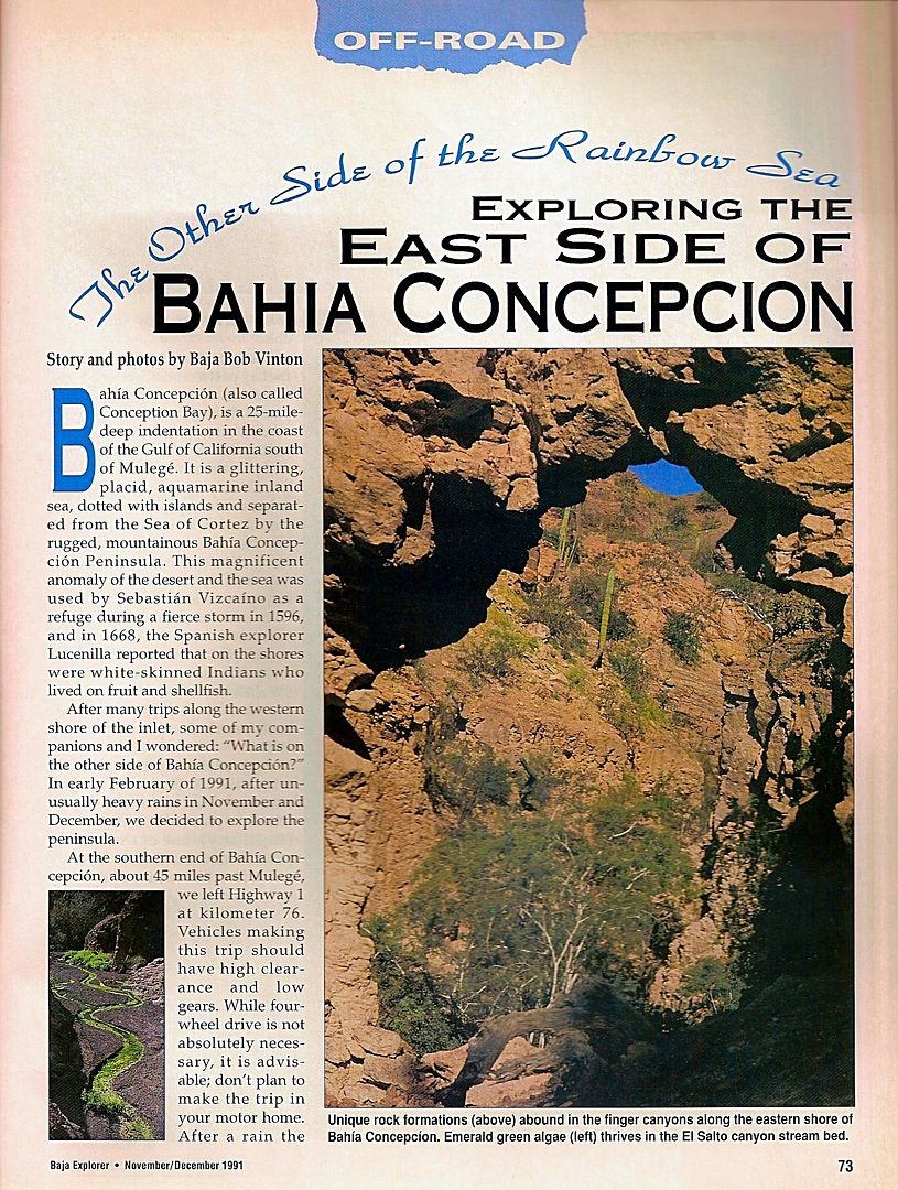
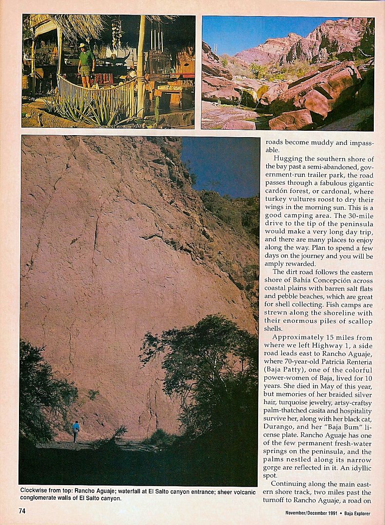
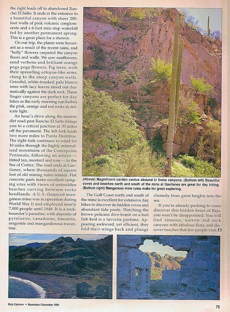
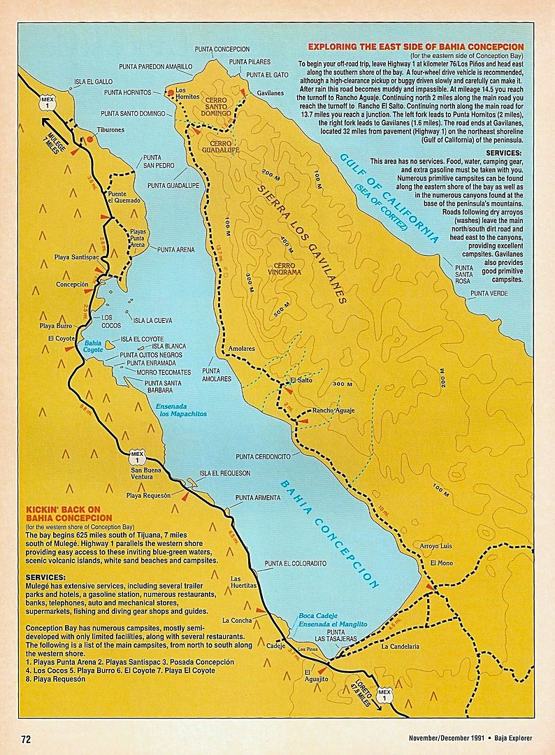
From Bicycle/Baja Bob Vinton, a few years ago...


StuckSucks - 8-16-2015 at 04:30 PM

This has been on my bucket list since forever - I need to budget time the next time I'm in the neighborhood. Sounds like 3-4 days is a good amount. With the use of Google Earth, I discovered a ton of potential side-trips.

sd2hi - 8-16-2015 at 04:56 PM

Great info, thanks.

If a can't find a reasonably priced rental vehicle what do you folks think of hiring a panguero to take me across and pick me up a few days later? I'm flying in to Loreto and have 2 weeks to enjoy the bahia.

SFandH - 8-16-2015 at 05:27 PM

A friend of mine, a Mulege native, runs a panga out of Santispac. The boat's name is Karla (his granddaughter), it has either a blue or yellow bimini top, I can't remember. He has the necessary permits from Santa Rosalia to take tourists on boat rides. Nice clean panga with a good Yamaha Enduro 48 motor. His name is Jose Manuel, nickname Chemanuel. He'll take you over to the east side and pick you up. Trustworthy guy, good fishing guide too. He knows where the trigger fish are.

Tip him good if you can afford it. He supports a large extended family in Mulege.


[Edited on 8-17-2015 by SFandH]

gallesram - 8-17-2015 at 04:41 PM

Quote: Originally posted by chuckie  
AND! DO NOT leave your car out of your sight for even a minute...


Are you aware of problems over there? I was thinking of taking my boat across and hiking around, but it would mean leaving my boat out of my sight. Wasn't sure if you were just joking or there's really something to worry about...

David K - 8-17-2015 at 05:45 PM

If you search back a few years, there were incidents at the south end of the bay (old government trailer park) and on the Concepcion Peninsula (although I don't recall those). It may be old history, but never leave anything that could be started up and taken away when you are away on a walk-about.

motoged - 8-17-2015 at 06:13 PM

The east side is worth exploring, for sure. The above info is helpful (south end issues a few years ago seemed to be thefts from parked vehicles)...

DT Bushpilot and I spent a day there a few years ago by moto....some images:

The road and fish camps...and outdoor program's sailboats....


East side at north tip:


bajabuddha - 8-17-2015 at 07:50 PM

Regardless of what people think, the east peninsula is not 'remote'. There are vehicles on that road daily, several temporary fish camps, supply mini-trucks, pescadores in pangas looking for schools, so comparatively to the other side yes, you'll find solitude...... mostly. If you love it and you leave it, LOCK IT. You're not alone in the Baja.

BigBearRider - 8-17-2015 at 08:07 PM

Thanks for posting that article, David K!

David K - 8-17-2015 at 09:59 PM

De nada Rider!
Erle Stanley Gardner (Perry Mason creator and Baja explorer) was fascinated with the Concepcion peninsula... back in the 1960's when there really wasn't a road or anyone out there.
Funny part was that after exploring it so well, building a runway for Capt. Muñoz to land over there, and then writing all about it in his 1967 'Off the Beaten Track in Baja', he never mentioned the mine!??

MulegeAL - 8-18-2015 at 07:16 AM

Figure around 130/140 miles round trip from the Pemex south end of Mulege, plus whatever sidetrips and so on.

The rancho folks are great out there.

I would expect that the recent rains have caused erosion damage in a few spots past El Salto rancho area; the track deteriorates as you go north. Take a shovel for sure. Also, this area I've seen more rattlers than anyplace else local, esp bushes near shore.

BigBearRider - 8-18-2015 at 09:08 AM

Quote: Originally posted by David K  
De nada Rider!
Erle Stanley Gardner (Perry Mason creator and Baja explorer) was fascinated with the Concepcion peninsula... back in the 1960's when there really wasn't a road or anyone out there.
Funny part was that after exploring it so well, building a runway for Capt. Muñoz to land over there, and then writing all about it in his 1967 'Off the Beaten Track in Baja', he never mentioned the mine!??


Maybe the mine is where Earl buried the treasure?!?

David K - 8-18-2015 at 11:30 AM

The roads are even on the Auto Club map! Over 10 years ago>>>


sd2hi - 8-18-2015 at 02:21 PM

You guys are awesome! Thanks for all the great info :-)

David K - 8-18-2015 at 03:17 PM

sd2hi, all we ask for in payment is a TRIP REPORT when you get back... and photos would be great too!!

Have a wonderful time!!:bounce::light::cool:

Alm - 8-19-2015 at 05:27 PM

Quote: Originally posted by chuckie  
AND! DO NOT leave your car out of your sight for even a minute...

True - for most of Baja. In that particular area, scarcely populated and difficult to access, it "should be" less of a problem. I always felt the most secure in places with no road access.

BigBearRider - 8-19-2015 at 09:41 PM

Quote: Originally posted by David K  
The roads are even on the Auto Club map! Over 10 years ago>>>


David K, I have two questions that I was thinking you may be able to answer:

1. do you know of a source to get the AAA map? I have the one with the San Felipe light house on it, from 2007 or something? Unfortunately, my dog decided to eat part of it. True story.

2. what is the significance of "microwave station" as referenced on the map, and along the road in various places Baja? I've asked some people and never gotten an answer that makes sense to me. Is it a cell phone tower? Why are they specially identified on maps and by road signs?

Thanks!

bajabuddha - 8-19-2015 at 10:40 PM

Quote: Originally posted by Alm  
Quote: Originally posted by chuckie  
AND! DO NOT leave your car out of your sight for even a minute...

True - for most of Baja. In that particular area, scarcely populated and difficult to access, it "should be" less of a problem. I always felt the most secure in places with no road access.

Sorry, but BULLPUCKEY, Alm. I've been all over the south and east bay, and if it's alone, it's gone. Pangeros are hungry, and if it's a mark, it's taken. The Bay is barren; the fishing is hard; if you find something to make a little earning from, and you're hungry, you'll take it.

Don't take my word for it though; just go, leave it out, and see if it stays put. Yes, there's less people across, but there still are people there, and the farther you are from 'the norm' of civilization, the more accessible you are. GO, ENJOY, just don't be stoopud. Anyone who's done Baja knows coyotes love seclusion and stealth.

chuckie - 8-20-2015 at 04:11 AM

LIKE I SAID!

TMW - 8-20-2015 at 07:33 AM

BBR the microwave sites were for telephone service before they ran fiber Optics along hwy 1 and other areas a few years ago. Still used as backup. Some may have cell antennas on them. The map ID is just a reference made by AAA and maybe other map makers. The sign with the name on the hwy is similar to a name for a ranch and most likely helps the service people who maintain the equipment and generators.

David K - 8-20-2015 at 08:21 AM

Quote: Originally posted by TMW  
BBR the microwave sites were for telephone service before they ran fiber Optics along hwy 1 and other areas a few years ago. Still used as backup. Some may have cell antennas on them. The map ID is just a reference made by AAA and maybe other map makers. The sign with the name on the hwy is similar to a name for a ranch and most likely helps the service people who maintain the equipment and generators.


Exactly!
Microwaves were the method to communicate distance without wires, before fiber-optics. Microwave towers follow Hwy. 1 in Baja CA Sur. A fiber optic cable was installed along Hwy. 1 back in 2006, or thereabouts, I think it was.

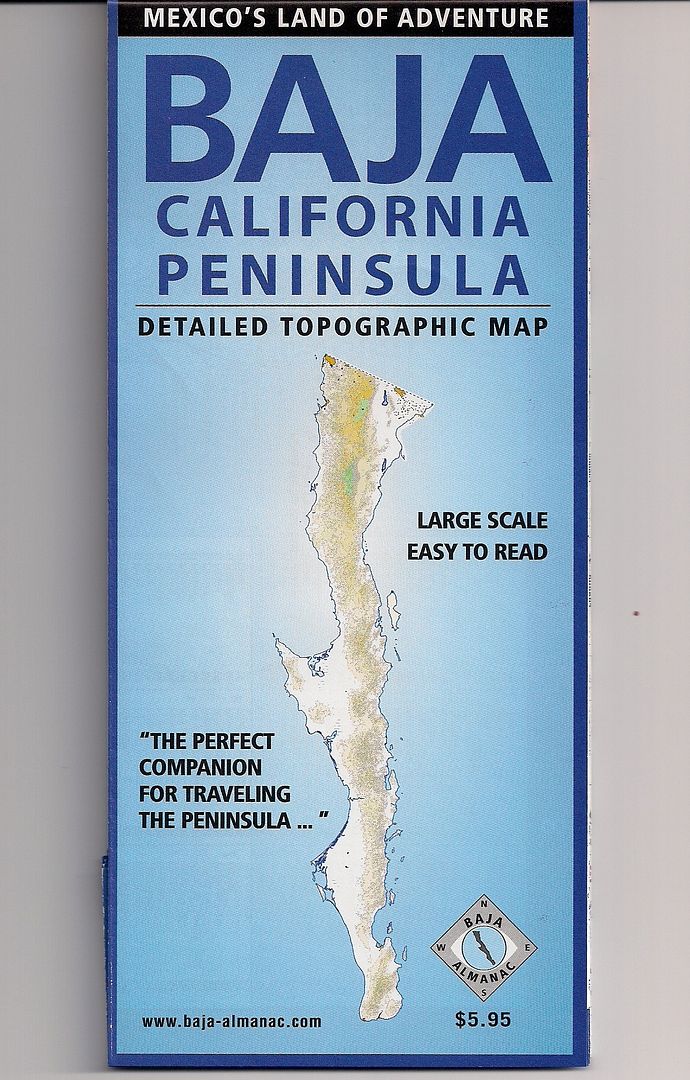
As for the AAA maps... good luck finding them... maybe eBay? I will help if you want a certain area to look at. The Baja Almanac offers much more detail and roads and trails.

The AAA map was great back in the 70's and maybe 80's, but in the following years, they would yield to upset members who got stuck or damaged their passenger car driving on a road shown as 'graded' on the map... so they removed many of the 4x4 "poor" roads and changed several graded roads to "poor" or unimproved roads, to make their lawyers happy!

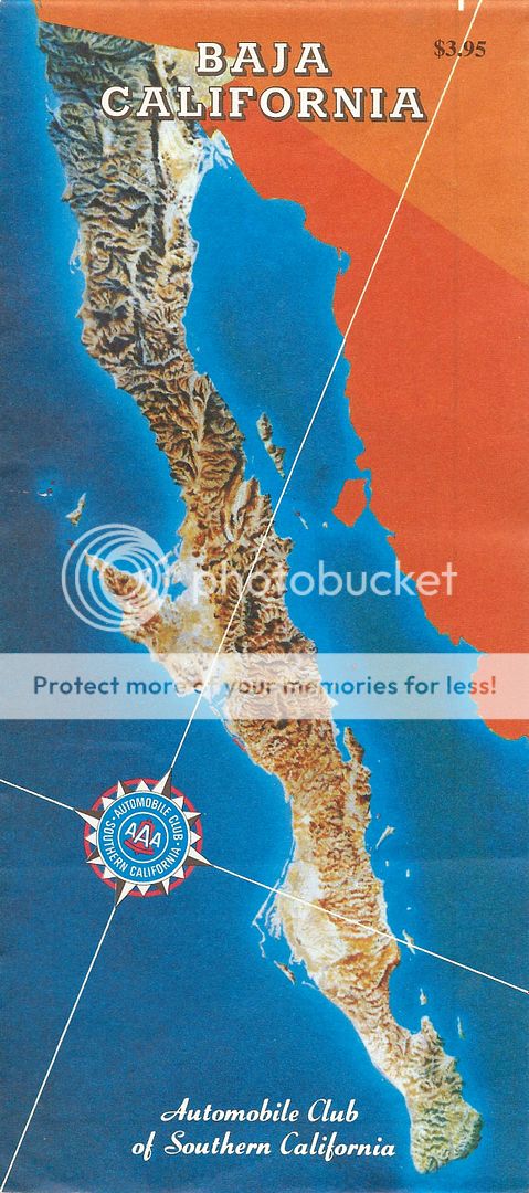
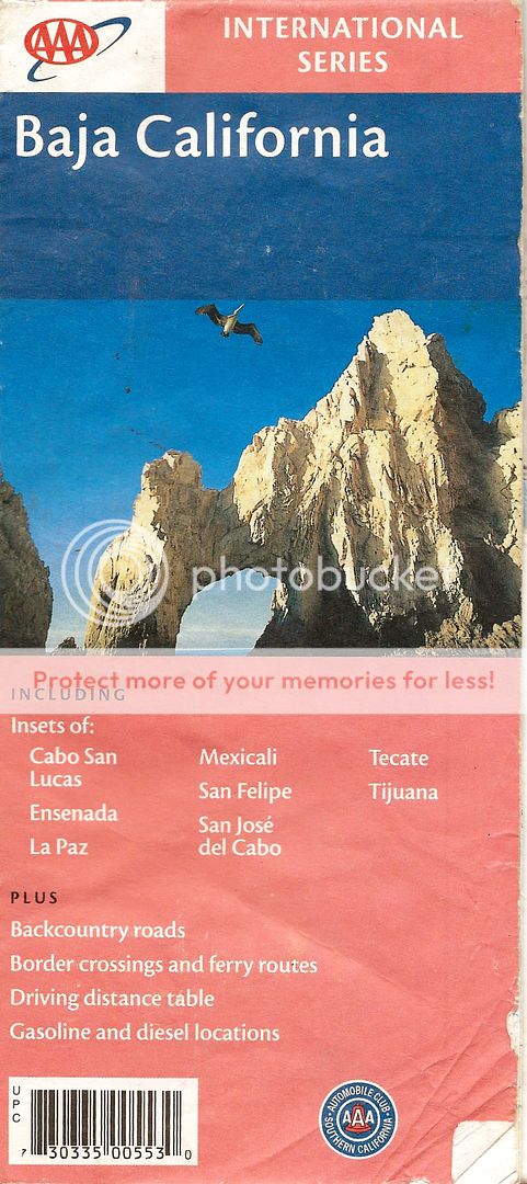
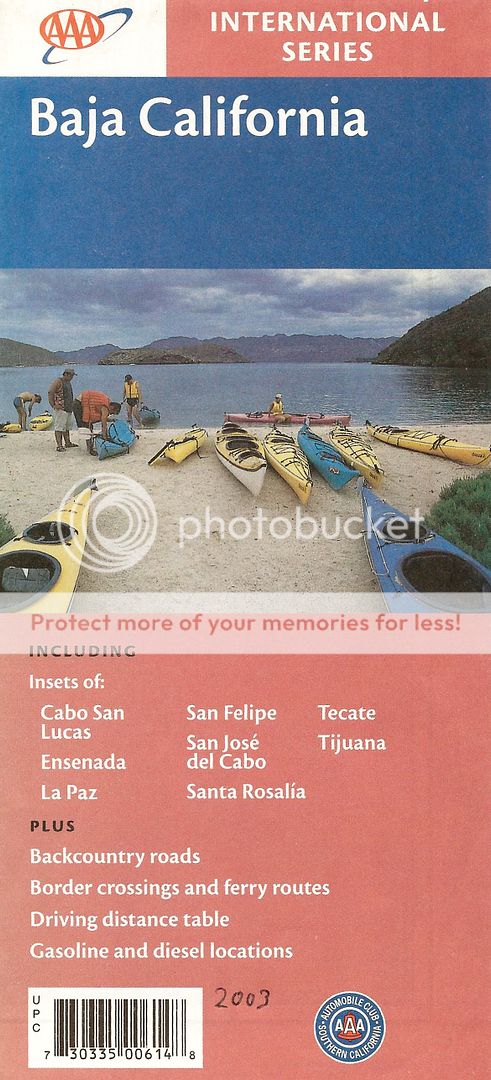
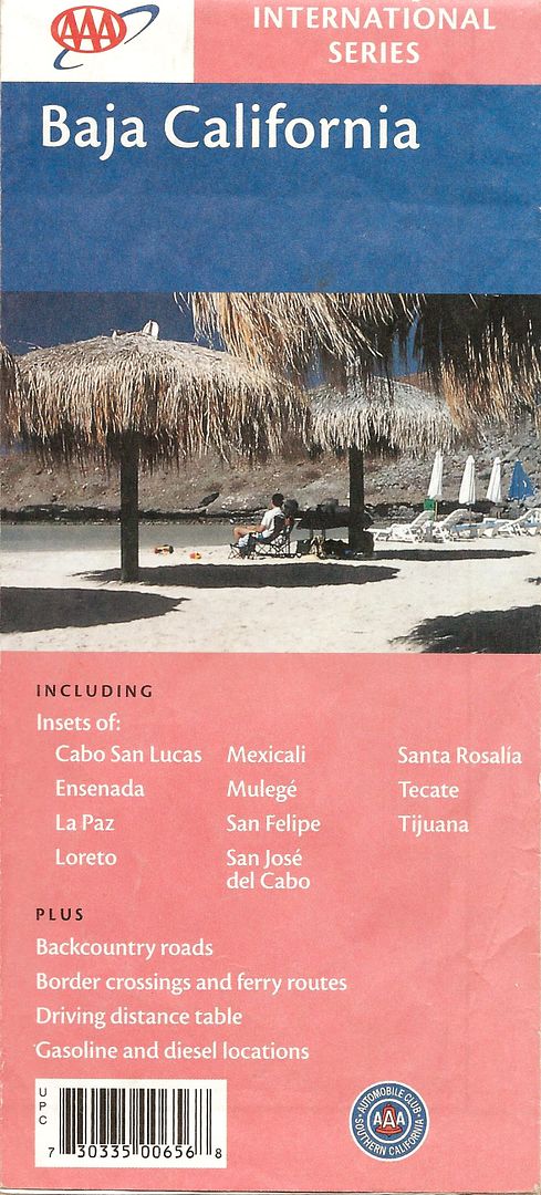
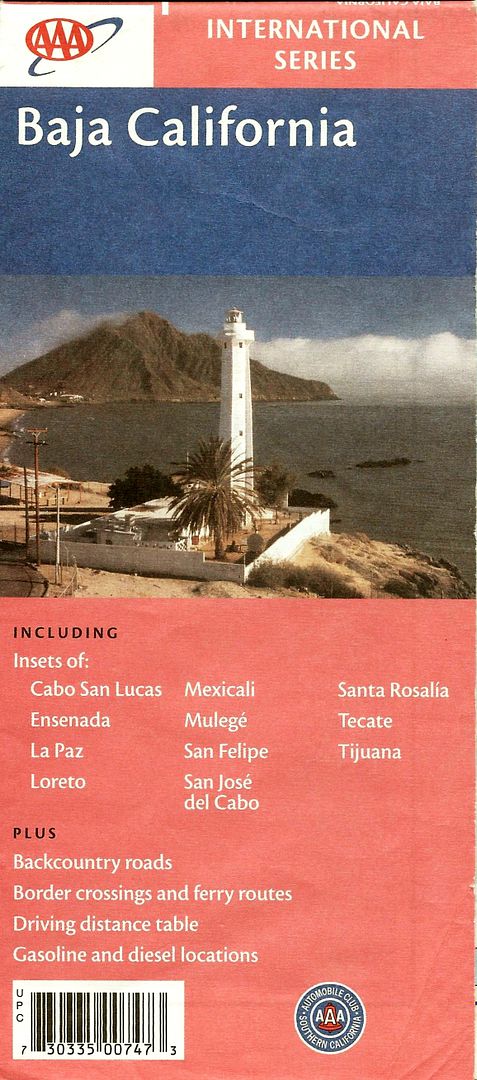
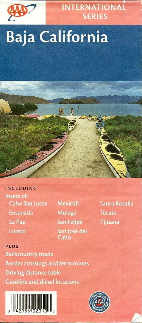
Here are (some of) the map covers...


1978-2000


2001


2003


2004


2007


2010

*The 2010 edition was just a reprint of the 2007 edition (which combined data from 2003-2007).

wilderone - 8-20-2015 at 09:18 AM

"hiring a panguero to take me across and pick me up a few days later?"
Please, let me/us know if you do this. Very interested in logistics for this.

wilderone - 8-20-2015 at 09:33 AM

I have 3 maps with the lighthouse - I'll give you one if you'd like. U2U me.

AKgringo - 8-20-2015 at 11:04 AM

I recently picked a couple of the latest version at a AAA location in Northern CA, so the maps are still around. Probably further away from the border would be a better chance of finding them.

I think with Dave's mapping skills and interest, he should check into acquiring the right to publish updated versions with credit given to AAA, and absolve them from responsibility for errors.

The format of the map is handy, and I would gladly pay five bucks for an updated copy every year! Wouldn't it be great to be able to make a buck, or even just break even by collecting and verifying changes to the roads system?

Verifying changes would require longer and more frequent trips SOB, but that is a small price to pay for the service that would be provided.

BigBearRider - 8-20-2015 at 01:43 PM

Thanks for the info, guys! Much appreciated!

The AAA map was the first real Baja map that I got, and I always found it to be comforting for some reason. I like the way it looks.

I'll check out the Baja Almanac as well.


[Edited on 8-20-2015 by BigBearRider]

TMW - 8-20-2015 at 04:44 PM

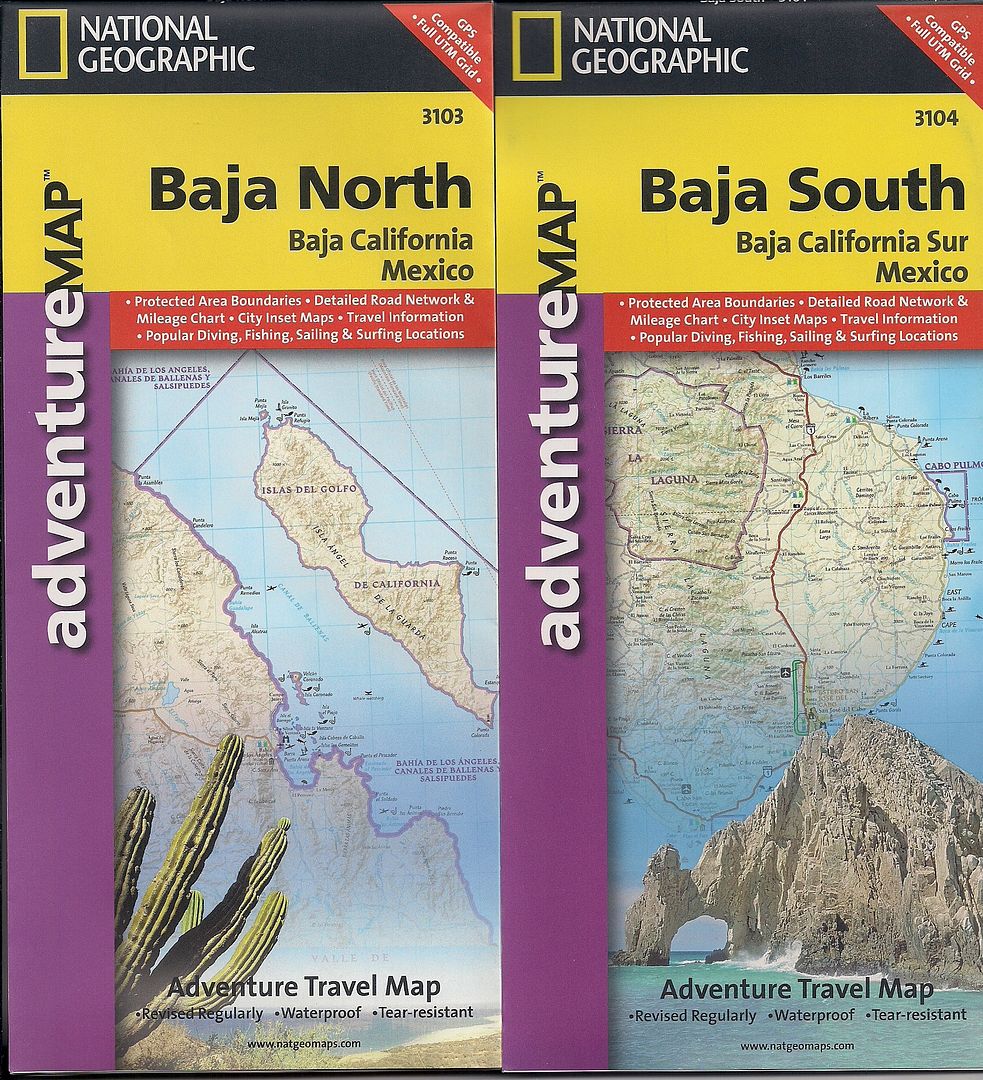
National Geographic has two maps out one for Baja North and one for Baja South. Also the guy that did the Almanac put out a map similar to the AAA map but with more detail and it shows the microwave towers which the Nat. Geo. map doesn't.


David K - 8-20-2015 at 04:52 PM

There's a chance that Discover Baja Travel Club has a supply of the Baja Almanac folding map (2003)... ??

Baja Bound has the 2009 Baja CA Almanacs (last I heard)...

I would be happy to provide updated parts of the AAA map, as best I can. Mostly more paved roads than the 2003-2010 editions show. The Corridor 2000 and Libramiento Mexicali are the two 'new' roads in the last editions of the AAA map.

ncampion - 8-20-2015 at 05:02 PM

Would anyone happen to have GPS tracks of the roads out to the Conception peninsula that they would like to share? (GPX format)

BigBearRider - 8-20-2015 at 05:30 PM

I got the Nat Geo maps. But, I prefer the AAA map. I searched for a long while, but was unable to find any. I did see one old one (I thinkt he first that David K posted above) on ebay, but that was it. Thanks to wilderone, I will have a new(ish) AAA map soon.


SFandH - 8-20-2015 at 05:51 PM

I have the 2003 AAA map. I'll trade it for a cold 6 pack of Tecate Lite. To find me just go to Bahia Concepcion this winter and ask every 60 something gringo guy you see if he's the AAA map for 6 pack guy. You also need to bring your refreshment of choice and sit around and drink it with me while I drink the 6 pack.


bajabuddha - 8-20-2015 at 09:58 PM

Are you ya-hoos going to go out and drive the gawdamned road, or just read about it and watch it go by on your GP-friggin'-S as you 'map' your way down? IT'S A ROAD, ffs.... get on it, and get to it.

The New Baja Techno-Geek Trail Rider Club. Does your Tacoma 4x4 Jacked-Up auto-parallel park??


OOh, is there internet access out there??? Any sat-up-links? Can we get HughesNet from the mine????

oy, ve. :biggrin:

David K - 8-20-2015 at 09:59 PM

Quote: Originally posted by bajabuddha  
Are you ya-hoos going to go out and drive the gawdamned road, or just read about it and watch it go by on your GP-friggin'-S as you 'map' your way down? IT'S A ROAD, ffs.... get on it, and get to it.

The New Baja Techno-Geek Trail Rider Club. Does your Tacoma 4x4 Jacked-Up auto-parallel park??


OOh, is there internet access out there??? Any sat-up-links? Can we get HughesNet from the mine????

oy, ve. :biggrin:


I agree!!! :light:

sd2hi - 8-23-2015 at 08:26 PM

David K, if you're interested in a few free drinks and some carne asada I'll be in San Diego Oct 4 (Clairemont)

StuckSucks - 8-24-2015 at 09:08 AM

Here's a photo sphere I took at the El Tiburón Microwave towers. To the south you can see Bahia Concepcion, and to the north you can see palms around Mulegé.

http://tinyurl.com/q82t8w8

David K - 8-24-2015 at 09:08 AM

Quote: Originally posted by sd2hi  
David K, if you're interested in a few free drinks and some carne asada I'll be in San Diego Oct 4 (Clairemont)

Sounds good, what's the occasion/what can I add?

Bob and Susan - 8-24-2015 at 02:30 PM

people don't use this road everyday...there is a lot of private property too...gates

the edijo has control of the area so permission from them is respectful

the road is a path not a road...it is passable but the car will get lots of scratches...lots of rocks so expect a flat

there's no "road service" so you're on your own...its not a friendly place for the timid...

just because the map shows a dirt road doesn't make it one

I would stay away...if you want to see the area go by boat

11-91001.jpg - 178kB

AKgringo - 8-24-2015 at 02:55 PM

B&S, Good information. How would one go about getting permission to access Ejido roads or beaches? Are all the gates locked privacy gates, or are some of them ranch gates that need to be closed after passing through?

chuckie - 8-24-2015 at 03:13 PM

Operative term from B&S "Its not a friendly place"......

bajabuddha - 8-24-2015 at 03:44 PM

IF you're just doing the east road around the bay, there are no gates. I've been out there dozens of times; you just have to take the road closest to the water across the South Bay, then stay to the left. All the private property gates are to the south of the bay; I've never been all the way to the north point, only about 2/3rds of the way. It can have some nasty spots, so be prepared and loaded for bear.

Oh, they did put a gate where the road leaves the highway; it's for livestock, so leave it like you find it (cowboy rule) as in, close it behind you if it's closed when you get there.

Again, if there's been any precipitation whatsoever in the last week to two weeks the mud flats are un-crossable, even with 4wd. If you don't believe me, have fun trying to get un-stuck.... and take an extra pair of shoes or two.

Bob and Susan - 8-24-2015 at 05:48 PM

if a gate is closed when you get there it means "stay out" or have permission to enter


David K - 8-24-2015 at 05:58 PM

In northern Baja, gates on rural roads that are not locked or signed are to control cattle movement and it is perfectly normal to pass through as long as you close the gate behind you. The roads were there before the ranches, to get around.

chippy - 8-24-2015 at 06:02 PM

Quote: Originally posted by Bob and Susan  
if a gate is closed when you get there it means "stay out" or have permission to enter


Croc o chite:lol:

AKgringo - 8-24-2015 at 06:11 PM

Quote: Originally posted by Bob and Susan  
if a gate is closed when you get there it means "stay out" or have permission to enter


I was asking how to get permission, if it is required. Like Buddha, I grew up in ranch country, where ranchers frequently had rights to graze cattle on property (and roads) that they did not own. The rule was, leave the gate like you find it!

I respect signs, so if I am not welcome, I won't enter. I just want to do some exploring without pi$$ng someone off.

SFandH - 8-24-2015 at 06:19 PM

It's tough to pi$$-off a Mexican rancher, mellow folks, at least the couple I've met.

bajabuddha - 8-24-2015 at 10:00 PM

Jayzus wept!! Again, just GO DRIVE THE DAMNED ROAD AND CLOSE THE DAMNED GATES BEHIND YOU.

If they're posted, then don't enter. Ranger Bob won't write you a ticket.

Bob and Susan - 8-25-2015 at 05:40 AM

Quote: Originally posted by bajabuddha  
Jayzus wept!! Again, just GO DRIVE THE DAMNED ROAD AND CLOSE THE DAMNED GATES BEHIND YOU.

If they're posted, then don't enter. Ranger Bob won't write you a ticket.


a great portion f this area IS NOT public land...

the "gringo" attitude is Baja is still the "wild west"and they can do anything they like...
its not...
"gringos" DO NOT and should not take advantage of this area
they are guests

the young go to college...smart...there is a new generation rising

respect is still important

the area we are talking about here is not for a rental car...and certainly not tourist friendly...there are no "ranger bob's" to assist you WHEN you get in trouble

don't "check your brain" at the border" as so many people do
would you want someone wandering around your back yard?
...just open your back gate and walk in....I don't think so
why would you do it here


if you want to see the area take a boat and land on the many beaches and explore

if there is a fence...keep out
if there is a gate...don't go in

this is NOT rural America...respect is important

Terry28 - 8-25-2015 at 09:54 AM

We had a house at Buenaventura for 10 years, had this conversation many times with locals there....If the gates is there at all, open or closed ask the rancher for permission.....no exceptions...Bob and Susan's answer is correct.....Just because someone else did it without asking does not make it right....no matter how many times you did it.....

BigBearRider - 8-25-2015 at 10:11 AM

Quote: Originally posted by StuckSucks  
Here's a photo sphere I took at the El Tiburón Microwave towers. To the south you can see Bahia Concepcion, and to the north you can see palms around Mulegé.

http://tinyurl.com/q82t8w8


Very cool. Thanks!

BajaGringo - 8-25-2015 at 10:44 AM

Up here in our region of Baja, closed gates are closed for a reason. The locally accepted way is to seek permission first, prior to passing through.

Does everybody follow that?

No, but I also know that most ranchers up here carry a handgun and/or rifle in their truck. When they see someone they don't recognize on their property nowadays, their first thought is more likely to be that it is someone moving drugs, not tourists on an off-road adventure. In some areas, the cartels have strong armed ranch owners into giving them access and control of their remote ranches.

You just cannot be sure who or what you will find today when you go through a closed gate down here, unannounced...

YMMV

David K - 8-25-2015 at 02:15 PM

Once the land of "Hardly Any Fences" ...

chuckie - 8-25-2015 at 03:21 PM

Gone

bajabuddha - 8-25-2015 at 09:38 PM

Quote: Originally posted by Terry28  
We had a house at Buenaventura for 10 years, had this conversation many times with locals there....If the gates is there at all, open or closed ask the rancher for permission.....no exceptions...Bob and Susan's answer is correct.....Just because someone else did it without asking does not make it right....no matter how many times you did it.....


So, tell the truth, straight up, Terry....

Did you sell out to TBH, or did you back MarK?

TELL IT LIKE IT IS.

Aside from that, the road from Hwy 1 to the East Bay road is open, I've never opened or closed a single gate IN TWENTY FREAKING YEARS, other than the recent one put on the Highway exit for livestock only. IF you stay to the left, close to the bay, NO GATES.

SOMEBODY NAME ONE GATE BETWEEN HIGHWAY ONE AND PINTURTA CAÑON, OR THE MOST MAJOR POINT ACROSS FROM COYOTE. NAME ONE GATE. I've traveled that enough to say BS to anyone, have taken dozens of tours to Pintura Cañon pictographs, andn 15 years worth.

There is a brand of people I call "The Last Pioneers"... they move in, with lots of buck$$$, and then slam the door behind them (i.e. "NIMBY Door-Slammers" {NIMBY= Not In My Back Yard}). I'm guilty in a lot of it from the 70's to the '90's in the expansion of "Search of Solitude" of the desert Southwest of the U.S., and I realized i'm an integral part of it, because I came , saw, and shared. The rest is history, same as Baja. Some come and with LOTS of money, build a lighthouse and then dictate how things should be. THE LAST PIONEER: NOW THE DOOR IS LOCKED, I AM THE LAST. Fine, keep your power structure to yourself.

I'll continue travelling to the Cañon Pinturas and the abandoned Ranchero watertanks, and Baja (Suzie? Sally?)'s old ruins until you pry my cold dead hands off my steering wheel. Until then, I strongly suggest, as in all Gringolandias in Baja, that you tend to your own propriedades and quit trying to rule everyone elses.

KurtG - 8-25-2015 at 10:49 PM

Quote: Originally posted by bajabuddha  
Quote: Originally posted by Terry28  
We had a house at Buenaventura for 10 years, had this conversation many times with locals there....If the gates is there at all, open or closed ask the rancher for permission.....no exceptions...Bob and Susan's answer is correct.....Just because someone else did it without asking does not make it right....no matter how many times you did it.....


So, tell the truth, straight up, Terry....

Did you sell out to TBH, or did you back MarK?

TELL IT LIKE IT IS.

Aside from that, the road from Hwy 1 to the East Bay road is open, I've never opened or closed a single gate IN TWENTY FREAKING YEARS, other than the recent one put on the Highway exit for livestock only. IF you stay to the left, close to the bay, NO GATES.

SOMEBODY NAME ONE GATE BETWEEN HIGHWAY ONE AND PINTURTA CAÑON, OR THE MOST MAJOR POINT ACROSS FROM COYOTE. NAME ONE GATE. I've traveled that enough to say BS to anyone, have taken dozens of tours to Pintura Cañon pictographs, andn 15 years worth.

There is a brand of people I call "The Last Pioneers"... they move in, with lots of buck$$$, and then slam the door behind them (i.e. "NIMBY Door-Slammers" {NIMBY= Not In My Back Yard}). I'm guilty in a lot of it from the 70's to the '90's in the expansion of "Search of Solitude" of the desert Southwest of the U.S., and I realized i'm an integral part of it, because I came , saw, and shared. The rest is history, same as Baja. Some come and with LOTS of money, build a lighthouse and then dictate how things should be. THE LAST PIONEER: NOW THE DOOR IS LOCKED, I AM THE LAST. Fine, keep your power structure to yourself.

I'll continue travelling to the Cañon Pinturas and the abandoned Ranchero watertanks, and Baja (Suzie? Sally?)'s old ruins until you pry my cold dead hands off my steering wheel. Until then, I strongly suggest, as in all Gringolandias in Baja, that you tend to your own propriedades and quit trying to rule everyone elses.


Like you I have encountered no gates on the way to Arroyo Pintado or further on to the turn off to Baja Patty's former place. Past there, however, I found a couple of gates between the old Rcho Margarita and El Salto that were closed. This was about 5 years ago. I went through and closed the gates behind me and then stopped at El Salto to ask permission. The man I talked to there was very friendly and was impressed that a guy of my "advanced age" was riding alone over there. I have done quite a few trips out that way, I especially like the easy hikes up both Pintado and El Salto arroyos. They are quite lovely.

Anybody else remember Corona Dave, longtime resident of "the far side?" I know Pompano also knew him and has posted a tale or two about him.

While Bob's suggestion to go there by boat is valid it just doesn't work for those of us who want to hike, camp and explore a bit. The hike from shore to the mouth of Arroyo Pintado or Patty's place is just a little too far. There is no water at Pintado but there is a spring at Patty's and good water at El Salto but that hike would only be for the very fit and experienced.

The few locals I have met on the East side of the bay have been cordial and hospitable, I hope that has not changed.

bajabuddha - 8-25-2015 at 10:56 PM

PERFECT, KURT!!

Baja Patty's (mind's goin', thanks for the up-link) and, Corona Dave's old relic. Bottom line, it's still totally doable, regardless of The Last Pioneers.

BajaGringo - 8-26-2015 at 11:33 AM

Quote: Originally posted by bajabuddha  
Bottom line, it's still totally doable, regardless of The Last Pioneers.


The problem is that in some remote parts of the peninsula, that "Last Pioneer" these days may be a cartel who bought or strong armed their way onto a ranch property that they see as strategic for growing/transporting drugs. I tell all my friends who come down with ideas of off-road exploring to take particular care with closed gates in remote areas. Find out who owns/controls the area and ALWAYS get permission BEFORE passing through any remote, gated property.

To recommend otherwise, based on your individual experience at one particular area in the past is extremely irresponsible IMHO...

Bob and Susan - 8-26-2015 at 12:01 PM

lets go back to the original question...

can you take a rental car down the east side of the bay?

answer...probably
but...
the dirt road is actually an unforgiving trail
who's going to "back you up"

a rental car will "for sure" have problems and
there's no cell coverage and NO "road-side" assistance
remember you only get one spare tire and rocks eat tires here

the land is not public property its "private property"
the only public land is the federal zone (20 meters)

there is NO expectation that you can cross private land with a car or truck and
you cannot drive on the federal zone using it as a highway

you can walk to the beach from a public street...
there has to be access
but there does not have to be parking

my advice for the tourist is to go by boat and walk to explore
if you can't walk...stay away from that area...you not in shape to go

these people telling you, "you can do anything in Baja" are just wrong
they will be the first to call foul
when something happens to them they don't like...and it will in the end

as for the old patty and dave...well...no dis-respect to them
but they were filthy, smelly, drinkers and squatters...
I hope none of us have to live like they did...
it must have been horrible


motoged - 8-26-2015 at 01:26 PM

Quote: Originally posted by Bob and Susan  

....no dis-respect to them but they were filthy, smelly, drinkers and squatters...


:o :biggrin:

"Excellent ubication", however....even dirty drunk squatters know a nice location when they see it .... :biggrin:


bajabuddha - 8-26-2015 at 01:48 PM

Oh golly, Ged!!!! YOU were on Private Property!! Did you close all the gates (or even see any), and get permission, plus sign a Waver of Indemnity? Gotta be PC now, pal.

Great pics btw. Ever been up Pintura Canyon to all the pictographs? :coolup:

KurtG - 8-26-2015 at 02:21 PM

Quote: Originally posted by Bob and Susan  
lets go back to the original question...

can you take a rental car down the east side of the bay?

answer...probably
but...
the dirt road is actually an unforgiving trail
who's going to "back you up"

a rental car will "for sure" have problems and
there's no cell coverage and NO "road-side" assistance
remember you only get one spare tire and rocks eat tires here

the land is not public property its "private property"
the only public land is the federal zone (20 meters)

there is NO expectation that you can cross private land with a car or truck and
you cannot drive on the federal zone using it as a highway

you can walk to the beach from a public street...
there has to be access
but there does not have to be parking

my advice for the tourist is to go by boat and walk to explore
if you can't walk...stay away from that area...you not in shape to go

these people telling you, "you can do anything in Baja" are just wrong
they will be the first to call foul
when something happens to them they don't like...and it will in the end

as for the old patty and dave...well...no dis-respect to them
but they were filthy, smelly, drinkers and squatters...
I hope none of us have to live like they did...
it must have been horrible


I'm certainly not saying "you can do anything you want in Baja"nor would I suggest taking a standard car over there. My trips have been in 4wd or by bike. I know that times change but my experiences on the east side of the bay have been positive, I have camped there for days at a time over the years and often saw nobody else.

Your description of Dave is pretty accurate. I never knew Patty but visited her place shortly after her death and was quite impressed. She had a good water source and had piped water down to her multi-room palapa. Had a shower and a flush toilet. When I was there that first time the spring had silted up behind the little dam she had built and another camper and I cleaned it out. The spring is in the little canyon NE of her grave site. It is a lovely spot and has enough elevation that the views back across the bay are very nice. Did you actually know her when she lived there?

I think those who go to the bay's far side for the first time underestimate the distance. From the highway turnoff to the end of the road at the tip of the peninsula is about 35 miles of quite slow going and if one is going across to the old mine site it is several miles further. I have done all that easily in one day by motorcycle but if I'm driving it is a camping trip. OTH, it is only 10 miles from the highway to the Arroyo Pintado turnoff so that is an easy day trip. Like all other Baja exploration, a good dose of common sense is essential. As to gates, I would never go through one that is posted.

Bob and Susan - 8-26-2015 at 03:26 PM

we cruised over by there today to "play" with the dolphins

a pretty remote area

took 10 minutes to get across

dolphinday.jpg - 171kB

motoged - 9-12-2015 at 10:02 AM

Quote: Originally posted by bajabuddha  
Oh golly, Ged!!!! YOU were on Private Property!! Did you close all the gates (or even see any), and get permission, plus sign a Waver of Indemnity? Gotta be PC now, pal.

Great pics btw. Ever been up Pintura Canyon to all the pictographs? :coolup:


BB,
Don't know about Pintura Canyon....DT Bushpilot and I rode motos north to mine site several years ago...don't recall any gates aside from one at highway entrance...first time on peninsula was in '94 and camped for several days halfway up....also have been over to San Sebastion Cove and down to San Nicolas and out from there to highway a few times.

I have ridden the area about five times and will do it again....only unfriendly vibe was from a few gringos in Sebstion Cove...but "Brown Rice" Dave(?) was welcoming...;D

Folks I met along the way were local fishermen headed out by road...


sd2hi - 9-13-2015 at 08:50 PM

Thanks Amigos for all of the somewhat conflicting information. I'm taking notes! It looks like I might have to change my plan and 4WD down from San Diego. Can't say I'm looking forward to a 2 day drive each way. However 10 days camping, fishing, diving and exploring should rejuvenate my soul. Thanks again for all of the scoops and post if you think of any other info. Aloha Andrew

sd2hi - 10-11-2015 at 09:18 PM

Hola Amigoes, I'm actually here! In Mulege now, buy supplies and fishing permit in the morning then off to see how deep the mud is an the Punta Concepcion road. Santa Rosalia is a mess, mud slides every where. Where the hell is the desert! It's been green ever since Rosario

bajabuddha - 10-11-2015 at 10:45 PM

Andrew, if you only have 10 days I think you're SOL for getting across the south bay mud flats, unless you have a hovercraft and a power washer when you're done. Trust me, that dawg ain't gonna hunt.

Happy trails,
bb.

MulegeAL - 10-12-2015 at 07:30 AM

I agree with bajab: if it has been raining heavily out there that place will be an alkali mudtrap. Baja weather does not heed man's vacation schedules. Lots of salts in the local mud flat, it etches metal and plastic permanently.

See if you can get some local road info from folks in San Nicolas area. They usually keep their road in good shape, and that is an alternative destination. I would say if you can't drive to San Nic then the camino de la tierra on the cape could be a get-stuck mudfest. Good luck trying this!

wilderone - 10-13-2015 at 07:03 PM

Definitely keep us posted - good luck!