BajaNomad

75 Anniv. Baja Pole Line Run - Feb. 18, 19, 20th 2017 - planning thread

 Pages:  1  

Ken Cooke - 8-6-2016 at 11:10 PM


The Baja Pole Line Run will take place over President's Weekend. Toyota drivers and Jeeple from Southern California to Arizona all the way to Washington State are talking about the 2017 edition of the popular 4x4 run inspired by Neal Johns and led by Ken Cooke since 2004.

Stickers have promoted the run ahead of a marketing campaign that includes more stickers, t-shirts, sweatshirts and even collectable Baja posters! T-shirts and sweatshirts will be available November 1st, 2016. Stickers have already been mailed out and are being placed in high-visibility areas to help get the word out about this historic and inspiring 4WD trail.

The plan:
[Day 1] Tacos for brunch before driving the Laguna Salada.
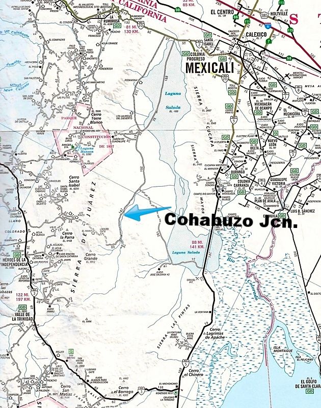
Set up camp at around 3 pm in the canyons past Cohabuzo Junction since the days will be short and the temperatures will be cool. Campfire will be a good, hardy one to keep our toes warm.

[Day 2] Begin the historic Pole Line Road. I have a more challenging plan for getting our group onto the trail without damaging vulnerable locker air-lines or scratching our nice 4WDs up. Travel the trail throughout the day, but set up camp before dusk in the majestic Jaquegel canyon a kilometer east of the running cold springs.

[Day 3] Continue down the Jaquegel canyon as it opens up and eventually meets the Arroyo Grande below. Right at the 'T' intersection, then off to La Ventana before reaching Hwy 5.

Who is in?

I'm hearing of interest from as far south as Mexicali and Tijuana from 4WD clubs in those two cities, hints of interest to the east in Arizona, my Seattle-based graphic designer is showing lots of enthusiasm and a bit of homesick feelings for his Pole Line memories [Pole Line delete/Palomar Canyon/Summit-'extreme' 2013].

This run will be one for the record books. Stickers and t-shirts usually bring everyone out of the woodwork. But the legend has been growing. 2017 will be the 75th birthday of the Pole Line Road!


[Edited on 8-7-2016 by Ken Cooke]

PaulW - 8-7-2016 at 06:29 AM

Count us in. Our plan is to drive from San Felipe and meet up near Cohabuzo Junction. We will be using the built LJ for this trip and it has both a CB & VHF radio setup.
Details for meet up later.

Paul & Julie Wilson

David K - 8-7-2016 at 07:08 AM


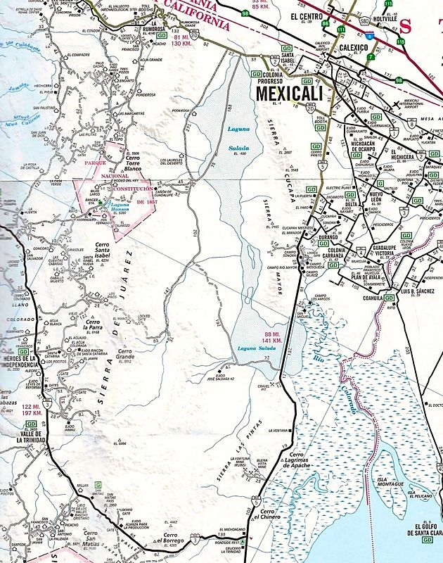
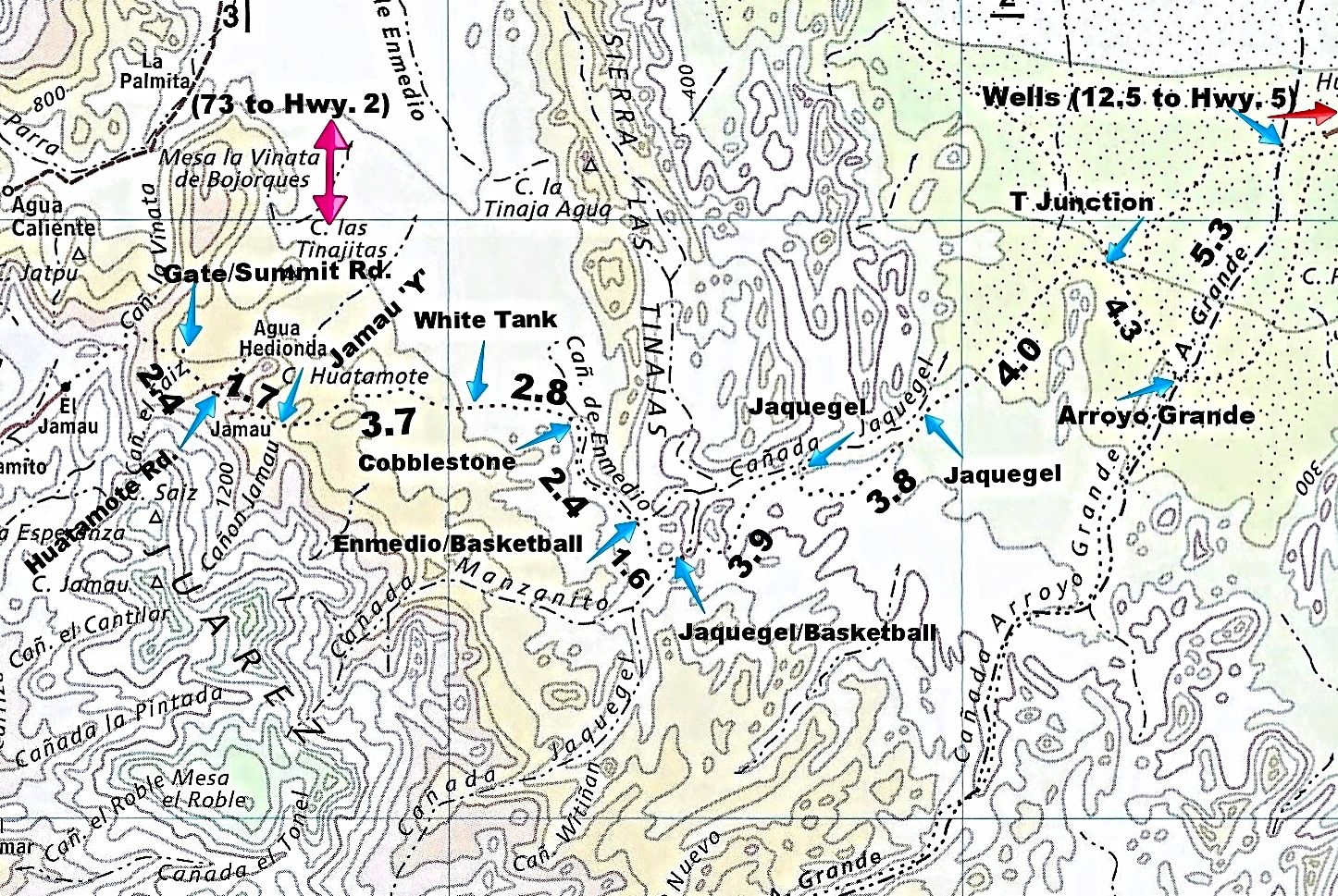
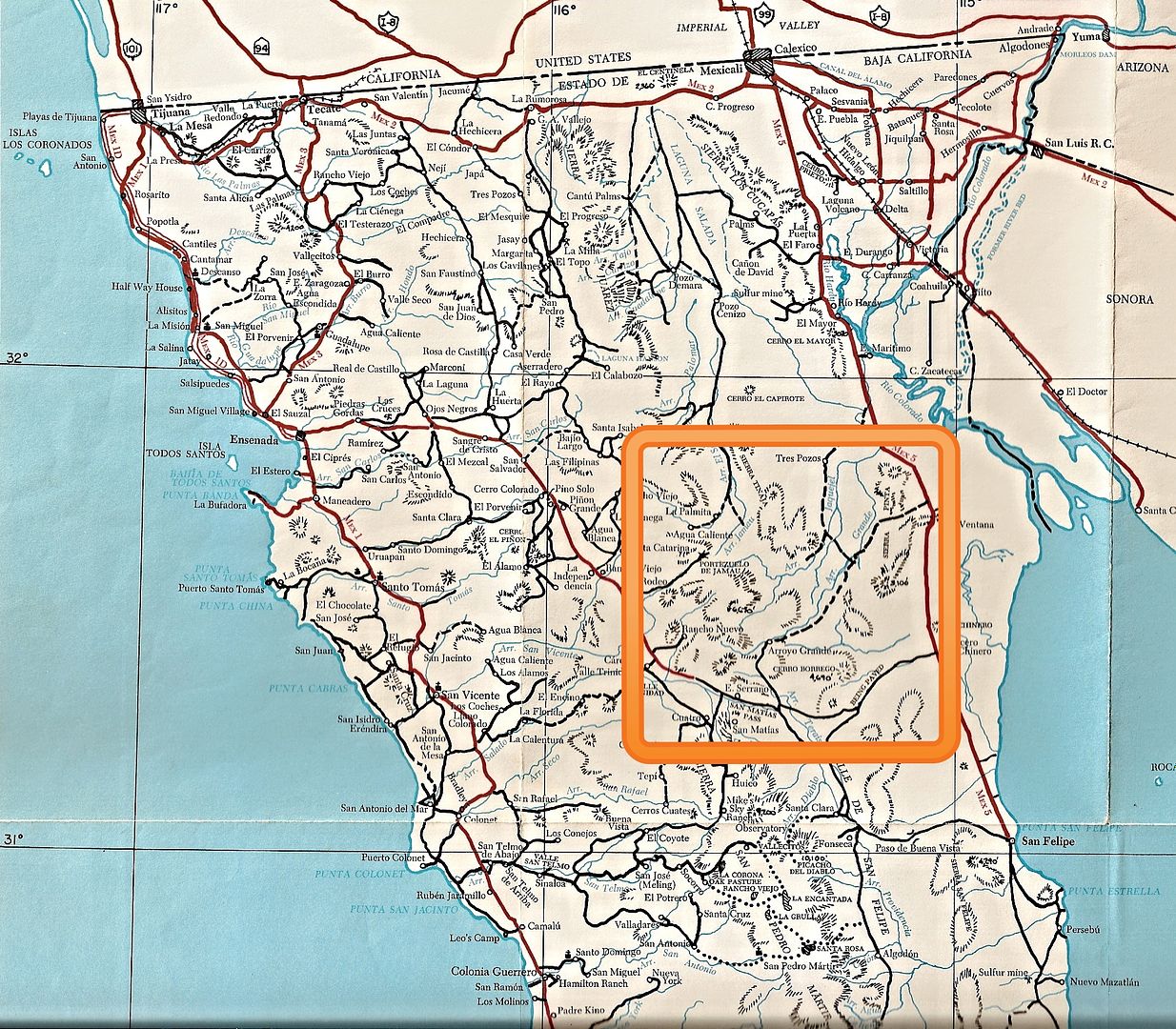
Here is the region of 1942 The Pole Line Road:


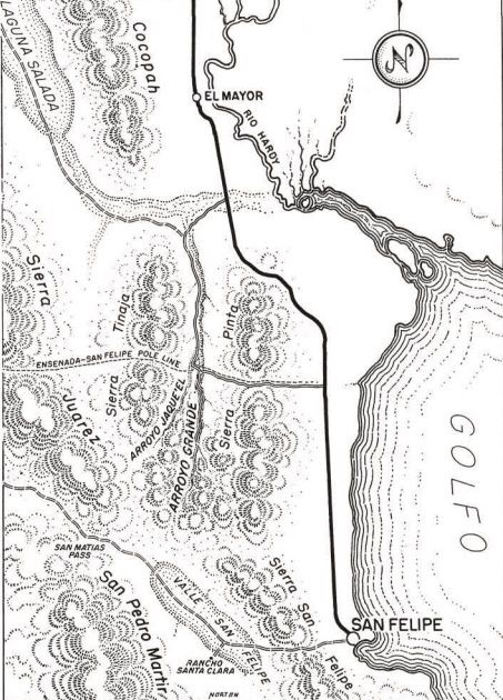
First named on this 1953 map:


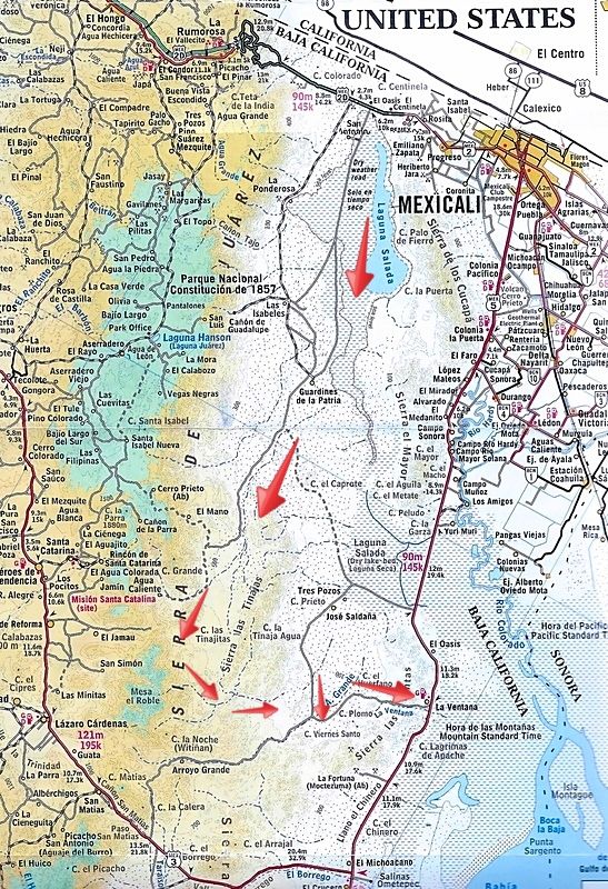
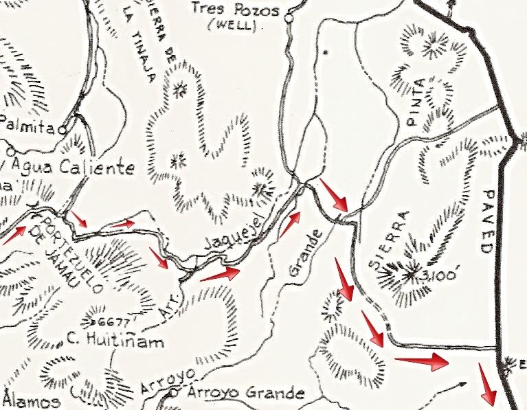
Here is the road as it was mapped for the 1962 Lower California Guidebook (arrows added):


[Edited on 8-8-2016 by David K]

Ken Cooke - 8-7-2016 at 07:13 AM

Thats a beautiful map. Rich details with all of the information in one place.

ehall - 8-7-2016 at 10:46 AM

I should be able to make it.

TMW - 8-7-2016 at 11:09 AM

From the beautiful city of sunshine I'm in. Glad it won't be a rush deal.

David K - 8-7-2016 at 11:10 AM

Quote: Originally posted by Ken Cooke  
Thats a beautiful map. Rich details with all of the information in one place.


Thanks!
The mileages are what I recorded last year and are between the arrow pointers. Each arrow also has a name we associate with that point.
The first mileage, between Gate/Summit Road (the locked steel gate) and Huatamote Road (2.4 miles) is using the detour we all took and passes where we camped the first night in Arroyo El Saiz.

The gate is 73 miles from Hwy. 2, via Laguna Salada and Cohabuzo Jcn.

The distance from the wells to Hwy. 5 (12.5 miles) is to the highway just south of La Ventana.

rich t - 8-7-2016 at 11:31 AM

We will be coming from San Felipe, will get with Paul W and head over with him, may have another Jeep coming(the one in the Mission Santa Marie
trip report).

Rich and Cathy

ChuckMRN - 8-8-2016 at 07:26 PM


Got the axles under it, now standing on her own. So much more to do, fingers crossed for Feb!


ehall - 8-8-2016 at 08:02 PM

Nice chuck. It looks like you are stretching it too?

Upgrades and buildups

Ken Cooke - 8-8-2016 at 09:24 PM

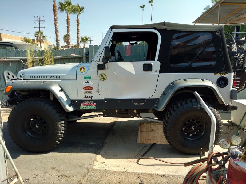
Here is mine while getting an exhaust resonator installed on Friday afternoon.


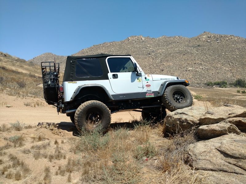
Out in the field on Sunday.


David K - 8-8-2016 at 09:32 PM

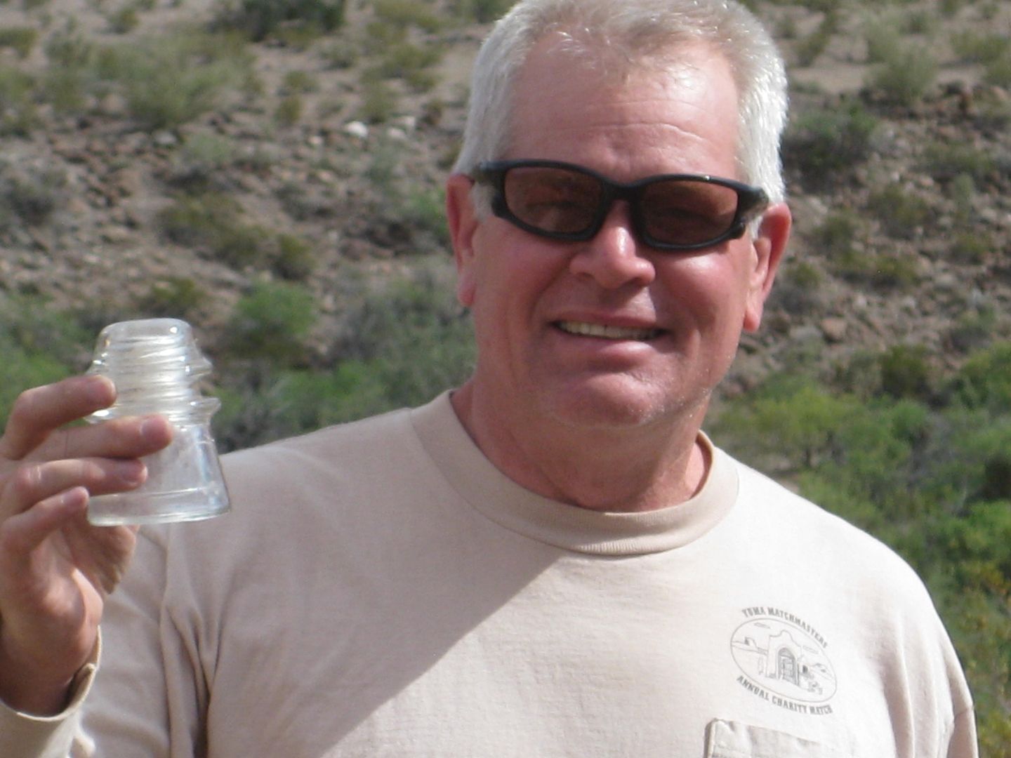
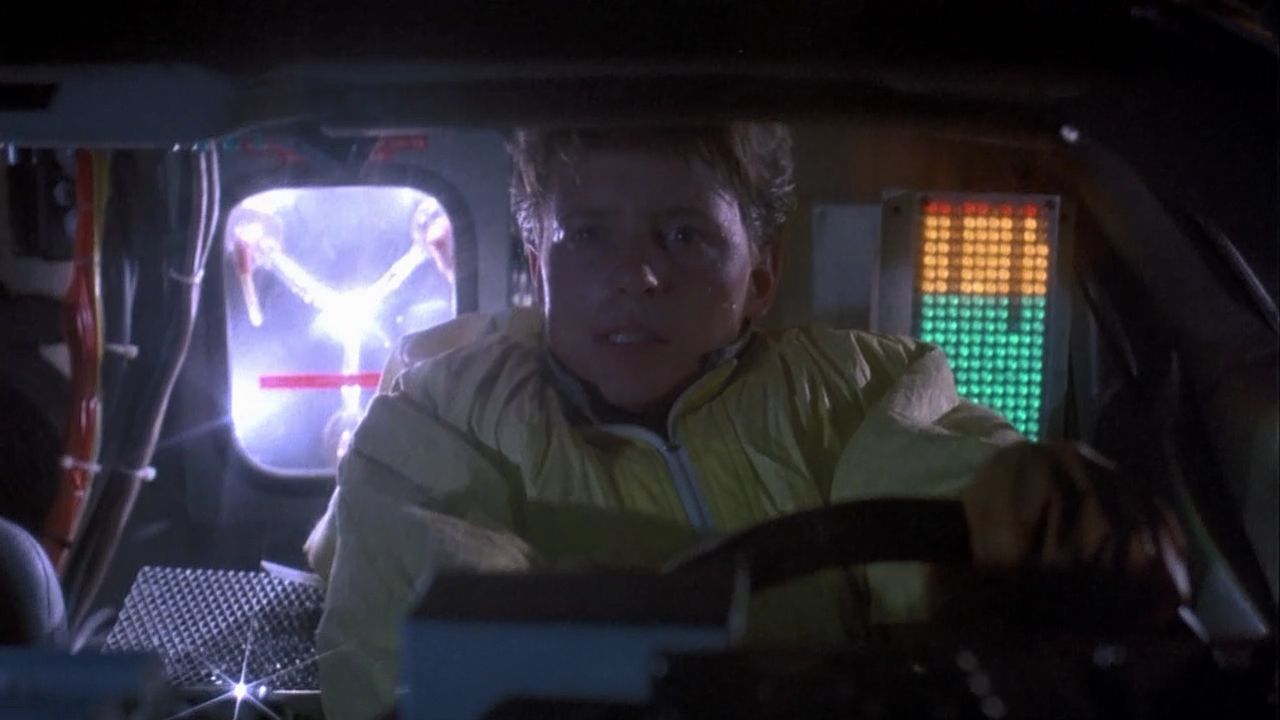
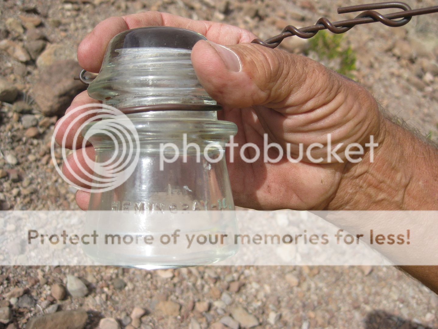
Chuck, do you have a full build thread on a Jeep forum or anywhere we can see your project? Congratulations!! You can use the 1942 pole insulator for the flux capacitor!!


PaulW - 8-9-2016 at 06:24 AM

The 1962 map above showing the PL going across Pinta pass is the most accurate so far. It would be interesting to go look and see if I can find any remnants of broken poles. I am sure remnants can be found.

mtgoat666 - 8-9-2016 at 06:39 AM

Quote: Originally posted by Ken Cooke  
Here is mine while getting an exhaust resonator installed on Friday afternoon.


Did you get the cricket chirp, roar, growl, or Chug-a-lug resonator?


David K - 8-9-2016 at 06:52 AM

Quote: Originally posted by PaulW  
The 1962 map above showing the PL going across Pinta pass is the most accurate so far. It would be interesting to go look and see if I can find any remnants of broken poles. I am sure remnants can be found.


That section has been used for off road racing a lot, people may have built campfires against any old poles? Keep an eye out for insulators still.

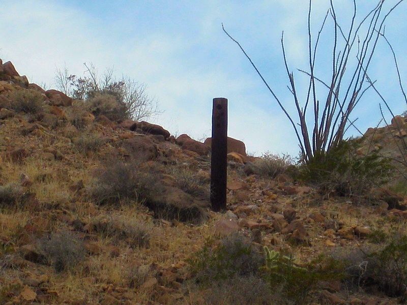
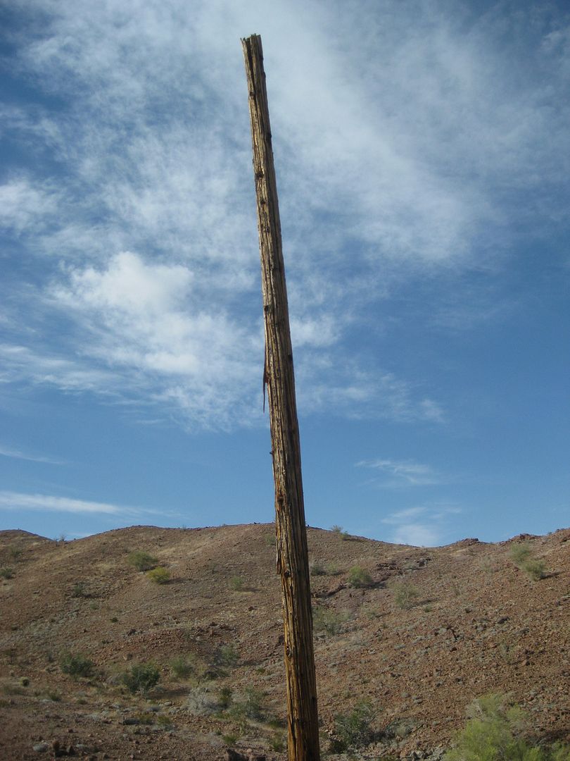
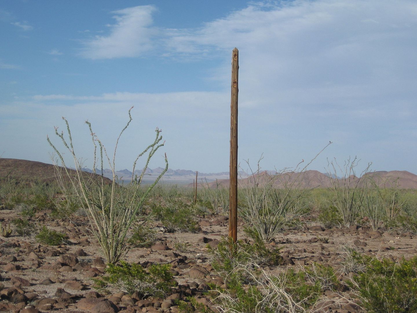
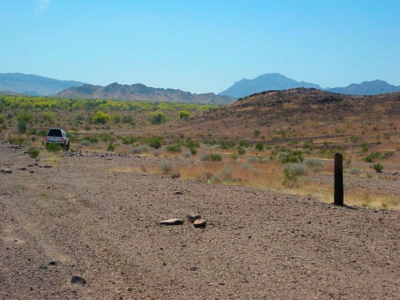
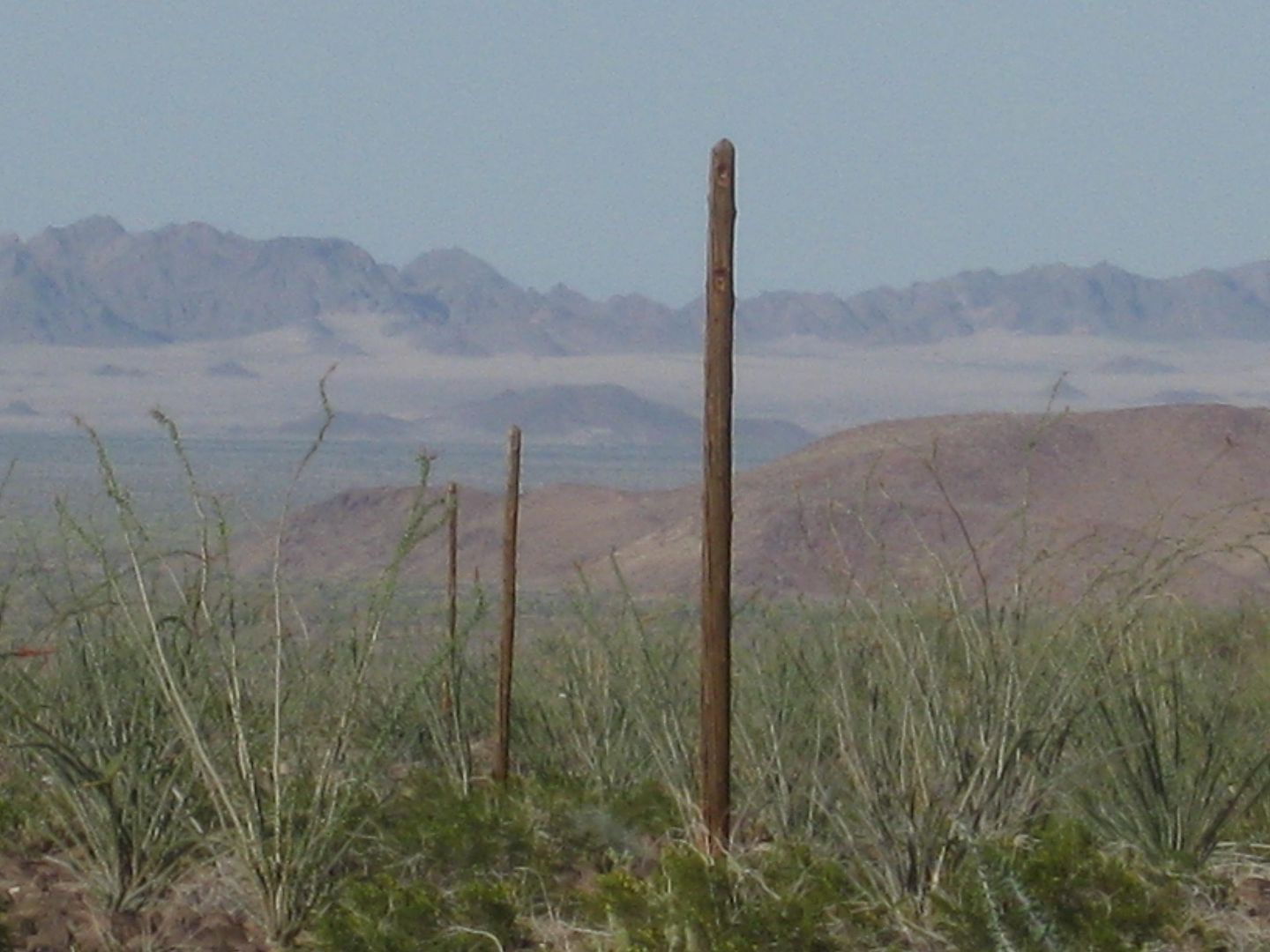
It was interesting how many were cut down to around 4 feet high, while many others remain untouched...


Last pole (cut) we saw before leaving the old road at Arroyo Grande:


PaulW - 8-9-2016 at 07:08 AM

Which Pinta pass ? Both are used for racing.

PaulW - 8-9-2016 at 07:20 AM

Mileage help requested
Coming from San Felipe and stopping for gas at the PMEX just west of Hwy5. How many miles to add to Davids 73mi on the map above? Hard for me to do because I have never driven from Hwy 2 to to get to our track. The PMEX is at 32 32.028, 115 25.721
I can do it from GE if I knew the coords where the 73 mile point crosses Hwy2.
David did you record the coords for that point?

David K - 8-9-2016 at 07:57 AM

Paul, the 73 miles is from Hwy. 2 at the Laguna Salada entrance road to the locked gate.

It is 22 miles from Hwy. 5 to the Laguna Salada road, using the toll road that stays south of Mexicali.

The Laguna Salada road at Hwy. 2 is: 32°34.560', -115°44.680'

EDIT: going west on Hwy. 2, you pass by the Laguna Salada road to make a (legal) U-turn to get back to it on the eastbound side.

[Edited on 8-9-2016 by David K]

rich t - 8-9-2016 at 08:04 AM

Do you take the Guadalupe Canyon turnoff from HWY 2?

David K - 8-9-2016 at 08:06 AM

Quote: Originally posted by PaulW  
Which Pinta pass ? Both are used for racing.


Well, that is for you to determine... since the 1962 map was drawn, there are more roads, yes. Between Arroyo Grande and El Chinero are at least two now. Happy hunting!


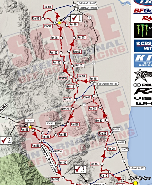
The 2015 San Felipe seems to have used both?:


PaulW - 8-9-2016 at 08:53 AM

Yes I made that track for SCORE and used both passes.
Just a stretch than maybe someone had seen a pole on one of those pass routes.

PaulW - 8-9-2016 at 09:05 AM

Got it - thanks
Jeep mileage is my issue to get from San Felipe and back. Going to have to plan for 190 to 200 miles between the two PMEX's

BTW, that is almost double the miles for the San Felipe PMEX going north then PLR and back over the summit to Valley Trin PMEX.
=============
Quote: Originally posted by David K  
Paul, the 73 miles is from Hwy. 2 at the Laguna Salada entrance road to the locked gate.

It is 22 miles from Hwy. 5 to the Laguna Salada road, using the toll road that stays south of Mexicali.

The Laguna Salada road at Hwy. 2 is: 32°34.560', -115°44.680'

EDIT: going west on Hwy. 2, you pass by the Laguna Salada road to make a (legal) U-turn to get back to it on the eastbound side.

[Edited on 8-9-2016 by David K]

David K - 8-9-2016 at 09:14 AM

Get gas at the Mexicali south station, then you have 200 miles via the Pole Line road to get back to San Felipe north station. Of course, 100 of those miles is in 4WD, and maybe 50 in low range... An extra 10 gallons should give you comfort.

Ken Cooke - 8-9-2016 at 09:22 AM

Quote: Originally posted by mtgoat666  
Quote: Originally posted by Ken Cooke  
Here is mine while getting an exhaust resonator installed on Friday afternoon.


Did you get the cricket chirp, roar, growl, or Chug-a-lug resonator?


The resonator was placed on backwards to reduce the unbearable noise/drone at 2,000 rpm my Jeep was exhibiting. The noise is much lower, but not to the level I find acceptable in a daily driving scenario. The performance gains were immediately noticeable, however.

TMW - 8-9-2016 at 09:36 AM

Quote: Originally posted by rich t  
Do you take the Guadalupe Canyon turnoff from HWY 2?


No it's 4 KMs to the east at KM24. Guadalupe Canyon is at KM28.

David K - 8-9-2016 at 09:40 AM

You could, but the dry lake road is much smoother and faster!

They come together or a branch off the dry lake road does about 24 miles south.

TMW - 8-9-2016 at 09:49 AM

Has anyone been to Tres Pozos (well). I've seen it on maps and SCORE calls the area near it by the name but I've never been to it.

David K - 8-9-2016 at 10:37 AM

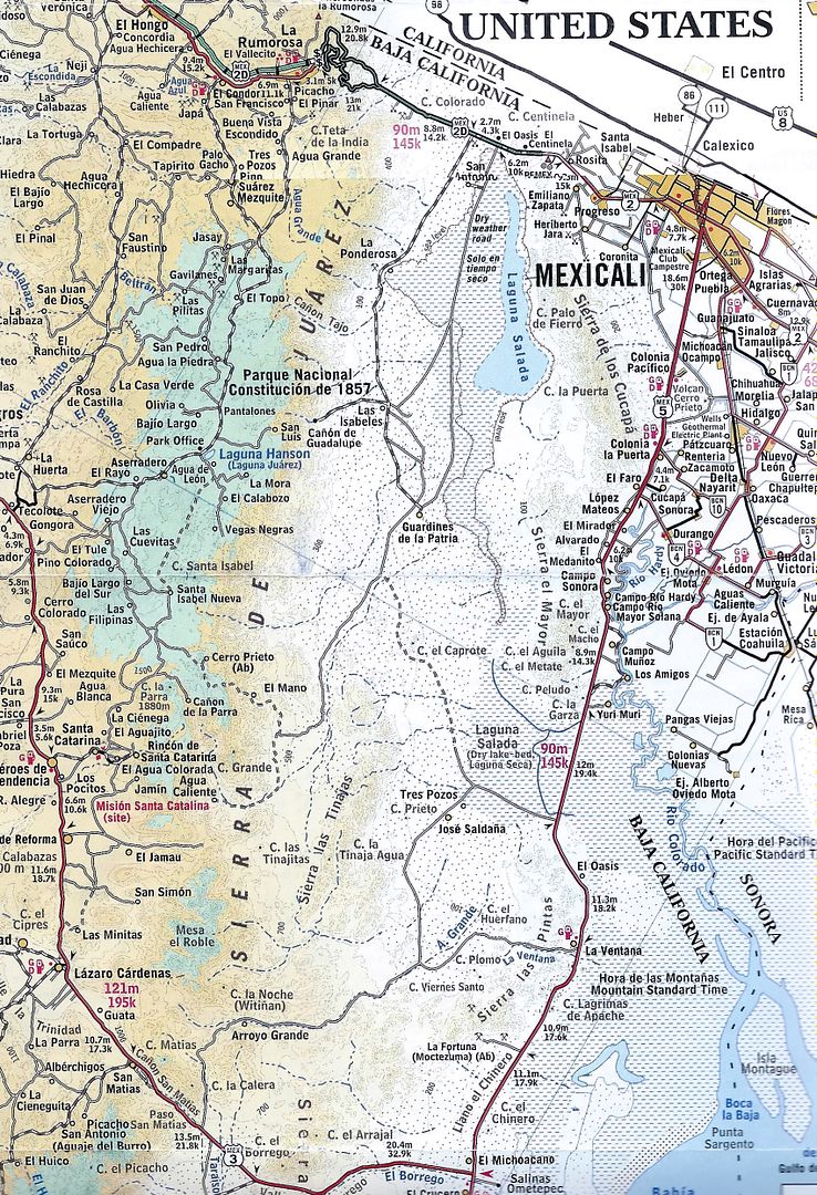
2003 Baja Almanac Folding Map:


Pole Line Run arrows:


2010 AAA Map


David K - 8-9-2016 at 10:54 AM

Paul: Why not meet up with Ken and the gang at Cohabuzo Jcn. as did MICK and others from Rio Hardy, last year? Access from the sand dunes and SCORE route, 60 miles north of San Felipe, instead of going all 120 miles to Hwy. 2 and then back down to Cohabuzo?


[Edited on 8-9-2016 by David K]

ehall - 8-9-2016 at 01:59 PM

Quote: Originally posted by TMW  
Has anyone been to Tres Pozos (well). I've seen it on maps and SCORE calls the area near it by the name but I've never been to it.


I think we were headed that direction last year but the road down the wash had completely disappeared and some of us were getting low on fuel so we turned back.

David K - 8-9-2016 at 05:03 PM

Quote: Originally posted by ehall  
Quote: Originally posted by TMW  
Has anyone been to Tres Pozos (well). I've seen it on maps and SCORE calls the area near it by the name but I've never been to it.


I think we were headed that direction last year but the road down the wash had completely disappeared and some of us were getting low on fuel so we turned back.


To not sidebar too far from Ken's Pole Line Road post, I made a new thread on finding Tres Pozos, here: http://forums.bajanomad.com/viewthread.php?tid=83734

PaulW - 8-10-2016 at 07:12 PM

Well I cannot go 200 miles even in 2wd so I have to find a solution.
Will check SF to KM31 then back to Km87 (35 miles) then to Saldana and catch the race road to Cohabuzo. Miles have to be way less than 200 total.
Questions:

Jeep guys who took the last trip. How much fuel did you carry?
How many miles did the group drive from fill up to Hwy 2 at the north end of the lake bed?
Thanks

rich t - 8-10-2016 at 08:15 PM

Paul, I was thinking about going to Guadalupe Canyon the night before,
fill up at the station about 15 miles from the turn off hwy2 and drive to
Cohabaza Jct. the next day, I have a 21 gallon tank and carry two 5
gallon cans, I hope that would make it.

Ken Cooke - 8-10-2016 at 08:39 PM

Quote: Originally posted by PaulW  
Questions:

Jeep guys who took the last trip. How much fuel did you carry?
How many miles did the group drive from fill up to Hwy 2 at the north end of the lake bed?
Thanks


Hi Paul,

I carry two 5 gallon jerry cans and top off in Progreso. I aired down my tires at the entrance to the Pole Line Road, providing better mileage for the entire run. I gassed up again traveling north on the outskirts of Mexicali.

One good option is to gas up in DURANGO north of Rio Hardy and cross the Sierra el Mayor (at El Medanito, I believe - check with MICK for exact coordinates). I have a full sequence of photos showing where we drove up the Mayor mountains and crossed the salty, muddy Rio Laguna Salada.

Our meeting place will be at Cohabuzo Junction and our campout the first evening will be a few hours south of Cohabuzo Junction.

The full trip from Progreso and back around to Mexicali was roughly 250 miles (on my odometer with 35" tires, stock speedo gears and diff gears). Getting back to the gas station wasn't exactly on fumes, but you will be down to your last 5 gallons if you travel up the 5. MICK might be able to chime in to share if any gas stations may be closer - such as that PEMEX in DURANGO that he took us to.

Those roughly 250 miles consumed much more gasoline than normal with all of the low range sections and sandy washes.

PaulW - 8-11-2016 at 12:34 PM

Thanks Ken,
10 gal is a lot to find room for.
Still planning
Latest idea is Pmex at Hwy5 k31 then back to K87 at the saldana turn, then the high road to Cohabuzo Estimate total miles to be approx 160-170. To far for my daily tripper Jeep considering useing low range. No provision go gas cans on my Jeep.

Considered the over the mtn route from, k40, but afraid to cross the mud flats. So I ruled out that route.
Considering leaving 5 gal at La Ventana to get me back the 45 miles south to the Pmex.
Btw, Durango turn is k38, so no reason to go there vs k31 Pmex.

David K - 8-11-2016 at 01:31 PM

Quote: Originally posted by PaulW  
Thanks Ken,
10 gal is a lot to find room for.
Still planning
Latest idea is Pmex at Hwy5 k31 then back to K87 at the saldana turn, then the high road to Cohabuzo Estimate total miles to be approx 160-170. To far for my daily tripper Jeep considering useing low range. No provision go gas cans on my Jeep.

Considered the over the mtn route from, k40, but afraid to cross the mud flats. So I ruled out that route.
Considering leaving 5 gal at La Ventana to get me back the 45 miles south to the Pmex.
Btw, Durango turn is k38, so no reason to go there vs k31 Pmex.


Paul, if you live in El Dorado and fill up by the crocodile Pemex... you go about 50 miles to the Sand Dunes, turn west on the Saldaña/Tres Pozos road... continue westbound 34 miles to Cohabuzo Junction.

Cohabuzo to the Pole Line Road (locked gate/ bottom of old summit) is 26 miles... total from Pemex: 110 miles.

The Pole Line Road run (to Arroyo Grande) is 30 miles. Yes, a bunch may be in Low Range, but not all.

From Arroyo Grande junction north to the wells and then east to Hwy. 5 by La Ventana is 18 miles. La Ventana back to the Pemex near the Rockadile sign is maybe 40 miles?

Paved road miles: 90
Dirt road miles: 110 miles
El Dorado Pemex Round trip: 200 miles.


Ken Cooke - 8-11-2016 at 06:02 PM

Quote: Originally posted by PaulW  
No provision go gas cans on my Jeep.

Btw, Durango turn is k38, so no reason to go there vs k31 Pmex.


This should allow for 5 gallons to be carried outside of your Jeep.

Smittybilt iRack
http://www.smittybilt.com/product/index/79.htm

Where do I get a link to your map showing kilometer designations along Hwy 5?

David K - 8-11-2016 at 07:37 PM

Quote: Originally posted by Ken Cooke  
Quote: Originally posted by PaulW  
No provision go gas cans on my Jeep.

Btw, Durango turn is k38, so no reason to go there vs k31 Pmex.


Where do I get a link to your map showing kilometer designations along Hwy 5?


Here is the official Nomad Kilometer thread: http://forums.bajanomad.com/viewthread.php?tid=50544


HWY 5:
KM 40 Access to Laguna Salada thru mtns.
KM 49 Access to Laguna Salada east side.
KM 87 Saldana I and Tres Pozos.
KM 89 Saldana II and access to Arroyo Grande wells.
KM 105 La Ventana.
KM 107 Access thru mtn to Arroyo Grande wells.
KM 123 Gold mine road.
KM 133 Access to race courses.
KM 141 Jct with hwy 3 KM197.
KM 142 Three Poles.
KM 149 Race course access.
KM 159 Race course access.
KM 168 Race course access.
KM 179 Zoo Road.
KM 188 San Felipe Arches.

PaulW - 8-11-2016 at 09:23 PM

Ok list above and more here
PMEX on hwy5
k178
East toward Durango at ~k38
k31.5
k15.5
k10.0
k4.7
k4.0
k2.7
k1.0
note: jct of 5 & 2 is 2k12/5k8
PMEX
2k11
= = = = =
Edit: Added access for my PLR trip study
More that I logged that are used by many off roaders
Access to L Salida
k39 over the mtns **
k49 S of the mtns **
k69.6 O-3 **
k74 O-2 **
k77 O-1 **
Note: ** Do not drive alone because these routes are over hard crust and depending on the water table break through is possible and the need for a tow strap will be required
"O" is my abbreviation for Oasis the old school name for these water logged mostly muddy roads.
k87 Saldana graded road
k89.4 Saldana
k92 race access
k106.6 Graded road to the Mine wells ~1KM S of La Ventana

k130.2 to Arrajal & Pinto pass
k134/5 to Arrajal & Pinto pass


[Edited on 8-12-2016 by PaulW]

PaulW - 8-11-2016 at 09:29 PM

Thanks David
Fills in a couple of missing numbers for me to bat around for my options.
============
Quote: Originally posted by David K  
,

Paul, if you live in El Dorado and fill up by the crocodile Pemex... you go about 50 miles to the Sand Dunes, turn west on the Saldaña/Tres Pozos road... continue westbound 34 miles to Cohabuzo Junction.

Cohabuzo to the Pole Line Road (locked gate/ bottom of old summit) is 26 miles... total from Pemex: 110 miles.

The Pole Line Road run (to Arroyo Grande) is 30 miles. Yes, a bunch may be in Low Range, but not all.

From Arroyo Grande junction north to the wells and then east to Hwy. 5 by La Ventana is 18 miles. La Ventana back to the Pemex near the Rockadile sign is maybe 40 miles?

Paved road miles: 90
Dirt road miles: 110 miles
El Dorado Pemex Round trip: 200 miles.


David K - 8-12-2016 at 07:53 AM

De nada Paul... Have you considered just meeting Ken's group at the bottom of the summit, coming in from La Ventana and use the Pole Line Road westbound, like you did just before our April 2015 run?

PaulW - 8-12-2016 at 08:03 AM

Yes, Considering the reverse run
* Also considering gas at Valley Trin over the summit and meet at the fence gate.
* Also Jeep mod I have always wanted, which is the 31 gal fuel tank instead of the stock 19 gal one.

Slow planning progress due to other commitments. Glad I have some time to get my act together.

David K - 8-12-2016 at 08:27 AM

Quote: Originally posted by PaulW  
Yes, Considering the reverse run
* Also considering gas at Valley Trin over the summit and meet at the fence gate.
* Also Jeep mod I have always wanted, which is the 31 gal fuel tank instead of the stock 19 gal one.

Slow planning progress due to other commitments. Glad I have some time to get my act together.


Yes, the Valle de Trinidad Pemex and over the summit is a great idea! You will be on several more miles of the Pole Line Road, as well!

I have no idea if I will make the next run, but it would be great to meet you, so I hope things work out so I can go. It was a great run with great people last year.

TMW - 8-12-2016 at 10:13 AM

Paul I plan to do the run and I normally carry two 5 gallon jugs which I don't need on the PLR at least I never have yet. You can put them in your vehicle. I normally carry Magna Sin but if you use Premium I'll put that in. Actually I can carry three which I did on my first No Wimp Trail run.

PaulW - 8-17-2016 at 06:32 AM

Update
A replacement fuel tank is on the way with +11 gal. No more distance limits. Mods required.

TMW - 8-17-2016 at 11:49 AM

Good news but make sure it doesn't drag the ground.

PaulW - 8-17-2016 at 01:20 PM

Includes new R springs. Hope they are correct. Will test at Moab on labor day
=========
Quote: Originally posted by TMW  
Good news but make sure it doesn't drag the ground.

David K - 10-9-2016 at 09:40 AM

Almost two months since the last post... Ken, do you have any updates? I am seeing interest over on Tacoma World by some to go on the next run.

Ken Cooke - 10-9-2016 at 02:08 PM

Quote: Originally posted by David K  
Almost two months since the last post... Ken, do you have any updates? I am seeing interest over on Tacoma World by some to go on the next run.


Hi David,

I will be posting a run announcement within the next hour at JustRuns.com

I also plan on beginning the manufacture process of Pole Line Road merchandise later this week. :bounce:

Merchandise will be available mid November! :bounce:

Merchandise includes: t-shirts, hooded sweatshirts, baseball caps! :light:

David K - 10-9-2016 at 02:12 PM

Please copy your posts here or post the link to the thread or post of interest. Thank you.

Ken Cooke - 10-9-2016 at 03:06 PM

"The Pole Line Road was constructed during WW2 to service a telephone road from the San Felipe area to Ensenada because of fear of Japanese submarines in the Sea of Cortez. It does not go from ranch to ranch or spring to spring, so it gets little travel (and no maintenance)." - Neal Johns

4WD Run Type: Bobtail Camping - 1 night in Canyon Alamito at the bottom of the Summit. 1 night in Canyon Jaquegel near the stream.

Date: Saturday February 18 - Monday February 20, 2017

Location: 400 Imperial Blvd, Calexico, CA 92231 - Pep Boys

Leader: Ken Cooke (and Wife Leidys Cooke)
Contact: thedesertoutlaw@yahoo.com 951-255-1589 cell

RSVP: Required for Run

Run Type: Camping Run (incl. 2 Full Days on the 1942 Pole Line Road) with an optional run to Enmedio Falls for those who want to try some moderate level rock crawling.

Difficulty Rating: 2+ (3 on optional Enmedio Falls section)

Required Equipment:
Provisions for 2 nights of camping in the remote backcountry.
31" Tire required.
CB Radio and Fire Extinguisher.
3 Days worth of Mexico Auto Insurance (Can be purchased in 24 hr. increments).
One traction aiding device strongly suggested (Limited Slip).
Skid plate for oil pan,
Spare tire
Spare (2) gerry gas cans to make entire round-trip from Progreso/Mexicali-area back to Mexicali. Gerry cans must be EMPTY to enter Mexico.
A good shovel to assist in trail washouts
Towstrap (no metal hooks!) for vehicle recovery

Meeting Time: 10 AM - Pep Boys, Calexico, CA - 400 S Imperial Ave Calexico, CA 92231

Departure Time: 10:30 AM from Pep Boys - 400 S Imperial Ave Calexico, CA 92231

* Please have your Mexican insurance already purchased/in hand, and Passports/Visas to return to USA.

*This is going to be a fun run - drivers from as far off as B.C. Canada will make the drive! Bring your cameras and extra memory cards - the vistas in this part of Baja are amazing. The trail has its' challenges, and will not disappoint. In 2015, we had to get out of our Jeep, Toyota and Ford 4x4s and rebuild a portion of the trail, so please bring a good shovel and maybe a good pick to break up the hard-packed ground.

Day 1: Our group will meet in Calexico at the Pep Boys parking lot. We will have a relaxed lunch at Asadero Morlan before heading to the PEMEX gas station where we will fill up our gerry cans and gas tanks. We will drive to Laguna Salada (at Hwy 2)- reset odometers at '0' where our next stop will be Cohabuzo Junction - 57 miles south. At mile 79, we will enter the sand wash of Canyon El Alamito where we will camp for the night. We should arrive at roughly 3:30 pm - enough time to set up tents, build camp fire. Note: The bottom of the summit gets cold and breezy at night.
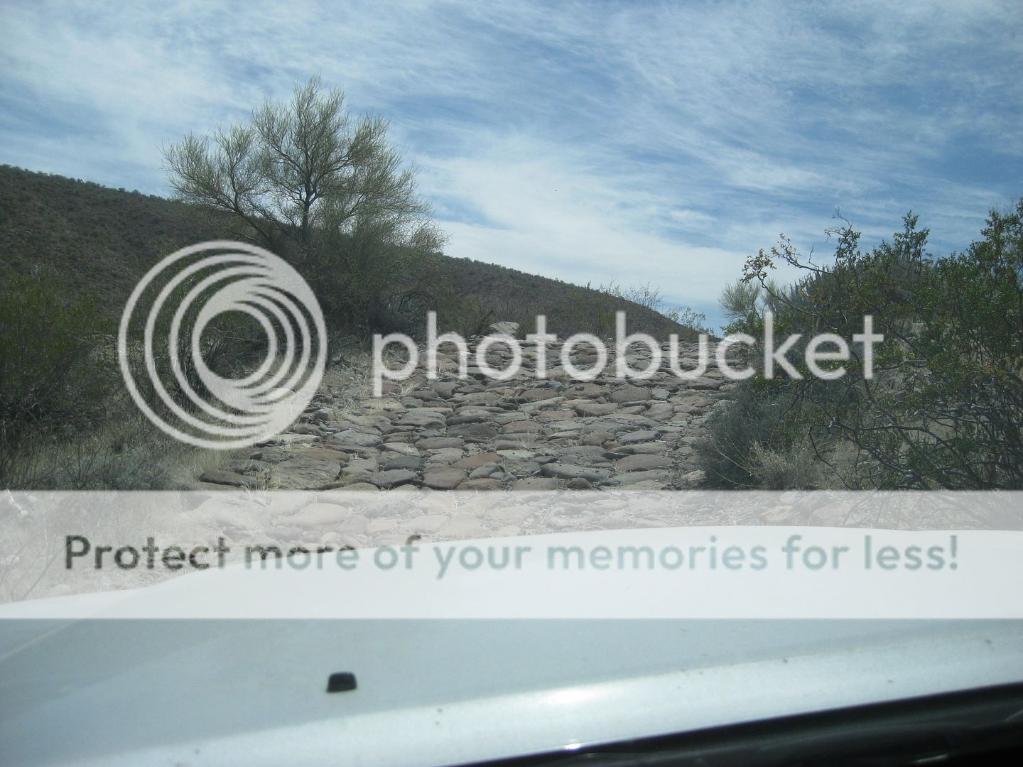
Day 2: We will take the bypass to enter our route (if gate is locked/closed). We will travel cobble stone sections that were built 75 years ago by Army Corps of Engineers - stopping to take photos. At Mile 95.4 we will take optional rock crawl section past Basketball Hill arroyo to survey canyon junction down below. "The reason for Basketball Hill is about two miles below; where Canyon Enmedio joins Canyon Jaquegel is a dry waterfall which Basketball hill bypasses. Bikes can continue down Enmedio if desired and there is a way down the waterfall on the left. Also, here at this canyon junction, is an old sidehill road over the hill left (OK for bikes, but no longer useable for 4wds - tippy plus!)" - Neal Johns Our day will end at mile 97.2 Canyon Jaquegel at approximately 3 p.m.

Day 3: Our last day will take us from mile 97.2 to mile 130.5 at Llano el Chinero where our dirt route will intersect with Hwy 5. Provided that our road is feasable at mile 105, we may have to get out and do trail repairs. We should reach Hwy 5 before dusk. Our vehicles will need to take us north into Mexicali where we can gas up our vehicles and grab some fresh food.

Your vehicle will need to be able to travel two days in low-range consuming a considerable amount of fuel. My 4.0l Jeep TJ consumes close to its' full 19 gallon tank along with the 10 gallons that I carry in auxilary fuel. Spare parts are always a good idea. Over the years, we have needed spare ignition parts, spare tires, spare motor oil, and even a translator or two. Be sure to pack enough food for the full 3 days. You can take food to go from Asadero Morlan to help augment your first day worth of food as we begin our run on the 1942 Pole Line Road.

Update: Pole Line merchandise

Ken Cooke - 10-16-2016 at 08:14 AM

T-shirt/Sweatshirt designs are in the completion stage. Preliminary orders are going out to the manufacturer this week. :bounce:

Baja Pole Line model session in the planning stages. :bounce:

Stay tuned!:yes:

ehall - 10-16-2016 at 11:34 AM

Model session? Lol. Can't wait.

Ken Cooke - 10-16-2016 at 08:35 PM

Quote: Originally posted by PaulW  
Yes, Considering the reverse run
* Also considering gas at Valley Trin over the summit and meet at the fence gate.


Paul,

Chippy is driving up from San Felipe (originating in Colima). Since he has never been to this region, would it be possible for him to caravan with you and your friend? He doesn't want to meet up in Progreso since he will be driving from mainland Mexico. Thanks if you can help him out.

Ken

PaulW - 10-17-2016 at 06:09 AM

Quote: Originally posted by Ken Cooke  
Quote: Originally posted by PaulW  
Yes, Considering the reverse run
* Also considering gas at Valley Trin over the summit and meet at the fence gate.


Paul,

Chippy is driving up from San Felipe (originating in Colima). Since he has never been to this region, would it be possible for him to caravan with you and your friend? He doesn't want to meet up in Progreso since he will be driving from mainland Mexico. Thanks if you can help him out.

Ken

= = =
Good, he is welcome to join Rich and I
PM sent
FYI, I will be taking the route via L Salida.

Numbers posted

Ken Cooke - 10-22-2016 at 10:58 PM

17 drivers have contacted me - confirmed
4 drivers - 'maybe'

It's going to be a lot of fun, and educational. Besides the Pole Line Road apparel, I am going to stop promoting this run for obvious reasons. We now have a full slate of drivers and passengers, and I don't want to worry about food shortages in Progreso or gasoline shortages at the Progreso PEMEX.

See you in Baja everyone..

David K - 10-23-2016 at 10:12 AM

Wow, you might add an extra day... that many vehicles will take quite awhile to do the crawl sections of PLR.

Keep in mind, unlike the last PLR trip in 2015, this time the border guards might make everyone go to INM for the (now*) required FMMs... that would be some kind of parking dilemma. The Baja Extreme three other vehicles following me were all told to go to INM, and to double park as the few parking spots were filled there.

*It was still as it had been, if under 3 days in Mexico and not south of San Felipe, no FMM required.

Ken Cooke - 10-23-2016 at 10:34 AM

Quote: Originally posted by David K  

*It was still as it had been, if under 3 days in Mexico and not south of San Felipe, no FMM required.


We will drive in on Saturday morning and out Monday evening, but the couple from Canada might have to get their FMMs if they plan to stay longer. I am just speculating, but this is good to know.

One more driver confirmed this morning and Pete unfortunately dropped out. His Jeep will be recovered sometime this week with the help of his friend Steve, Mark and PaulW. Roughly, we are at 20 rigs.

Akula - 10-27-2016 at 04:12 PM

Quote: Originally posted by Ken Cooke  
Quote: Originally posted by David K  

*It was still as it had been, if under 3 days in Mexico and not south of San Felipe, no FMM required.


We will drive in on Saturday morning and out Monday evening, but the couple from Canada might have to get their FMMs if they plan to stay longer. I am just speculating, but this is good to know.

One more driver confirmed this morning and Pete unfortunately dropped out. His Jeep will be recovered sometime this week with the help of his friend Steve, Mark and PaulW. Roughly, we are at 20 rigs.


The wife and I will be heading back Monday evening with the rest of the crew Ken. We have some family in Palm Springs we're going to visit with. Just wondering about the FMM's I pulled this info off the Discover Baja website:

As of September 2015, there is no longer a “free zone” and every person entering Baja, regardless of destination or duration of trip needs to obtain an FMM. If you are only going to be in Mexico for seven days or less, you can get a free FMM, but you still need to stop at the border to fill out the paperwork to obtain the permit.

I just want to make sure we have everything we need and not get delayed on the trip. Does anyone have any extra info on this?

David K - 10-27-2016 at 04:39 PM

The really key thing about the FREE 7 day FMM is that it must be returned to the INM office at the border, and that hassle alone (with Mexicali traffic and finding the border line street going back north) could easily justify buying the 180 day FMM instead. Your passport is scanned to monitor it and scanned again when you return the free FMM, which makes sure people leave Mexico in 7 days or less, otherwise you get charged for 180 days. The 180 day FMM can be thrown away after 180 days.

Akula - 10-27-2016 at 04:47 PM

Quote: Originally posted by David K  
The really key thing about the FREE 7 day FMM is that it must be returned to the INM office at the border, and that hassle alone (with Mexicali traffic and finding the border line street going back north) could easily justify buying the 180 day FMM instead. Your passport is scanned to monitor it and scanned again when you return the free FMM, which makes sure people leave Mexico in 7 days or less, otherwise you get charged for 180 days. The 180 day FMM can be thrown away after 180 days.


Good to know. Thanks for the info David.

David K - 10-27-2016 at 05:11 PM

You bet, keep in mind, this was told to us twice at Mexicali this year but different Mexican officials might tell you different things, that is just the nature of things with government officials in Mexico.

Just try not to put a lot of stress into it, if they ask for something, fine, if not just have a good time, anyway! In 2015 (April) none of the Pole Line Run members were asked to pull over and we just followed Ken into Mexicali and that turned into a real interesting look at a residential area for several dozen blocks of 4 way stop signs! In the end, we met others who were already in Mexico at the various spots and it was good fun.

The thing is, there is just no parking for 20 vehicles at the same time at the border INM office so it may be just a formality not enforced? One of the members of Cameron's tours who flew back north with me in the helicopter did not get an FMM when they crossed south, so maybe big tour groups are exempted, just because they have no infrastructure for huge groups, at Mexicali or Tecate?

ehall - 10-27-2016 at 06:15 PM

You got me on your list Ken? Maybe the wife will come. She's not much of a camping person. I think I will just start buying the 180 day fmm. I go south 4 or 5 times a year. 50 bucks a year is reasonable.

Saturday morning entry

John M - 10-27-2016 at 07:43 PM

We entered at Mexicali west three weeks ago at about 10:00 a.m. on a Saturday morning. There was a small back-up before and after the last Calexico traffic signal, and all the way through the Mexicali entry station. Being quite busy, they were waving a good number of vehicles straight through (including us) - no conversation or looking at all. My daughter was stopped momentarily just to take a look in the back seat area - heavily tinted windows, then waved through.

Mexicali east has lots of parking for FMMs and fairly straightforward access to the Highway 2 toll road westbound.

John M

Ken Cooke - 10-27-2016 at 08:21 PM

Quote: Originally posted by ehall  
You got me on your list Ken? Maybe the wife will come. She's not much of a camping person.


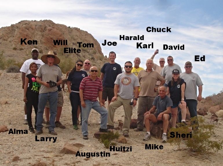
The wives will all have each other to talk to. Armando and Michael are taking their significant others, STEVE from the San Felipe Jeep Recovery thread is bringing Lillian, Saturnino is bringing his (Spanish-speaking) wife, I'm bringing my (Spanish-speaking) wife, Akulas wife is going, as is PaulW's wife Julie. I reached out to Alma to start bugging BajaTrailRider as well.

The run may be closed now to a lot of folk, but plenty are bringing their wives!:bounce:

PaulW - 11-1-2016 at 10:08 AM

Ken, here is the count from San Felipe
Rich Tiesso
Jerry Lightell
Harvey Schuler
Paul Wilson
And
Gustavo Nelson (Chippy)

Ken Cooke - 11-1-2016 at 04:01 PM

Quote: Originally posted by PaulW  
Ken, here is the count from San Felipe
Rich Tiesso
Jerry Lightell
Harvey Schuler
Paul Wilson
And
Gustavo Nelson (Chippy)


Thanks for the list, Paul! Rich T has a seriously built CJ. Please tell everyone that they have to buy a T-shirt from me if they plan to go!

Optional Box Canyon Rock crawl Day#2

Ken Cooke - 11-5-2016 at 07:44 PM

Question: In 2005, the group set up camp in upper Jaque'el just like we will in 2017, and after dinner made a night run up Cowboy Canyon , Basketball Hill and down Cañon Enmedio to the crazy cliff trail leading down to Arroyo Jaque'el that Neal Johns describes in some trail notes he provided to me in 2004.

It obviously take more fuel to set up camp, and make this night run, but not everyone will want to do the insane rocks at night - on our last night on the trail. However, not everyone will be enthusiastic about waiting at Basketball Hill while the crazies check out the hill earlier in the day..

Hmmm.. Perhaps, we should split the groups up - one group going to the camp area in Jaque'el near the spring, while the Jeep Rocks group check out the boulders and big cliff trail?? Hmmm.. Anyone care to chime in??

reasonable proposal

John M - 11-6-2016 at 01:27 PM

That seems to me to have merit Ken. Let's work on some details.

John M

ehall - 11-6-2016 at 03:25 PM

I'm sure we can figure it out. I might have to bring more gas for more adventure.

Akula - 11-7-2016 at 07:52 PM

How insane are we talking Ken? 35"+ tire size with lockers etc. or just the difficulty of it being a night run?

Ken Cooke - 11-8-2016 at 08:08 PM

Quote: Originally posted by Akula  
How insane are we talking Ken? 35"+ tire size with lockers etc. or just the difficulty of it being a night run?


The trail is something a stock Toyota Tacoma or a stock Jeep Wrangler can handle. The night run would require 33"+ tires and limited slip and/or locking differentials. The route back down Basketball Hill is going to be a small challenge due to it being partially shut off with the large boulder near its entrance. To negotiate it, you must scale a small canyon wall. Going down the canyon wall is one thing, but going up it will require throttle, up the short but loose section of trail. This is due to the loose nature of that section of trail. The boulders down Enmedio canyon will require a small lift and 32" or 33" tires.

Here is a view of the small closure section/go around at 1:25
https://youtu.be/Ux1jmXllskM


Ken Cooke - 11-29-2016 at 10:26 PM

One slot was open, and it got filled quickly. A Land Rover, or 'Landie' driver was having maintenance and repair problems, so she decided to ride along with her Jeep-driving friend, so Justin in San Diego (and Rio Hardy) slid into her spot with his pair of CJ-5s. There look to be right over 25 rigs going. Justin mentioned that he knows 'Mickey' from Baja Nomad!

ehall - 11-30-2016 at 10:53 AM

25 rigs, wow. We might have to find a little bigger spot to camp the first night. lol

Ken Cooke - 11-30-2016 at 09:06 PM

Quote: Originally posted by ehall  
25 rigs, wow. We might have to find a little bigger spot to camp the first night. lol


I have a great idea for night #1. Night #2 will be great with the sandy canyon and cold spring.

David K - 12-1-2016 at 08:48 AM

Are you sure about these camping ideas?
We had unplanned camps (that turned out just fine) with less than half the vehicles, in 2015. More rigs, more people, more problems, slower going! Be open to alternatives and flexible!

A look back at Pole Line 2015:
http://forums.bajanomad.com/viewthread.php?tid=78415

I wish you all the luck, without the breakdowns (Ford) of the previous run. Seeing the 1942 road and telephone poles and insulators in Baja California was amazing!


ehall - 12-3-2016 at 07:16 AM

Thanks for reposting that link DK. Lots of great pictures in that thread.

David K - 12-3-2016 at 01:09 PM

It was a great trip, even with the Ford problem!
I would go back, but when I can take more time to explore the old poles and cobblestone.

Ken Cooke - 12-4-2016 at 11:33 AM

My wife will have that three or four day weekend - we may take one additional day to cross the border north into the USA to avoid the holiday weekend traffic. I have the entire week off from work which will be nice.

ehall - 12-5-2016 at 04:45 AM

Good for you ken. It would be nice to drop down to San felipe for a day or 2 before heading back.

Happy New Year - Got Gas?

Ken Cooke - 1-11-2017 at 08:50 PM

Happy 2017 Pole Line Group! The year was ushered in with an economic boom in the form of the 20% rise in gasoline prices and the resulting #Gasolinazo. I am watching the supply issues closely with Pole Line Group members in Tijuana, Mexicali and San Felipe.

There will be another gasoline increase on February 12th. It is uncertain what level of supply challenges this may create. So, lets see where all of this goes. There are a few options for a safe, worry-free run this year, but as the situation in Mexico continues to evolve, all I can confidently do is watch and observe.

David K - 1-11-2017 at 10:09 PM

San Felipe was only about 15% higher and along the border even less. Don't believe the fake news. :lol:

Seriously, it was a big jump without warning, I guess. When government meddles in industry and marketing, such stupidity is not surprising.

PaulW - 1-12-2017 at 09:37 AM

Actual
13.88 before 16.17 Sunday (16.5%)
When we get more gas I will report

PaulW - 1-12-2017 at 10:20 AM

San Felipe 2 hours ago
Should be gas just about everywhere. EDR PMEX open and tanker there now. Just saw a double tanker coming out of town now.

David K - 1-12-2017 at 11:41 AM

Quote: Originally posted by PaulW  
San Felipe 2 hours ago
Should be gas just about everywhere. EDR PMEX open and tanker there now. Just saw a double tanker coming out of town now.


Great news Paul. Thanks. By next week, this mess should be history.
On Tue. Jan 3 Bahia de L.A. was 16.16 pesos/liter, up from 13.98/liter on Dec. 30. San Felipe (older station at traffic circle) was 16.17/ liter also on Jan. 3.
Just under 16% increases.

Keep up the reports, thanks!

Ken Cooke - 1-12-2017 at 04:40 PM

Quote: Originally posted by PaulW  
San Felipe 2 hours ago
Should be gas just about everywhere. EDR PMEX open and tanker there now. Just saw a double tanker coming out of town now.


That is great news! :yes:

JZ - 1-12-2017 at 05:38 PM

Trip looks like it would be a blast and pretty easy on a bike if you could get gas.


Ken Cooke - 1-12-2017 at 07:26 PM

Quote: Originally posted by JZ  
Trip looks like it would be a blast and pretty easy on a bike if you could get gas.


Bikes have made the trek in a matter of hours.

PaulW - 1-13-2017 at 10:19 AM

Figure your fuel strategy.
Kens log shows 130 miles from Progreso PMEX to Hwy5. Plus another 35 miles up the hwy to the closest PMEX total is 165 miles.

If you do the run from San Felipe then over the summit and to Valley Trinidad the distance from SF N PMEX to PMEX at Valley Trinidad is 130 miles including extra side trips. Without side trips and following the GPS expect the trip to be around 100 PMEX to PMEX.
Easy day trip either way.
Not having done it you will need route finding help. Easy to miss the turns. A gps will solve that issue. My first trip took many extra hours and miles of back tracking to find my way. When we got to V Trinidad several jeeps were on fumes.

Ken Cooke - 1-13-2017 at 04:16 PM

We have a fun night run planned on our Sunday night. Night rock crawl with the big dogs! (33" and taller)

David K - 1-13-2017 at 05:47 PM

Quote: Originally posted by Ken Cooke  
We have a fun night run planned on our Sunday night. Night rock crawl with the big dogs! (33" and taller)


Is there an option for those who have driven all day to sit around a campfire and share stories, and socialize? Some of us aren't 29 anymore, lol!

It is beautiful out there... but in February it may be VERY cold at night. April was perfect and talking with Fernweh and 4x4abc and the others in 2015 was a great part of that trip.

Baja Nomads Four Wheeling into history on the WWII Pole Line Road built in 1942...


Ken Cooke - 1-13-2017 at 06:26 PM

Quote: Originally posted by David K  
Quote: Originally posted by Ken Cooke  
We have a fun night run planned on our Sunday night. Night rock crawl with the big dogs! (33" and taller)


Is there an option for those who have driven all day to sit around a campfire and share stories, and socialize? Some of us aren't 29 anymore, lol!

It is beautiful out there... but in February it may be VERY cold at night.


It is colder in December!! Brrr!!:!:

The night run is for THOSE ABOUT TO ROCK. Not mandatory, nor recommended.. It's a Jeep thing!:!:

bajatrailrider - 1-14-2017 at 10:32 AM

I wish you guys a great trip,I cant make it this year.As already planned off road Moto ride. Dont worry about the fuel it will settle down. Dont worry about cost I just got 20.75 on the dollar. So for 500$ dollars I got 10,375. Pesos that buys lots of tacos and fuel. Have a safe great trip all.

Ken Cooke - 1-14-2017 at 07:52 PM

Quote: Originally posted by bajatrailrider  
I wish you guys a great trip,I cant make it this year.As already planned off road Moto ride. Dont worry about the fuel it will settle down. Dont worry about cost I just got 20.75 on the dollar. So for 500$ dollars I got 10,375. Pesos that buys lots of tacos and fuel. Have a safe great trip all.


Muchas gracias, Larry. I figured this was a busy time for you and your business. I need to come over and 'wheel with you guys.

bajatrailrider - 1-14-2017 at 09:56 PM

Mi casa Tu casa. Ken I know places not on any maps. When you get time to run that Awesome Jeep. Alma says HI to All. best of wishes.

This week

Ken Cooke - 1-22-2017 at 11:02 AM

During the past weekend, I took the Jeep to Joshua Tree and did further vehicle testing. The suspension works great. The onboard air system worked flawlessly.

On Wednesday, Leidys and I celebrated a major milestone.:!:


I am ordering Pole Line Run apparel this week. With Christmas and Anniversary within 2 days, the t-shirts had to be postponed.

David K - 1-22-2017 at 11:16 AM

That is a wonderful thing... becoming a legal resident first and then becoming an American... a new and Great American, too! ;)

ehall - 1-22-2017 at 11:39 AM

That's awesome. Tell her congrats.

Pole Line Road damage

Ken Cooke - 1-22-2017 at 12:01 PM

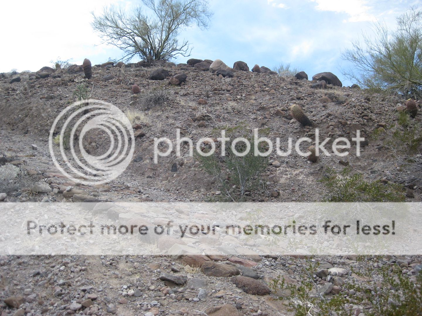
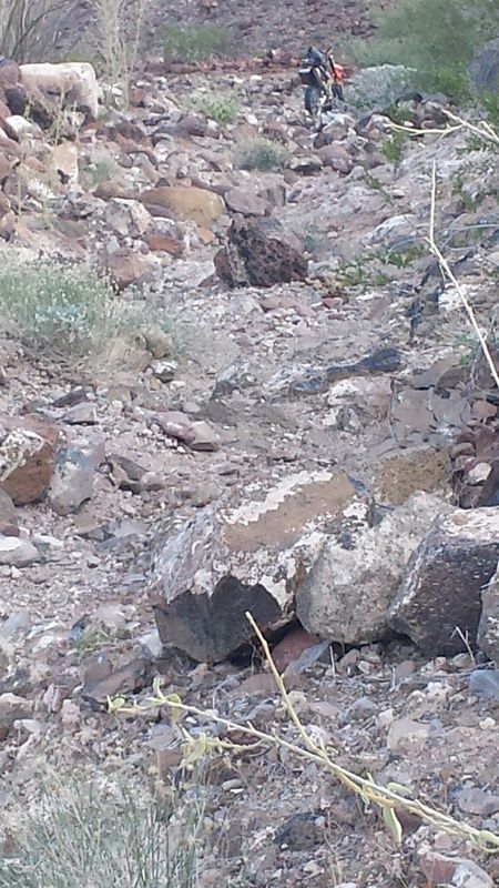
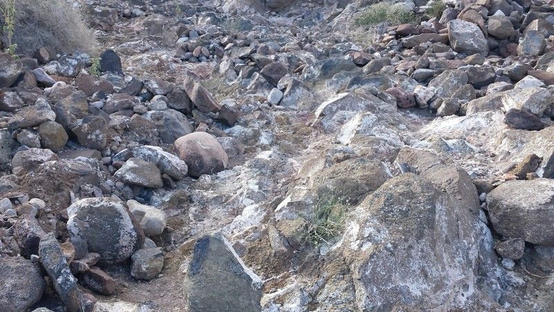
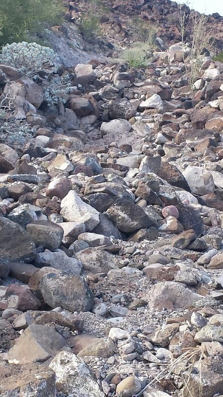
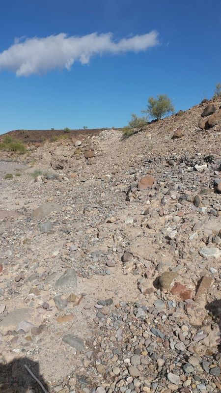
With recent climatic conditions, the Pole Line Road has taken some serious damage to get our 4x4s through. What was once a 1 day drive is now a JOHNSON VALLEY trail complete with boulders and holes needing to be filled in! Are you up for the challenge? Is your oil pan skidplate protected?

Here's the damage..


Bad Hill looks bad

Ken Cooke - 1-22-2017 at 12:03 PM


TWs BRONCO HILL is looking bad..


 Pages:  1