| Pages:
1
2
3
..
8 |
Ken Cooke
Elite Nomad
     
Posts: 8970
Registered: 2-9-2004
Location: Riverside, CA
Member Is Offline
Mood: Pole Line Road postponed due to injury
|
|
75 Anniv. Baja Pole Line Run - Feb. 18, 19, 20th 2017 - planning thread
The Baja Pole Line Run will take place over President's Weekend. Toyota drivers and Jeeple from Southern California to Arizona all the way to
Washington State are talking about the 2017 edition of the popular 4x4 run inspired by Neal Johns and led by Ken Cooke since 2004.
Stickers have promoted the run ahead of a marketing campaign that includes more stickers, t-shirts, sweatshirts and even collectable Baja posters!
T-shirts and sweatshirts will be available November 1st, 2016. Stickers have already been mailed out and are being placed in high-visibility areas to
help get the word out about this historic and inspiring 4WD trail.
The plan:
[Day 1] Tacos for brunch before driving the Laguna Salada.
Set up camp at around 3 pm in the canyons past Cohabuzo Junction since the days will be short and the temperatures will be cool. Campfire will be a
good, hardy one to keep our toes warm.
[Day 2] Begin the historic Pole Line Road. I have a more challenging plan for getting our group onto the trail without damaging vulnerable locker
air-lines or scratching our nice 4WDs up. Travel the trail throughout the day, but set up camp before dusk in the majestic Jaquegel canyon a
kilometer east of the running cold springs.
[Day 3] Continue down the Jaquegel canyon as it opens up and eventually meets the Arroyo Grande below. Right at the 'T' intersection, then off to La
Ventana before reaching Hwy 5.
Who is in?
I'm hearing of interest from as far south as Mexicali and Tijuana from 4WD clubs in those two cities, hints of interest to the east in Arizona, my
Seattle-based graphic designer is showing lots of enthusiasm and a bit of homesick feelings for his Pole Line memories [Pole Line delete/Palomar
Canyon/Summit-'extreme' 2013].
This run will be one for the record books. Stickers and t-shirts usually bring everyone out of the woodwork. But the legend has been growing. 2017
will be the 75th birthday of the Pole Line Road!
[Edited on 8-7-2016 by Ken Cooke]
|
|
|
PaulW
Ultra Nomad
    
Posts: 3113
Registered: 5-21-2013
Member Is Offline
|
|
Count us in. Our plan is to drive from San Felipe and meet up near Cohabuzo Junction. We will be using the built LJ for this trip and it has both a CB
& VHF radio setup.
Details for meet up later.
Paul & Julie Wilson
|
|
|
David K
Honored Nomad
        
Posts: 65411
Registered: 8-30-2002
Location: San Diego County
Member Is Offline
Mood: Have Baja Fever
|
|
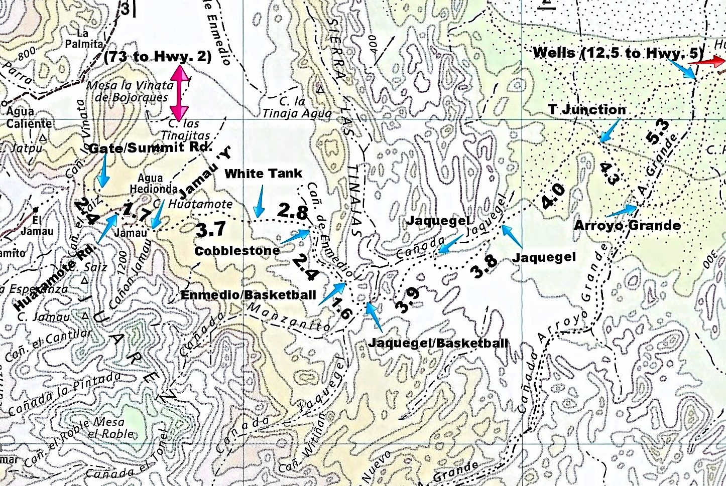
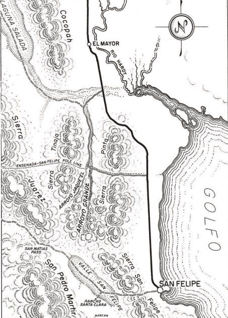
Here is the region of 1942 The Pole Line Road:
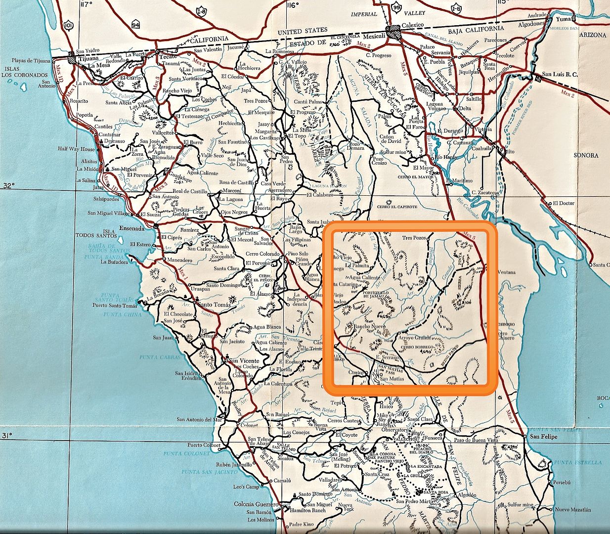
First named on this 1953 map:
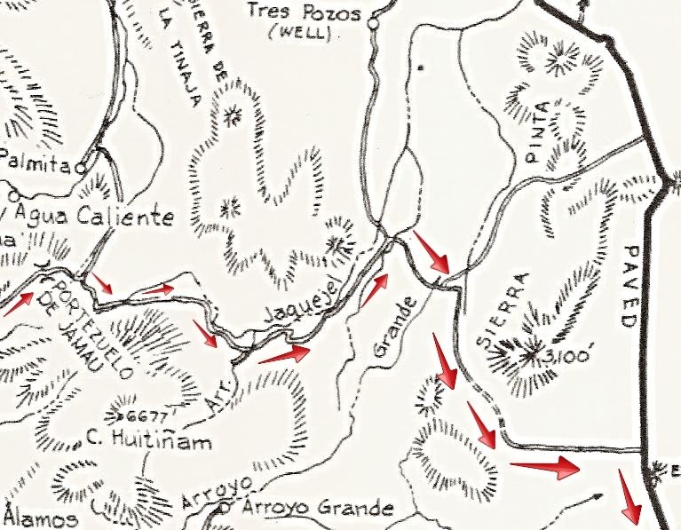
Here is the road as it was mapped for the 1962 Lower California Guidebook (arrows added):
[Edited on 8-8-2016 by David K]
|
|
|
Ken Cooke
Elite Nomad
     
Posts: 8970
Registered: 2-9-2004
Location: Riverside, CA
Member Is Offline
Mood: Pole Line Road postponed due to injury
|
|
Thats a beautiful map. Rich details with all of the information in one place.
|
|
|
ehall
Super Nomad
   
Posts: 1906
Registered: 3-29-2014
Location: Buckeye, Az
Member Is Offline
Mood: It's 5 o'clock somewhere
|
|
I should be able to make it.
|
|
|
TMW
Select Nomad
      
Posts: 10659
Registered: 9-1-2003
Location: Bakersfield, CA
Member Is Offline
|
|
From the beautiful city of sunshine I'm in. Glad it won't be a rush deal.
|
|
|
David K
Honored Nomad
        
Posts: 65411
Registered: 8-30-2002
Location: San Diego County
Member Is Offline
Mood: Have Baja Fever
|
|
Thanks!
The mileages are what I recorded last year and are between the arrow pointers. Each arrow also has a name we associate with that point.
The first mileage, between Gate/Summit Road (the locked steel gate) and Huatamote Road (2.4 miles) is using the detour we all took and passes where we
camped the first night in Arroyo El Saiz.
The gate is 73 miles from Hwy. 2, via Laguna Salada and Cohabuzo Jcn.
The distance from the wells to Hwy. 5 (12.5 miles) is to the highway just south of La Ventana.
|
|
|
rich t
Nomad
 
Posts: 102
Registered: 4-18-2016
Member Is Offline
|
|
We will be coming from San Felipe, will get with Paul W and head over with him, may have another Jeep coming(the one in the Mission Santa Marie
trip report).
Rich and Cathy
|
|
|
ChuckMRN
Newbie
Posts: 10
Registered: 3-15-2015
Member Is Offline
|
|
Got the axles under it, now standing on her own. So much more to do, fingers crossed for Feb!

|
|
|
ehall
Super Nomad
   
Posts: 1906
Registered: 3-29-2014
Location: Buckeye, Az
Member Is Offline
Mood: It's 5 o'clock somewhere
|
|
Nice chuck. It looks like you are stretching it too?
|
|
|
Ken Cooke
Elite Nomad
     
Posts: 8970
Registered: 2-9-2004
Location: Riverside, CA
Member Is Offline
Mood: Pole Line Road postponed due to injury
|
|
Upgrades and buildups
Here is mine while getting an exhaust resonator installed on Friday afternoon.
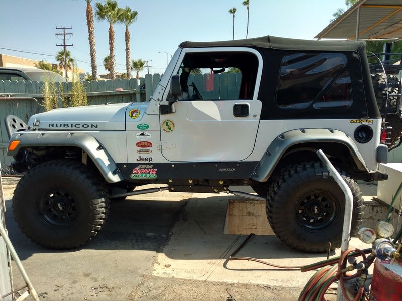
Out in the field on Sunday.
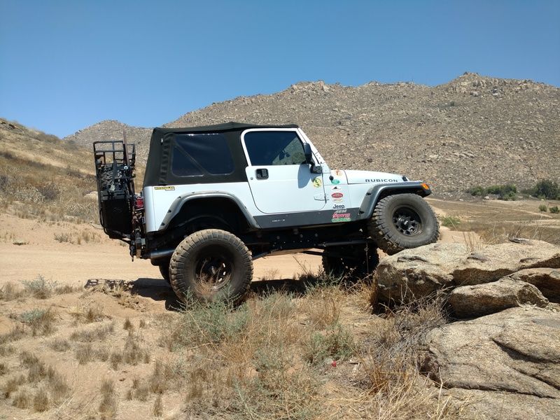
|
|
|
David K
Honored Nomad
        
Posts: 65411
Registered: 8-30-2002
Location: San Diego County
Member Is Offline
Mood: Have Baja Fever
|
|
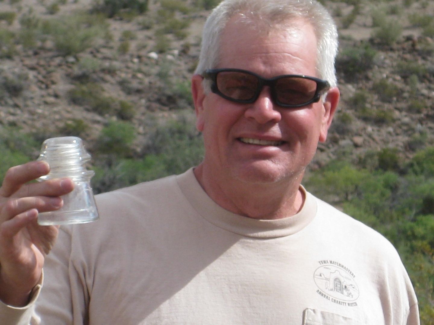
Chuck, do you have a full build thread on a Jeep forum or anywhere we can see your project? Congratulations!! You can use the 1942 pole insulator for
the flux capacitor!!


|
|
|
PaulW
Ultra Nomad
    
Posts: 3113
Registered: 5-21-2013
Member Is Offline
|
|
The 1962 map above showing the PL going across Pinta pass is the most accurate so far. It would be interesting to go look and see if I can find any
remnants of broken poles. I am sure remnants can be found.
|
|
|
mtgoat666
Platinum Nomad
       
Posts: 20396
Registered: 9-16-2006
Location: San Diego
Member Is Offline
Mood: Hot n spicy
|
|
Did you get the cricket chirp, roar, growl, or Chug-a-lug resonator?
|
|
|
David K
Honored Nomad
        
Posts: 65411
Registered: 8-30-2002
Location: San Diego County
Member Is Offline
Mood: Have Baja Fever
|
|
Quote: Originally posted by PaulW  | | The 1962 map above showing the PL going across Pinta pass is the most accurate so far. It would be interesting to go look and see if I can find any
remnants of broken poles. I am sure remnants can be found. |
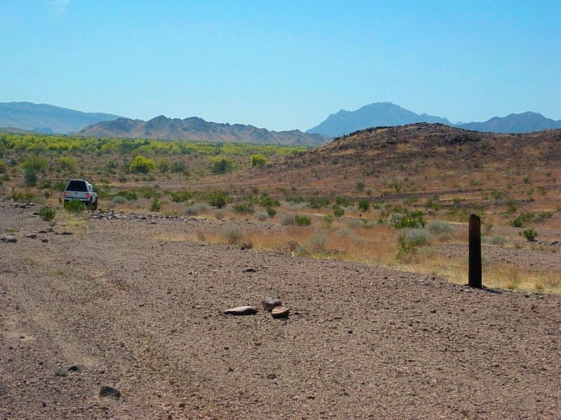
That section has been used for off road racing a lot, people may have built campfires against any old poles? Keep an eye out for insulators still.
It was interesting how many were cut down to around 4 feet high, while many others remain untouched...
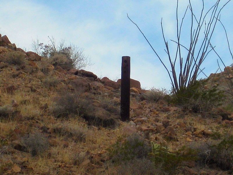
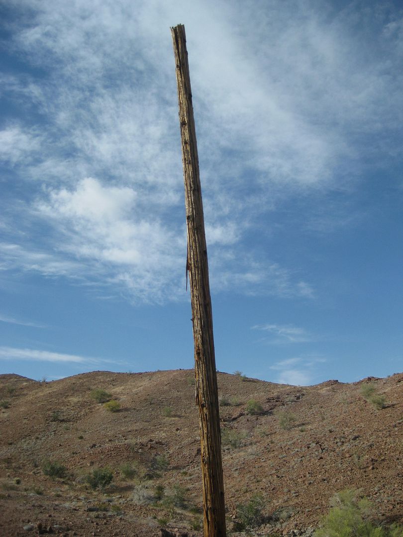
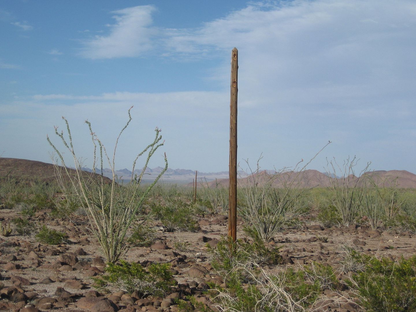
Last pole (cut) we saw before leaving the old road at Arroyo Grande:
|
|
|
PaulW
Ultra Nomad
    
Posts: 3113
Registered: 5-21-2013
Member Is Offline
|
|
Which Pinta pass ? Both are used for racing.
|
|
|
PaulW
Ultra Nomad
    
Posts: 3113
Registered: 5-21-2013
Member Is Offline
|
|
Mileage help requested
Coming from San Felipe and stopping for gas at the PMEX just west of Hwy5. How many miles to add to Davids 73mi on the map above? Hard for me to do
because I have never driven from Hwy 2 to to get to our track. The PMEX is at 32 32.028, 115 25.721
I can do it from GE if I knew the coords where the 73 mile point crosses Hwy2.
David did you record the coords for that point?
|
|
|
David K
Honored Nomad
        
Posts: 65411
Registered: 8-30-2002
Location: San Diego County
Member Is Offline
Mood: Have Baja Fever
|
|
Paul, the 73 miles is from Hwy. 2 at the Laguna Salada entrance road to the locked gate.
It is 22 miles from Hwy. 5 to the Laguna Salada road, using the toll road that stays south of Mexicali.
The Laguna Salada road at Hwy. 2 is: 32°34.560', -115°44.680'
EDIT: going west on Hwy. 2, you pass by the Laguna Salada road to make a (legal) U-turn to get back to it on the eastbound side.
[Edited on 8-9-2016 by David K]
|
|
|
rich t
Nomad
 
Posts: 102
Registered: 4-18-2016
Member Is Offline
|
|
Do you take the Guadalupe Canyon turnoff from HWY 2?
|
|
|
David K
Honored Nomad
        
Posts: 65411
Registered: 8-30-2002
Location: San Diego County
Member Is Offline
Mood: Have Baja Fever
|
|
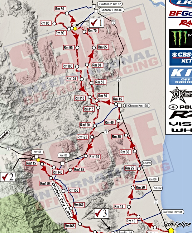
Well, that is for you to determine... since the 1962 map was drawn, there are more roads, yes. Between Arroyo Grande and El Chinero are at least two
now. Happy hunting!

The 2015 San Felipe seems to have used both?:
|
|
|
| Pages:
1
2
3
..
8 |

