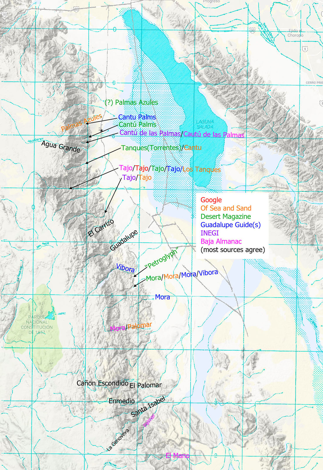
Writing up my last trip into the Laguna Salada area, I wanted to properly name the canyons I visited. As with PaulW's in his recent posting about the canyons east side of San Pedro Martir, I thought I might now try to list all the canyons in the east side
of Sierra de Juarez and their names. Yes, I'm a bit of a nerd like that 
It turned out to be surprisingly difficult! Many of the sources conflict. I looked at Google Maps, Bruce Barber's Of Sea and Sand book, various old
articles in Desert Magazine, Rob Williams' Guadalupe Canyon Guidebook, INEGI, and the Baja Almanac. (Desert Magazine doesn't really count, as they
have hand-drawn maps.) These sources usually have the canyons listed named in the same north/south order, but their maps point out different canyons.
Here's what I've found so far:
Cantú Palms - I presume what I have labeled in green is correct, as that's where I went. The others are close, except of Sea and
Sand.
Cañon el Tajo - The majority of sources agree, but not INEGI. Shouldn't INEGI be the ultimate authority?
Vibora Canyon - This name only appears in the maps of the Guadalupe Guidebook, but its two maps disagree! Desert magazine calls it
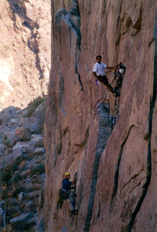
"Petroglyph Canyon". I visited this and did find petroglyphs.
Cañon la Mora - Most sources show this as one of the canyons I hiked on my last trip, but Baja Almanac shows a different location.
And again the Guadalupe Guidebook maps show two different places.
El Palomar - I'm pretty sure Of Sea and Sand gets this wrong.
Does anyone have the definitive answers here? DavidK?
-- Geoff
[Edited on 3-31-2018 by geoffff] |