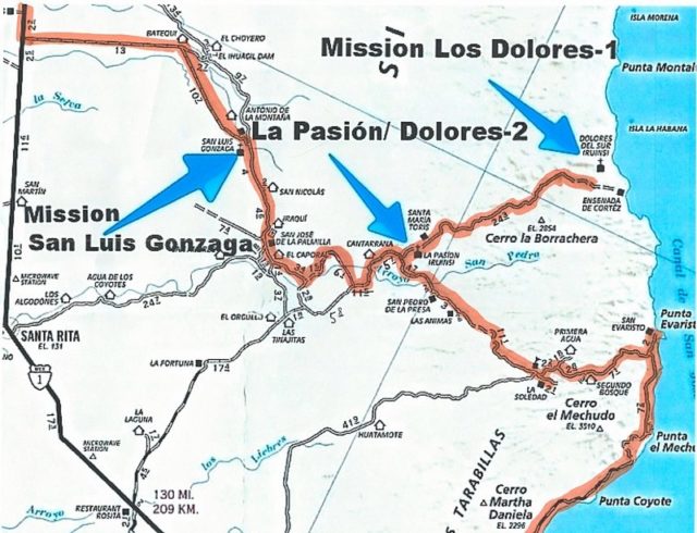
I wish I had it in 2017, traveling south from Mission San Luis Gonzaga! While I did get to the La Pasión/ Dolores-2 mission that day, I didn't use
the road I had intended to. I followed the most worn or recent tracks, which is usually a good choice. Perhaps the road I took was better than the
maybe shorter route across the big arroyo of La Pasión (San Pedro on this map)?
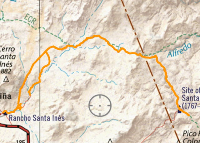
I took the left fork at El Caporal, and the next fork after, rather than the right... and on this AAA map, showing my driving the two days before
arriving at your home, I drew in the the road that made that big northward loop. Arroyos point to the mission sites.
|