4x4abc
Ultra Nomad

Posts: 4456
Registered: 4-24-2009
Location: La Paz, BCS
Member Is Offline
Mood: happy - always
|
|
the "monument" at Playa Santa Ines
the "monument" at Punta Chivato
asked this question in some other groups as well
what is the "monument" near Playa Santa Ines that is mentioned on some maps?
and if it exists - where is it?

[Edited on 3-17-2025 by 4x4abc]
Harald Pietschmann
|
|
|
4x4abc
Ultra Nomad
Posts: 4456
Registered: 4-24-2009
Location: La Paz, BCS
Member Is Offline
Mood: happy - always
|
|
there is something important going on in this corner of the world
even this 1871 map shows a E. N. Base and E. S. Base
E. S. Base could be the monument location
can't see anything on Google Earth

Harald Pietschmann
|
|
|
4x4abc
Ultra Nomad
Posts: 4456
Registered: 4-24-2009
Location: La Paz, BCS
Member Is Offline
Mood: happy - always
|
|
sounds reasonable
too bad the plans are not very accurate
accurate like the initial concession map

Harald Pietschmann
|
|
|
AKgringo
Elite Nomad
Posts: 6364
Registered: 9-20-2014
Location: Anchorage, AK (no mas!)
Member Is Offline
Mood: Retireded
|
|
Monuments sometimes move!
My grandfather bought a section of land from the railroad back before I was born. It was part of the land grant given to the railroad for
establishing a trans-continental railroad back in the 1860s.
I don't know when the physical "monument" was set, but when the BLM re-surveyed their holdings in the 1980s it was discovered to be off by about a
hundred yards on the northwest corner!
[Edited on 3-17-2025 by AKgringo]
If you are not living on the edge, you are taking up too much space!
"Could do better if he tried!" Report card comments from most of my grade school teachers. Sadly, still true!
|
|
|
AKgringo
Elite Nomad
Posts: 6364
Registered: 9-20-2014
Location: Anchorage, AK (no mas!)
Member Is Offline
Mood: Retireded
|
|
Those who consider their smart phone a "modern survey equipment" are introducing new errors.
A satellite directly overhead on flat ground can be incredibly accurate, but if the view is from a latitude further south, a straight line from point
A to point B can be affected by the contour of the parcel.
My neighbors to the north walked our property line with their smart phones, setting stakes along the way. The result does not appear to be a straight
line to me, although I am going to have to clear trees or re-survey to prove where the line is.
If you are not living on the edge, you are taking up too much space!
"Could do better if he tried!" Report card comments from most of my grade school teachers. Sadly, still true!
|
|
|
4x4abc
Ultra Nomad
Posts: 4456
Registered: 4-24-2009
Location: La Paz, BCS
Member Is Offline
Mood: happy - always
|
|
I researched this a bit further. A base or baseline is common in surveying. A number of Mojons (survey points) were established in 1871 along the 27th
Parallel. Someone had mentioned Cerro Mojonera in connection with this "monument" thread. Indeed, Cerro Mojonera played a role. It has one of the
survey markers. On the old map it is called Cerro San Juan. On this map the 27th Parallel is called Mojonera del 27°. In surveying cornerstones or
Mojons are also called monument. So there has to be a more or less clearly Mojon close to the Santa Ines beach at 27° Parallel
I sent the map to David so he can make it available
no sense to post it here with the bad resolution
Harald Pietschmann
|
|
|
David K
Honored Nomad
Posts: 65581
Registered: 8-30-2002
Location: San Diego County
Member Is Offline
Mood: Have Baja Fever
|
|
Quote: Originally posted by 4x4abc  | I researched this a bit further. A base or baseline is common in surveying. A number of Mojons (survey points) were established in 1871 along the 27th
Parallel. Someone had mentioned Cerro Mojonera in connection with this "monument" thread. Indeed, Cerro Mojonera played a role. It has one of the
survey markers. On the old map it is called Cerro San Juan. On this map the 27th Parallel is called Mojonera del 27°. In surveying cornerstones or
Mojons are also called monument. So there has to be a more or less clearly Mojon close to the Santa Ines beach at 27° Parallel
I sent the map to David so he can make it available
no sense to post it here with the bad resolution |
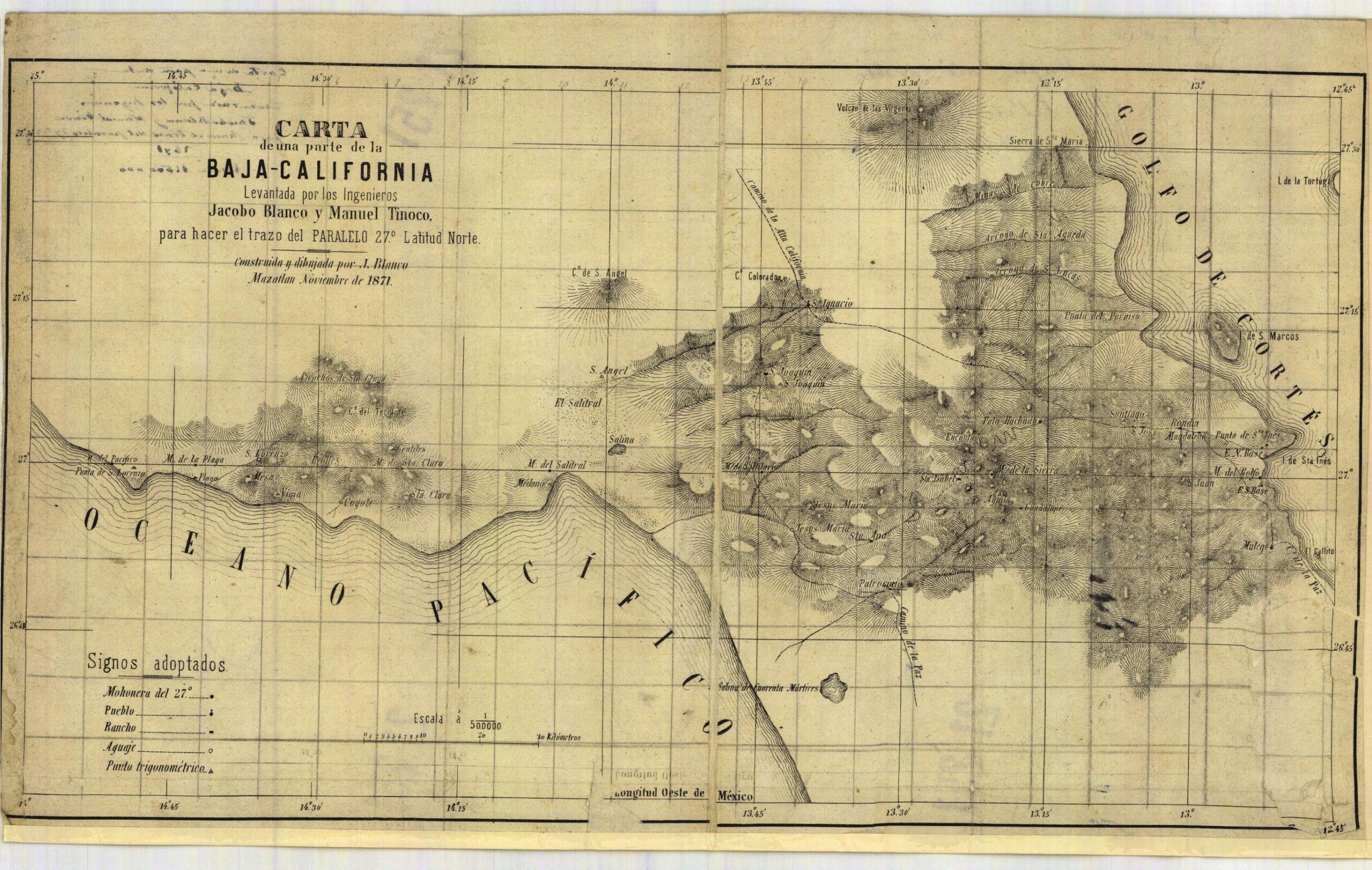
Here is the map 'cleaned up':
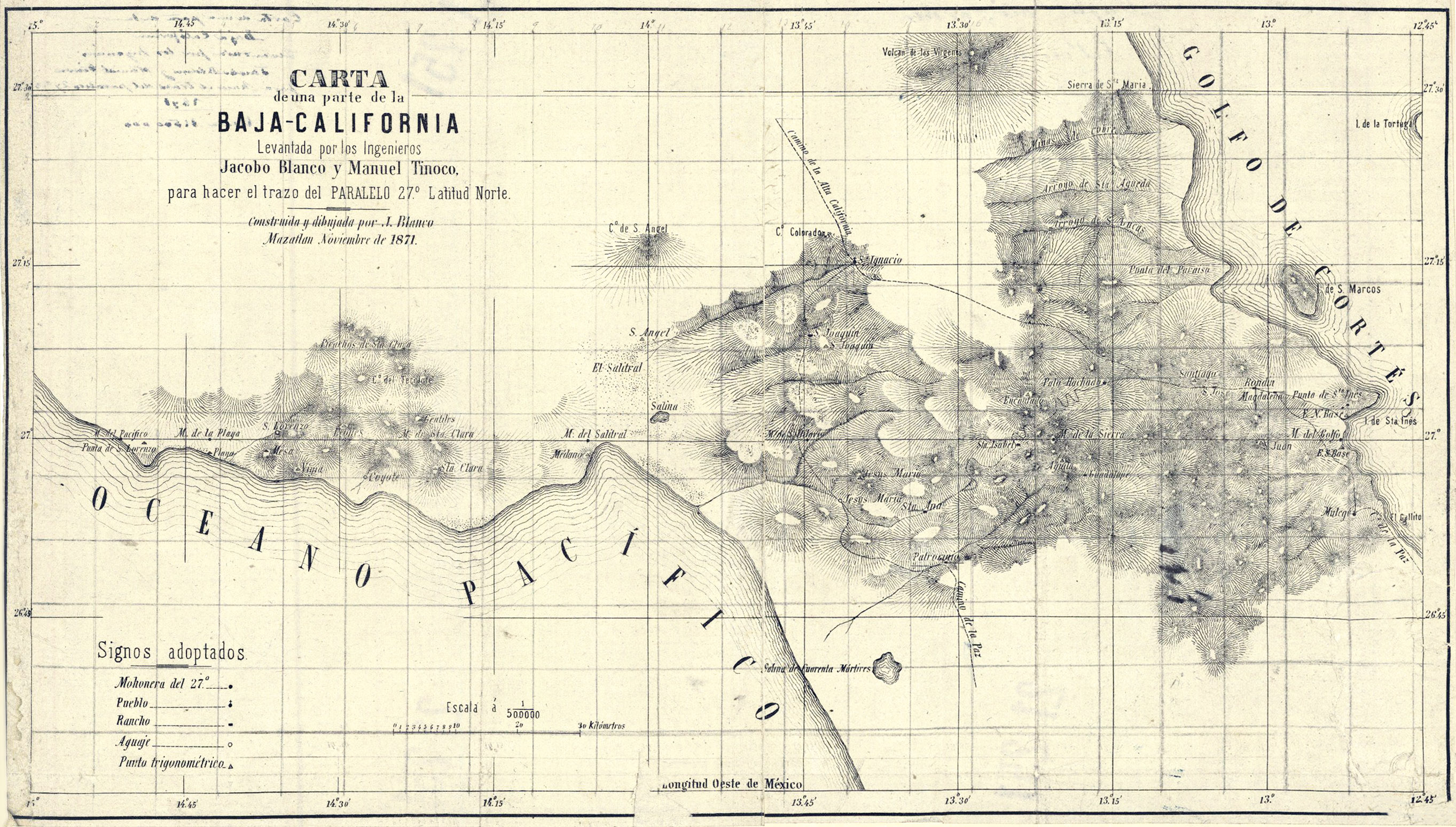
[Edited on 3-19-2025 by David K]
|
|
|
4x4abc
Ultra Nomad
Posts: 4456
Registered: 4-24-2009
Location: La Paz, BCS
Member Is Offline
Mood: happy - always
|
|
| Quote: Originally posted by lencho |
It amazes me that old surveys were even as accurate as they were, considering the techniques they had available!
|
surveyors were always the smart guys
remember the pyramids in Egypt?
those guys were more accurate than early GPS units
consider this:
St Peter at the Vatican was built in 1506
architects of important buildings almost always align them to something similarly important
look at the shape of St Peter's Square and the adjacent buildings
as seen with god's eyes (thanks to Google Earth we can do the same now), the public space in front of St Peter's forms an "arrow"
it points to the Hagia Sophia in Istanbul - 859 miles away
accuracy is within a few inches
why the Hagia Sophia?
because it was an early Christian church built in 325
Constantinople (today Istanbul) or New Rome did become the second See of Christendom after Old Rome, and was ranked above the older Patriarchates of
Jerusalem, Antioch and Alexandria
how do we know that this "arrow" at St Peter points to the Hagia Sophia?
because the architects (Michelangelo among them) wrote it down
so don't make the mistake and think the guys a long time ago were dull
granted, like today, most are dull - but a significant number has always been brilliant
with that said - surveying in the late 1800's was a highly accurate affair
now let's go find that marker at Playa Santa Ines!

Harald Pietschmann
|
|
|
David K
Honored Nomad
Posts: 65581
Registered: 8-30-2002
Location: San Diego County
Member Is Offline
Mood: Have Baja Fever
|
|
Good morning Harald,
Thanks for the map. I was on my phone last night and saved it to my www.VivaBaja.com/maps page (1871 map). We were watching a movie, so I was not able to do much more than that and post it above, at the 800 pixel
max for Nomad photos.
Now (Tuesday AM), I can post the link, at full size if anyone wants to look at it in detail:
https://vivabaja.com/wp-content/uploads/2025/03/1871-santa-r...
I will update the link if my map expert is able to make it look better!
Stay tuned.
UPDATE:
https://octopup.org/img/media/maps/baja/1871--Baja-Californi...
[Edited on 3-19-2025 by David K]
|
|
|
David K
Honored Nomad
Posts: 65581
Registered: 8-30-2002
Location: San Diego County
Member Is Offline
Mood: Have Baja Fever
|
|
By-the-way, the very top map, posted by 4x4abc, is the 1888 2-piece Charles Nordhoff map:
1888 Nordhoff Map
It comes from his book (the oldest book in my collection):
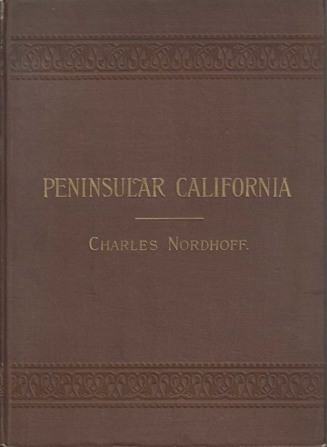
[Edited on 3-18-2025 by David K]
|
|
|
David K
Honored Nomad
Posts: 65581
Registered: 8-30-2002
Location: San Diego County
Member Is Offline
Mood: Have Baja Fever
|
|
Edited above was the addition of this enhanced or 'cleaned-up' version of the map:
Full size https://octopup.org/img/media/maps/baja/1871--Baja-Californi...
Sized to fit on Nomad
|
|
|
AKgringo
Elite Nomad
Posts: 6364
Registered: 9-20-2014
Location: Anchorage, AK (no mas!)
Member Is Offline
Mood: Retireded
|
|
| Quote: Originally posted by 4x4abc |
surveyors were always the smart guys
remember the pyramids in Egypt?
those guys were more accurate than early GPS units
consider this:
St Peter at the Vatican was built in 1506
architects of important buildings almost always align them to something similarly important
look at the shape of St Peter's Square and the adjacent buildings
as seen with god's eyes (thanks to Google Earth we can do the same now), the public space in front of St Peter's forms an "arrow"
it points to the Hagia Sophia in Istanbul - 859 miles away
accuracy is within a few inches
why the Hagia Sophia?
because it was an early Christian church built in 325
Constantinople (today Istanbul) or New Rome did become the second See of Christendom after Old Rome, and was ranked above the older Patriarchates of
Jerusalem, Antioch and Alexandria |
Sounds like an episode of "Ancient Aliens"
If you are not living on the edge, you are taking up too much space!
"Could do better if he tried!" Report card comments from most of my grade school teachers. Sadly, still true!
|
|
|


