TMW
Select Nomad

Posts: 10659
Registered: 9-1-2003
Location: Bakersfield, CA
Member Is Offline
|
|
TW New Years Trip 2013
Saturday morning December 29, 2012 I picked up my friend Bill in LA and we headed for the border crossing in TJ. Traffic was medium light and moving
good. I love the new border crossing; its so much easier to get to the toll road. This trip was to check out a couple of dirt roads for use later
this year in a trip to La Paz and back and drop off supplies to a couple of friends.
We stopped for gas and a snack in Ensenada then continued south to San Quintin. We arrived just after dark and checked into the Villa de San Quintin
hotel. We made our way over to the Cielito Lindo restaurant for a great Veracruz style fish dinner. Up early for a buffet breakfast in the hotel
restaurant then hit the trail.
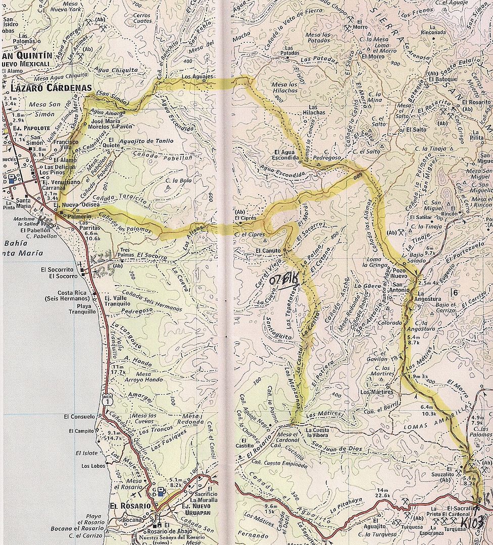
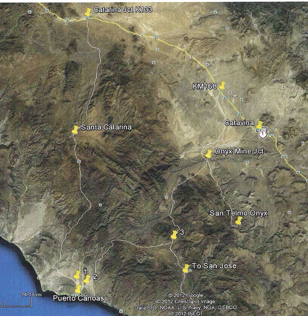
The Map
Google Earth
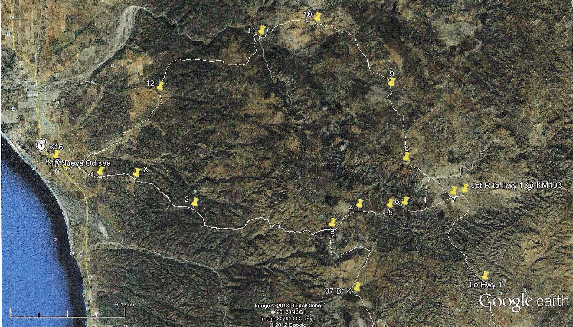
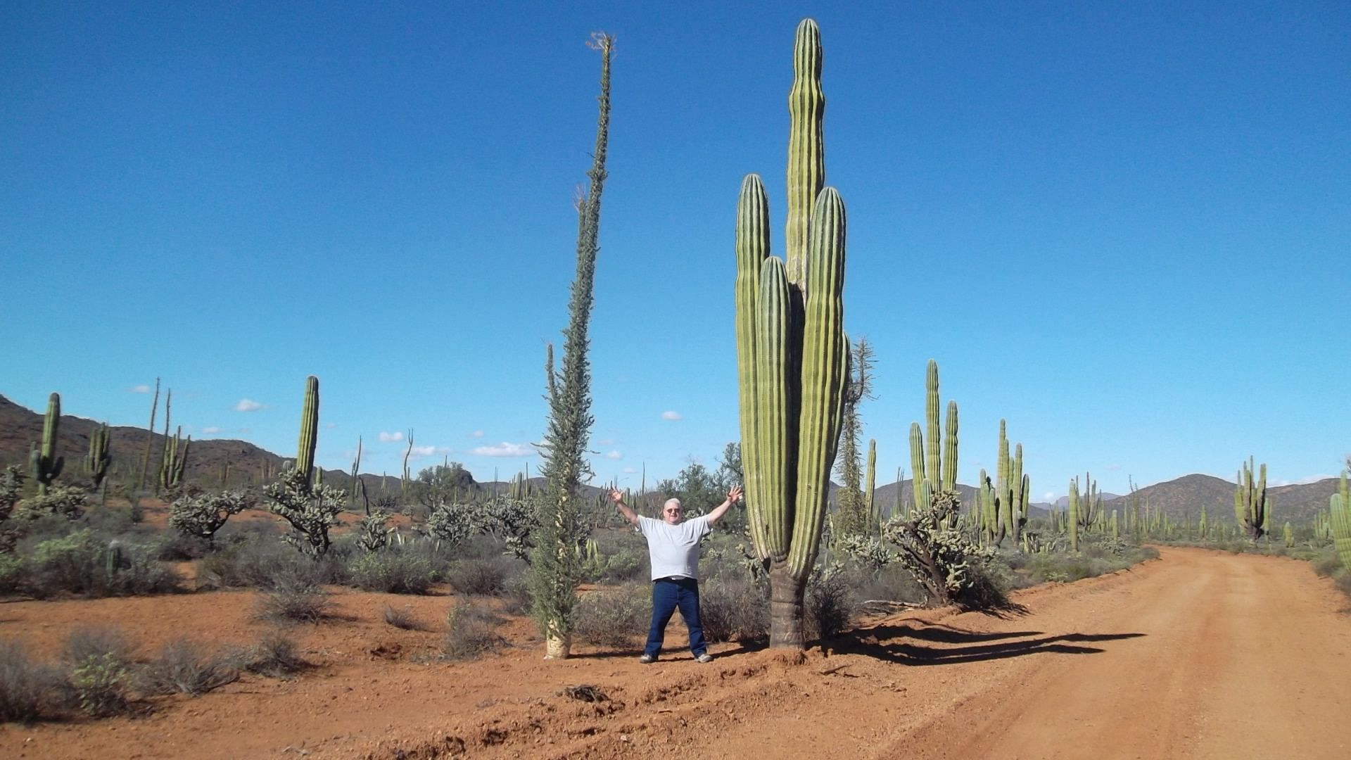
We left hwy 1 at KM16 going east following an old Baja 1000 trail last used in 1989. I had marked the route on Google Earth with way points to follow.
It was a little confusing at first with several roads going everywhere but once on the route it was easy to follow. The X spot @ 30-22-963x115-46.986
shown on the Google Earth map puts you on the correct road. Once on the right road there are side roads but none had any traffic lately on them. Our
route had two sets of motorcycle tracks and two sets of truck/SUV tracks.
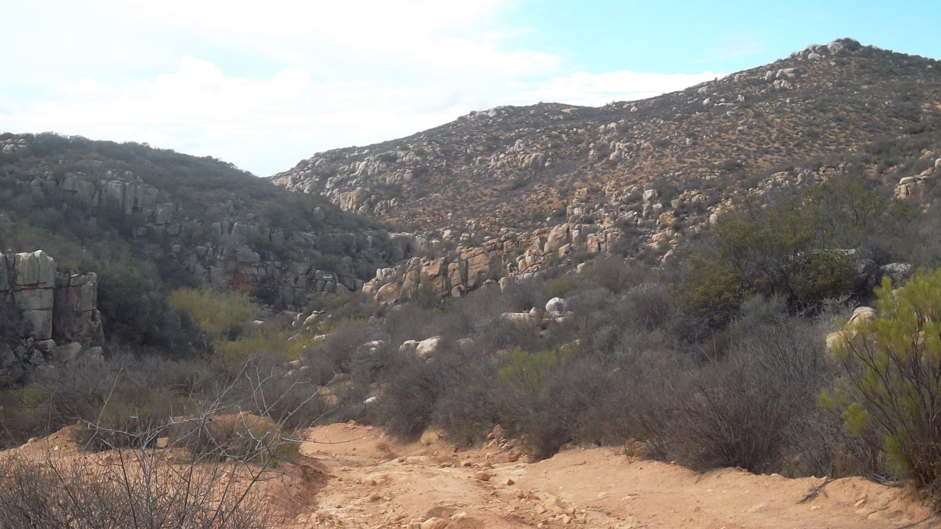
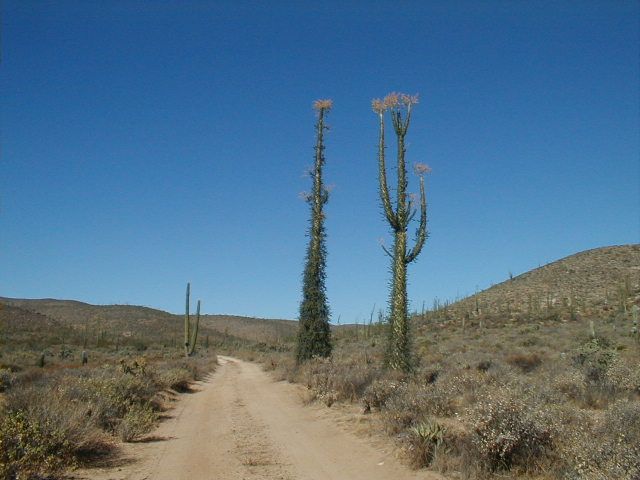
The road is typical of the dirt roads after a heavy rain. Gullies and rocks are washed down it. Nothing was too bad except a downhill at 18.5 miles
in. The center was washed out pretty deep. Of course the MCs just went to the sides and the Truck/SUVs were wide enough to straddle it. My Tacoma was
too narrow. We could have dumped rocks in it etc but that would take some time. To the left was an off camber wide enough for me to try and go around.
I did and all was fine.
We soon came upon the jct. which was part of the 2007 Baja 1000. It followed the east part of the road we were on and turned south at the jct. Next we
dropped into a wash for a mile. At 21.5 miles we turned left, going north. Another .5 miles east is the jct. for a well used road south to hwy 1 at
KM103.
We soon crossed Agua Escondida, a wide arroyo. About 4 miles from the jct. are ranch buildings to the left. At 7.6 miles is a ranch on the left and a
well used road to the right. We went straight. At 13.5 miles is another ranch on the left. Again we traveled the most used road. At 18 miles we
crossed another wide wash. It may be the Santa Maria arroyo as seen on the maps.
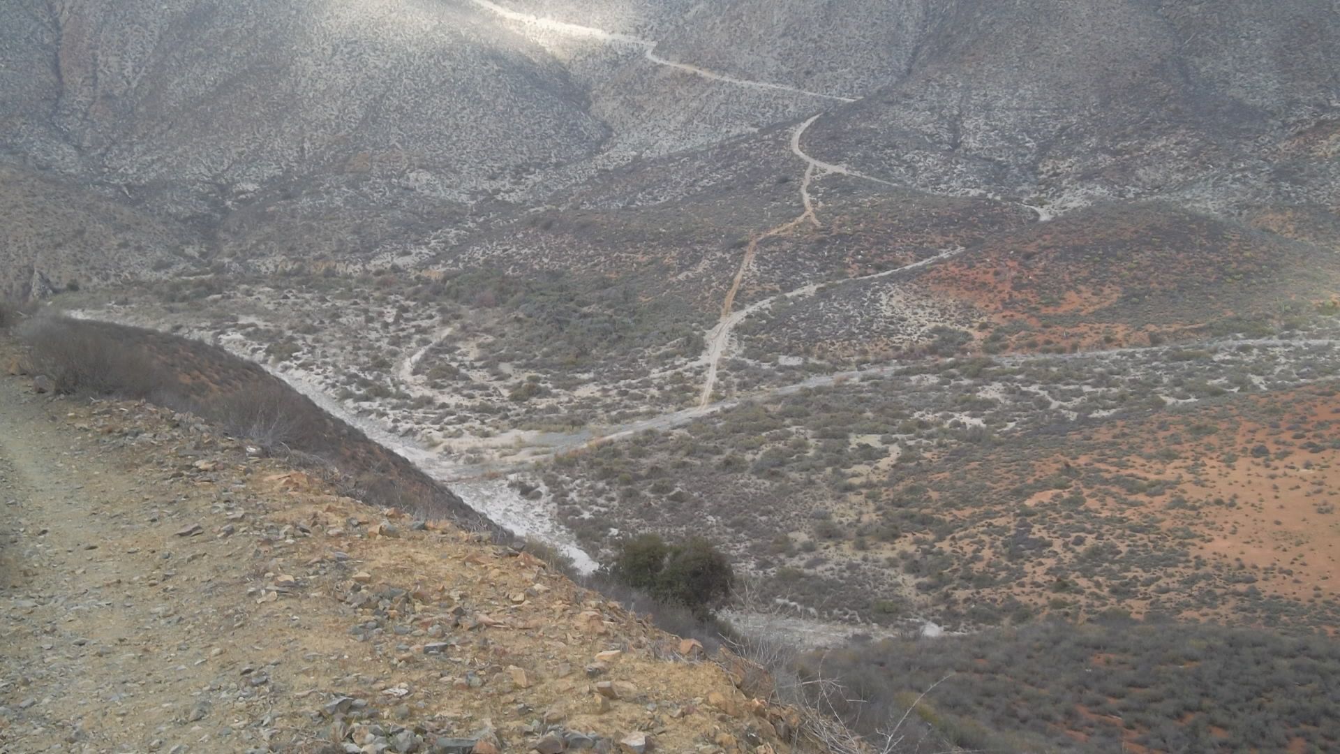
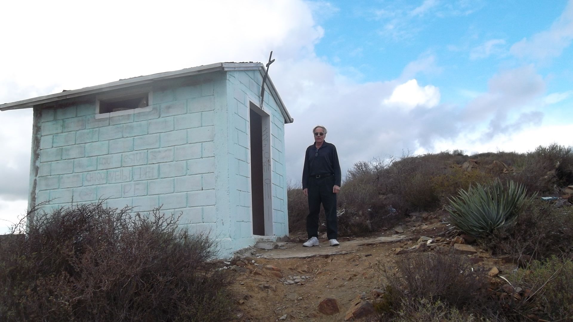
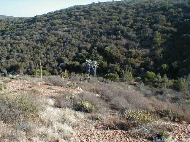
Just after the wash we turned left up a long steep switchback hill. At the top is a building shrine.
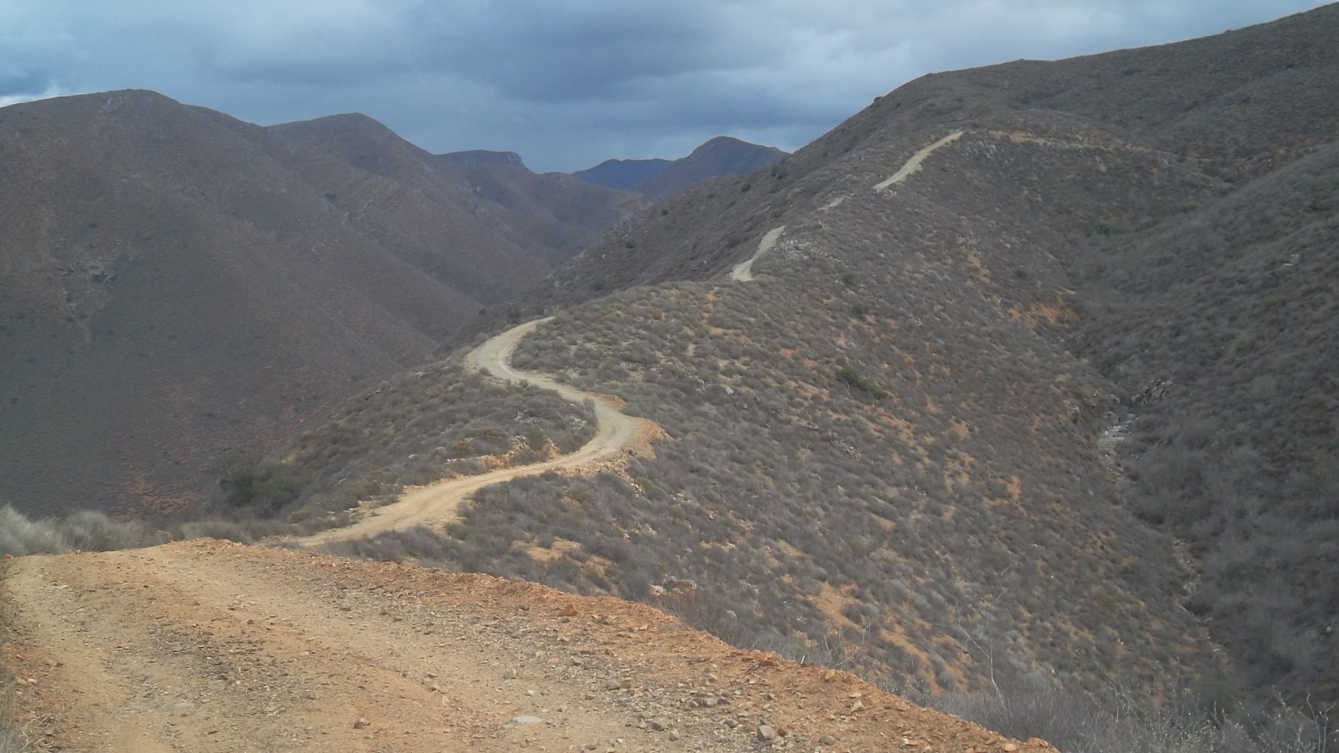
Road after the shrine.
At 25 miles is the corner of a crop field. For the next 7 miles it gets very confusing with multiple roads and some dead ends. Somewhere we crossed
over the road we started on and came out to hwy 1 at KM17. The total loop is about 50 miles if you dont get confused on the start and especially the
end.
It was near dark when we got to the hwy so we went back to the Villa de San Quintin hotel. We had dinner at the Old Mill restaurant. Another excellent
fish dinner. After dinner we stopped by Don Eddies place. His son Tony runs it. They are rebuilding after the fire. The restaurant and bar are open as
are several rooms for the hotel. Tony said he contracts out the bar and restaurant. He lives and works in Chula Vista.
Monday morning we traveled south on hwy 1 to the Catarina turnoff at KM133. The road is well graded.
Several miles from the ocean you get into the mud flats and when SCORE runs a race thru there they turn into silt beds. We bear to the left before the
ocean and at 45 miles there is a jct. to the right the road goes to the ocean and follows the coast line down. I have not been on that road other than
to where it meets the ocean so I cant say how good it is. We bear to the left at the jct.
Its a good road and after about 17 miles from the jct. (62 miles total) it meets the road from the ocean at San Jose. We turned left toward hwy 1.
Rancho Bonito is 8 miles up the road on the left (70 miles total). Another 6 miles (76 total) is the road to the San Telmo onyx mine on the right. The
hwy is 25 miles from the jct. The complete loop from hwy 1 at KM133 around the hwy 1 at KM168 is about 87 miles.
On hwy 1 we make hast for LA Bay. At La Bay we stayed at the Villa Del Sol. For dinner they had a ham special which was very good. There were 3 off
road motorcycle riders there plus the chase truck driver and we sat outside and chatted for a couple of hours then they went to a party and I went to
bed. Must be an age thing. Tuesday morning after breakfast Bill and I continue down the recent Baja 1000 course to Bahia San Rafael to see Pancho.
Bill and Pancho
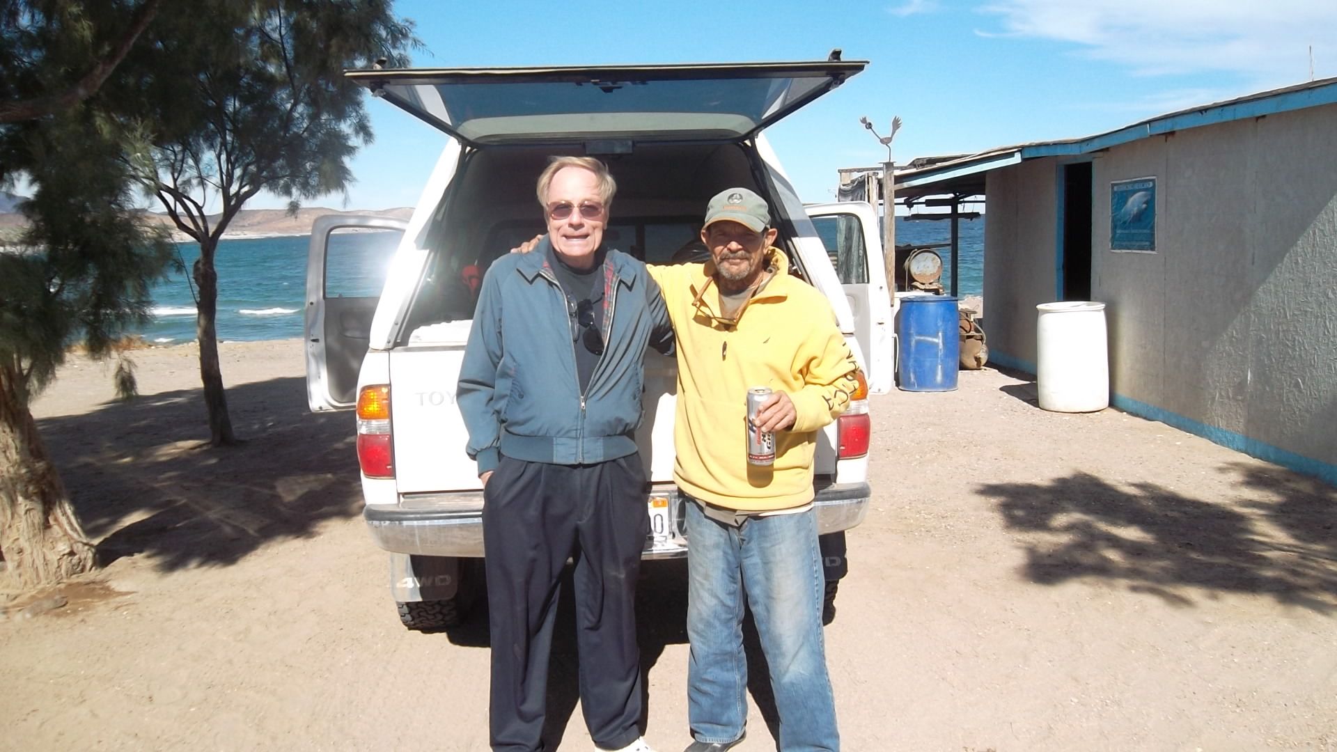
As we pulled into Panchos place he greeted us with a big smile and handshake. I had some supplies for him and he gave me some sea shells, a couple
were very delicate. He showed us his satellite system and solar panels. I cant remember his little dogs name but she is a sweet thing. Later we
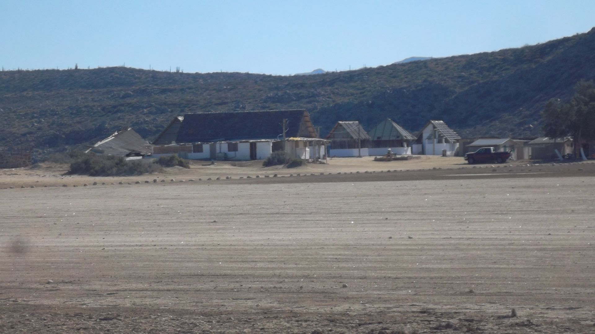
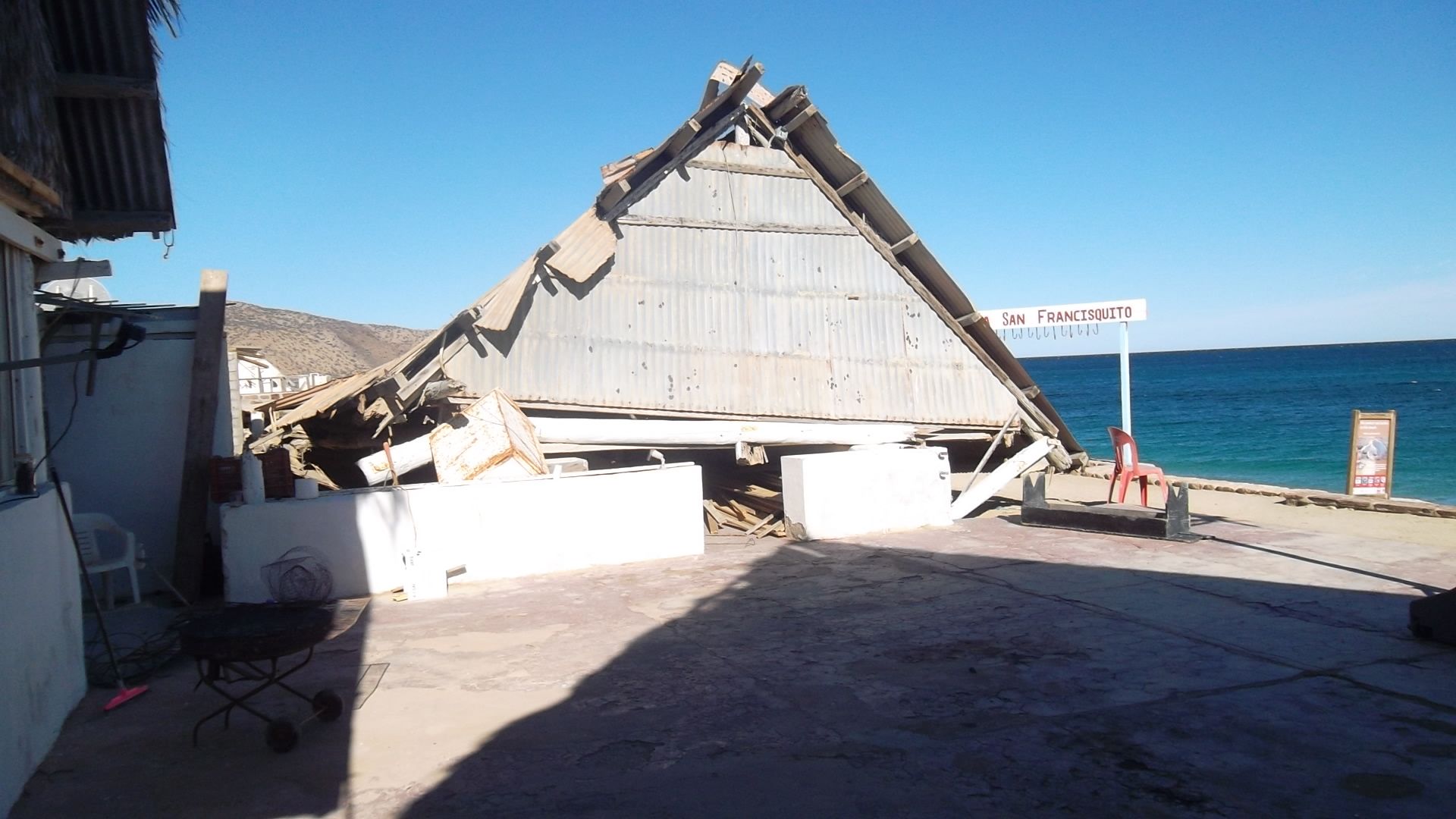
pushed on for San Francisquito. San Francisquito is not in the shape it was on my last visit. The showers are out, at least the hot water side is.
There were only three rooms for use. The building behind the restaurant had collapsed. They appear to be fixing things up as there were people
working. I guess it just takes time.
We went out thru El Arco to hwy 1 and north to the Chapala turn off for Cocos. We got to Cocos about 7pm. We gave him some supplies and chatted for
a while. We moved on to Gonzaga Bay. Alfonsinas restaurant was closed so we move on for San Felipe. To our surprise the paved hwy started 3.6 miles
from the Pemex station. We made good time but arrived in San Felipe at 10pm so we stopped at an Oxxo store and picked up some things to eat. We slept
in Wednesday morning and after breakfast we didnt get on the road until 10am. Went thru Mexicali with a 1.5 hour border wait. Back to LA by 6pm.
It was a quick trip, fun and interesting.
[Edited on 1-10-2013 by TW]
|
|
|
David K
Honored Nomad
Posts: 65575
Registered: 8-30-2002
Location: San Diego County
Member Is Offline
Mood: Have Baja Fever
|
|
Great report Tom!
|
|
|
Bajaboy
Ultra Nomad
Posts: 4375
Registered: 10-9-2003
Location: Bahia Asuncion, BCS, Mexico
Member Is Offline
|
|
Thanks for the report. I plan on doing some exploring in March with my kids in that area. Always enjoy reading about the dirt roads of Baja.
|
|
|
David K
Honored Nomad
Posts: 65575
Registered: 8-30-2002
Location: San Diego County
Member Is Offline
Mood: Have Baja Fever
|
|
Petroglyph Park is on that route too! East of El Cipres.
|
|
|
Ateo
Elite Nomad
Posts: 5964
Registered: 7-18-2011
Member Is Offline
|
|
Thanks for the report TW. We may have only been a few miles away from each other the last couple days............
|
|
|
motoged
Elite Nomad
Posts: 6481
Registered: 7-31-2006
Location: Kamloops, BC
Member Is Offline
Mood: Gettin' Better
|
|
TW,
There sure is some great riding east of San Quintin and El Rosario....


And my favourite....
"AFTER THE RAINS .... " :

Don't believe everything you think....
|
|
|
David K
Honored Nomad
Posts: 65575
Registered: 8-30-2002
Location: San Diego County
Member Is Offline
Mood: Have Baja Fever
|
|
Same area, 11/05
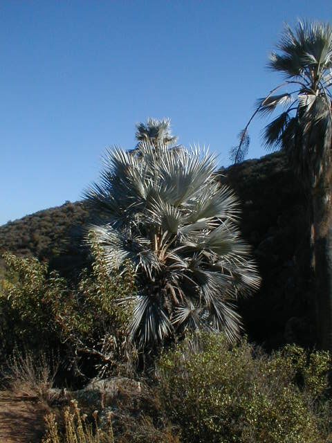
Cool that Ged found the blue palms in there, as well...
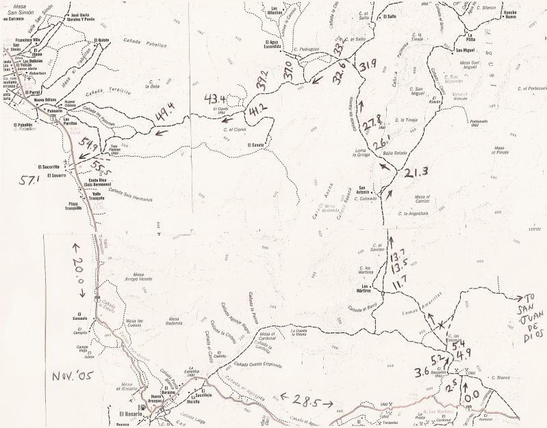
Trip Road Log (in miles) and 21 GPS waypoints (Map Datum NAD27)
0.0 Leave Hwy. 1 (28.5 mi. from El Rosario Pemex) at cafe just past Km. 103, head north. 30°03.81', 115°20.87'
2.5 Fork, go left
3.6 El Sauzalito ruins on left at 30°05.89', 115°21.76'
4.9 Cross San Juan de Dios river 30°06.83', 115°21.28'
5.2 Fork, go right (left goes back to El Rosario via La Vibora grade) 30°07.04', 115°21.33'
5.4 Fork, go left (right goes to San Juan de Dios) 30°07.22', 115°21.42'
11.7 Fork, go right (left goes to Rancho Los Martires)
13.5 Cross Arroyo Los Matires/ Arroyo Grande 30°12.37', 115°26.33'
13.7 Road in from left to Rancho Los Martires. Rancho San Antonio is passed about five miles ahead
21.3 Fork just north of Arroyo El Portezuelo crossing, go left (right goes to San Miguel and La Suerte) 30°18.42', 115°42.28'
26.1 Fork, go left (right goes to ranch). Only 4WD beyond here.
27.8 Bulldozed switchback grade to ridge top 30°22.26', 115°29.21'
31.9 Fork, go left (right for La Suerte) 30°24.79', 115°29.21'
32.6 Jcn. with old El Socorro to La Suerte road, turn left 30°25.18', 115°29.72'
33.2 Jcn. with road north to El Agua Escondida 30°24.97', 115°30.27'. A second road north is at 30°24.28', 115°31.51'
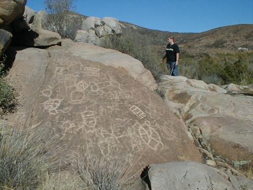
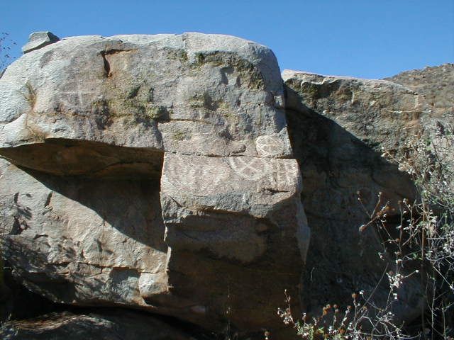
37.0 'Petroglyph Park' 30°24.19', 115°33.38'
39.2 Fork, go left (right goes 0.9 mi. to blue palms and beyond) 30°23.58', 115°35.01'
41.2 Jcn. road south to El Canuto 30°22.51', 115°36.24'
43.4 El Cipres (abandoned ranch) 30°22.10', 115°37.98'
49.4 Fork, go left (right to Nuevo Odisea) 30°21.56', 115°42.80'
54.8 Jcn., road in from left to Tres Palmas 30°19.96', 115°46.82'
54.9 Old road to north (to Nuevo Odisea) 30°19.94', 115°46.85'
55.5 Join road along south side of river valley, turn right 30°19.66', 115°47.25'
57.1 Hwy. 1 near El Socorro (Km. 24-25). El Rosario is 20.0 mi. south. 30°19.25', 115°48.77'
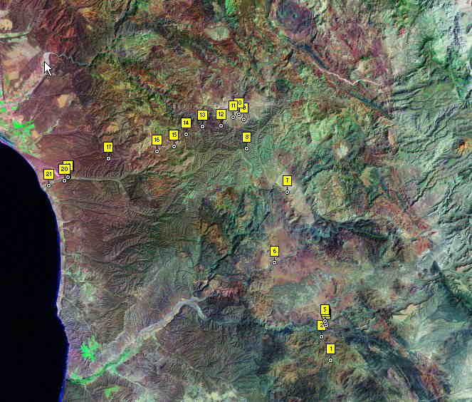
BajaLou made this map from my GPS waypoints:
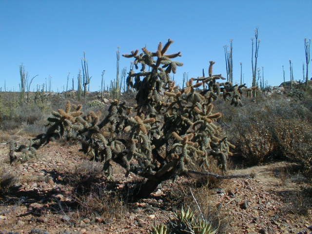
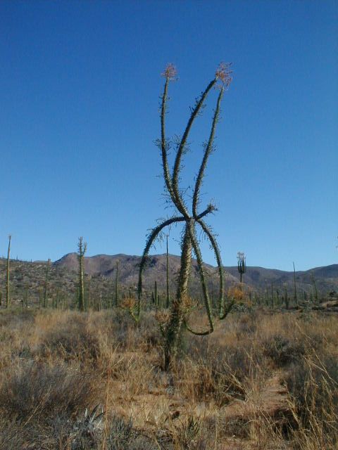
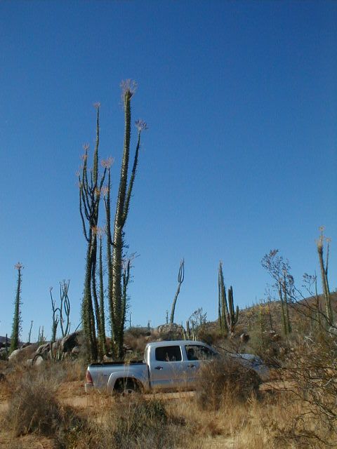
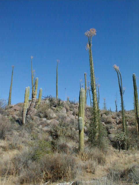
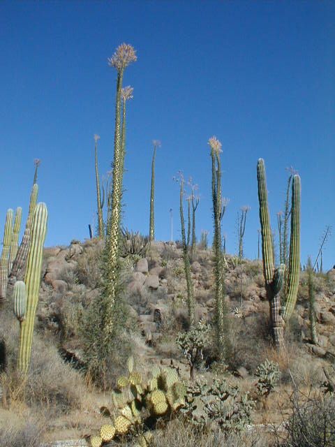
Lot's of boojums along this route, and some cardons too...
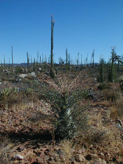
Rarely seen 'baby boojum'!

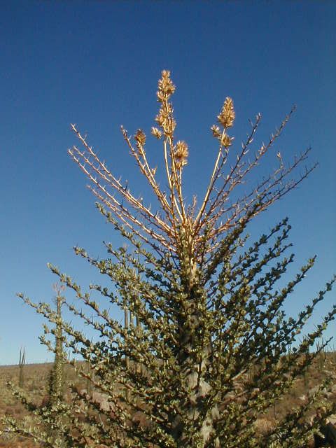


El Cipres
|
|
|
TMW
Select Nomad
Posts: 10659
Registered: 9-1-2003
Location: Bakersfield, CA
Member Is Offline
|
|
It's amazing what the rain can do to a road. The pix above is a great example. Thanks
|
|
|
BajaBlanca
Select Nomad
Posts: 13247
Registered: 10-28-2008
Location: La Bocana, BCS
Member Is Offline
|
|
wow ! wonderful following in your footsteps via photos !
|
|
|
BajaKurtis
Newbie
Posts: 22
Registered: 6-18-2012
Location: San Diego
Member Is Offline
|
|
TW.
How was the Road from HWY 1 to San Felipe, dirt section? Fast, as in 40-50 mph fast or slow going? Sounds like the paving has made it down pretty
far.
A few years back, we took it, in a F250, and it was really in bad shape, extra wash board. That was after we had done 100's of dirt miles, earlier in
the trip.
|
|
|
TMW
Select Nomad
Posts: 10659
Registered: 9-1-2003
Location: Bakersfield, CA
Member Is Offline
|
|
The road is mostly good that you can do 35-50 on with a few slow down sections. The best is as you get to Gonzaga Bay. The rain has caused a couple
of large holes on the side between hwy 1 and Cocos that you don't want to drop a wheel in.
|
|
|


