Justbozo
Nomad
 
Posts: 139
Registered: 11-20-2012
Location: Lake Michigan/Bahia Concepcion
Member Is Offline
Mood: Got my little stone hut on the bay
|
|
Route south thru Mexicali from the east crossing. Suggestions?
We will be crossing south at Mexicali east in a couple of days.
This is the first time crossing here and just looking for route suggestions to pick up Mex 5.
Simple is good when I'm trying to read Mex street signs in traffic!
Thanks in advance for any help.
|
|
|
PaulW
Ultra Nomad
    
Posts: 3113
Registered: 5-21-2013
Member Is Offline
|
|
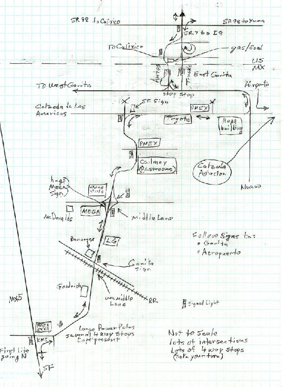
This map is good for going north from SF You should be able to use it going S.
PW

|
|
|
Justbozo
Nomad
 
Posts: 139
Registered: 11-20-2012
Location: Lake Michigan/Bahia Concepcion
Member Is Offline
Mood: Got my little stone hut on the bay
|
|
Thanks PaulW
That confirms what I had planned.
Looks easy enough.
|
|
|
TMW
Select Nomad
      
Posts: 10659
Registered: 9-1-2003
Location: Bakersfield, CA
Member Is Offline
|
|
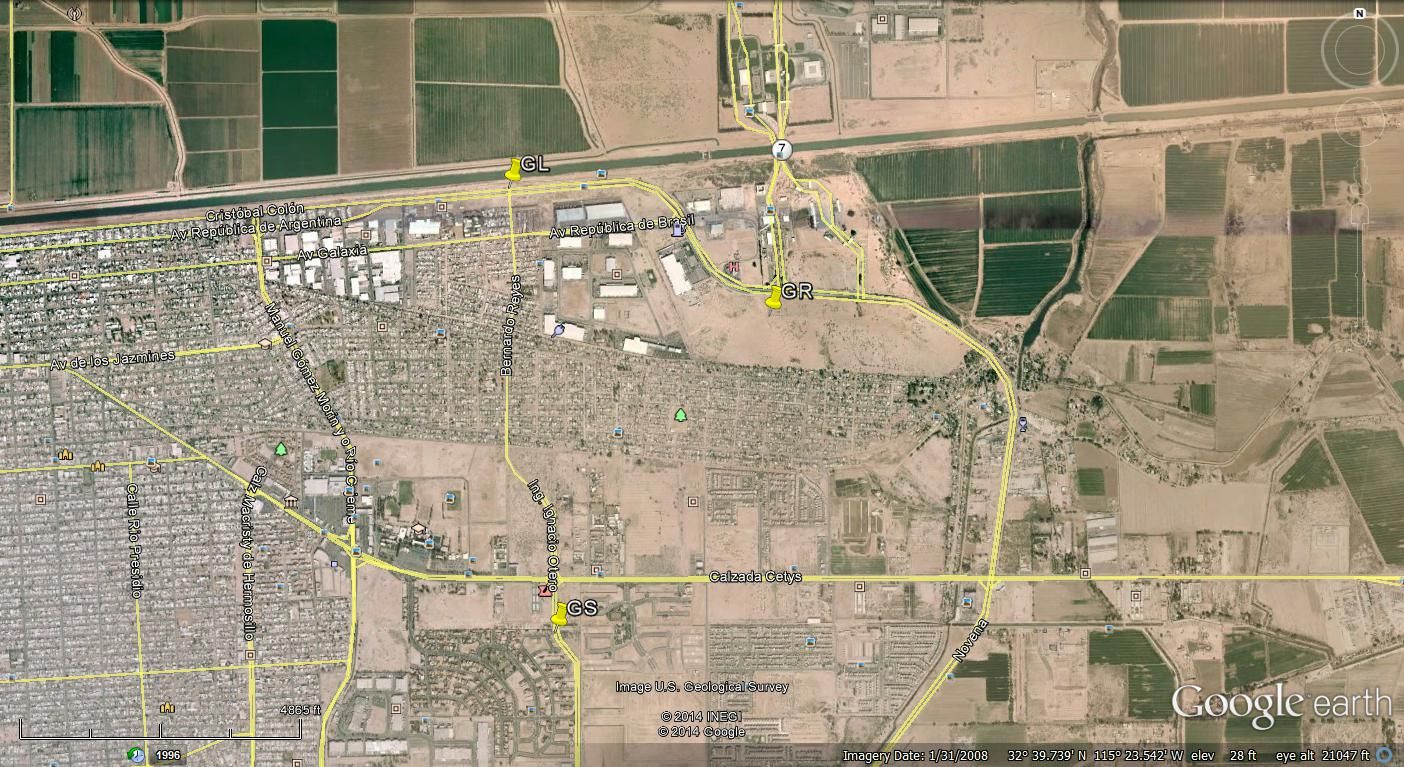
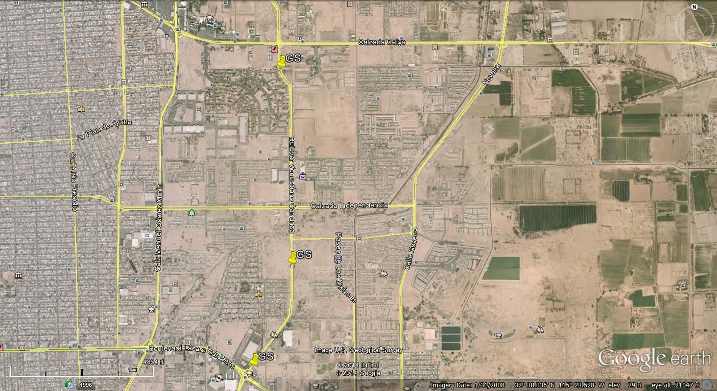
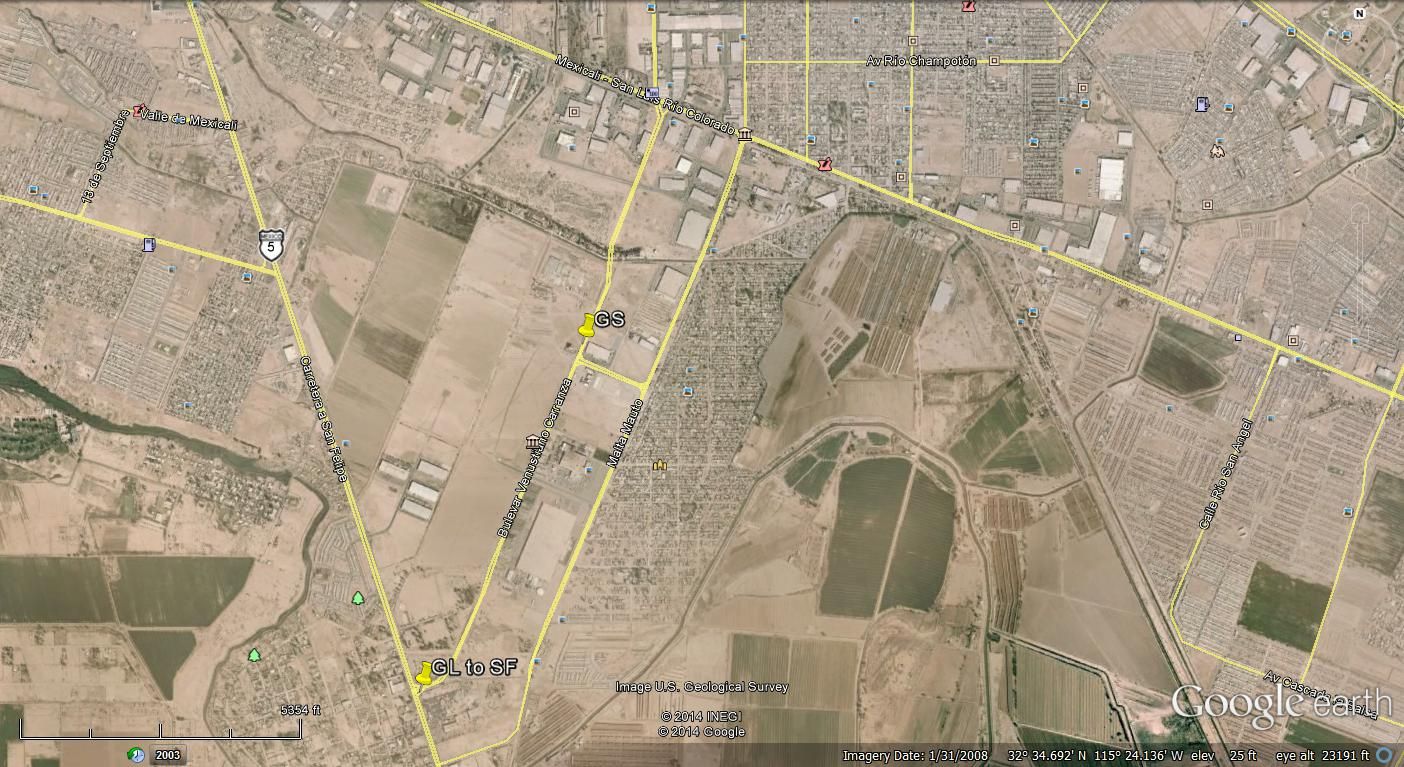
Look on Google Earth. The down loaded version is best. Then you can see where the best or simplest route will be. Like this.
Cross Border turn right.

Round the bend and turn left.

Go Straight.

Go left at Hwy 5

[Edited on 1-9-2015 by TMW]
|
|
|
PaulW
Ultra Nomad
    
Posts: 3113
Registered: 5-21-2013
Member Is Offline
|
|
I did try to GR GL from the border. The result going the other way - going north was the road was closed which resulted in way to much driving around,
and anyway it is in a low income bad housing area not advisable for gringos. My map is marked with an X for good reason. Please do no go that way.
From the border use the main multi-lane truck route - GL, GR at the airport road, GL to get to the same place. But do not speed or forget to use your
turn signals. Heavy Police patrol.
PW
|
|
|
Justbozo
Nomad
 
Posts: 139
Registered: 11-20-2012
Location: Lake Michigan/Bahia Concepcion
Member Is Offline
Mood: Got my little stone hut on the bay
|
|
OK, thanks again PaulW. That is exactly why I asked.
You can only see, not feel from a map.
I will try to behave as best as I can on the streets!
TMW, I do need to learn more about using Google Earth.
Great mapping!
|
|
|
Justbozo
Nomad
 
Posts: 139
Registered: 11-20-2012
Location: Lake Michigan/Bahia Concepcion
Member Is Offline
Mood: Got my little stone hut on the bay
|
|
Just to say we made it through Mexicali just fine with a little help from Nomads.
Left, right, left (sounds like boot camp) and big green and whites for San Felipe got us on our way!
Thanks for putting up with what is probably an old hat question .
AAAH...Little stone hut on the bay!
|
|
|
CortezBlue
Super Nomad
   
Posts: 2213
Registered: 11-14-2006
Location: Fenix/San Phelipe
Member Is Offline
|
|
After many years of driving through Mexicali, we started using, what I will call, the airport route or Nuevo route.
After crossing the boarder, turn left instead of right.
This is especially helpful when we come back on Sundays as it is in a more commercial area and the traffic is very lite, but on the other hand if you
are driving during work hours M-F it can be a bit busy.
The pot holes in the roads are really bad, but they are fixing them as we, Type?
It drops you on Hwy 5 south of all traffic lights and it may not be much shorter but I think I have a better chance of not being in a car accident.
“Two things are infinite: the universe and human stupidity; and I'm not sure about the universe.”
- Albert Einstein
Follow Cortez Blue
www.cortezblue.com
We put the FUNK in disFUNKtion |
|
|

