| Pages:
1
2 |
4x4abc
Ultra Nomad
    
Posts: 4453
Registered: 4-24-2009
Location: La Paz, BCS
Member Is Offline
Mood: happy - always
|
|
I know about the rock art site - and it is close to Rancho La Venta.
Question is, did Gulick refer to Rancho La Venta when he writes about Rancho Las Pintas (no other rancho close by)?
The distance from MEX1 (9.2 miles) matches
Why would they have renamed the rancho?
Keep visitors out?
Harald Pietschmann
|
|
|
David K
Honored Nomad
        
Posts: 65395
Registered: 8-30-2002
Location: San Diego County
Member Is Offline
Mood: Have Baja Fever
|
|
Gee Harald, I see names in Mexico change a lot. Different owners, most likely? The site had a parking area and a path plus observation platform before
the flood. Is this La Venta something you saw personally or is that just another name INEGI got wrong?
Looking back to my July 2009 trip report (http://forums.bajanomad.com/viewthread.php?tid=40423) I documented the rock art site at 8.2 miles from Hwy. 1 (Km. 13). Photos at the site on that
page (plus I added them to an earlier post in this thread).
[Edited on 4-28-2018 by David K]
|
|
|
David K
Honored Nomad
        
Posts: 65395
Registered: 8-30-2002
Location: San Diego County
Member Is Offline
Mood: Have Baja Fever
|
|
Here are before and after shots of the painted rock site. The storm was reported here in October 2013:
Quote: Originally posted by David K  | Here is a comparison between my 2009 photo and Mike's 2013 photo, cropped to be close to same area:
2009:
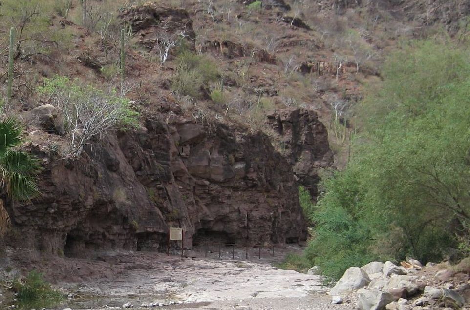
2013:
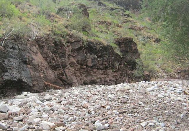
The top of the painted cave is visible in Mike's new photo... so it is only a couple feet covered. There is hope! |
[Edited on 4-27-2021 by David K]
|
|
|
David K
Honored Nomad
        
Posts: 65395
Registered: 8-30-2002
Location: San Diego County
Member Is Offline
Mood: Have Baja Fever
|
|
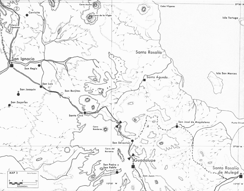
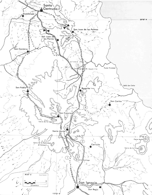
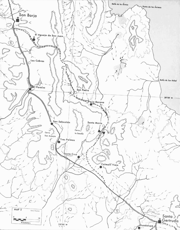
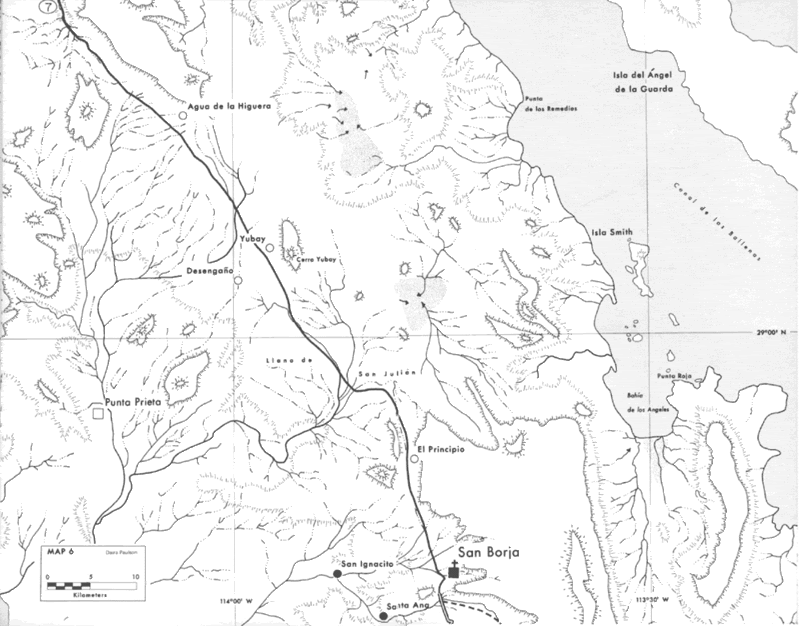
The 1977 Crosby Commissioned Maps
Harry had these more detailed maps made following the publication of his 1974 book. Harry did not travel on ECR until he reached San José Comondú,
as mules were not available to him in Loreto or San Javier, as he had planned.
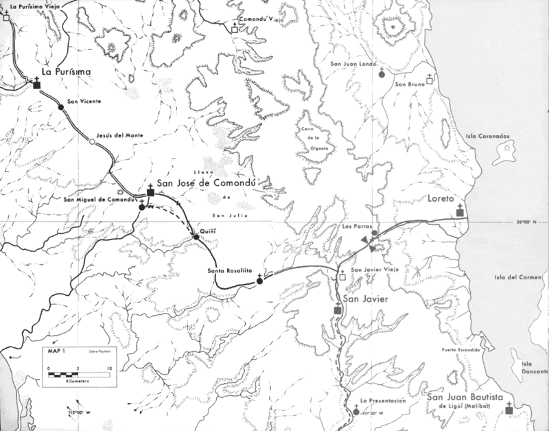
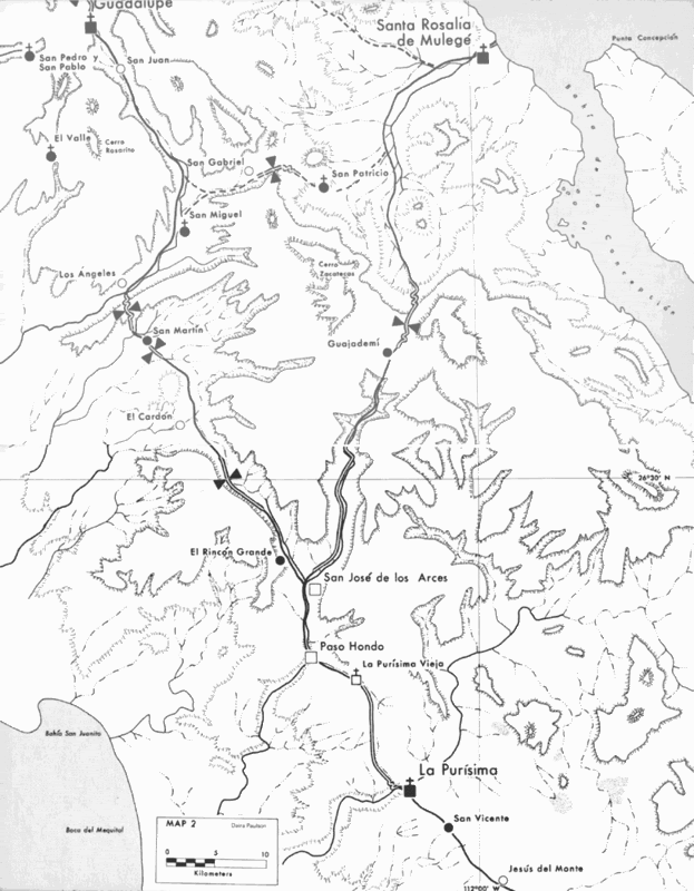
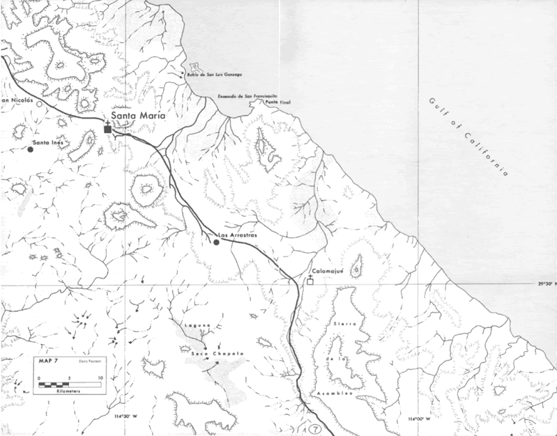
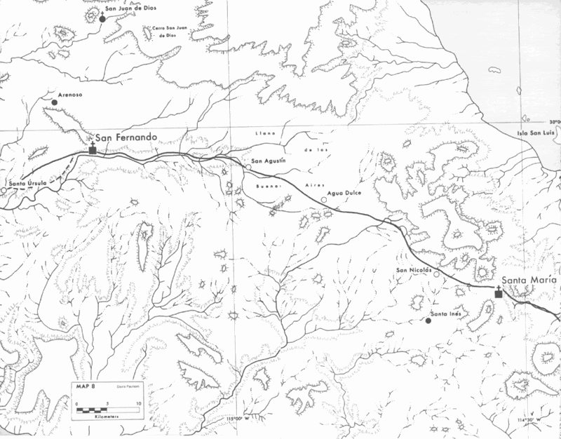
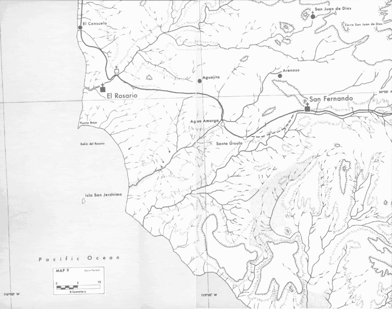
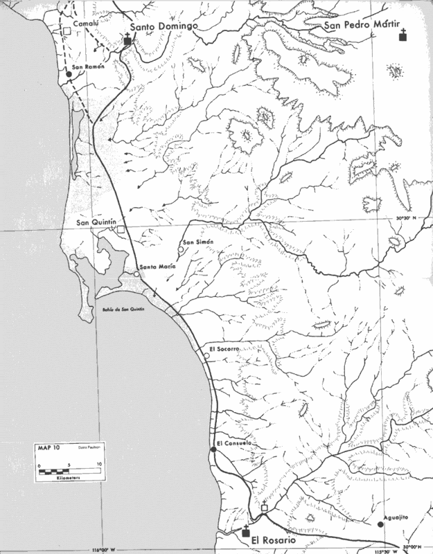
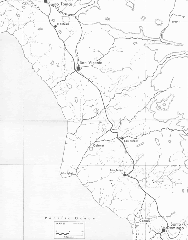
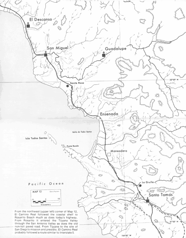
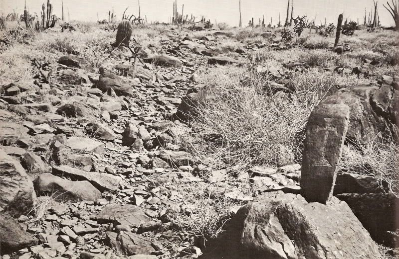
The kilometer marker of the 1760s:
|
|
|
David K
Honored Nomad
        
Posts: 65395
Registered: 8-30-2002
Location: San Diego County
Member Is Offline
Mood: Have Baja Fever
|
|
Wowsers... Photobucket has done it again!
Photos and maps on Photobucket that I had uploaded at the Nomad friendly 800 pixel limit are no longer sized and automatically shown at their standard
1,200 pixels!
In this thread, I manually added the '=800x' modifier after the IMG (so it is [IMG=800x]) to many of the images... but there is no way I am able to
change the thousands of images and maps I have posted here using Photobucket.
The past couple of years, I have switched to using Postimages.org which is both free and has the upload size tool so photos will fit on Nomad that
otherwise are too big, which is an issue mostly with standard monitor viewers, as it stretches the text wide, requiring sideways scrolling to read.
Naturally, we hope that Doug will update this site to allow photo posting directly from our computers or phones and the images will be auto sized, as
they are on Facebook and other forums. Then, we can stop depending on third-party-hosting of our nice photos.
Thanks!
[Edited on 4-27-2021 by David K]
|
|
|
| Pages:
1
2 |
|

