bajamedic
Nomad
 
Posts: 392
Registered: 12-5-2008
Location: Northern California
Member Is Offline
Mood: Just waitin for baja
|
|
San Felipe to El Rosario
I am considering a trip to El Rosario from San Felipe, I drive a 4X4 Ram PU. My maps are showing Highway 5, back to Ensenada and then down the coast,
is there a "semi decent" dirt road that is worth considering. I have read of people taking off near Coco's Corner but I am having problems finding
anything on a map. Any Suggestions? JH
|
|
|
David K
Honored Nomad
        
Posts: 65420
Registered: 8-30-2002
Location: San Diego County
Member Is Offline
Mood: Have Baja Fever
|
|
Hwy. 5 goes to Laguna Chapala on Hwy. 1, 130 miles south from San Felipe... less than 30 miles are unpaved, but 2WD graded dirt, rocky and rough for
weak vehicles or weak people perhaps?
Laguna Chapala to El Rosario is about 110 miles.
Total: 240 miles, beautiful views of the Sea of Cortez, wild desert landscape, boojum trees, etc. and no cities, or farm traffic, nada!
To go north, west, and then south via Ensenada:
300 miles, lots of towns, crossing the city of Ensenada, farm traffic... but no 30 miles of rough graded road.
You decide!
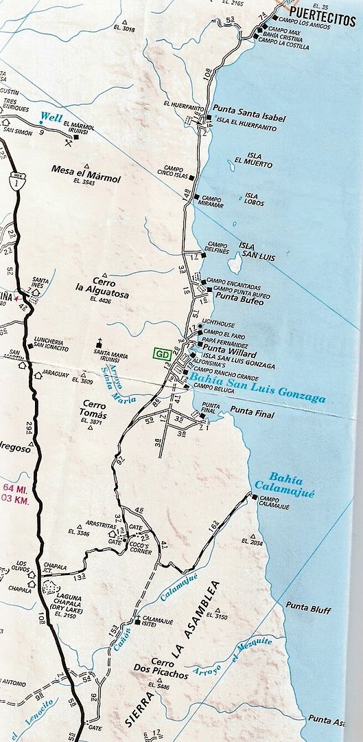
Again, it is paved to a point 10 miles north of Coco's Corner/ 13 miles south of Gonzaga Bay Pemex (Alfonsina's).
[Edited on 4-11-2015 by David K]
|
|
|
woody with a view
PITA Nomad
      
Posts: 15940
Registered: 11-8-2004
Location: Looking at the Coronado Islands
Member Is Offline
Mood: Everchangin'
|
|
no brainer!
|
|
|
AKgringo
Elite Nomad
     
Posts: 6282
Registered: 9-20-2014
Location: Anchorage, AK (no mas!)
Member Is Offline
Mood: Retireded
|
|
Just north of Coco's Corner, there is a road heading west to a turquoise mine. I have not been on it, but was told at Coco's that it was not
passable.
I don't know if they meant to the mine, or to Mex 1, but I sure wouldn't recommend it alone!
[Edited on 4-11-2015 by AKgringo]
If you are not living on the edge, you are taking up too much space!
"Could do better if he tried!" Report card comments from most of my grade school teachers. Sadly, still true!
|
|
|
rts551
Elite Nomad
     
Posts: 6700
Registered: 9-5-2003
Member Is Offline
|
|
Beware of recommendations from people who have not been on this road in a long time (maybe it is because they are weak) . The 23 miles dirt section is getting worse but is traveled by semi's.
Lots of up to date info by actual travelers on Talk Baja, a facebook page. . The 23 miles dirt section is getting worse but is traveled by semi's.
Lots of up to date info by actual travelers on Talk Baja, a facebook page.
|
|
|
David K
Honored Nomad
        
Posts: 65420
Registered: 8-30-2002
Location: San Diego County
Member Is Offline
Mood: Have Baja Fever
|
|
Quote: Originally posted by AKgringo  | Just north of Coco's Corner, there is a road heading west to a turquoise mine. I have not been on it, but was told at Coco's that it was not
passable.
I don't know if they meant to the mine, or to Mex 1, but I sure wouldn't recommend it alone!
|
AK... the La Turquesa Canyon road is an abandoned and washed out vehicle trail used by off road motorcycles, but has been traveled by at least one
Nomad in his Land Rover, with help from TW and others clearing the way. See posts by The squarecircle and photos of his climb up the grade I posted
for him....
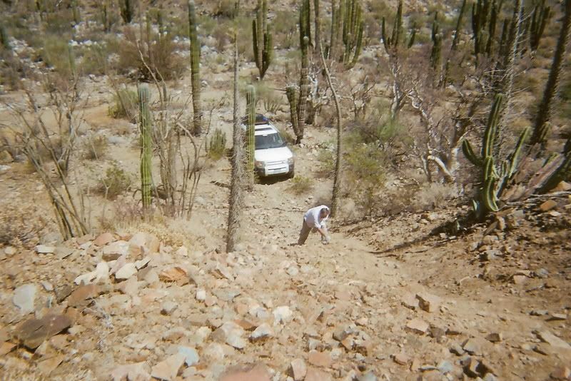
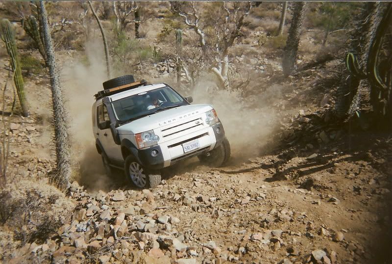
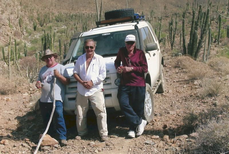
TW and The squarecircle... not sure of the guy on the right?
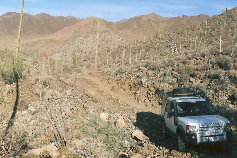
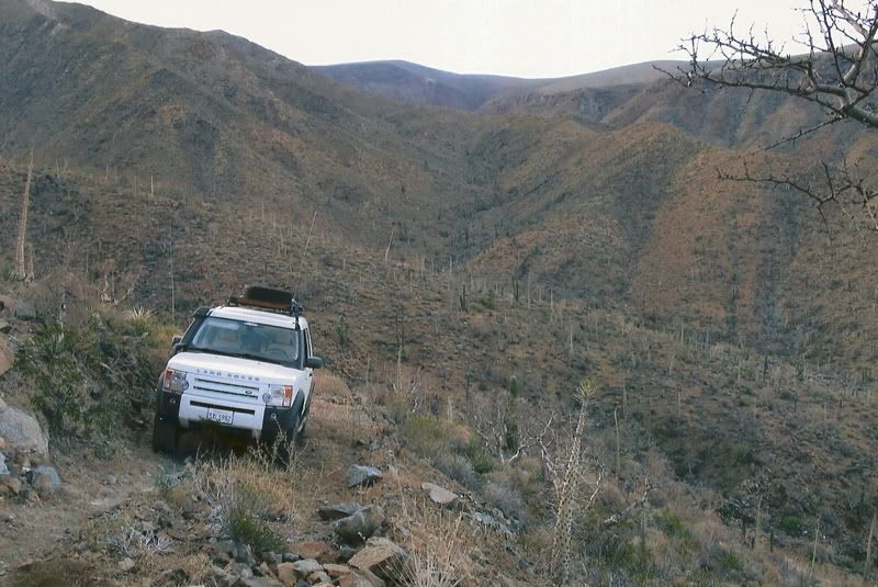
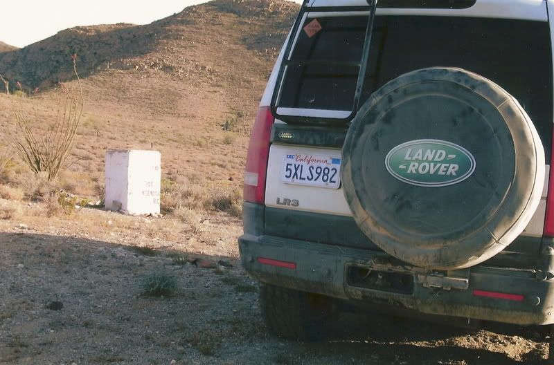
The top of the La Turquesa Grade. Congratulations to the squarecircle!
To see what it looks like from the Hwy. 1 side, and a view down from the top: http://vivabaja.com/207/
[Edited on 4-12-2015 by David K]
|
|
|
mjs
Nomad
 
Posts: 333
Registered: 2-20-2013
Location: Off grid in San Felipe
Member Is Offline
|
|
Went over the dirt section yesterday. Best condition it has been in since the hurricane. A bit rocky over the pass but the graders have done a good
job on the south end. Maybe not US freeway standard road but passable with just about any vehicle with a reasonable driver.
|
|
|
David K
Honored Nomad
        
Posts: 65420
Registered: 8-30-2002
Location: San Diego County
Member Is Offline
Mood: Have Baja Fever
|
|
Quote: Originally posted by mjs  | | Went over the dirt section yesterday. Best condition it has been in since the hurricane. A bit rocky over the pass but the graders have done a good
job on the south end. Maybe not US freeway standard road but passable with just about any vehicle with a reasonable driver. |
Thank you for posting a fresh, new confirmation of what I had been recently told and read, and personally experienced in the not too distant past! You
can't beat Nomad for the current conditions.
|
|
|
rts551
Elite Nomad
     
Posts: 6700
Registered: 9-5-2003
Member Is Offline
|
|
Quote: Originally posted by mjs  | | Went over the dirt section yesterday. Best condition it has been in since the hurricane. A bit rocky over the pass but the graders have done a good
job on the south end. Maybe not US freeway standard road but passable with just about any vehicle with a reasonable driver. |
Thanks for a recent report. 2 weeks ago, it was not smooth at all, but very passable (2 hours for us slow pokes). and the most recent reports
complained of broken shocks and flat tires. When you say south end...do you mean the pass to Chapala? Hope the latest rains didn't hit there and
mess it up.
|
|
|
LaTijereta
Super Nomad
   
Posts: 1192
Registered: 8-27-2003
Location: Loreto
Member Is Offline
|
|
Why not run the "cross-over" road from Valle de La Trinidad over to HWY1, and skip the Ensenada traffic.. Where the road meets the HWY your about an
hour north of El Rosario..
I would guess a 3-4 trip from SF.. The "cross-over" offroad section is about 40 miles, but fast...
Democracy is like two wolves and a lamb voting on what to have for lunch. Liberty is a well-armed lamb contesting the vote.
Ben Franklin (1759)
|
|
|
TMW
Select Nomad
      
Posts: 10659
Registered: 9-1-2003
Location: Bakersfield, CA
Member Is Offline
|
|
It's funny how different people have such different views of the graded road past Cocos to hwy 1 at Chapala. I've driven that road every year for
almost 30 years. Twice already this year and getting ready to do it again in a couple of weeks during the NORRA race. I just view it as a graded road
with some good spots and some bad spots. Would I take a car on it? No not unless it was an old beater. Would I pull an RV trailer over it? Not if I
had an alternative. But I have no problem taking my GMC Z71 or my Tacoma 4x4 (without ATRAC, sorry DK) over it.
The first time my wife was with me she said it was the most ****** bumpy road she had ever been on.
|
|
|
David K
Honored Nomad
        
Posts: 65420
Registered: 8-30-2002
Location: San Diego County
Member Is Offline
Mood: Have Baja Fever
|
|
A-TRAC is a 4WD LOW traction system. This road is 2WD easy.
|
|
|
rts551
Elite Nomad
     
Posts: 6700
Registered: 9-5-2003
Member Is Offline
|
|
Quote: Originally posted by TMW  | It's funny how different people have such different views of the graded road past Cocos to hwy 1 at Chapala. I've driven that road every year for
almost 30 years. Twice already this year and getting ready to do it again in a couple of weeks during the NORRA race. I just view it as a graded road
with some good spots and some bad spots. Would I take a car on it? No not unless it was an old beater. Would I pull an RV trailer over it? Not if I
had an alternative. But I have no problem taking my GMC Z71 or my Tacoma 4x4 (without ATRAC, sorry DK) over it.
The first time my wife was with me she said it was the most ****** bumpy road she had ever been on. |
I think that is what everybody has been saying. just different words and people take it at different speeds. Lots more traffic now including semi's
which is why people are asking about conditions. Not like 30 years ago when we might not see anyone all day.
|
|
|

