Baja Bucko
Nomad
 
Posts: 288
Registered: 9-23-2003
Member Is Offline
|
|
Rosarito (SE of SSMartir, BCN)-old mining community info needed
I am trying to find out anything at all about the tiny former mining community called Rosarito. This Rosarito is found in the Sierra de San Miguel
range SW of the Sierra de San Pedro Martir in BCNorte. All that is left there today are a few ruins of homes and corrals with a graveyard and old
adobe walls where the mining town was. While riding mules on La Mula Mil we camped at the location and mi primo, who happened to be the guide for us
for this area, told the stories of our ancestor who had history in the area in the late 1800s. I have been unable to find out much historically other
than Gerhard & Gulick's comments from the 1960s. Anybody have any leads as to its history? His grandmother (1870-pre-1940) would ride from Santo
Domingo in the early 1900s to Rosarito. I suspect some of the Martorell families in the SSPM would know something but in my excitement of visiting
with them on the mule trip, I never got around to asking...any historians have clues?
My other 4WD is a Baja Mule!
La Mula Mil Survivor 2013-2014!
1000 miles by mule from the tip to Tecate!
|
|
|
dtbushpilot
Ultra Nomad
    
Posts: 3296
Registered: 1-11-2007
Location: Buena Vista BCS
Member Is Offline
Mood: Tranquilo
|
|
How about a map DK?
"Life is tough".....It's even tougher if you're stupid.....
|
|
|
Baja Bucko
Nomad
 
Posts: 288
Registered: 9-23-2003
Member Is Offline
|
|
It is easily seen in the Baja almanac....
My other 4WD is a Baja Mule!
La Mula Mil Survivor 2013-2014!
1000 miles by mule from the tip to Tecate!
|
|
|
David K
Honored Nomad
        
Posts: 65421
Registered: 8-30-2002
Location: San Diego County
Member Is Offline
Mood: Have Baja Fever
|
|
Maps
1905:
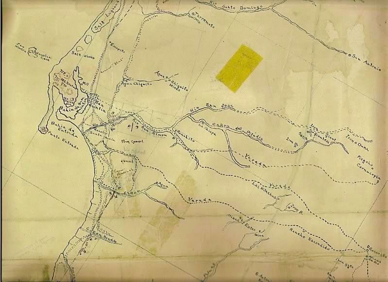
On the far right edge of this 1905 Mines and Roads Map. Note the "Mina de Oro" just south of Rosarito.
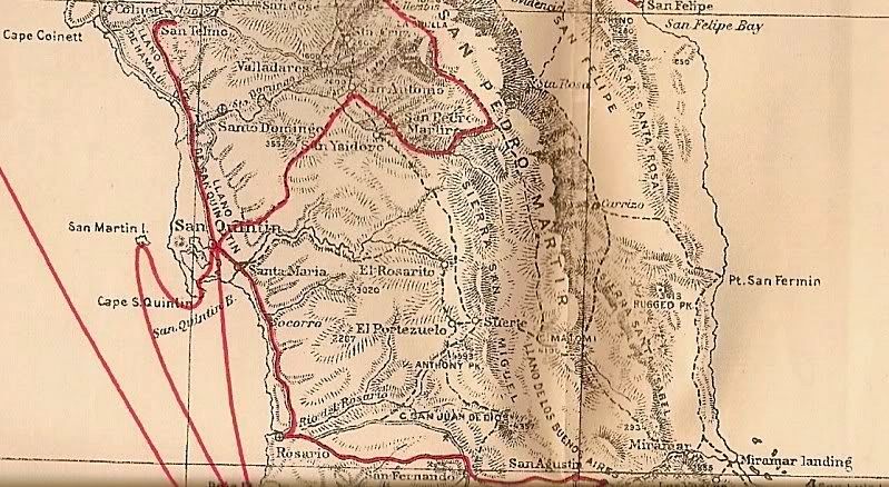
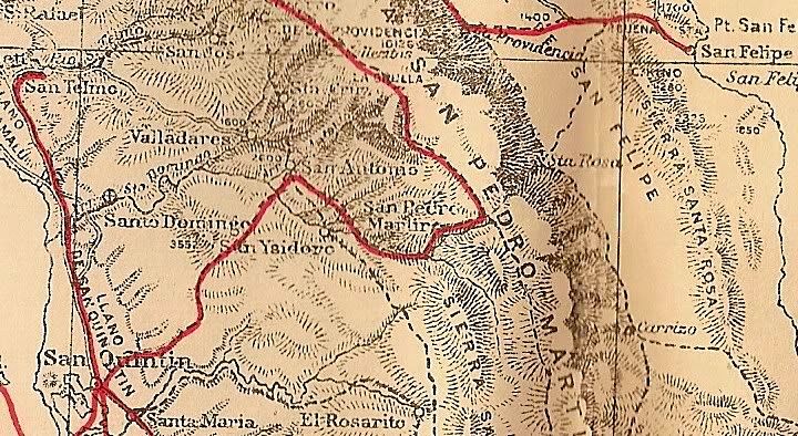
Here it is on the bottom of Nelson's 1919 map (about his 1905 expedition).
Nelson's route is the red line, so he didn't visit El Rosarito, but shows it on a trail from Santa Maria/ San Quintin and then south.
1907:
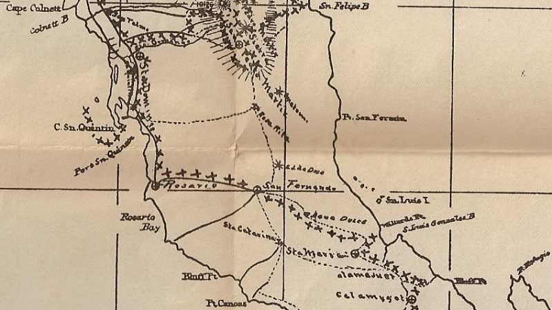
Arthur North calls it "Rosa Rita"
1930:
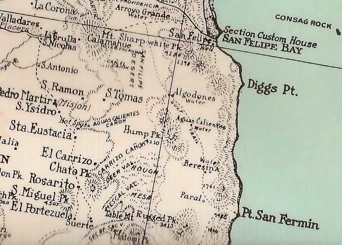
In the lower left quarter of this 1930 map.
1941:
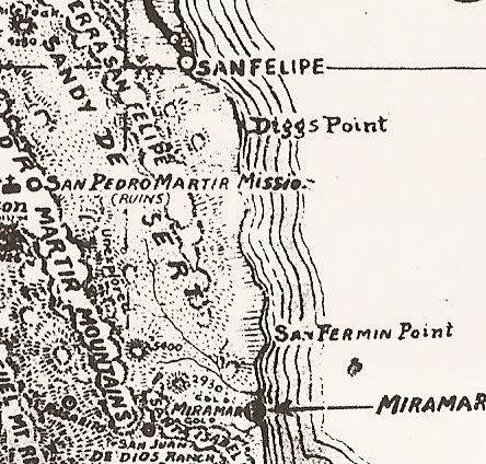
Lower left corner, again.
1962:
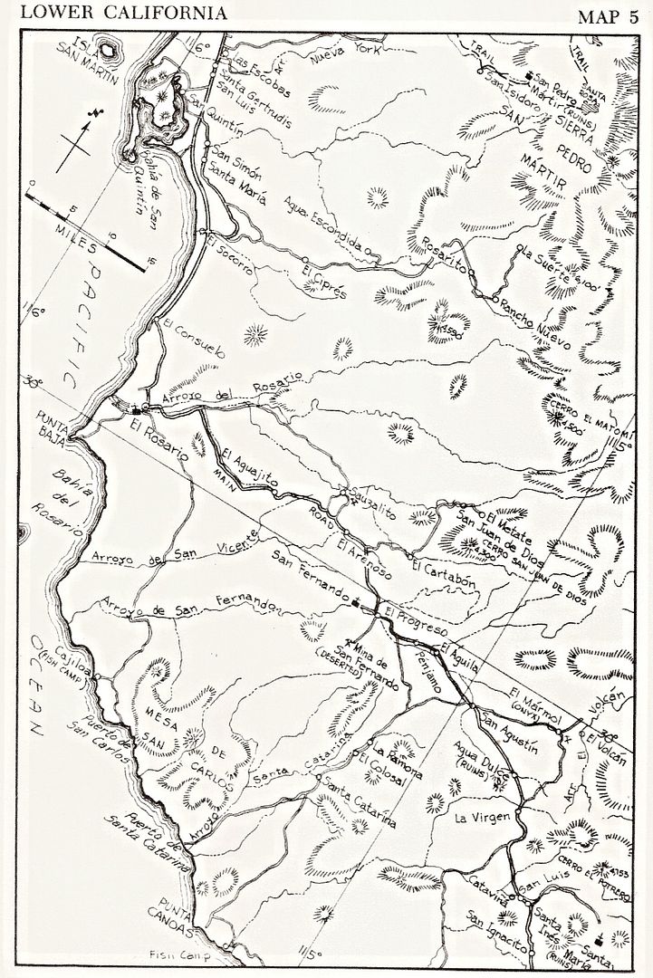
Howard Gulick, Lower California Guidebook Map
2009:
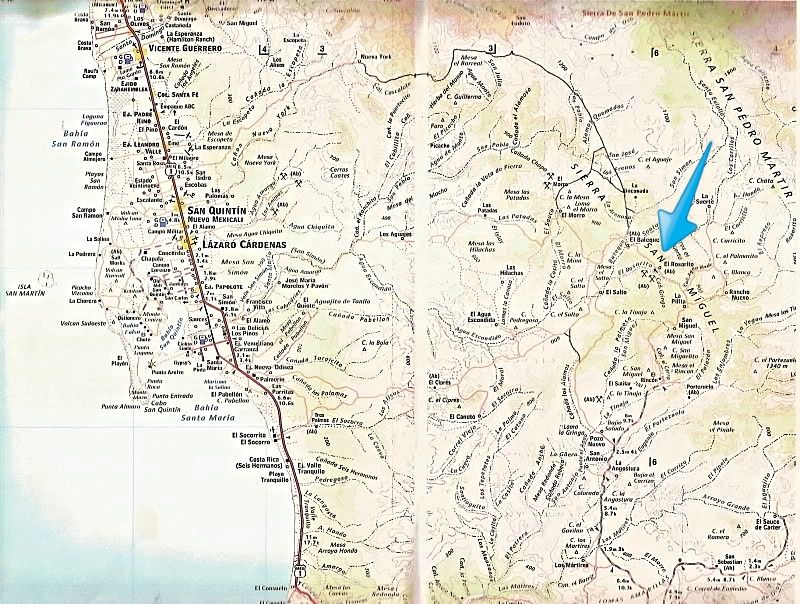
|
|
|
TMW
Select Nomad
      
Posts: 10659
Registered: 9-1-2003
Location: Bakersfield, CA
Member Is Offline
|
|
The Squarecircle and I are going to be in that area near the end of the month. If we meet anyone in the area we could ask about it.
|
|
|
David K
Honored Nomad
        
Posts: 65421
Registered: 8-30-2002
Location: San Diego County
Member Is Offline
Mood: Have Baja Fever
|
|
Quote: Originally posted by TMW  | | The Squarecircle and I are going to be in that area near the end of the month. If we meet anyone in the area we could ask about it.
|
Tom, if you are going to take the "new" road that circles around from Nueva York (NE of San Quintin town) to El Rosarito (that we can see on Google
Earth and I drew in as a single line on the 2009 map above), please make a road log and some photos of the road or sites along the way.
Thank you!
PS the new road comes closer to San Isidoro than the traditional access from Meling/ Santa Cruz. San Isidoro was a visita or waypoint on the trail to
Mission San Pedro Martir. A trail (or maybe a road now?) goes from the new road to San Isidoro.
|
|
|
xolotl_tj
Junior Nomad

Posts: 38
Registered: 9-20-2008
Location: Col. Libertad, Tijuana
Member Is Offline
|
|
Historia de la colonización de la Baja California y decreto del 10 de marzo de 1857 by Ulises Urbano Lassépas identifies El Rosarito as being
one sitio de ganado mayor ("cattle ranch" = 17.6 sq km) within the district of Santo Tomás granted to Francisco del Castillo Negrete by Rafael
Espinosa, the jefe político, on 10 May 1852. (This is not the del Castillo of Real del Castillo.)
El Álamo, mineral de Baja California, by José Luis López Cárdenas, cites an article in the Lower Californian of 3 May 1888 in which
the output of the mines at Real del Castillo, Jacalitos, Juárez, Zaragoza, Campo Nacional, Santa Catarina, San Pablo, Socorro, Valladares, Rosarito,
and Agua Dulce are listed in unspecified units: Rosarito's output was lesser than all but four of these mines. El Álamo came on line a few months
later.
L’homme ici arrive où il peut et non où il veut.
—Vasco Núñez de Balboa
|
|
|
Ateo
Elite Nomad
     
Posts: 5940
Registered: 7-18-2011
Member Is Offline
|
|
That area is awesome. I scouted it out during the 2013 Baja 1000. I have nothing to add to this discussion other than that.
|
|
|
Baja Bucko
Nomad
 
Posts: 288
Registered: 9-23-2003
Member Is Offline
|
|
Thanks Xoloti---excellent info re history-hope more pops up. That time period is a tough one for sources.
My other 4WD is a Baja Mule!
La Mula Mil Survivor 2013-2014!
1000 miles by mule from the tip to Tecate!
|
|
|
David K
Honored Nomad
        
Posts: 65421
Registered: 8-30-2002
Location: San Diego County
Member Is Offline
Mood: Have Baja Fever
|
|
I just checked in the mining book, 'Modest Fortunes' (Dawson Series #51) and found nada on a Rosarito mine... just Valladares and Socorro to the north
and the many copper mines to the south.
I also checked the first edition (1956) Lower California Guidebook, which has a population given for Rosarito of 63, not included in the later
editions.
|
|
|
TMW
Select Nomad
      
Posts: 10659
Registered: 9-1-2003
Location: Bakersfield, CA
Member Is Offline
|
|
Quote: Originally posted by David K  | Quote: Originally posted by TMW  | | The Squarecircle and I are going to be in that area near the end of the month. If we meet anyone in the area we could ask about it.
|
Tom, if you are going to take the "new" road that circles around from Nueva York (NE of San Quintin town) to El Rosarito (that we can see on Google
Earth and I drew in as a single line on the 2009 map above), please make a road log and some photos of the road or sites along the way.
Thank you!
PS the new road comes closer to San Isidoro than the traditional access from Meling/ Santa Cruz. San Isidoro was a visita or waypoint on the trail to
Mission San Pedro Martir. A trail (or maybe a road now?) goes from the new road to San Isidoro. |
I traced out some of the roads on Google Earth and did an overlay of the 2013 B1K showing where it went back to the Santo Domingo arroyo. The 2003 B1K
route was the same in this area. I also used the coordinates from the almanac to show the location of Rosarito, ER on GE below.
I wanted to go in from Hwy 1 at KM16 and follow the 1989 B1K route. It went east then south up a large hill with white rocks then down to an arroyo.
I'm looking for that white rock hill. I pre-ran the 2003 B1K and it did not go up a white rock hill. Nor did I go over one when I followed your
direction and when BJ and I was in the are a couple of years ago.
I raced over it in 89 and I've been over it several times in the early 90s. I just want to figure out where it sets in relation to the other routes in
the area.

[Edited on 10-19-2015 by TMW]
|
|
|
David K
Honored Nomad
        
Posts: 65421
Registered: 8-30-2002
Location: San Diego County
Member Is Offline
Mood: Have Baja Fever
|
|
I see the ER pushpin on the map (El Rosarito).
I hadn't recalled that Score used that road, thanks for the reminder!
Looks like that race course out from Colonia Guerrero joins the San Quintin/Rancho Nueva York road at RM 645?
|
|
|

