| Pages:
1
2 |
StuckSucks
Super Nomad

Posts: 2376
Registered: 10-17-2013
Location: Pacific Plate
Member Is Offline
|
|
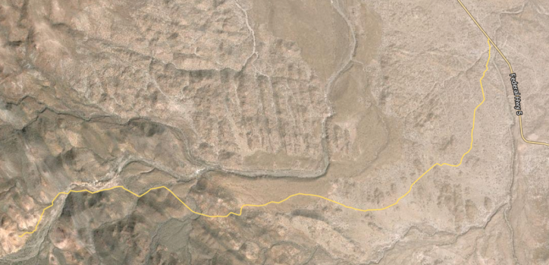
I started doing homework for Turquesa Canyon, and realized that I'd taken a photo sphere in the wash were the road for the canyon intersects Highway
5.
https://goo.gl/maps/c3VtxLfkJAR2
|
|
|
David K
Honored Nomad
Posts: 65562
Registered: 8-30-2002
Location: San Diego County
Member Is Offline
Mood: Have Baja Fever
|
|
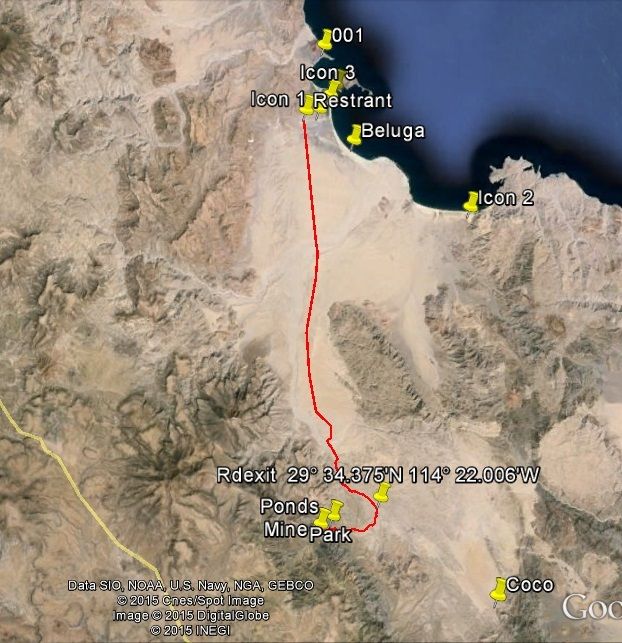
I am following Nomad 'Pappy Jon' (from New Mexico) with his DeLorme In Reach signal and he was there last night, up by the green pools...
If you are macho, like The Squarecircle (Roy), you can drive from the pools, past the turquoise mine and to the bottom of the switchback grade that
comes down from Highway One (by El Pedregoso 'The Boulder Hill'). Of course he used a Land Rover, so it was easy (NOT)! TW was there and helped blaze
the trail from the mine to the switchback.
I am surprised Score hasn't used it yet, but they don't like roads that are too rough, for off road racing! LOL
[Edited on 10-22-2015 by David K]
|
|
|
MMc
Super Nomad
Posts: 1679
Registered: 6-29-2011
Member Is Offline
Mood: Current
|
|
I was saying also bring beer, there is never enough beer.
"Never teach a pig to sing it frustrates you and annoys the pig" - W.C.Fields
|
|
|
StuckSucks
Super Nomad
Posts: 2376
Registered: 10-17-2013
Location: Pacific Plate
Member Is Offline
|
|
Quote: Originally posted by David K  | | If you are macho, like The Squarecircle (Roy), you can drive from the pools, past the turquoise mine and to the bottom of the switchback grade that
comes down from Highway One (by El Pedregoso 'The Boulder Hill'). |
Ultimately, I need to get to Highway 1 to get to the Pacific Coast, so if I had juevos ...
If a Landcruiser made it, then I might have to put the Tacoma in 4x4 ...
|
|
|
PaulW
Ultra Nomad
Posts: 3113
Registered: 5-21-2013
Member Is Offline
|
|
=======
Hi James,
here is the post on another discussion showing the turn from the road to Coco's to the turq ponds. From what I have read a 4WD high clearance rig can
do the grade for the pond or mine area to Hwy 1.
|
|
|
David K
Honored Nomad
Posts: 65562
Registered: 8-30-2002
Location: San Diego County
Member Is Offline
Mood: Have Baja Fever
|
|
| Quote: Originally posted by StuckSucks | | Quote: Originally posted by David K | | If you are macho, like The Squarecircle (Roy), you can drive from the pools, past the turquoise mine and to the bottom of the switchback grade that
comes down from Highway One (by El Pedregoso 'The Boulder Hill'). |
Ultimately, I need to get to Highway 1 to get to the Pacific Coast, so if I had juevos ...
If a Landcruiser made it, then I might have to put the Tacoma in 4x4 ... |
It was Roy's LR3 Land Rover!
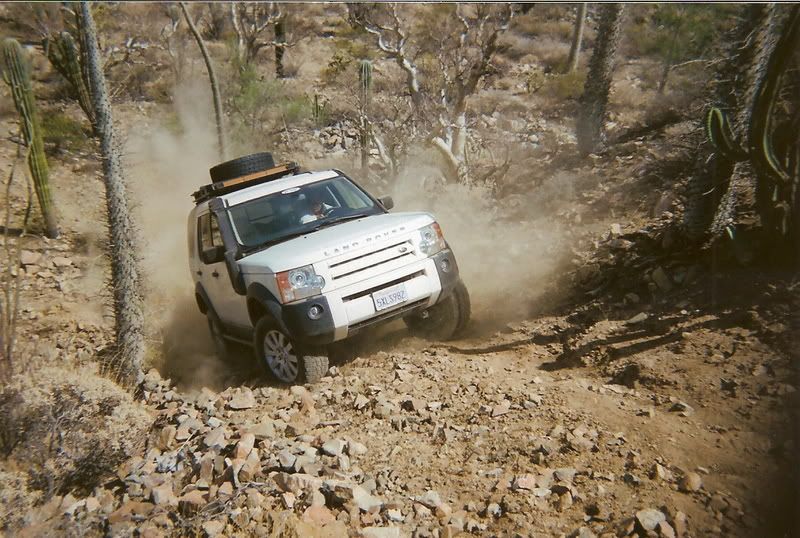
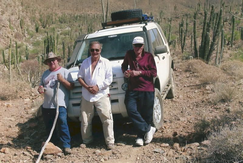
The Top!
|
|
|
StuckSucks
Super Nomad
Posts: 2376
Registered: 10-17-2013
Location: Pacific Plate
Member Is Offline
|
|
| Quote: Originally posted by PaulW |
Hi James,
here is the post on another discussion showing the turn from the road to Coco's to the turq ponds. From what I have read a 4WD high clearance rig can
do the grade for the pond or mine area to Hwy 1.
|
Thanks Paul,
I just added the road to a map, and will make a file to move to my GPS. I assume the pools are in that rocky area when you enter the canyon
approaching the mine?
|
|
|
StuckSucks
Super Nomad
Posts: 2376
Registered: 10-17-2013
Location: Pacific Plate
Member Is Offline
|
|
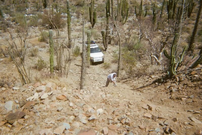
Whoa - looks like a loose, gravely mess. And fun.
|
|
|
PaulW
Ultra Nomad
Posts: 3113
Registered: 5-21-2013
Member Is Offline
|
|
James, attached is the USR Zip file for the track. Hope it works?
Pools are surrounded with hard rock. Park and walk a short distance to view/explore them. Short gravel approach to the mine. Slim pickings to find the
turq. The climb up the grade is described a difficult. Its on my bucket list to do sometime.
Paul
=============
| Quote: Originally posted by StuckSucks | | Quote: Originally posted by PaulW |
Hi James,
here is the post on another discussion showing the turn from the road to Coco's to the turq ponds. From what I have read a 4WD high clearance rig can
do the grade for the pond or mine area to Hwy 1.
[ |
Thanks Paul,
I just added the road to a map, and will make a file to move to my GPS. I assume the pools are in that rocky area when you enter the canyon
approaching the mine?
|
Attachment: Turq Ponds.zip (2kB)
This file has been downloaded 389 times
|
|
|
StuckSucks
Super Nomad
Posts: 2376
Registered: 10-17-2013
Location: Pacific Plate
Member Is Offline
|
|
Thank Paul, worked great. I embedded in a Google Map to have a good look-see. How did you know .usr is my flavor?
|
|
|
PaulW
Ultra Nomad
Posts: 3113
Registered: 5-21-2013
Member Is Offline
|
|
=======
Involved in Cops racing - racers always use Lowrance. When I see you doing tracks USR is the obvious way to go. I use Garmin and Lowrance and Garmin
sucks I may just dump the G units.
|
|
|
TMW
Select Nomad
Posts: 10659
Registered: 9-1-2003
Location: Bakersfield, CA
Member Is Offline
|
|
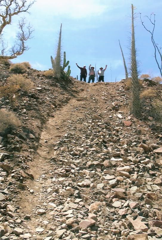
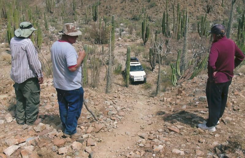
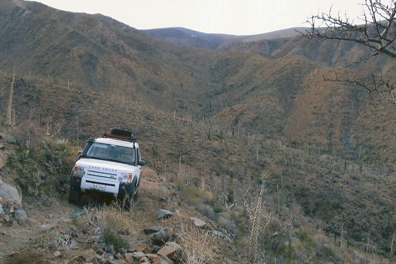
From the mine to the hill out of the wash there were two places we had some difficulty getting Roy thru. The first was an S shaped turn against the
north embankment soon after leaving the mine. This section is not for a long wheel base vehicle. The second was a step up that needed some road
building.
That was several years ago and the rains could have changed all that. The trail Roy followed was what the bikers use. It mostly stays along the north
side of the arroyo.
Roys problem getting up the hill was because he does not have a locker. He has all kinds of traction control stuff that in his case did not provide
the type of traction needed on a hill of loose rocks. He finally just blasted his way up. He said they had to move a lot of rocks after the hill top
for a short section.
If I remember right it took us about 8 hours to go 2 miles. It's 2 miles from the mine to the hill out of the wash.
[Edited on 10-23-2015 by TMW]
|
|
|
David K
Honored Nomad
Posts: 65562
Registered: 8-30-2002
Location: San Diego County
Member Is Offline
Mood: Have Baja Fever
|
|
Yes, the motorcycles love it and Kacey Smith named it the "XR Ride Up" in her first book ('All About Your Whereabouts' Baja GPS Guide). It is also
called, "Coco's Shortcut".
|
|
|
| Pages:
1
2 |


