| Pages:
1
2 |
PaulW
Ultra Nomad
    
Posts: 3113
Registered: 5-21-2013
Member Is Offline
|
|
Inreach today 11/21/17
Followed instruction thins time and got all my track points to display.Tiny straight lines between each point
So - settings are 10 min , send interva, 1 secl log interval. I cleared the track. (when done I had used 12% of my Inreach memory.)
Clear track, Sync, send message to my email and start tracking. When I got home I executed the Inreach stop command and did another sync. Opened the
link from my email and got the usual unacceptable 10 second plot even with settings only for track points and latest track.
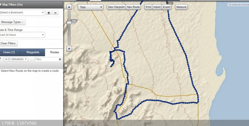
Opened my Garmin Inreach account and chose map. Made sure I had only checked track points, then chose last 24 hours. Result was all track points were
displayed and no extraneous straight lines.
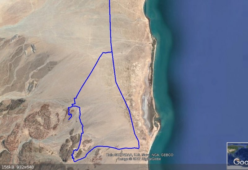
GE screen shot

Screen shot for Account map page

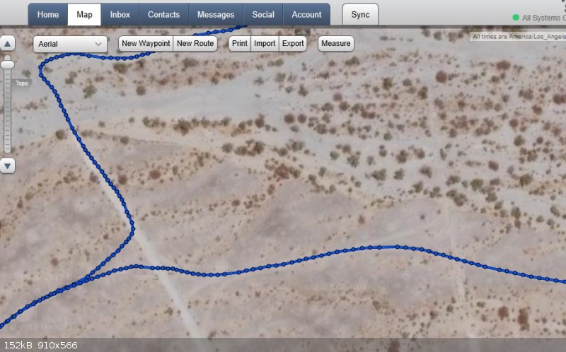
Screen shot greatly blown up. Shows all the track points. Note that the out and back portion shows double track points.

|
|
|
PaulW
Ultra Nomad
    
Posts: 3113
Registered: 5-21-2013
Member Is Offline
|
|
More details
I have taken a large number of driving trips in the last three months and none of the trips when viewed in the email link have the straight lines.
Then when going to my account and converting to a GPX file I have success with a valid file. This is validated by opening the GPX file in Trackmaker
which allows me to zoom way in to see if all my breadcrumbs have been captured – success.
The trips when viewed on the email link show very few track points (10-minute interval), however they are all in place on the roads I drove. This file
is not the place to use for a GPS track. They are just far apart, but allows a good overview. I send an email to myself for each trip/day to allow the
detail to be captured.
Something I have found to be important is to create a GPX file each day to avoid multiple trips from merging together. They are very hard to break
apart. First I Sync in my account then I create the GPX file. Then I go to the Inreach device and clear the track then Sync and I am ready to do
another day or trip.
I generate so many breadcrumbs (track points) that I must keep my Inreach device powered externally always.
I still have not figured out how to display (as I am driving) the track on Earthmate (on my Android tablet), but they show up great on any IOS
device.
Merge the above with my previous post for more detail.
|
|
|
David K
Honored Nomad
        
Posts: 65411
Registered: 8-30-2002
Location: San Diego County
Member Is Offline
Mood: Have Baja Fever
|
|
Thanks for the details Paul.
Not sure if I can change anything I already saved... But, for sure, there was no reason for the rouge straight lines to appear randomly as they did on
my tracks.
|
|
|
PaulW
Ultra Nomad
    
Posts: 3113
Registered: 5-21-2013
Member Is Offline
|
|
An example for you to play with using the email link.
Choose “track points” only and “most recent track” and what you get is shown below. Obviously, the image is the default 10 minute
breadcrumbs (track points). If you use the default settings you will get a straight line in addition to the track. Try it.
Here is the link to play with:
https://share.garmin.com/PaulWilson Ha - now you all can track my travels forever I don't care. Just like me you will have trouble going back in
time.
Note, as you zoom way in, each 10 minute track point will be connected with a straight line. That also happens with the GPX file except the many
points are very close together and does not affect the resolution or readability.
And here is the screen shot of the result with correct settings:

|
|
|
StuckSucks
Super Nomad
   
Posts: 2369
Registered: 10-17-2013
Location: Pacific Plate
Member Is Offline
|
|
Ahhhh ... Durango, one of my favorite place to ride mtb. "God owns a mountain bike and he lives in Durango."
|
|
|
PaulW
Ultra Nomad
    
Posts: 3113
Registered: 5-21-2013
Member Is Offline
|
|
Nice place to hang out in summer and great off road possibilities for our Jeeping. Lots of folks that like what we do. Including George and his 1072.
Others also
|
|
|
| Pages:
1
2 |

