| Pages:
1
2 |
TMW
Select Nomad
      
Posts: 10659
Registered: 9-1-2003
Location: Bakersfield, CA
Member Is Offline
|
|
The motorhome is at Three Sisters south of Puertecitos.
|
|
|
David K
Honored Nomad
        
Posts: 65383
Registered: 8-30-2002
Location: San Diego County
Member Is Offline
Mood: Have Baja Fever
|
|
The map inside the book's cover shows the roads they traveled.
It doesn't say in the book, but if I were to make a guess, the older road to La Purísima would be it. The Auto Club posted a photo of a road that
looked similar to the photo with the 'motorhome' on it. Let me see if I can find it!
FOUND IT!

[Edited on 4-30-2018 by David K]
|
|
|
David K
Honored Nomad
        
Posts: 65383
Registered: 8-30-2002
Location: San Diego County
Member Is Offline
Mood: Have Baja Fever
|
|
Page 52
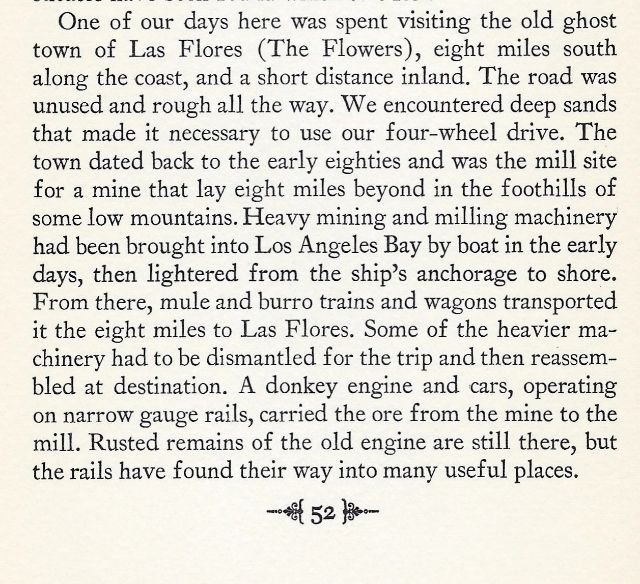
Far easier to scan and crop than to type!
Here is the region discussed, as it was around the book's printing:
1958 Shell Baja Map, showing Las Flores:
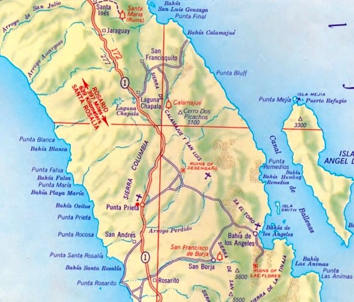
San Francisquito is next to Las Arrastras... and the 1956 road blazed north to Gonzaga Bay and San Felipe's sulfur mine by Arturo Grosso is not yet
shown
|
|
|
David K
Honored Nomad
        
Posts: 65383
Registered: 8-30-2002
Location: San Diego County
Member Is Offline
Mood: Have Baja Fever
|
|
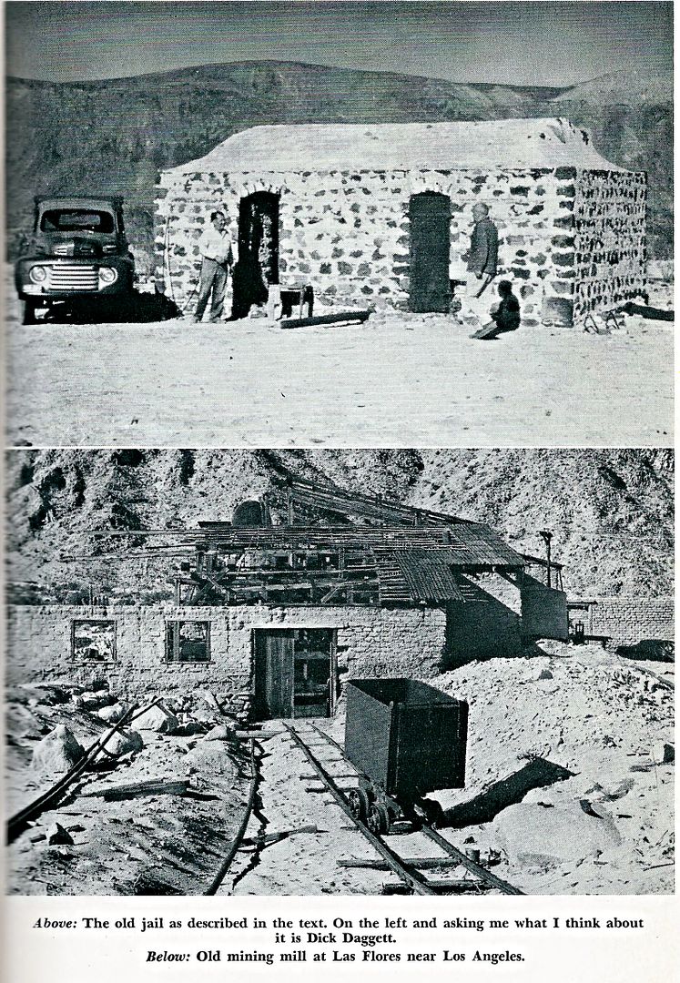
More at Las Flores from a 1951 book (The Curse of the Cow):
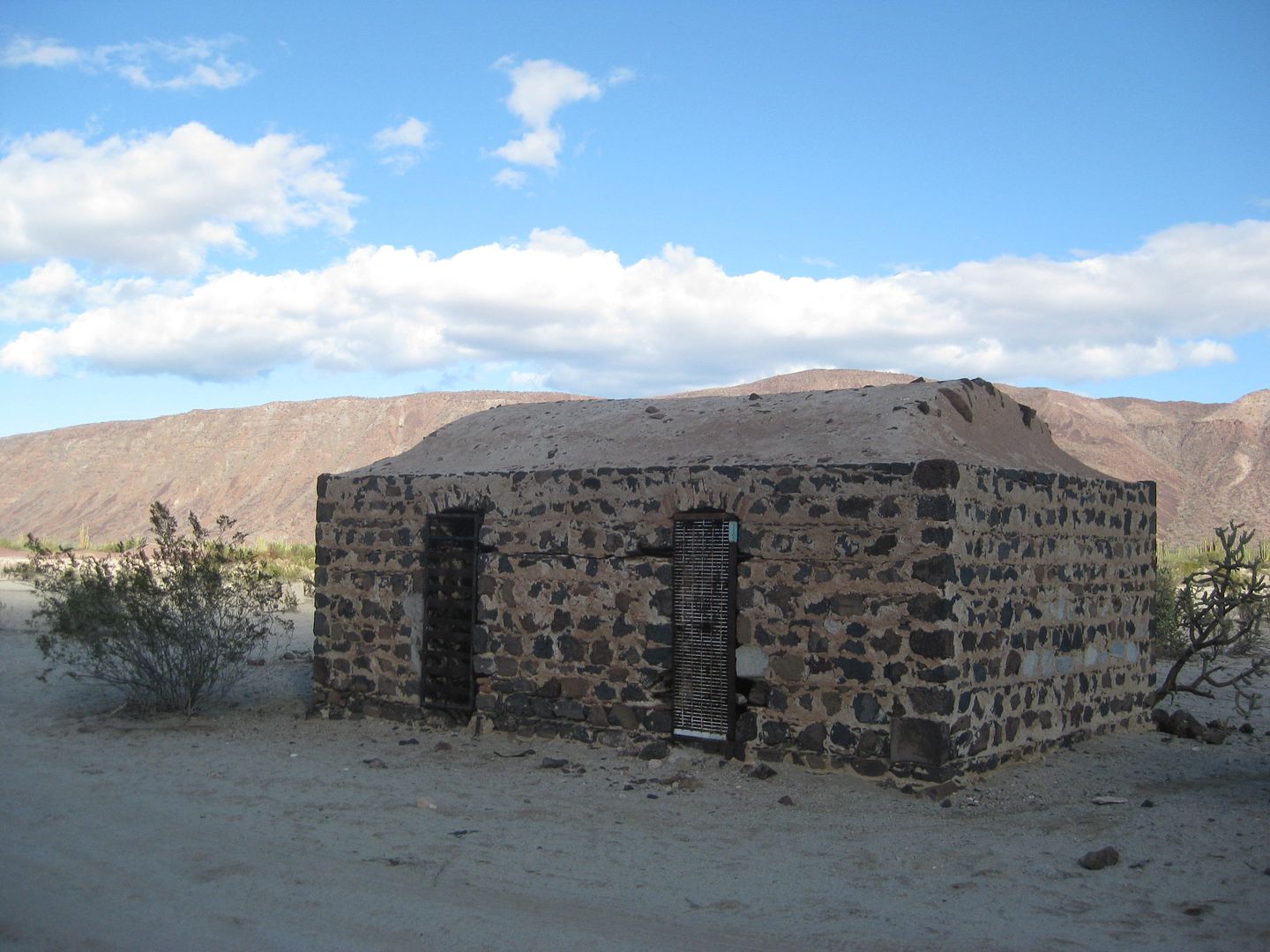
Las Flores jail in 2017:
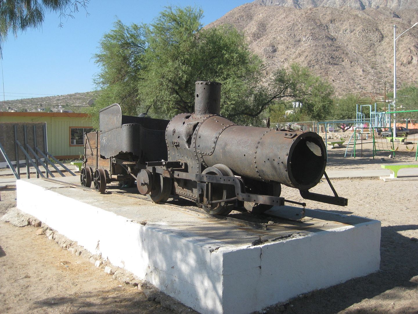
The Las Flores Railroad engine moved to town plaza in Bahía de los Angeles:
|
|
|
thebajarunner
Ultra Nomad
    
Posts: 3754
Registered: 9-8-2003
Location: Arizona....."Free at last from crumbling Cali
Member Is Offline
Mood: muy amable
|
|
Pretty close actually...
Quote: Originally posted by David K  |
The map inside the book's cover shows the roads they traveled.
It doesn't say in the book, but if I were to make a guess, the older road to La Purísima would be it. The Auto Club posted a photo of a road that
looked similar to the photo with the 'motorhome' on it. Let me see if I can find it!
FOUND IT!

[Edited on 4-30-2018 by David K] |
That spot was on the road out of San Ignacio, headed for the "Beach Route" for the 1000 race in the mid-70s.
I suppose you could say it was on the way to La Purisima, although it was probably only about a third of the way from San Ignacio to Rancho Cuarenta
(one of the checkpoints in the race)
I have tried to find the old slides that I took there.
We were pre-running with Bob Gookin, driver/owner of Gookins Gherkin, a green Baja Bug. I stopped ahead and snapped some shots back of him in the
middle of the rock road and he put prints of my pic up in his shop wall out in El Cajon.
As to south of Puertecitos.... I don't remember any of those type of trees in that area, nor the distinct pattern of rocky road. But then, there is a
lot I don't remember too well these days.
|
|
|
David K
Honored Nomad
        
Posts: 65383
Registered: 8-30-2002
Location: San Diego County
Member Is Offline
Mood: Have Baja Fever
|
|
Hmmm... I guess there are a few places in Baja where you drive on big cobble rock?
The 1959 book trip did not go south of San Ignacio to the lagoon. There is a chance he tossed that photo in from a different trip, perhaps?
You are correct that there are no cardón trees in quantity between Puertecitos and Gonzaga. Plus, the 1959 trip did not go that way either.
Keep looking for those slides!
|
|
|
David K
Honored Nomad
        
Posts: 65383
Registered: 8-30-2002
Location: San Diego County
Member Is Offline
Mood: Have Baja Fever
|
|
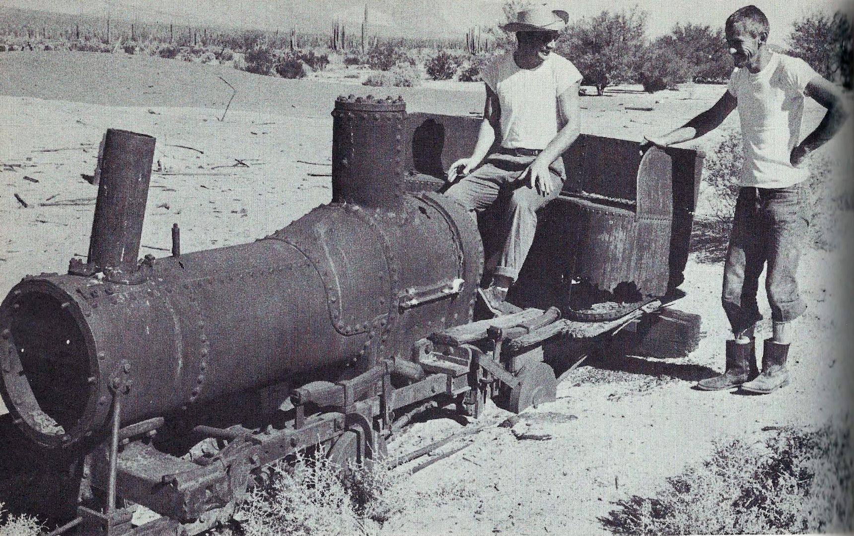
Before it was moved to town, this is how the Las Flores train engine sat, by the jail in Las Flores. I first visited it there in 1976. This photo is
from a 1963 book, Cruising the Sea of Cortez by Spencer Murray.
|
|
|
thebajarunner
Ultra Nomad
    
Posts: 3754
Registered: 9-8-2003
Location: Arizona....."Free at last from crumbling Cali
Member Is Offline
Mood: muy amable
|
|
Love that old jail
Las Flores jail in 2017:

When things get too boring in LABay we drive out there, sit in the shade and have a few cool ones.
Great place to sit in peace (or rest in peace in the nearby graves of the early settlers)
|
|
|
David K
Honored Nomad
        
Posts: 65383
Registered: 8-30-2002
Location: San Diego County
Member Is Offline
Mood: Have Baja Fever
|
|
When the wind blows, preventing water sports, L.A. Bay has so many area attractions!
On my website (www.vivabaja.com) I have links to pages with photos at some of them:
Bahia de los Angeles Area:
Tinaja de Yubay
Punta Candeleros & Remedios (Bahia Guadalupe)
El Toro Copper Mine
Camp Gecko cabin, turtle research station, & La Gringa
Bahia de los Angeles highway, Pemex, etc. '05
Bahia de los Angeles Museum
Mision San Borja
Mision San Borja (inside)
Old San Gregorio
Santa Ana, San Ignacito
Montevideo Petroglyphs
Las Tinajitas Petroglyphs
Camp Gecko '03
Las Flores
Los Paredones, La Bocana, Bahia San Rafael
Las Flores Railroad and Tramway
Rock Palm Hill (near Yubay)
Bahia las Animas
Punta La Gringa
Mysterious Ruins/ Lost Mission Site?
|
|
|
David K
Honored Nomad
        
Posts: 65383
Registered: 8-30-2002
Location: San Diego County
Member Is Offline
Mood: Have Baja Fever
|
|
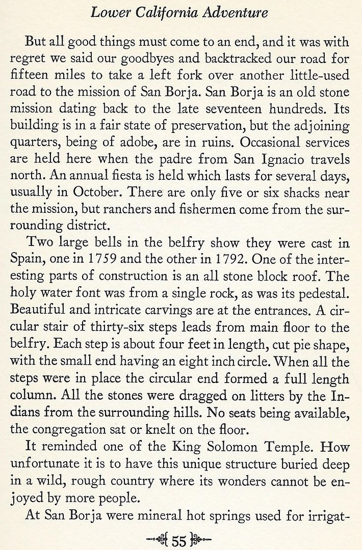
Continuing the journey...
|
|
|
David K
Honored Nomad
        
Posts: 65383
Registered: 8-30-2002
Location: San Diego County
Member Is Offline
Mood: Have Baja Fever
|
|
Continuing the journey...
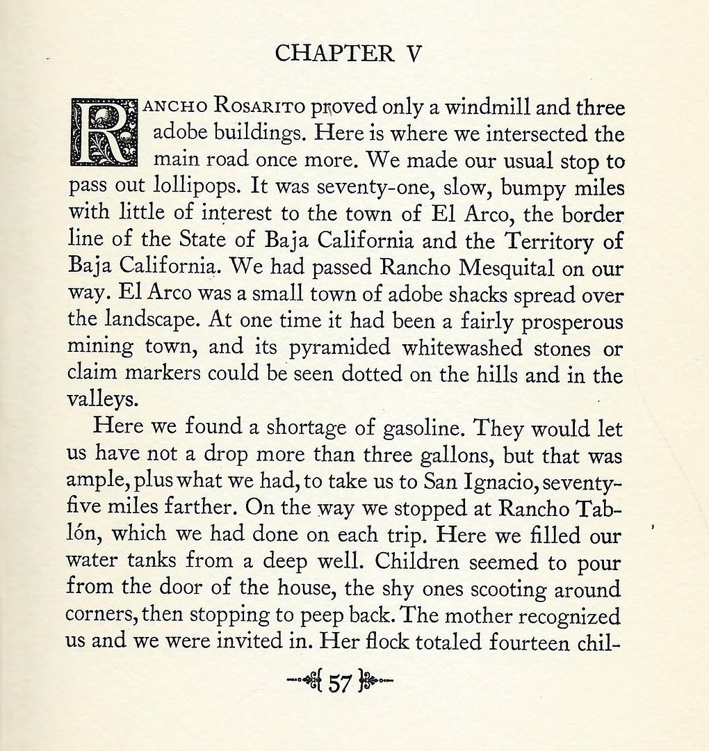
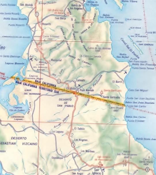
Rancho Rosarito is today's Nuevo Rosarito. Also see Rancho Mesquital, El Arco, Rancho Tablón (today is east of the city of El Vizcaíno), ranches and
villages on the original 'Highway 1'... as seen on this 1958 Shell Oil Map of Baja:
|
|
|
David K
Honored Nomad
        
Posts: 65383
Registered: 8-30-2002
Location: San Diego County
Member Is Offline
Mood: Have Baja Fever
|
|
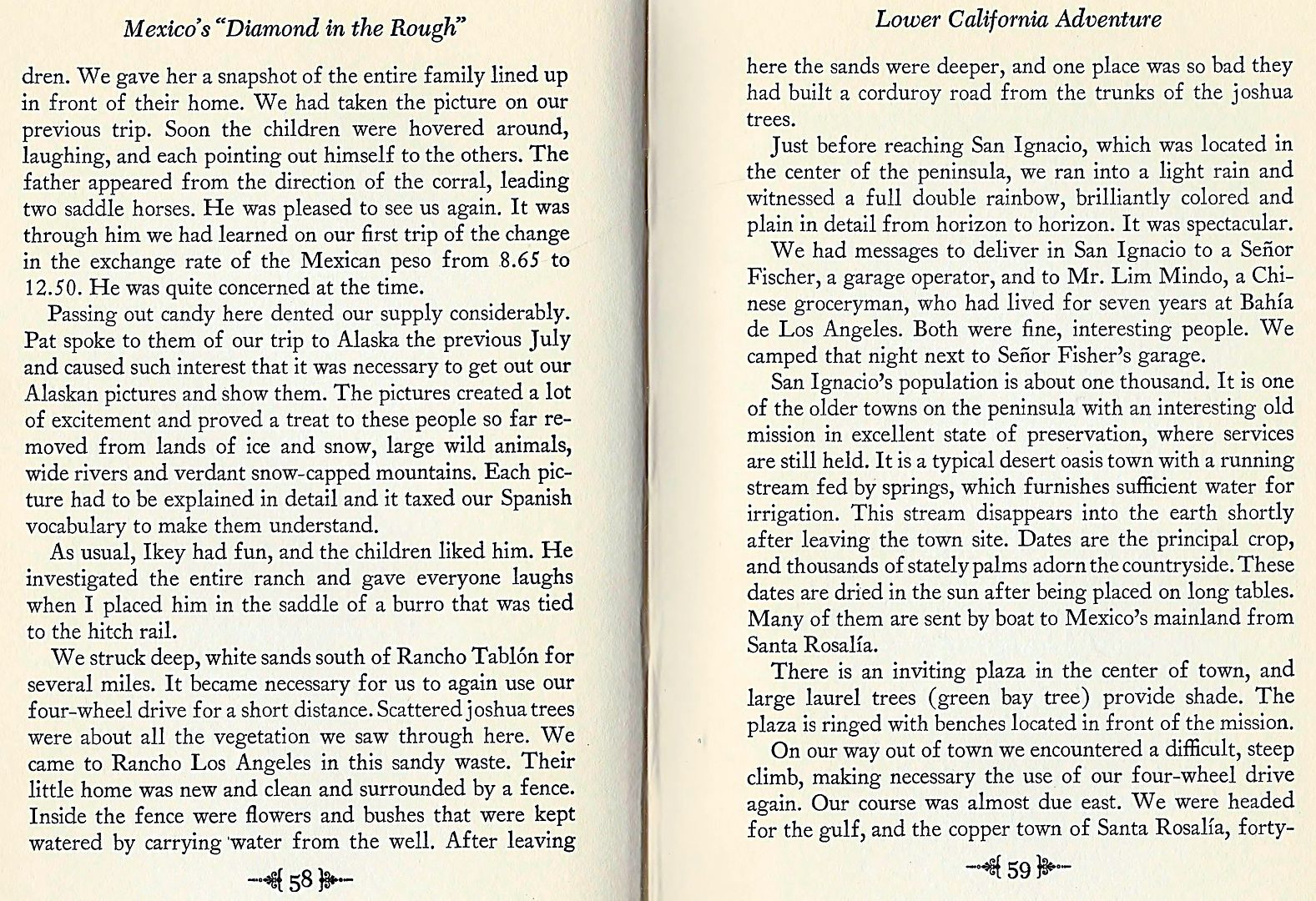
The next couple of pages really paint a great picture of what it was like to drive to San Ignacio from the north in the 1950s and 1960s:
|
|
|
David K
Honored Nomad
        
Posts: 65383
Registered: 8-30-2002
Location: San Diego County
Member Is Offline
Mood: Have Baja Fever
|
|
The great stories of driving down Baja before paved roads continue to entertain us...
|
|
|
| Pages:
1
2 |

