| Pages:
1
2
3 |
PaulW
Ultra Nomad
    
Posts: 3113
Registered: 5-21-2013
Member Is Offline
|
|
Quote: Originally posted by wolfpack  | David - is the *old road* the one that runs parallel to 5 - just a little west of highway 5?
====
I will answer
The Old Pureticitos road (I call it OPR) parallels Hwy 5 and the drive is a good way to see the desert as opposed to the drive on the pavement. Yes
the road is damaged, buy just about an off road rig or pickup can drive it with no issues. Some places will be such that you will have to negotiate
some big rocks. In the worst whoops you will find a better bypass on the side.
Do it at least once and tell your friends all about it.
From the north the road begins just south of the south PMEX and merges with Hwy 5 at ~Km51.
|
|
|
|
PaulW
Ultra Nomad
    
Posts: 3113
Registered: 5-21-2013
Member Is Offline
|
|
Quote: Originally posted by David K  | | Yes. On my map, I only show a few miles of it near the sulfur mine as it is very torn up, being used for the Baja 1000 and other races and not being
graded since 1983 when the new road was built along the coast. Not much need for it to get anywhere, anymore. Where the highway swings away from the
coast it joins the route of the old road and stays on it to Puertecitos. |
===
I am surprised you don't show the road on your map. Many of the trails we use require access from OPR. Even the when starting on Hwy 5.
Example: Trips to enter the arroyos we always use OPR, especially Amarilias, Chanate, and Huatamote. I would describe that portion from the north
and easy and can be done with any suv/pickup at speeds above 40 MPH. The part near the sulfur mine is pretty rough.
I suggest doing the drive and tell your friends all about it.
|
|
|
David K
Honored Nomad
        
Posts: 65422
Registered: 8-30-2002
Location: San Diego County
Member Is Offline
Mood: Have Baja Fever
|
|
Hi Paul, the new 2018 maps I have made are to complement the Baja Bound Road Guide I produced.
I like maps and I wanted to make my road logs even more visual so the reader can "see" where the roads I have logs for are in relation to the land and
sea, and other major roads mentioned or logged by me.
The Old Puertecitos Road (OPR) was very important to me as it was the first dirt road I traveled on in Baja... in 1965 going to Gonzaga Bay.
I traveled over it often, and later (1974+) drove it many many times from that year until 1982 when I was surprised to bump into a new graded highway
as I was driving to Shell Island from OPR. It blocked the original arroyo road and I had to find a way to get around this huge new dam!
In any case, The only place I see a need to show OPR for my readers was where I actually use a bit of it in the new guide from the Azufre Pass road to
the Sulfur Mine. It is in really bad shape now in that area.
I purposely avoided crowding the map with more details than needed for what the book had to keep it easy to use. We have the Baja Almanac, even though
it is almost 10 years old, to show more, plus I bet someone will take up the reins of making new San Felipe South off-road maps, as I used to do in
the 70s and 80s.
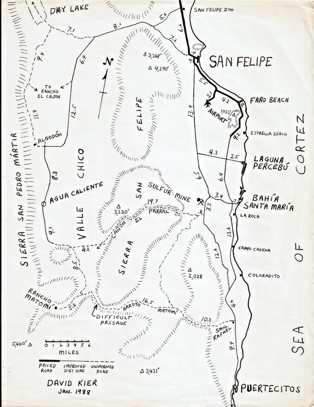
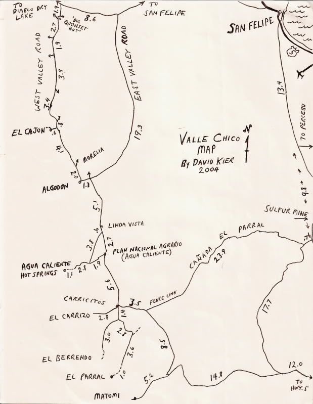
Here are some of my hand-drawn maps from age 16-47 for anyone who likes maps, as I do... It was one way I could "go back to Baja" when I was at
home... I have Mike McMahan and other Baja maps on my walls, wherever I lived... since I was 13!
1973:
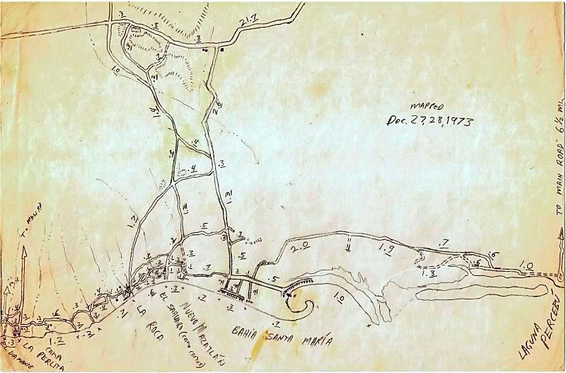
1978:
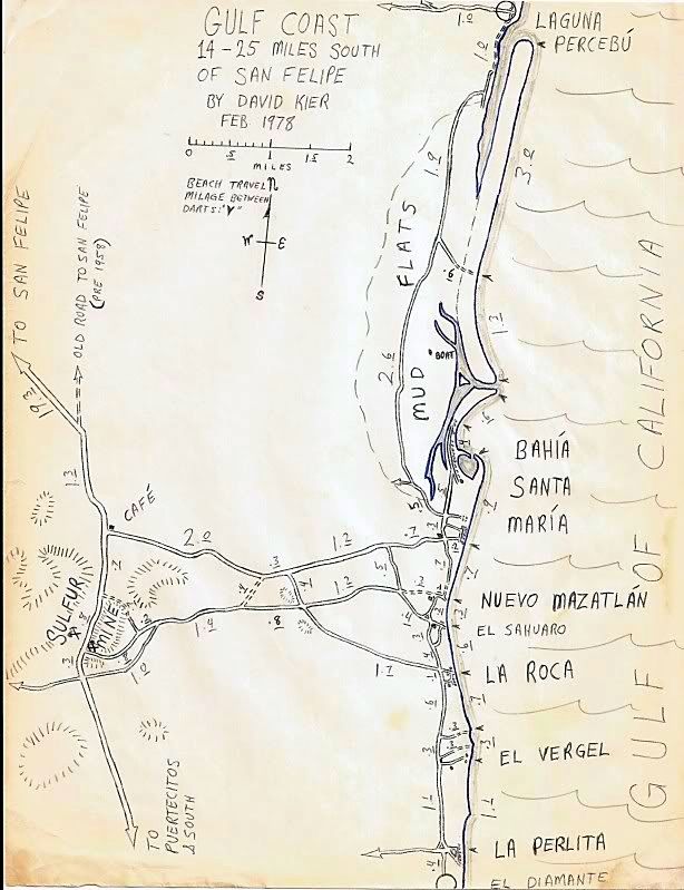
1980:
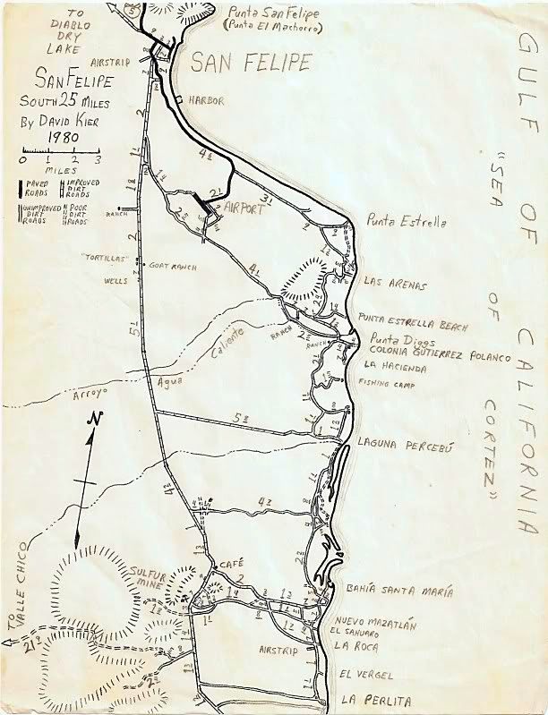
1980:
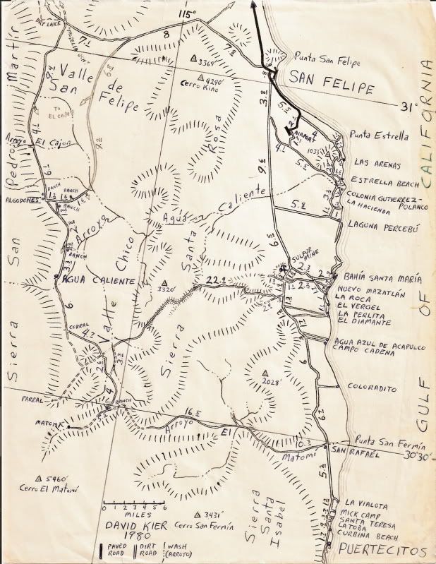
1988:
2004:
I did a lot of my mapping using a Subaru 4WD wagon! I re-opened the Azufre Pass route which was an abandoned road when I found it in 1978... and moved
a lot of rocks to get through! I called it Santa Rosa Canyon originally as some maps called the mountain, Sierra Santa Rosa. I am the one who showed
my map of it to Sal Fish and he invited me to help Score... I declined, but it wasn't long before the San Felipe 250 used it.
Here I am with my Subaru, pre-running the Baja 1000 in 1979, south of Puertecitos. I was 22...
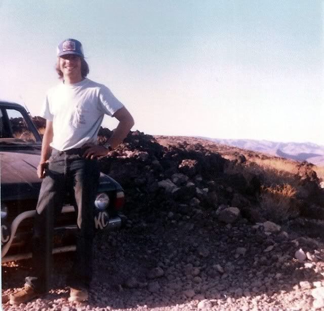
|
|
|
JZ
Select Nomad
      
Posts: 13796
Registered: 10-3-2003
Member Is Online
|
|
SF is just such a hard pass guys. Just because it's close to the border doesn't mean its any good.
|
|
|
David K
Honored Nomad
        
Posts: 65422
Registered: 8-30-2002
Location: San Diego County
Member Is Offline
Mood: Have Baja Fever
|
|
It is over 2 hours from the border, not close, and 5 hours from San Diego. It is where the big sand beaches begin and all sorts of desert and canyon
sidetrips for us with 4WD, buggies, bikes, or like camping. We don't stay in town or motels. Where we camp is the greatest and being an island, most
don't go there or like camping under the stars like we do. Sand, sea, and shells are all we need to be provided with.
|
|
|
JZ
Select Nomad
      
Posts: 13796
Registered: 10-3-2003
Member Is Online
|
|
Quote: Originally posted by David K  | | It is over 2 hours from the border, not close, and 5 hours from San Diego. It is where the big sand beaches begin and all sorts of desert and canyon
sidetrips for us with 4WD, buggies, bikes, or like camping. We don't stay in town or motels. Where we camp is the greatest and being an island, most
don't go there or like camping under the stars like we do. Sand, sea, and shells are all we need to be provided with. |
You are trying to move the goal posts now. And still failing.
A couple weeks back, I had a friend try to talk me into hanging out there over a long weekend, and exploring the desert region. I thought what the
hell, let's give it a shot. Posted a message on here asking good places to ride, to a man, everyone came back and said the riding is total chit.
Just a bunch over used tracks with endless whoops was the census.
It's the first town past the border, that's why it is quote "close." But just like Rocky Point is the junk place that most AZ folks know because it's
the closest, it's sister city SF straight across the SoC is trashy.
San Carlos, Sonora is 10x the place that Rock Point is, just like Loreto and so many spots in between are.
Especially, if you are a boater and love the ocean. Where are the islands and coves and mountains! The ocean at the top of the gulf is just plain
horrible. Even from the land it's bad with the low lying flat land and terrible tides, muddy waters.
Again, SF is the arm pit of Baja.
[Edited on 12-8-2018 by JZ]
|
|
|
David K
Honored Nomad
        
Posts: 65422
Registered: 8-30-2002
Location: San Diego County
Member Is Offline
Mood: Have Baja Fever
|
|
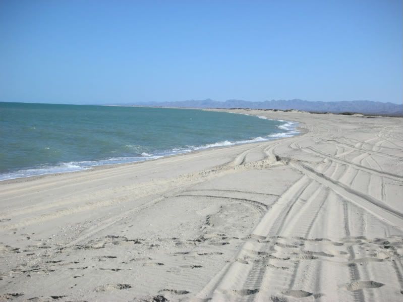
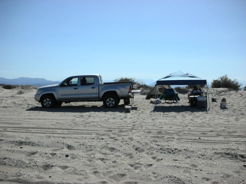
Again, you are focussing on the city of San Felipe and not the desert region beyond. I don't do cities. I can stay in the United States if I wanted to
be around crowds and have paved streets. San Felipe is where I fill my gas tank, get some fish tacos sometimes, and leave to go here...
|
|
|
JZ
Select Nomad
      
Posts: 13796
Registered: 10-3-2003
Member Is Online
|
|
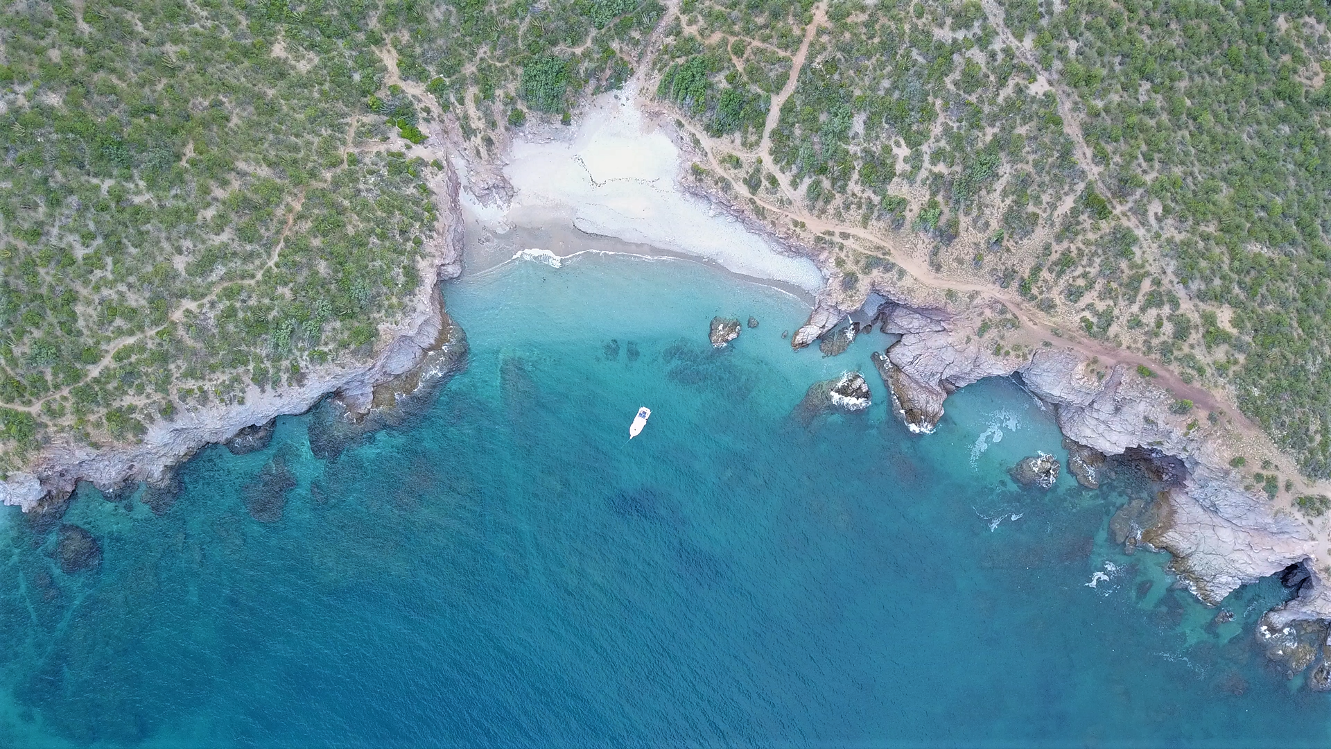
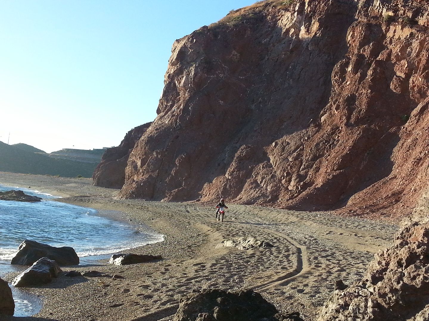
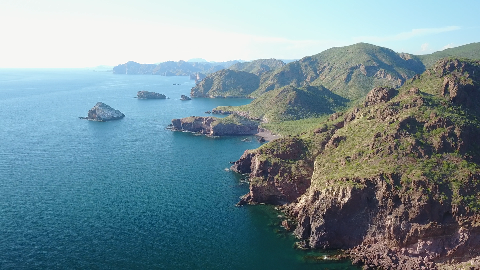
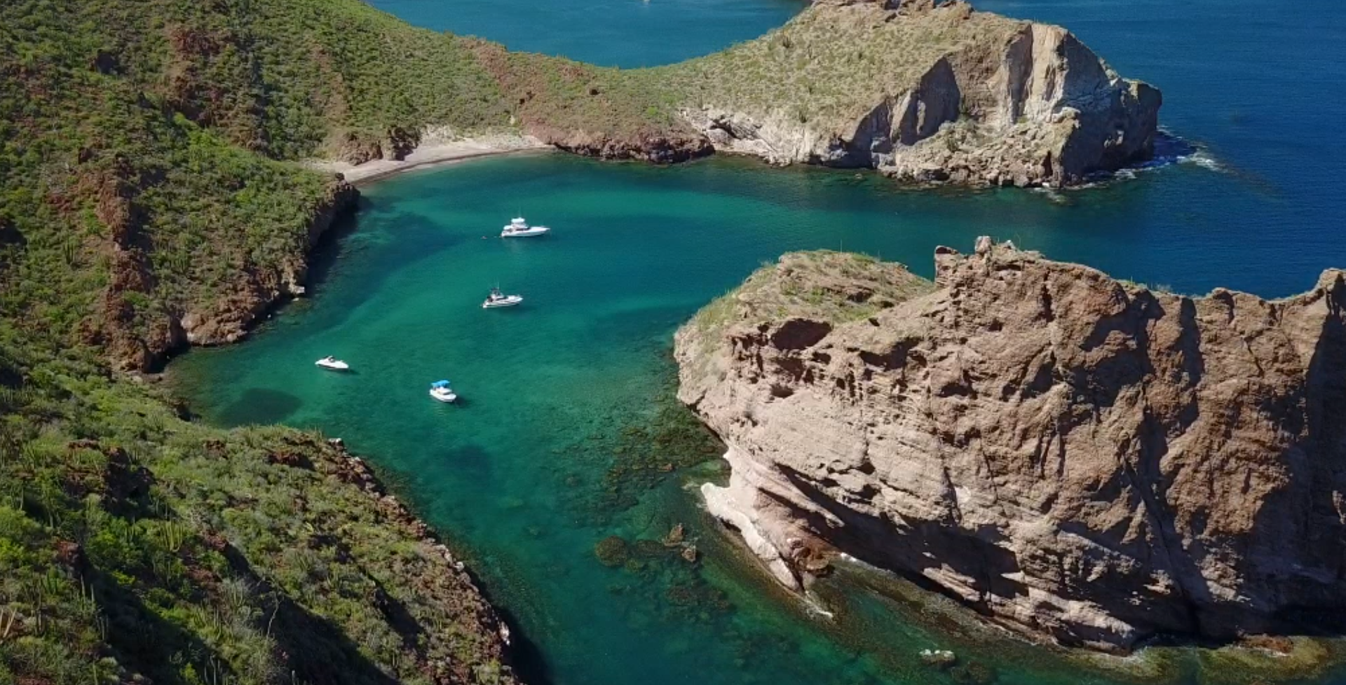
Oh, I'm not talking about the town of SF, because we all know how crappy that is, I'm talking about the desert and ocean in that area.
Just look at that flat, low lying coastline in your pic. And the tide is gonna go out a 1/4 mile in an hr or so.
SF is trash compared to this:
[Edited on 12-12-2018 by JZ]
|
|
|
TMW
Select Nomad
      
Posts: 10659
Registered: 9-1-2003
Location: Bakersfield, CA
Member Is Offline
|
|
JZ San Felipe can't compare to the beautiful coves etc you show above because there are no mountains near the water until much further south. Yes a
lot of the riding trails are screwed up due to the off road racing in the area. There are three, maybe more, off road promoters doing racing around
San Felipe, SCORE, CODE and RECORD. However the run across Diablo is not bad as is the road down the west side to Matomi. Matomi usually gets messed
up during a race but after a rain it's back to OK.
Your type of MC riding is probably not a good fit for SF but for many especially those who like to explore SF is great. For me I like the food, hotels
and margaritas, Petes Camp makes a great one. The Miramar Bar on the Malecon is a great place to hang out and visit with friends if you are of age,
probably not so good for kids. SF is also a great place to hang for racing if you are into that sort of thing. Also what can be wrong with fish tacos.
One place in SF was picked as a best in fish tacos by Discover Baja.
Taquería y Mariscos Adriana
Location: San Felipe, BC
Information: Malecón #196, tel. 011-52-686-212-7747
Why We Love It: Rumor has it that this is the taco joint that inspired the U.S. Rubio’s fish taco chain. Whether or not the rumor is true, Maria
Soledad has been running this popular taco stand for over 30 years. In addition to tacos they also serve seafood c-cktails.
DBTC Insider Tip: The cheery and casual spot on the malecón can get busy, but there are tables set up near the stand and also spilling out onto the
boardwalk.
[Edited on 12-8-2018 by TMW]
|
|
|
HeyMulegeScott
Senior Nomad
  
Posts: 717
Registered: 8-25-2009
Location: Orygone/Mulege
Member Is Offline
|
|
We have enjoyed our time in San Felipe. It's a fun little town. We even kind of like the scruffiness. Much better than a fake tourist town like Cabo
or Cancun. It would be awesome if the water was like JZ is showing in his pictures but then it wouldn't be an affordable place to visit. It's not like
Rocky Point in that the vast majority of visitors are actually Mexican unless you are hanging out in the gringo communities like El Dorado Ranch.
|
|
|
advrider
Super Nomad
   
Posts: 1920
Registered: 10-2-2015
Member Is Offline
|
|
Quote: Originally posted by Three2tango  | | We have enjoyed our time in San Felipe. It's a fun little town. We even kind of like the scruffiness. Much better than a fake tourist town like Cabo
or Cancun. It would be awesome if the water was like JZ is showing in his pictures but then it wouldn't be an affordable place to visit. It's not like
Rocky Point in that the vast majority of visitors are actually Mexican unless you are hanging out in the gringo communities like El Dorado Ranch.
|
Very well said about SF, same way the wife and I feel about it. It seems like a lot of the area is very wooped out for a bike but I would love to get
my SXS into some of the canyons to explore! Still some fun desert around the area that we have ridden on our bikes but a lot more to see. The people
are very friendly! To each his own.
|
|
|
| Pages:
1
2
3 |

