JZ
Select Nomad

Posts: 14910
Registered: 10-3-2003
Member Is Offline
|
|
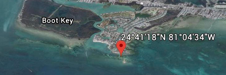
How do you enter GPS coordinates? Need some help from Baja experts.
I've always struggled with different GPS formats. And how to type them out.
See the pic below. What's the easiest way to type that location into Google Earth or another GPS app?
[Edited on 8-8-2020 by JZ]
|
|
|
JZ
Select Nomad
Posts: 14910
Registered: 10-3-2003
Member Is Offline
|
|
Well, there you go.
Much appreciated.
|
|
|
PaulW
Ultra Nomad
Posts: 3113
Registered: 5-21-2013
Member Is Offline
|
|
post a picture with coordinates
On a picture vs EG image. See if you can use an app for met data. Then use it to get the coordinates and past them into your computer image. For an
iPhone the app is called EXIF.
The coordinates are at the location of the phone not the far distance in the picture.
Here is an example where I sent the picture from my phone to the pc opened paint and pasted the coordinates.
Pic is the spring in Agua Caliente. Some think the spring is elsewhere, but here is where we found it.

|
|
|
pacificobob
Super Nomad
Posts: 2381
Registered: 4-23-2006
Member Is Offline
|
|
in the days prior to loran and gps, we called them latitude and longitude.
fun fact, boeing 747s built in the 70s had a small opening in the overhead of the c-ckpit for a sexton. although I never saw one used.
|
|
|
BajaMama
Super Nomad
Posts: 1108
Registered: 10-4-2015
Location: Pleasanton/Punta Chivato
Member Is Offline
Mood: Got Baja fever!!
|
|
I'm pretty sure my garmin and Acura gps thingies would take it exactly as the pic shows. You just have to select that format to enter.
[Edited on 8-8-2020 by BajaMama]
|
|
|
David K
Honored Nomad
Posts: 65586
Registered: 8-30-2002
Location: San Diego County
Member Is Offline
Mood: Have Baja Fever
|
|
Some GPS 101...
If you want to show the degree symbol, hold down the Alt key and enter the three numbers: 2 4 8 to get ° or in other words Alt+248 = °
The longitude (in this hemisphere) is either expressed as being west with a W or with a negative sign -.
So, if you were near Santo Tomás, you might be at
31°33.38', -116°24.34' or it could be written as
N31°33.38', W116°24.34'
This format is called Decimal Minutes.
Another format is called Decimal Seconds:
27°17'02.2", -112°53'56.1"
You can either use the - sign or the letter W for west longitude. North latitude is either expressed by an N or with nothing, as above.
Decimal degrees looks like: 27.28394°, -112.8989°
Google Earth accepts all formats, but if you forget the negative sign or W, it will put you in Asia instead of Baja!
|
|
|
David K
Honored Nomad
Posts: 65586
Registered: 8-30-2002
Location: San Diego County
Member Is Offline
Mood: Have Baja Fever
|
|
Quote: Originally posted by PaulW  | On a picture vs EG image. See if you can use an app for met data. Then use it to get the coordinates and past them into your computer image. For an
iPhone the app is called EXIF.
The coordinates are at the location of the phone not the far distance in the picture.
Here is an example where I sent the picture from my phone to the pc opened paint and pasted the coordinates.
Pic is the spring in Agua Caliente. Some think the spring is elsewhere, but here is where we found it.
|
I don't see any steam in that photo? If that was hot water, where was the cool stream in distance away?
The hot spring in 2004 and 2000 was on the west bank bench and flowed down to the arroyo floor (where someone had built a soaking tub lined with
rocks) and then a hot stream flowed down the arroyo floor parallel to the cool mountain stream, which was about 50 feet away, in the middle of the
canyon floor.
I was not doubting you found another spring. I was only correcting where you were placing my location of the hot spring on your aerial maps. The
location that I photographed those two trips.
|
|
|
BajaNomad
|
Thread Moved
8-8-2020 at 12:17 PM |
Alan
Super Nomad
Posts: 1631
Registered: 4-6-2005
Location: Yucaipa, CA/La Paz
Member Is Offline
|
|
| Quote: Originally posted by pacificobob | in the days prior to loran and gps, we called them latitude and longitude.
fun fact, boeing 747s built in the 70s had a small opening in the overhead of the c-ckpit for a sexton. although I never saw one used.
|
I used to fly on P-3's. When we went to Diego Garcia in the early 70's there were no Loran stations in that
area. The navigator stood on his chair and used the sextant through a port in the ceiling to shoot sun lines. When he got us close I fired up my
radar to bring us in. 
In Memory of E-57
|
|
|
PaulW
Ultra Nomad
Posts: 3113
Registered: 5-21-2013
Member Is Offline
|
|
Spring
Luke warm Nice to walk in ankle deep water. Flow was minimal. Avoiding the rocks was an issue for driving. To be exact the water was coming from the
tall bushes (in the pic look left), but that area was not where we wanted to drive and looked even more difficult.
If you want to locate the water source I suggest you drive there and park and wade thru the bushes. Your truck might be able to drive that far.
Following the road requires going up and down a steep drainage bank.
I would suggest parking before the place in the pic to make it easier to turn around.
| Quote: Originally posted by David K | | Quote: Originally posted by PaulW | On a picture vs EG image. See if you can use an app for met data. Then use it to get the coordinates and past them into your computer image. For an
iPhone the app is called EXIF.
The coordinates are at the location of the phone not the far distance in the picture.
Here is an example where I sent the picture from my phone to the pc opened paint and pasted the coordinates.
Pic is the spring in Agua Caliente. Some think the spring is elsewhere, but here is where we found it.
|
I don't see any steam in that photo? If that was hot water, where was the cool stream in distance away?
The hot spring in 2004 and 2000 was on the west bank bench and flowed down to the arroyo floor (where someone had built a soaking tub lined with
rocks) and then a hot stream flowed down the arroyo floor parallel to the cool mountain stream, which was about 50 feet away, in the middle of the
canyon floor.
I was not doubting you found another spring. I was only correcting where you were placing my location of the hot spring on your aerial maps. The
location that I photographed those two trips. |
|
|
|


