David K
Honored Nomad
        
Posts: 65361
Registered: 8-30-2002
Location: San Diego County
Member Is Offline
Mood: Have Baja Fever
|
|
Here I am, but just where, exactly? Good Job Nomads!
1: (answered by geoffff: Km. 105 south of San Quintín): 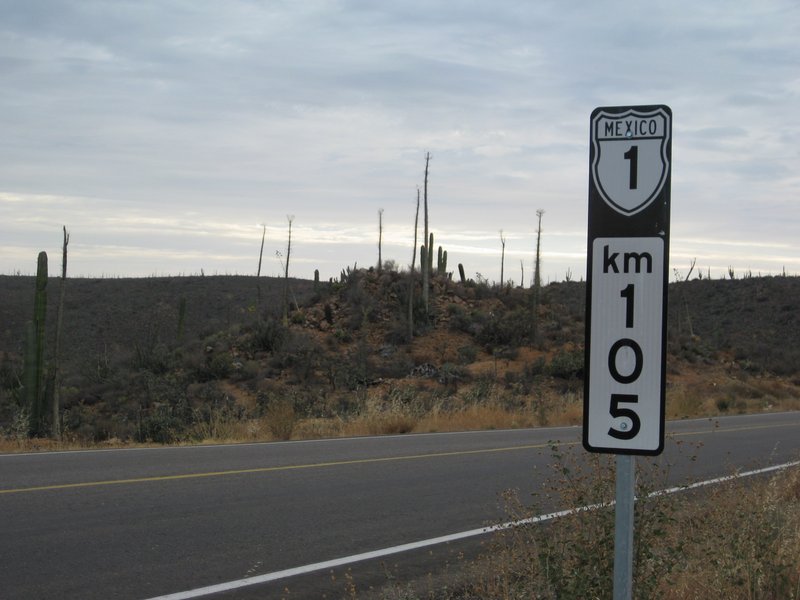
Making this a Guess Where in Baja is a bit silly, right? There are many places with the same kilometer markers, as there are different highways or in
the case of Highway 1, about 8 separate kilometer sections. Also, just because it says Mexico #1, doesn't make it so! LOL
2: (answered by advrider: Observatory Road) 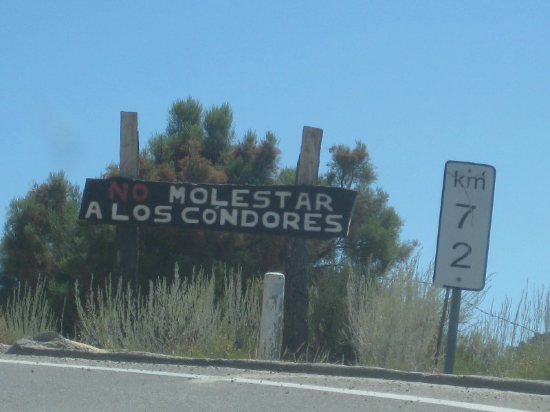
3: (answered by geoffff: just south of Bahía Concepción, 71 kms north of Loreto)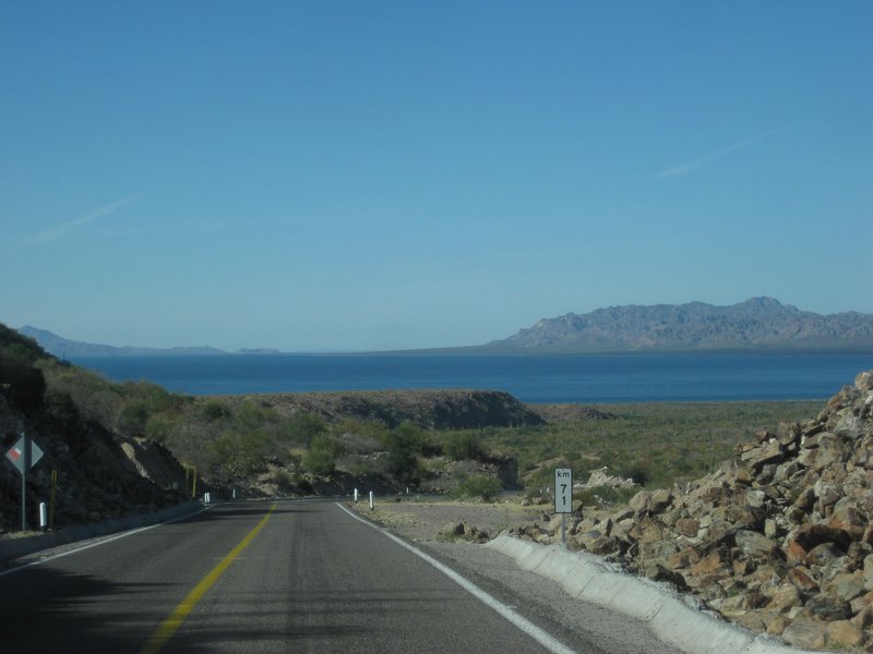
4: (answered by RnR: L.A. Bay junction/ Parador Punta Prieta) 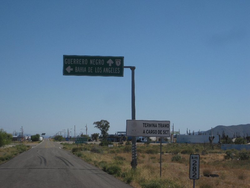
5: (answered by RnR: San Quintín area) 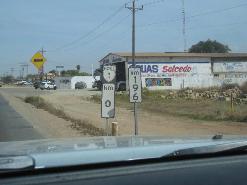
6: (answered by TMW: Los Martires/ San Juan de Dios access road)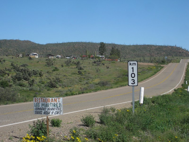
7: (answered by RnR: El Rosario) 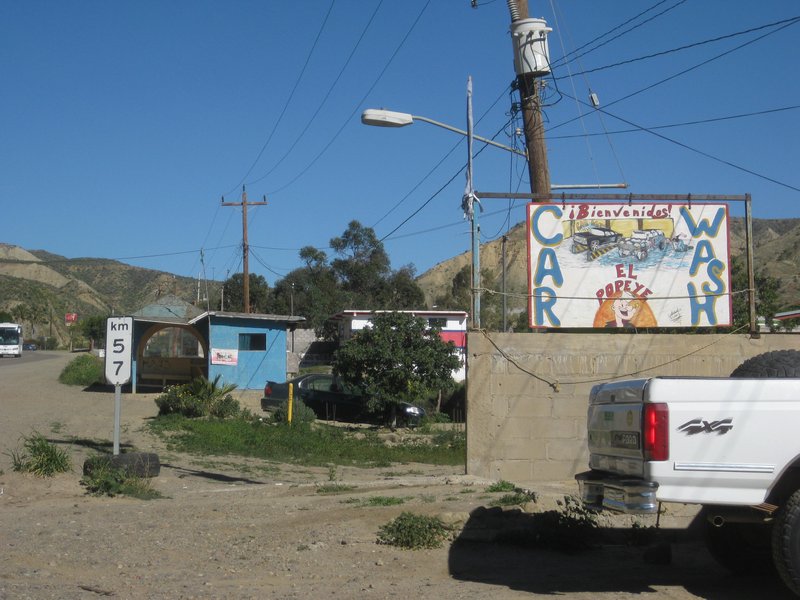
8: (answered by geoffff: Bahía Tortugas road at Bahía Asunción junction): 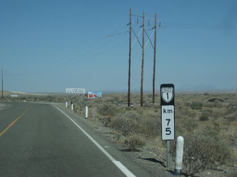
9 (answered by geoffff: Km. 5 north of San Juanico): 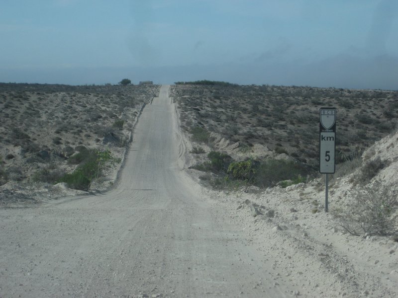
10: (answered by RnR: North from La Paz) 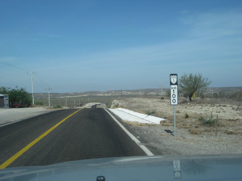
[Edited on 5-6-2021 by David K]
|
|
|
advrider
Super Nomad
   
Posts: 1916
Registered: 10-2-2015
Member Is Offline
|
|
#2 on the way to the observatory. #3 headed into BOLA past the pull out over look. .
|
|
|
David K
Honored Nomad
        
Posts: 65361
Registered: 8-30-2002
Location: San Diego County
Member Is Offline
Mood: Have Baja Fever
|
|
#2 Correct
#3 Not correct, try again!
|
|
|
RnR
Senior Nomad
  
Posts: 839
Registered: 5-1-2010
Member Is Offline
|
|
#4 - LA Bay junction heading south.
#5 - just south of San Quintin heading north. (Actually Lazaro Card##as.
Jardines is at KM 3 just south of here) Federal Police office in background.
#7 - El Rosario heading north.
#10 - El Cien heading north.
[Edited on 5-5-2021 by RnR]
|
|
|
David K
Honored Nomad
        
Posts: 65361
Registered: 8-30-2002
Location: San Diego County
Member Is Offline
Mood: Have Baja Fever
|
|
Quote: Originally posted by RnR  | #4 - LA Bay junction heading south.
#5 - just south of San Quintin heading north. (Actually Lazaro Car de nas.
Jardines is at KM 3 just south of here) Federal Police office in background.
#7 - El Rosario heading north.
#10 - El Cien heading north.
|
100% Correct!
El Cien (The 100) is northbound from La Paz, 92 kilometers from the Dove of Peace or Whale Tail monument (which is at Km. 8).
|
|
|
BajaBlanca
Select Nomad
      
Posts: 13241
Registered: 10-28-2008
Location: La Bocana, BCS
Member Is Offline
|
|
Boy, you guys are good guessers!
|
|
|
David K
Honored Nomad
        
Posts: 65361
Registered: 8-30-2002
Location: San Diego County
Member Is Offline
Mood: Have Baja Fever
|
|
These are all major roads in Baja... Everyone here should know! 
Time for hints, yet?
|
|
|
TMW
Select Nomad
      
Posts: 10659
Registered: 9-1-2003
Location: Bakersfield, CA
Member Is Offline
|
|
#6 is the turn off to R. Los Martires, El Sauzalito and points north. Often used by SCORE as part of the Baja 1000 race.
|
|
|
TMW
Select Nomad
      
Posts: 10659
Registered: 9-1-2003
Location: Bakersfield, CA
Member Is Offline
|
|
#3 coming back from Mission San Javier looking toward Loreto.
|
|
|
David K
Honored Nomad
        
Posts: 65361
Registered: 8-30-2002
Location: San Diego County
Member Is Offline
Mood: Have Baja Fever
|
|
Quote: Originally posted by TMW  | | #6 is the turn off to R. Los Martires, El Sauzalito and points north. Often used by SCORE as part of the Baja 1000 race. |
Yes! San Juan de Dios mission visita site is also reached from here (now called Rancho Las Palmas)
|
|
|
David K
Honored Nomad
        
Posts: 65361
Registered: 8-30-2002
Location: San Diego County
Member Is Offline
Mood: Have Baja Fever
|
|
Sorry, no... note the kilometer marker for distance from Loreto (hint).
|
|
|
David K
Honored Nomad
        
Posts: 65361
Registered: 8-30-2002
Location: San Diego County
Member Is Offline
Mood: Have Baja Fever
|
|
OK, hints:
#1 NOT in Baja Sur, 105 kms from a bay with an old mill.
#3 NOT in Baja Norte, driving north from the first successful mission.
#8 NOT on Highway 1. At a junction of paved roads to fishing towns.
#9 A popular surf 'bay' with a name that 'stings' is 3 miles away.
     
|
|
|
geoffff
Senior Nomad
  
Posts: 710
Registered: 1-15-2009
Member Is Offline
|
|
| Quote: | | #9 A popular surf 'bay' with a name that 'stings' is 3 miles away. |
Well, with a clue like that  5 km north of San Juanico, about here:
26.3084,-112.4896 5 km north of San Juanico, about here:
26.3084,-112.4896
|
|
|
geoffff
Senior Nomad
  
Posts: 710
Registered: 1-15-2009
Member Is Offline
|
|
#8: Maybe: on the Bahia de Tortugas road 75 km west of Vizcaino (looking east) GPS:27.4321,-114.0695
[Edited on 5-6-2021 by geoffff]
|
|
|
geoffff
Senior Nomad
  
Posts: 710
Registered: 1-15-2009
Member Is Offline
|
|
#3: Too easy with clues  Hwy 1, looking north, just south of Bahia Concepcion
26.5160,-111.7036 https://www.google.com/maps/@26.516015,-111.7036504,3a,75y,3... Hwy 1, looking north, just south of Bahia Concepcion
26.5160,-111.7036 https://www.google.com/maps/@26.516015,-111.7036504,3a,75y,3...
|
|
|
geoffff
Senior Nomad
  
Posts: 710
Registered: 1-15-2009
Member Is Offline
|
|
#1: OK, a wild guess: somewhere on the new Ensenada bypass road north of Ensenada?
|
|
|
geoffff
Senior Nomad
  
Posts: 710
Registered: 1-15-2009
Member Is Offline
|
|
In Baja all highways get to be #1
|
|
|
David K
Honored Nomad
        
Posts: 65361
Registered: 8-30-2002
Location: San Diego County
Member Is Offline
Mood: Have Baja Fever
|
|
geoffff, you answered the remaining photos all correctly!
del mar, I don't know what 'emergency beacons' you are seeing?
Game over!
Results:
geoffff: 4
RnR: 4
advrider: 1
TMW: 1
|
|
|
del mar
Banned
Posts: 1057
Registered: 7-23-2016
Location: the cantina of course
Member Is Offline
Mood: lil' fuzzy
|
|
Quote: Originally posted by David K  | geoffff, you answered the remaining photos all correctly!
del mar, I don't know what 'emergency beacons' you are seeing?
Game over!
Results:
geoffff: 4
RnR: 4
advrider: 1
TMW: 1 |
"emergency beacons" ended up on the wrong "where am I" post, should have been on geofff's.
|
|
|
David K
Honored Nomad
        
Posts: 65361
Registered: 8-30-2002
Location: San Diego County
Member Is Offline
Mood: Have Baja Fever
|
|

|
|
|

