elfbrewery
Nomad
 
Posts: 349
Registered: 12-25-2006
Member Is Offline
|
|
Bahia Concepcion Peninsula road
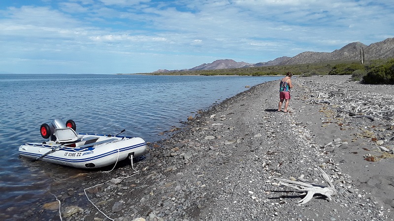
Anyone been out driving along the peninsula this year (2022)? I would like to take some friends to explore.
Thanks!
|
|
|
David K
Honored Nomad
        
Posts: 65435
Registered: 8-30-2002
Location: San Diego County
Member Is Offline
Mood: Have Baja Fever
|
|
Until you get an answer for 2022, enjoy the trip report by 'geoffff' from 2019. Here is his web page for that road: https://octopup.org/baja2019/bahia-concepcion
I went out there in 2016... a hurricane made getting to the end impossible, we were cut off about 8 miles from the tip, as I recall...
https://vivabaja.com/p916/
|
|
|
elfbrewery
Nomad
 
Posts: 349
Registered: 12-25-2006
Member Is Offline
|
|
Thanks. We have also explored the peninsula in the past, but not since we lost the jeep in 2016. Some friends have biked parts of it as well, but
again, no recent info and we know it changes from season to season. Having no big storm in 2021 makes me want to assume it should be fine, but we know
how that goes...
Cheers!
|
|
|
Bob and Susan
Elite Nomad
     
Posts: 8813
Registered: 8-20-2003
Location: Mulege BCS on the BAY
Member Is Offline
Mood: Full Time Residents
|
|
there is no road...
and
you need permission to cross properties at the end of the bay...
dont assume its public land...its not
|
|
|
elfbrewery
Nomad
 
Posts: 349
Registered: 12-25-2006
Member Is Offline
|
|
Well, there is no proper road, just a 4wd track. But is that in good enough condition to get to Punta Amolares - N 26°42.919 W 111°48.657?
Thanks!
|
|
|
David K
Honored Nomad
        
Posts: 65435
Registered: 8-30-2002
Location: San Diego County
Member Is Offline
Mood: Have Baja Fever
|
|
LOL, ok Bob... but even the Auto Club put it on their map and it also part of the well-published 'Baja Divide Trail,' as shown in the new 2021 Baja
California Road & Recreation Atlas! 
|
|
|
Bob and Susan
Elite Nomad
     
Posts: 8813
Registered: 8-20-2003
Location: Mulege BCS on the BAY
Member Is Offline
Mood: Full Time Residents
|
|
again...its not public property...you need permission to pass
|
|
|
David K
Honored Nomad
        
Posts: 65435
Registered: 8-30-2002
Location: San Diego County
Member Is Offline
Mood: Have Baja Fever
|
|
I think most of Baja is private or ejido property. The peninsula is crisscrossed by roads... most were there before many were born. I saw no keep out
or private property signs or locked gates on most roads. In fact, when I come upon a ranch out in the boonies, I am greeting with hospitality. Of
course, I am not in a Razor making clouds of dust or scaring livestock!!
|
|
|
geoffff
Senior Nomad
  
Posts: 710
Registered: 1-15-2009
Member Is Offline
|
|
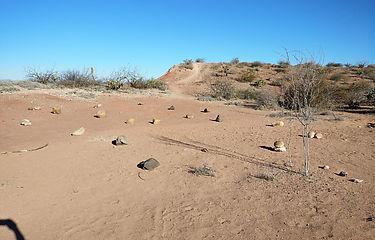
When I drove the road in 2019, there were some rocks blocking the very end of the road at GPS:26.868,-111.8429 which implied I shouldn't go the last
little bit to Punta los Hornitos. I stopped there. But otherwise, I could explore everything by road, including the Galivan Manganese mine.

|
|
|
paranewbi
Senior Nomad
  
Posts: 913
Registered: 4-15-2011
Location: San diego
Member Is Offline
|
|
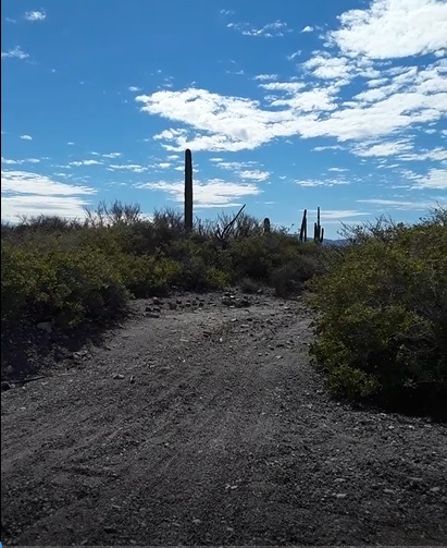
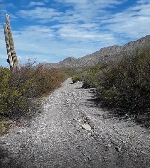
January/February 2022
Looking south then north at road
  
|
|
|
David K
Honored Nomad
        
Posts: 65435
Registered: 8-30-2002
Location: San Diego County
Member Is Offline
Mood: Have Baja Fever
|
|
If you want to scratch your car, then this is the road for you! Drove it in 2016 and never again! LOL. See the Concepción peninsula driving part,
minute 2:00-2:45 https://youtu.be/eM4NlmqPi8U
|
|
|
geoffff
Senior Nomad
  
Posts: 710
Registered: 1-15-2009
Member Is Offline
|
|
Yah, get your first scratches somewhere, then come here for more.

[Edited on 4-6-2022 by geoffff]
|
|
|
MulegeAL
Nomad
 
Posts: 299
Registered: 8-25-2009
Location: PDX/Mulege
Member Is Offline
|
|
Quote: Originally posted by geoffff  | | When I drove the road in 2019, there were some rocks blocking the very end of the road at GPS:26.868,-111.8429 which implied I shouldn't go the last
little bit to Punta los Hornitos. I stopped there. But otherwise, I could explore everything by road, including the Galivan Manganese mine.
|
Geoff, hi.
My experience with those rocks is they get used to hold down kayaker tents there, kayakers camp at that spot frequently.
|
|
|
geoffff
Senior Nomad
  
Posts: 710
Registered: 1-15-2009
Member Is Offline
|
|
Quote: Originally posted by MulegeAL  | Quote: Originally posted by geoffff  | | When I drove the road in 2019, there were some rocks blocking the very end of the road at GPS:26.868,-111.8429 which implied I shouldn't go the last
little bit to Punta los Hornitos. I stopped there. But otherwise, I could explore everything by road, including the Galivan Manganese mine.
|
Geoff, hi.
My experience with those rocks is they get used to hold down kayaker tents there, kayakers camp at that spot frequently. |
Oh! Thank you MulegeAL. Maybe I totally misread the situation.  That does
explain why they were so spread out, not organized into a line. That does
explain why they were so spread out, not organized into a line.
[Edited on 4-7-2022 by geoffff]
|
|
|
HeyMulegeScott
Senior Nomad
  
Posts: 717
Registered: 8-25-2009
Location: Orygone/Mulege
Member Is Offline
|
|
Our friends did it last year in their Jeeps. They said to expect some scratches from the bushes. https://youtu.be/2G88PAFQPfw
|
|
|
elfbrewery
Nomad
 
Posts: 349
Registered: 12-25-2006
Member Is Offline
|
|
I just learned that a group of RZRs made it to the mine recently.
|
|
|
David K
Honored Nomad
        
Posts: 65435
Registered: 8-30-2002
Location: San Diego County
Member Is Offline
Mood: Have Baja Fever
|
|
Per Bob & Susan: I wonder how many got permission from the landowners???
How would anyone be able to even do such a thing?
Are they all on the Internet and read emails daily?
Wouldn't a no trespassing sign or locked gate be a better way if they wanted no visitors on that long dirt road?
|
|
|
4x4abc
Ultra Nomad
    
Posts: 4454
Registered: 4-24-2009
Location: La Paz, BCS
Member Is Offline
Mood: happy - always
|
|
like in the US
you may own property the size of New York
but if a public road has been going through for the last 100 years, you might not be able to lock the public out
problem in Mexico is that it takes much longer to formalize the process of what is private and what has to stay public
Harald Pietschmann
|
|
|
mtgoat666
Platinum Nomad
       
Posts: 20555
Registered: 9-16-2006
Location: San Diego
Member Is Online
Mood: Hot n spicy
|
|
Quote: Originally posted by MulegeAL  | Quote: Originally posted by geoffff  | | When I drove the road in 2019, there were some rocks blocking the very end of the road at GPS:26.868,-111.8429 which implied I shouldn't go the last
little bit to Punta los Hornitos. I stopped there. But otherwise, I could explore everything by road, including the Galivan Manganese mine.
|
Geoff, hi.
My experience with those rocks is they get used to hold down kayaker tents there, kayakers camp at that spot frequently. |
Maybe tent stakes. Maybe a tripping-hazard-booby-trap. Is this an american kayak outfitter that can be written up for osha violations?
Woke!
Hands off!
“Por el bien de todos, primero los pobres.”
“...ask not what your country can do for you – ask what you can do for your country.” “My fellow citizens of the world: ask not what America
will do for you, but what together we can do for the freedom of man.”
Pronoun: the royal we
|
|
|
elfbrewery
Nomad
 
Posts: 349
Registered: 12-25-2006
Member Is Offline
|
|
It is probably NOLS. They kayak the peninsula.
|
|
|

