| Pages:
1
..
11
12
13 |
4x4abc
Ultra Nomad
    
Posts: 4454
Registered: 4-24-2009
Location: La Paz, BCS
Member Is Offline
Mood: happy - always
|
|
does anyone have an idea what the airstrip at 29°32'29.85"N, 114°27'23.47"W was/is all about?
Harald Pietschmann
|
|
|
Fernweh
Nomad
 
Posts: 444
Registered: 2-24-2011
Location: Centenario, BCS
Member Is Offline
|
|
Still on Google Earth over there?
|
|
|
David K
Honored Nomad
        
Posts: 65433
Registered: 8-30-2002
Location: San Diego County
Member Is Offline
Mood: Have Baja Fever
|
|
Looks like one of the many runways around central Baja. They are used until the army ditches them.
|
|
|
TMW
Select Nomad
      
Posts: 10659
Registered: 9-1-2003
Location: Bakersfield, CA
Member Is Offline
|
|
It's not listed in my 1969 Airports of Baja California by Arnold Senterfitt. I think it may have been built for use when the hwy was paved or used by
the mine owner/operators. If they would build a road up the mountain they wouldn't have any problem building an airstrip.
|
|
|
PaulW
Ultra Nomad
    
Posts: 3113
Registered: 5-21-2013
Member Is Offline
|
|
Quote: Originally posted by David K  | | Thanks Paul. It is sad that paved roads destroy so much of what once was. The other barrier is the fence they add on both sides with no openings for
existing roads. They eventually get opened as we have seen north of San Felipe. |
= =
Bring your wire cutters which will be needed pretty soon. The fence does not extend to that place yet.
|
|
|
David K
Honored Nomad
        
Posts: 65433
Registered: 8-30-2002
Location: San Diego County
Member Is Offline
Mood: Have Baja Fever
|
|
Quote: Originally posted by TMW  | | It's not listed in my 1969 Airports of Baja California by Arnold Senterfitt. I think it may have been built for use when the hwy was paved or used by
the mine owner/operators. If they would build a road up the mountain they wouldn't have any problem building an airstrip. |
It's actually a new strip... wasn't there that long ago. There are a few north of El Marmol and Agua Dulce, as well... They have to do with
"agricultural product distribution", LOL.
|
|
|
Debra
Super Nomad
   
Posts: 2101
Registered: 10-31-2002
Location: Port Orchard Wa./Bahia de Los Angeles BC
Member Is Offline
|
|
Hey David would it be okay if an old lady with a really old 4Runner tagged along?
Mean people suck!
|
|
|
David K
Honored Nomad
        
Posts: 65433
Registered: 8-30-2002
Location: San Diego County
Member Is Offline
Mood: Have Baja Fever
|
|
Hi Debra, traveled where? You know Baja as well as anyone here!
I just got home from spending a few days with Sarah (now 25) and Savannah (now 5)! They are great... Big difference from when she was 11 on our Baja
trips in the van!
|
|
|
steekers
Nomad
 
Posts: 257
Registered: 12-4-2007
Member Is Offline
|
|
Quote: Originally posted by David K  | | Thanks Paul. It is sad that paved roads destroy so much of what once was. The other barrier is the fence they add on both sides with no openings for
existing roads. They eventually get openened as we have seen north of San Felipe. |
I guess my friend and I need to do this route by motorcycle before it gets trashed by the 4-wheeler crowd. I kind of like that the paved road covers
up the entrance. Sorry for sounding too selfish. I used to make the run from Puertecitos to Gonzaga on the old rocky road and loved the minimal
traffic.
|
|
|
TMW
Select Nomad
      
Posts: 10659
Registered: 9-1-2003
Location: Bakersfield, CA
Member Is Offline
|
|
When Roy and I did the NWT in early Dec. we stopped at the bridge that crosses the arroyo and road that went back to the mine. It's still accessible
now but when the Hwy is finished they will have a fence up blocking access.
|
|
|
steekers
Nomad
 
Posts: 257
Registered: 12-4-2007
Member Is Offline
|
|
Quote: Originally posted by TMW  | | When Roy and I did the NWT in early Dec. we stopped at the bridge that crosses the arroyo and road that went back to the mine. It's still accessible
now but when the Hwy is finished they will have a fence up blocking access. |
Thanks TMW...got any pics of that bridge overpass?
|
|
|
Ken Cooke
Elite Nomad
     
Posts: 8970
Registered: 2-9-2004
Location: Riverside, CA
Member Is Offline
Mood: Pole Line Road postponed due to injury
|
|
Why would they do that 
|
|
|
4x4abc
Ultra Nomad
    
Posts: 4454
Registered: 4-24-2009
Location: La Paz, BCS
Member Is Offline
Mood: happy - always
|
|
Mexico copies everything the US does. So there has to be a fence long the freeway. whether you need it or not.
Agricultural inspection between Nevada and California? OK, we get the idea.
Agricultural inspection between Baja California and Baja California Sur (in Guerrerro Negro)? Well.....
Harald Pietschmann
|
|
|
TMW
Select Nomad
      
Posts: 10659
Registered: 9-1-2003
Location: Bakersfield, CA
Member Is Offline
|
|
In many places the fence has been cut for access. Whether it is by the officials or individuals I don't know, maybe both
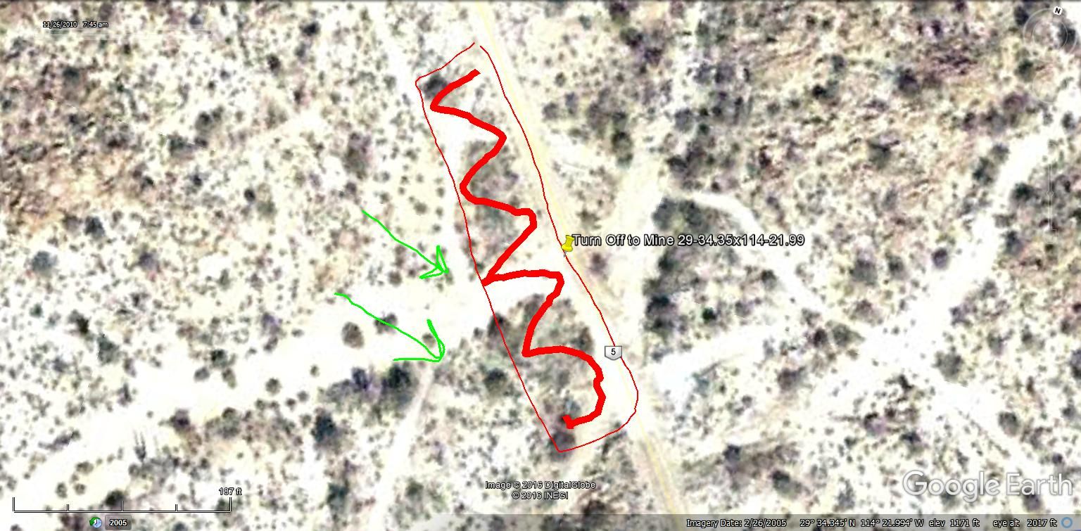
Here is a GE image I drew to show where the bridge is. When we were there access was from the northwest side of the bridge, top green arrow. I assume
that will be blocked off.
May have to get off the new Hwy and get on the old road and go under the bridge to the bottom green arrow.

[Edited on 1-3-2017 by TMW]
|
|
|
David K
Honored Nomad
        
Posts: 65433
Registered: 8-30-2002
Location: San Diego County
Member Is Offline
Mood: Have Baja Fever
|
|
Tom, what are we looking at here?
|
|
|
TMW
Select Nomad
      
Posts: 10659
Registered: 9-1-2003
Location: Bakersfield, CA
Member Is Offline
|
|
The outline in red and the pin is where a new bridge is over the wash where the turn off is to the La Turquesa mine north of Cocos. When Roy and I
were down in Dec. we stopped at the bridge at that time there was a road from the northwest end of the bridge down into the wash and to the road to
the mine. I'm sure there will be a fence up when the hwy is paved.
|
|
|
PaulW
Ultra Nomad
    
Posts: 3113
Registered: 5-21-2013
Member Is Offline
|
|
Quote: Originally posted by TMW  | | The outline in red and the pin is where a new bridge is over the wash where the turn off is to the La Turquesa mine north of Cocos. When Roy and I
were down in Dec. we stopped at the bridge at that time there was a road from the northwest end of the bridge down into the wash and to the road to
the mine. I'm sure there will be a fence up when the hwy is paved. |
======
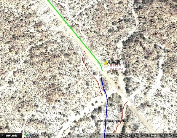
My track is Green and Blue
Other possibilities depending on the bridge ends are shown in red

|
|
|
David K
Honored Nomad
        
Posts: 65433
Registered: 8-30-2002
Location: San Diego County
Member Is Offline
Mood: Have Baja Fever
|
|
Debra came up in another thread, regarding David Eidell, whom she was quite angry at for his habit using people or using women for favors.
The creator of this thread Roy, The Squarecircle, a fun-loving Desert exploring Nomad, has been in really poor shape in recent months. TW (TMW) and I
visited with him this past Thursday. Doug (BajaNomad) has visited him a few months ago before Roy became ill and unable to walk.
|
|
|
| Pages:
1
..
11
12
13 |

