| Pages:
1
2 |
towntaco
Junior Nomad

Posts: 76
Registered: 1-14-2018
Member Is Offline
|
|
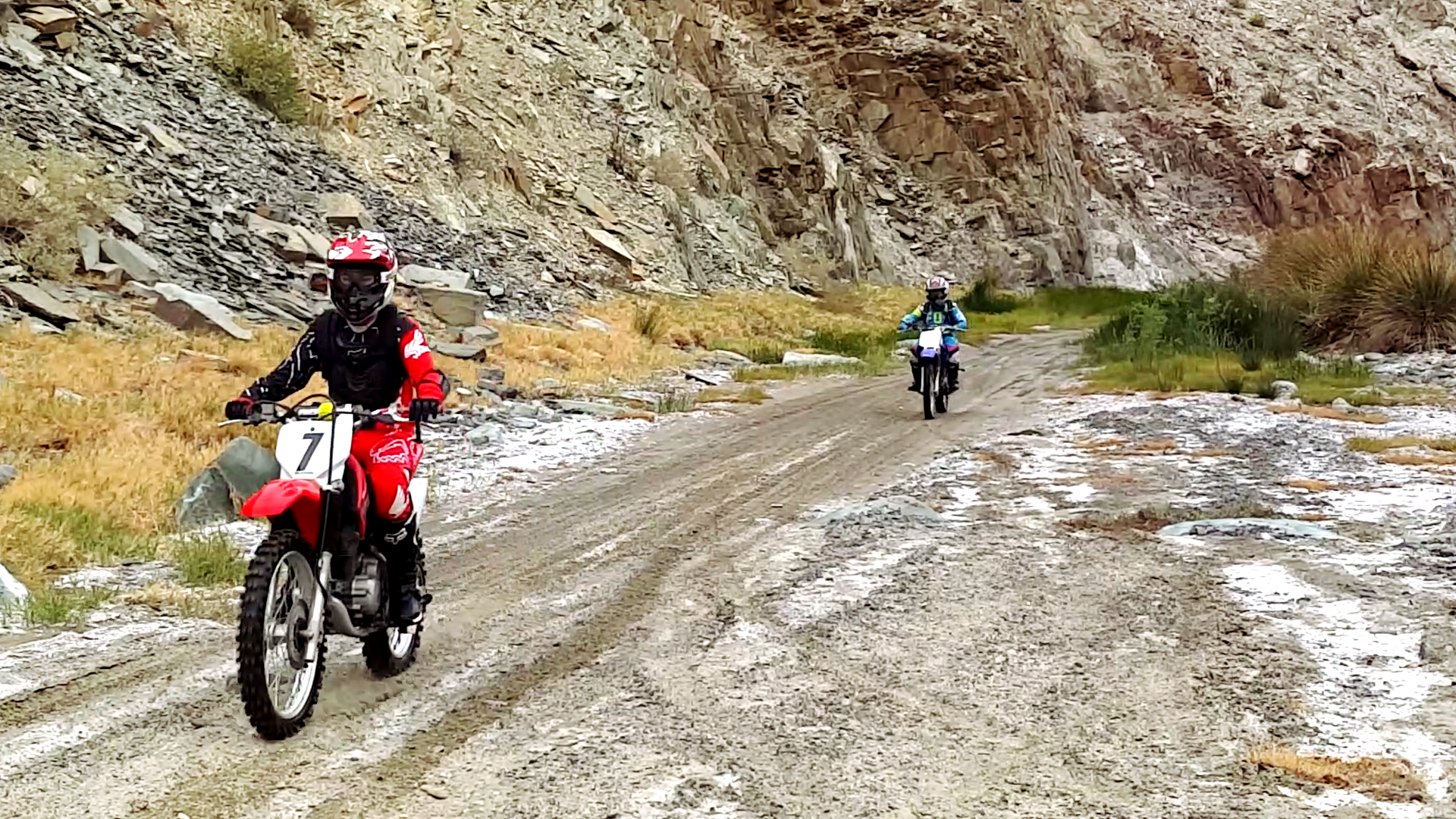
I rode it on a loaded down 690
Enduro and found it easier than the deep sand on Laguna del Diablo. You will get wet.
|
|
|
JZ
Select Nomad
Posts: 14910
Registered: 10-3-2003
Member Is Offline
|
|
It's a really easy ride on bikes. My kid did it when he was 11 or 12. That video showed an abnormal amount of water (it's rained so much this
winter). Generally, there is a small fraction of that.
|
|
|
4x4abc
Ultra Nomad
Posts: 4456
Registered: 4-24-2009
Location: La Paz, BCS
Member Is Offline
Mood: happy - always
|
|
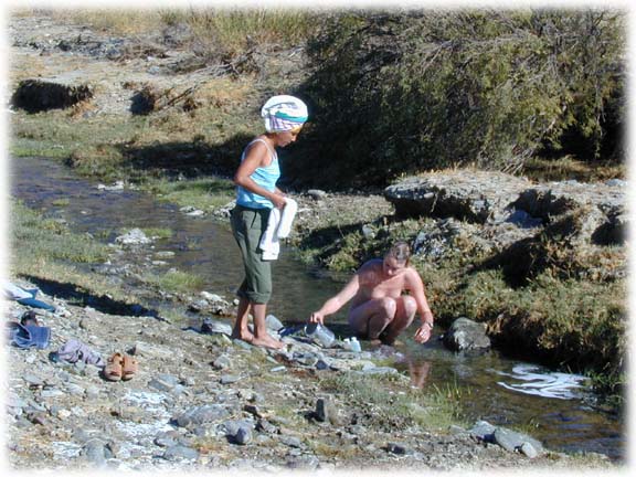
by the way, some of the water is warm
Harald Pietschmann
|
|
|
Udo
Elite Nomad
Posts: 6364
Registered: 4-26-2008
Location: Black Hills, SD/Ensenada/San Felipe
Member Is Offline
Mood: TEQUILA!
|
|
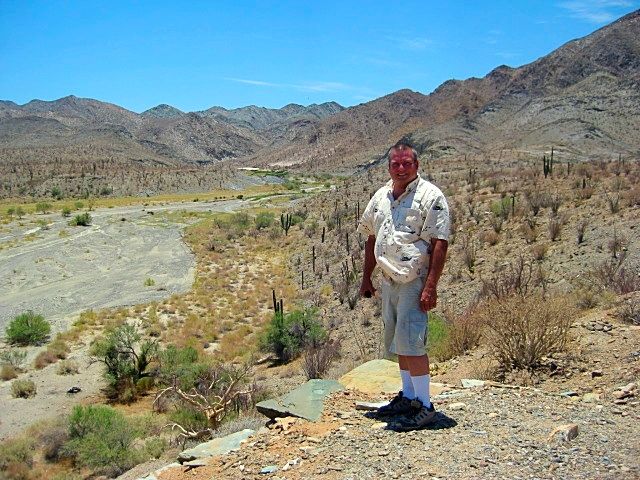
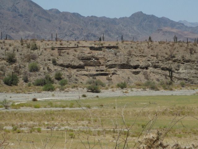
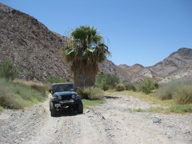
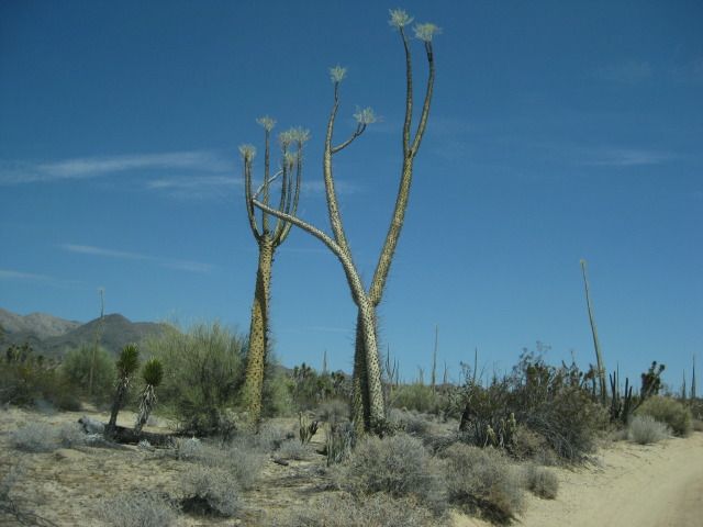
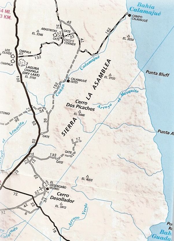
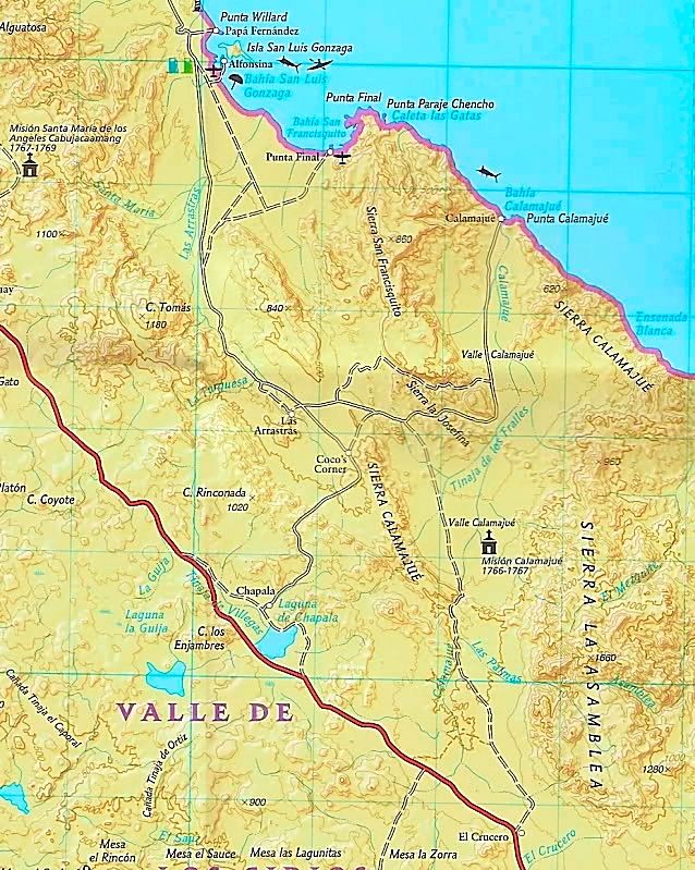
Thanks for the grat photos, David. We will be there a little later this year on a RZR run. Quote: Originally posted by David K  | Southbound, between Coco's Corner and Arroyo Calamajué (arroyo is located where the hills are in the distance, about 5 miles south)...

----------------------------------------------------------------------------------------------------------------------
At the edge of the arroyo, by the gold ore mill ruins, just before the road drops down into the arroyo...
-----------------------------------------------------------------------------------------------------------------------
The remains of the short-lived Jesuit mission church (October 16, 1766-May 1767) located on the opposite side of the arroyo from the mill ruins. See
the road dropping down to the arroyo across...
----------------------------------------------------------------------------------------------------------------------
Gold mill ruins as seen from the mission site...
-----------------------------------------------------------------------------------------------------------------------
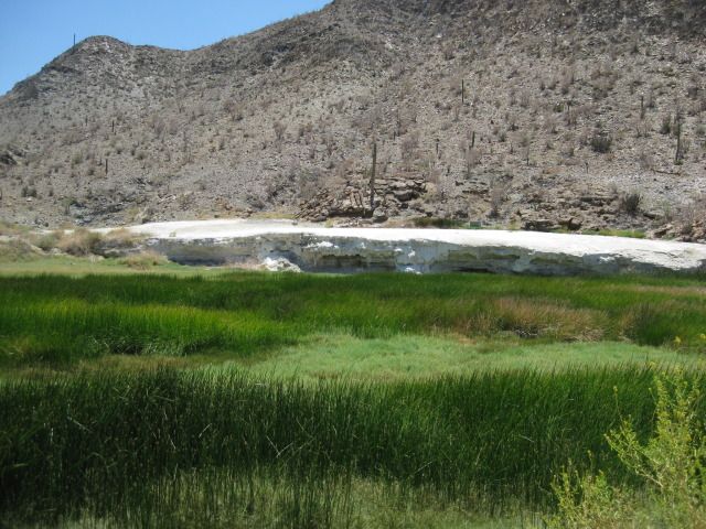
Mineral shelf just inside the canyon entrance, south from the mill and mission...
---------------------------------------------------------------------------------------------------------------------
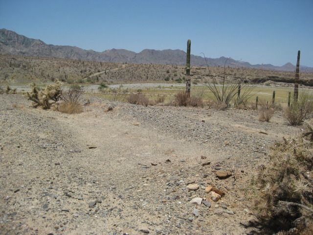
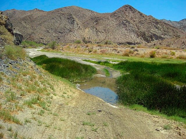
The road drives right in the streambed for a few miles.
Deepest water in July 2012...
-----------------------------------------------------------------------------------------------------------------------
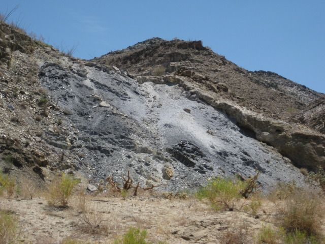
Lot's of mineral coloring in the cliffs...
---------------------------------------------------------------------------------------------------------------------
Lone palm tree just out of water portion of the road...
-----------------------------------------------------------------------------------------------------------------
Once out of the canyon and heading to Hwy. 1 at El Crucero, we find these "dancing" boojum trees...
--------------------------------------------------------------------------------------------------------------
On a map:
[Edited on 3-11-2019 by David K] |
Thanks for the great photos David, we will be going there on a RZR run a little later this Spring.
Udo
Youth is wasted on the young!
|
|
|
David K
Honored Nomad
Posts: 65586
Registered: 8-30-2002
Location: San Diego County
Member Is Offline
Mood: Have Baja Fever
|
|
De nada, Udo.
Living the good life?
It would be nice to see you guys again!
Miss those surprise visits of years ago.
Once again, I live right off the 76, just further east, next to the 15.
|
|
|
Bajazly
Super Nomad
Posts: 1018
Registered: 6-4-2015
Location: Goodbye Cali and Hello San Felipe
Member Is Offline
Mood: More Relaxed Everyday
|
|
We came north thru there a few weeks ago and while many places we traveled were wet, a lot of standing water to drive thru or around, Frog Canyon was
no wetter or dryer than it has ever been that I have seen.
Believing is religion - Knowing is science
Harald Pietschmann
"Get off the beaten path and memories, friends and new techniques are developed"
Bajazly, August 2019
|
|
|
Ken Cooke
Elite Nomad
Posts: 8971
Registered: 2-9-2004
Location: Riverside, CA
Member Is Offline
Mood: Pole Line Road postponed due to injury
|
|
February 2019


|
|
|
matthew_mangus
Junior Nomad
Posts: 83
Registered: 10-4-2019
Location: Portland, OR
Member Is Offline
|
|
| Quote: Originally posted by David K | Why not... unless getting wet is a problem! You can pop out to Km. 251 or Km. 261. The canyon is also the route of El Camino Real... the Mission Raod
from Loreto to San Diego to Monterey!
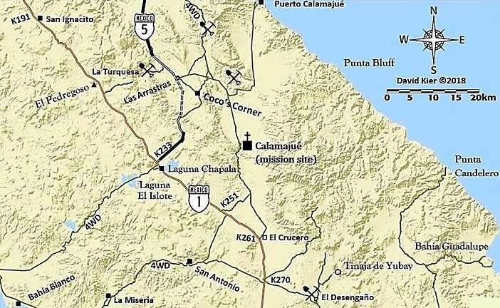 |
David, in this map, it looks like its possible to cross the mex1 and continue to the Pacific and then loop back via the 4x4 road that cuts through
Laguna Isolote. Have you documented this route?
I like to explore remote dirt tracks and beaches.
|
|
|
Udo
Elite Nomad
Posts: 6364
Registered: 4-26-2008
Location: Black Hills, SD/Ensenada/San Felipe
Member Is Offline
Mood: TEQUILA!
|
|
That looked like a fun run!
Udo
Youth is wasted on the young!
|
|
|
David K
Honored Nomad
Posts: 65586
Registered: 8-30-2002
Location: San Diego County
Member Is Offline
Mood: Have Baja Fever
|
|
| Quote: Originally posted by matthew_mangus | | Quote: Originally posted by David K | Why not... unless getting wet is a problem! You can pop out to Km. 251 or Km. 261. The canyon is also the route of El Camino Real... the Mission Raod
from Loreto to San Diego to Monterey!
|
David, in this map, it looks like its possible to cross the mex1 and continue to the Pacific and then loop back via the 4x4 road that cuts through
Laguna Isolote. Have you documented this route? |
Yes. The road log (sample section Part 3 of the new road guide) is posted in the Nomad Road Conditions forum and the trip report (2017) is #4 in the
Nomad Trip Reports forum. The road west from Laguna Chapala I did not get to, but Nomads Stuck Sucks and TMW have.
|
|
|
| Pages:
1
2 |


