| Pages:
1
..
6
7
8
9 |
PaulW
Ultra Nomad
    
Posts: 3113
Registered: 5-21-2013
Member Is Offline
|
|
Look at Davids map closely for the road south of Cohabuzo and you will see 2 locked gates. Best would be to head east from Cohabuzo. Rough and slow.
Very accessible, just follow the roads.
Having said the above. if you have the correct track there is a go around the gates by way of the Pole Line Road. Your rig can do it. Do not go
without the most recent GPS track.
=== ===
Quote: Originally posted by KNR  | Hi David,
I have a question about the Laguna Salada on your maps 2 and 5. We are heading out for a week starting 3/20 traveling from Tacate down to Gonzaga
Bay/Punta Final and then back up through Catavina and the Paque Nacional Sierra De San Pedro, then up through Guadalupe Valley and back to the States
Via Tacate.
We have a reservation at the Guadalupe Canyon Hot Springs, and the next stop is dispersed camping at a beach south of San Felipe. I notice on your
map, (and have mapped out on google maps and seen the trail on Satellite view) the route heading south from the Hot Springs, continuing down the
Laguna Salada and heading east at what you show as Cohabuza Junction which should take us to to the 5. In the past I have just headed back north out
of the canyon to the 2 and then meet the 5 and head to San Felipe. I'd like to drive south this time. My question is, is that path accessible to
your knowledge? If so would the drive time be equivalent, less or more then going the 2 to the 5 route. Any info would be greatly appreciated. Our
vehicle is a capable, 4 wheel drive 33" tires and 2.5" so unless there is major rocks we should be ok in that respect
Very Much Appreciated. |
|
|
|
KNR
Newbie
Posts: 5
Registered: 1-10-2021
Member Is Offline
|
|
Quote: Originally posted by PaulW  | Look at Davids map closely for the road south of Cohabuzo and you will see 2 locked gates. Best would be to head east from Cohabuzo. Rough and slow.
Very accessible, just follow the roads.
Having said the above. if you have the correct track there is a go around the gates by way of the Pole Line Road. Your rig can do it. Do not go
without the most recent GPS track.[/rquote] |
=== ===
Great thanks! The idea was to use the Cohabuzo junction to get to the 5, so that works perfect. What are your thoughts on drive time leaving the hot
springs? Do you think the travel times are similar between Retracing back north to the 2, then 5 south to San Felipe vs continuing south to the
Cohabuzo Junction and heading east to the 5? If we get a late start leaving the hot springs, we will be letting travel time dictate which way we go.
If we leave earlier then want to continue down to the south until the junction.
|
|
|
PaulW
Ultra Nomad
    
Posts: 3113
Registered: 5-21-2013
Member Is Offline
|
|
Either way will be similar in drive time.
|
|
|
KNR
Newbie
Posts: 5
Registered: 1-10-2021
Member Is Offline
|
|
Great and thanks. Very much appreciated.
|
|
|
David K
Honored Nomad
        
Posts: 65436
Registered: 8-30-2002
Location: San Diego County
Member Is Offline
Mood: Have Baja Fever
|
|
Hi KNR, looks like you may have your answers?
The road from Cohabuzo Jcn. to the edge of Laguna Salada was miserable the one time I drove it, but that was 19 years ago! It is a SCORE Baja race
road so gets chewed up and has silt beds. Again that was in 2002.
Once near the lakebed and heading south then east to Hwy. 5, is was fine and the last few miles are graded (serving Ejido Saldaña).
Personally, I was recommending back then, to take the long way around to get to San Felipe from Guadalupe Canyon!
There is also a route that cuts across the lakebed to the area of the sulfur mine. See photos and map posted by Nomad 'geoffff' who went that way just
a year or two ago.
|
|
|
KNR
Newbie
Posts: 5
Registered: 1-10-2021
Member Is Offline
|
|
Thanks David, We will probably be taking the long way around this time. Maybe I'll explore it more next trip eown when I have more time. Thanks
again!
|
|
|
David K
Honored Nomad
        
Posts: 65436
Registered: 8-30-2002
Location: San Diego County
Member Is Offline
Mood: Have Baja Fever
|
|
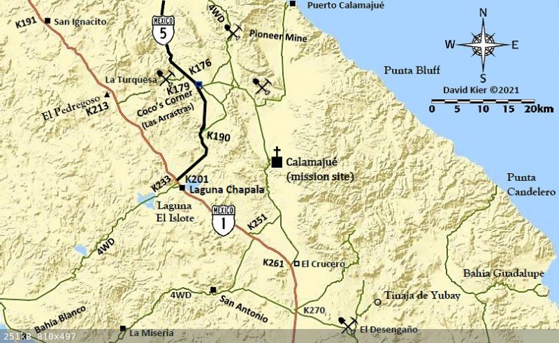
New Map showing new Coco's Corner
[Edited on 4-20-2021 by David K]
|
|
|
Glidergeek
Nomad
 
Posts: 115
Registered: 9-22-2014
Location: Hesperia Ca
Member Is Offline
Mood: Moody
|
|
"A new Baja map book is coming in 2021. You will just need to retrace all you past travels and make new notes! It will be fun!"
Is it 2021 yet  I'd love to have (buy) a full size map of Baja w/the KM's on
it. I'd love to have (buy) a full size map of Baja w/the KM's on
it.
|
|
|
David K
Honored Nomad
        
Posts: 65436
Registered: 8-30-2002
Location: San Diego County
Member Is Offline
Mood: Have Baja Fever
|
|
Quote: Originally posted by Glidergeek  | "A new Baja map book is coming in 2021. You will just need to retrace all you past travels and make new notes! It will be fun!"
Is it 2021 yet  I'd love to have (buy) a full size map of Baja w/the KM's on
it. I'd love to have (buy) a full size map of Baja w/the KM's on
it.
|
The new Benchmark Maps Baja Atlas has the kilometer points of probably every road in Baja with kilometer posts! The kilometer # is added every 5
kilometers and any special places, such as where Km. 168 magically becomes Km. 171 south of Gonzaga Bay!
|
|
|
BajaMama
Super Nomad
   
Posts: 1108
Registered: 10-4-2015
Location: Pleasanton/Punta Chivato
Member Is Offline
Mood: Got Baja fever!!
|
|
Stupid question #342: David, did you publish a book of the maps? If so, may I have the link to purchase?
|
|
|
Mr. Bills
Nomad
 
Posts: 189
Registered: 9-10-2019
Location: Area Code 530
Member Is Offline
|
|
Link to Benchmark map book for Baja California scheduled for release May 5, 2021:
https://www.bajabound.com/baja-atlas.php
|
|
|
David K
Honored Nomad
        
Posts: 65436
Registered: 8-30-2002
Location: San Diego County
Member Is Offline
Mood: Have Baja Fever
|
|
Good morning... and there are no stupid questions!
With so much Baja to learn and explore, keep them coming!
OK, so here is the deal as best I know it...
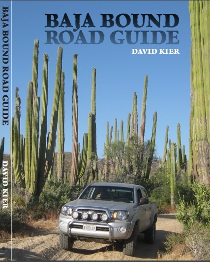
1) My 31 area maps of Baja (those posted here in this thread) will be used in an upcoming roadguide book I produced for Baja Bound Insurance. Half of
that road guide (pre-publication edition) is also here on Nomad, in the Road Conditions forum, for you all to enjoy or just check out.
2) A professional person has been formatting my roadguide pages into a book so it looks really sharp for Baja Bound.
3) The roadguide was to have been released last year and Covid killed that idea. We are looking forward to it being published this year. Because of
the delays, at least I could edit it to show a completed Hwy. 5 and a new location for Coco's Corner.
My 31 area maps were my creation, on my own time, and not something Baja Bound sponsored. That is why I am freely sharing them with anyone who can use
them for their personal travels or simply enjoy seeing them.
The three (pre-publication) sections of the roadguide [2019 version] are here on Nomad with Baja Bound's permission, as they were created thanks to
the sponsorship. Links to them:
Highway 5: Mexicali to Laguna Chapala + Hwy. 2 and side trips.
http://forums.bajanomad.com/viewthread.php?tid=95028
Highway 1: San Quintín to Guerrero Negro + side trips.
http://forums.bajanomad.com/viewthread.php?tid=91898
Highway 1: Guerrero Negro to San Ignacio + side trips.
http://forums.bajanomad.com/viewthread.php?tid=92377
===================================================================
What else have I done with maps?:
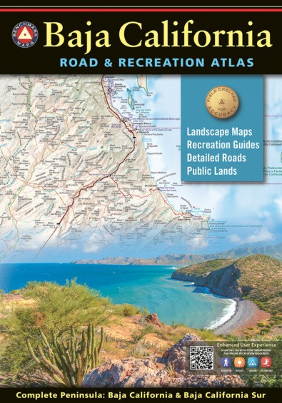
The Benchmark Map company contacted me over a year ago and asked if I would like to be a consultant on their new Atlas for Baja California. As it
turned out, I could provide a lot of input having traveled so much of Baja in 2017-2019 (for Baja Bound's roadguide and two TV shows in 2019).
The base map comes from the same source as the Baja Almanac, the government. I did my best to correct the errors and update the roads that have been
paved (all of Hwy. 5 and Abreojos to La Bocana, for example). I also added a couple of Nomad businesses that the base map missed.
It turned out that I did three rounds of editing, at first with big sheets covering my dinning room table. I may have missed things, but I really
tried to make these maps as accurate as possible! I have nothing to do with the sales part beyond my enthusiasm by promoting the product on the
Internet. They are not "my maps" just ones I helped to edit.
The new Atlas will fill in the gap left when Landon Crumpton died, as he had produced the Baja Topo Atlas (1986 & 1992) and the Baja Almanacs
(1998, 2003, 2009). The new Atlas is a road and recreation guide and includes such things as the kilometer marker points, missions, Baja Divide route,
El Camino Real route, campgrounds, hotels, mountain peaks with elevations. There are no contour lines on Benchmark maps but the mountain slopes are
shown using color shading.
It is about the same overall size as the 2009 Almanac, but with more maps inside...
[Edited on 4-25-2021 by David K]
|
|
|
David K
Honored Nomad
        
Posts: 65436
Registered: 8-30-2002
Location: San Diego County
Member Is Offline
Mood: Have Baja Fever
|
|
Benchmark samples
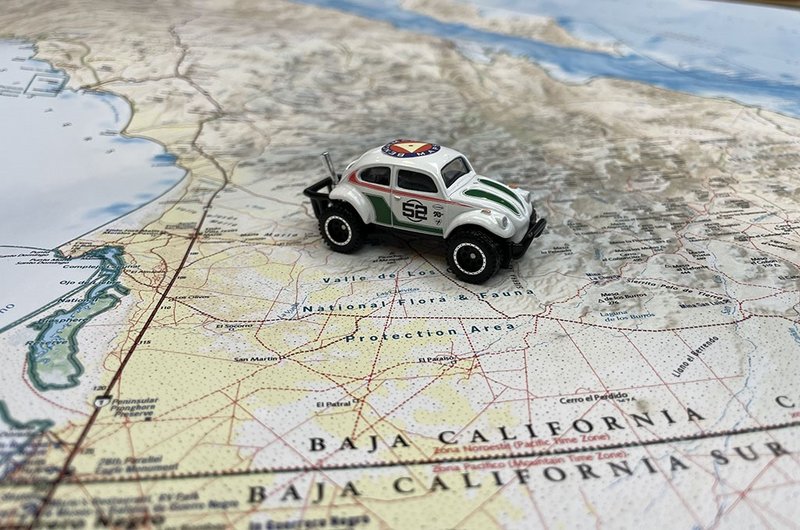
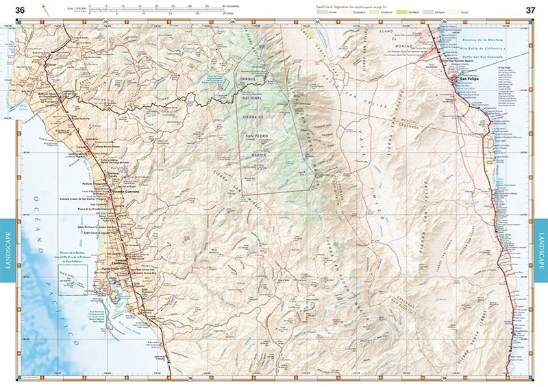
See more, and closer-up sample: https://www.benchmarkmaps.com/product/baja-california-road-r...
[Edited on 4-25-2021 by David K]
|
|
|
BajaMama
Super Nomad
   
Posts: 1108
Registered: 10-4-2015
Location: Pleasanton/Punta Chivato
Member Is Offline
Mood: Got Baja fever!!
|
|
That's fantastic, David, thank you so much for all your work putting it together. My dream is to spend weeks/months overlanding in Baja as soon as I
can get my husband to retire. He has outfitted a Chevy Colorado ZR2 Bison (we love it in the desert, just sold the rock crawler Jeep) and I am just
about talked into the new Bronco Wildtrak. My idea of a good time is being in the middle of Nevada 70+ miles out a dirt road in the middle of nowhere
while scouting Antelope. I love the remoteness of Baja!
|
|
|
advrider
Super Nomad
   
Posts: 1920
Registered: 10-2-2015
Member Is Offline
|
|
BajaMama, we will have to connect for some trips. I will retire in November and we are building a new Jeep Gladiator as well as an off-road camp
trailer for our Baja travels. We plan to spend months at a time traveling in Baja. We spend plenty of time in Nevada as well.
Not sure if I'm more excited about the new Atlas or David's road guide? I have all kinds of tracks for Baja but I'm a bit of a map geek!
|
|
|
BajaMama
Super Nomad
   
Posts: 1108
Registered: 10-4-2015
Location: Pleasanton/Punta Chivato
Member Is Offline
Mood: Got Baja fever!!
|
|
Ha ha - David I ordered the atlas, looking forward to it. I'm laughing because the first thing my husband asked is, "Is there an electronic version?"
( for Gaya Maps.)
Any chance that will be coming soon? He has the app on an old iPad that was set up for cell service or wi-fi so it has GPS and works really well.
|
|
|
PaulW
Ultra Nomad
    
Posts: 3113
Registered: 5-21-2013
Member Is Offline
|
|
Is Baja Bound taking preorders for the DK road book?
Or just the Benchmark map.
|
|
|
BajaMama
Super Nomad
   
Posts: 1108
Registered: 10-4-2015
Location: Pleasanton/Punta Chivato
Member Is Offline
Mood: Got Baja fever!!
|
|
Quote: Originally posted by advrider  | BajaMama, we will have to connect for some trips. I will retire in November and we are building a new Jeep Gladiator as well as an off-road camp
trailer for our Baja travels. We plan to spend months at a time traveling in Baja. We spend plenty of time in Nevada as well.
Not sure if I'm more excited about the new Atlas or David's road guide? I have all kinds of tracks for Baja but I'm a bit of a map geek!
|
I like paper maps, my husband likes Gaya so we usually have both! I thought I had him talked into retirement October 2022 but now it looks like 2023.
But he does get 5 weeks off a year! We built a camp trailer out of a Canadian military trailer, not for sleeping in but it carries a lot of stuff.
[Edited on 4-25-2021 by BajaMama]
[Edited on 4-25-2021 by BajaMama]
|
|
|
BajaMama
Super Nomad
   
Posts: 1108
Registered: 10-4-2015
Location: Pleasanton/Punta Chivato
Member Is Offline
Mood: Got Baja fever!!
|
|
Click the bottom link on David's post for My 30 maps and it will take you to Benchmark Maps. You can order the atlas but it will not be released until
May 5, about $37 with tax and shipping.
[Edited on 4-25-2021 by BajaMama]
|
|
|
David K
Honored Nomad
        
Posts: 65436
Registered: 8-30-2002
Location: San Diego County
Member Is Offline
Mood: Have Baja Fever
|
|
Paul, the Baja Bound pre order link for the Benchmark Atlas is posted just above my post this morning, by mr.bills.
BajaMama, the price is just $20 + shipping (~$5), last I checked?
I look forward to helping anybody find their own Baja adventure!
|
|
|
| Pages:
1
..
6
7
8
9 |

