| Pages:
1
2 |
RFClark
Super Nomad
   
Posts: 2470
Registered: 8-27-2015
Member Is Offline
Mood: Delighted with 2024 and looking forward to 2025
|
|
So it seems that a tropical storm popped up just today and probably is responsible for todayâs rain. Itâs forecast to move parallel to the coast a
couple of hundred miles offshore before turning west. I wonder if any of the models forecast todayâs storm? It wasnât on NOAAâs radar yesterday.
I saw the area yesterday and wondered about it. And then thereâs next Wednesday!
|
|
|
mtgoat666
Platinum Nomad
       
Posts: 20900
Registered: 9-16-2006
Location: San Diego
Member Is Offline
Mood: Hot n spicy
|
|
It has been in NOAA NHC forecast for past few days, been keeping an eye on it for past few days The NHC doesnât post track path graphics until
event reaches TS level.
NHC has archive feature, you can go back and read reports for past daysâ¦
Woke!
Hands off!
âPor el bien de todos, primero los pobres.â
â...ask not what your country can do for you â ask what you can do for your country.â âMy fellow citizens of the world: ask not what America
will do for you, but what together we can do for the freedom of man.â
Pronoun: the royal we
|
|
|
SFandH
Elite Nomad
     
Posts: 7519
Registered: 8-5-2011
Member Is Offline
|
|
windy is now showing the storm hitting a bit north of Todos Santos Wednesday evening and crossing over the peninsula.
[Edited on 9-2-2022 by SFandH]
|
|
|
RFClark
Super Nomad
   
Posts: 2470
Registered: 8-27-2015
Member Is Offline
Mood: Delighted with 2024 and looking forward to 2025
|
|
It started raining south of Cerritos last night. 1.37â to current. Itâs partly cloudy with solar at about 35% of normal and over 1 KW solar
output.
|
|
|
azucena
Nomad
 
Posts: 193
Registered: 8-25-2012
Member Is Offline
|
|
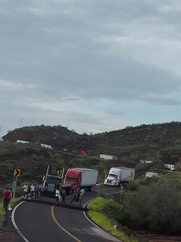
Looks like the rain is hitting Muleje/Loreto area, reports of washouts at km 125 on 1.
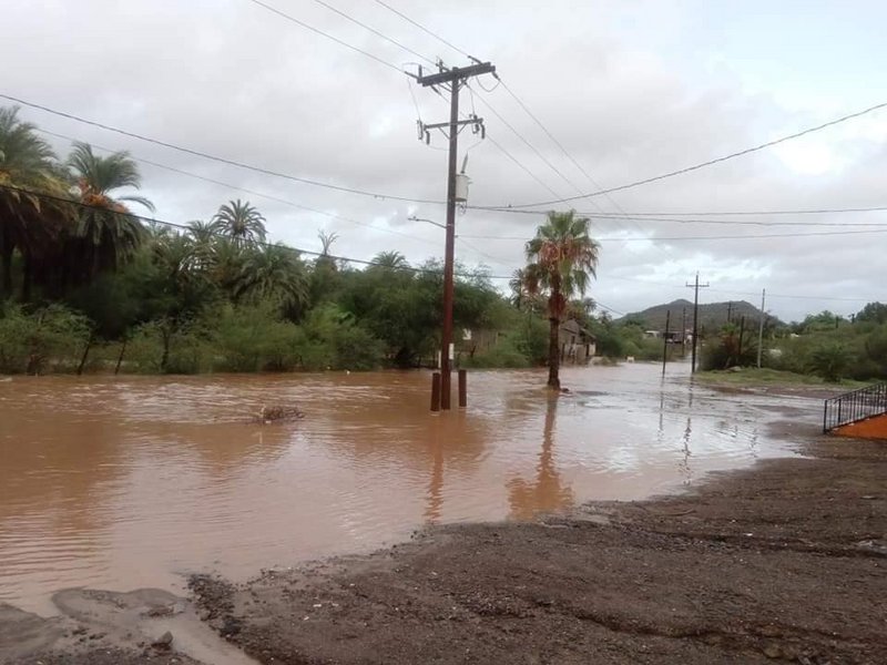
East Cape also getting a good bit of rain, lots of flow through arroyos.
Potentially more on tap in the coming week.
|
|
|
AKgringo
Elite Nomad
     
Posts: 6337
Registered: 9-20-2014
Location: Anchorage, AK (no mas!)
Member Is Offline
Mood: Retireded
|
|
Playing with Windy....
For those who have not used www.windy.com before, you can change the display from a wind forecast to a rain forecast by using the vertical bar on the right side of the
display. You can move focus area around, zoom in and out and play with the forecast date/time slider at the bottom.
Of course, it is just a forecast and is always being updated, so I check often. The tropical disturbance headed for Baja could turn east and soak the
mainland, or turn west and head toward Hawaii.
Right now it shows the potential of becoming a problem the length of the peninsula!
If you are not living on the edge, you are taking up too much space!
"Could do better if he tried!" Report card comments from most of my grade school teachers. Sadly, still true!
|
|
|
Don Pisto
Banned
Posts: 1282
Registered: 8-1-2018
Location: El Pescador
Member Is Offline
Mood: weary like everyone else
|
|
Quote: Originally posted by azucena  | Looks like the rain is hitting Muleje/Loreto area, reports of washouts at km 125 on 1.
East Cape also getting a good bit of rain, lots of flow through arroyos.
Potentially more on tap in the coming week. |

there's only two things in life but I forget what they are........
John Hiatt
|
|
|
shari
Select Nomad
      
Posts: 13052
Registered: 3-10-2006
Location: bahia asuncion, baja sur
Member Is Offline
Mood: there is no reality except the one contained within us "Herman Hesse"
|
|
Here in Bahia Asuncion where it RARELY rains we got a half hour of moderate rain yesterday afternoon and then not again till around 7:30 this morning
and it rained hard for over an hour. Winds are up to about 30 knots making it hard to open my back door & will most likely destroy my roses and
other of my beloved plants!
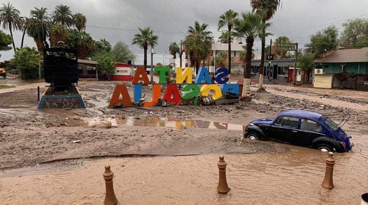
Other areas in our municipality of Mulege fared much worse with lots of flooding in Sta.Rosalia and some in Mulege.
Hope this wasnt just a dress rehearsal for what is to come on Thursday when a bigger storm threatens to really screw things up.
|
|
|
HeyMulegeScott
Senior Nomad
  
Posts: 719
Registered: 8-25-2009
Location: Orygone/Mulege
Member Is Offline
|
|
Seeing lots of reports of flooding and damage around Mulege. Damage to Mex1 on Mulege - Loreto.


[Edited on 9-3-2022 by HeyMulegeScott]
|
|
|
Zola
Nomad
 
Posts: 122
Registered: 9-7-2014
Location: San Juanico, Point Loma
Member Is Offline
Mood: Enthusiastic
|
|
Stay posted. According to most models, the new storm forming off the coast of southern Mexico appears likely to become a major hurricane (category 3
or 4), and most models predict that it will make landfall in BCS or at least come close. It is still too early to have exactly reliable predictions,
but people should stay posted and make appropriate arrangements so far as possible.
The system might reach Todos Santos and los Cabos by Tuesday (?) and further up the coast of BCS by Wednesday or Thursday. One or two models show it
tracking along the east cape, but most models have it land near Todos Santos or march up the west coast.
With luck, it will spare us all. The NHC site is very helpful for this information.
[Edited on 9-4-2022 by Zola]
Sometimes the questions are complicated and the answers are simple. Dr. Seuss
Never wrestle with pigs. You both get dirty and the pig likes it. George Bernard Shaw
|
|
|
Zola
Nomad
 
Posts: 122
Registered: 9-7-2014
Location: San Juanico, Point Loma
Member Is Offline
Mood: Enthusiastic
|
|
The storm might be much weaker than originally projected, but still plenty potent, especially as it approaches the tip of BSC. It is likely to come
very close to Todos Santos by Tuesday, then move northwest off the coast of BCS.
Sometimes the questions are complicated and the answers are simple. Dr. Seuss
Never wrestle with pigs. You both get dirty and the pig likes it. George Bernard Shaw
|
|
|
| Pages:
1
2 |

