geoffff
Senior Nomad

Posts: 721
Registered: 1-15-2009
Member Is Offline
|
|
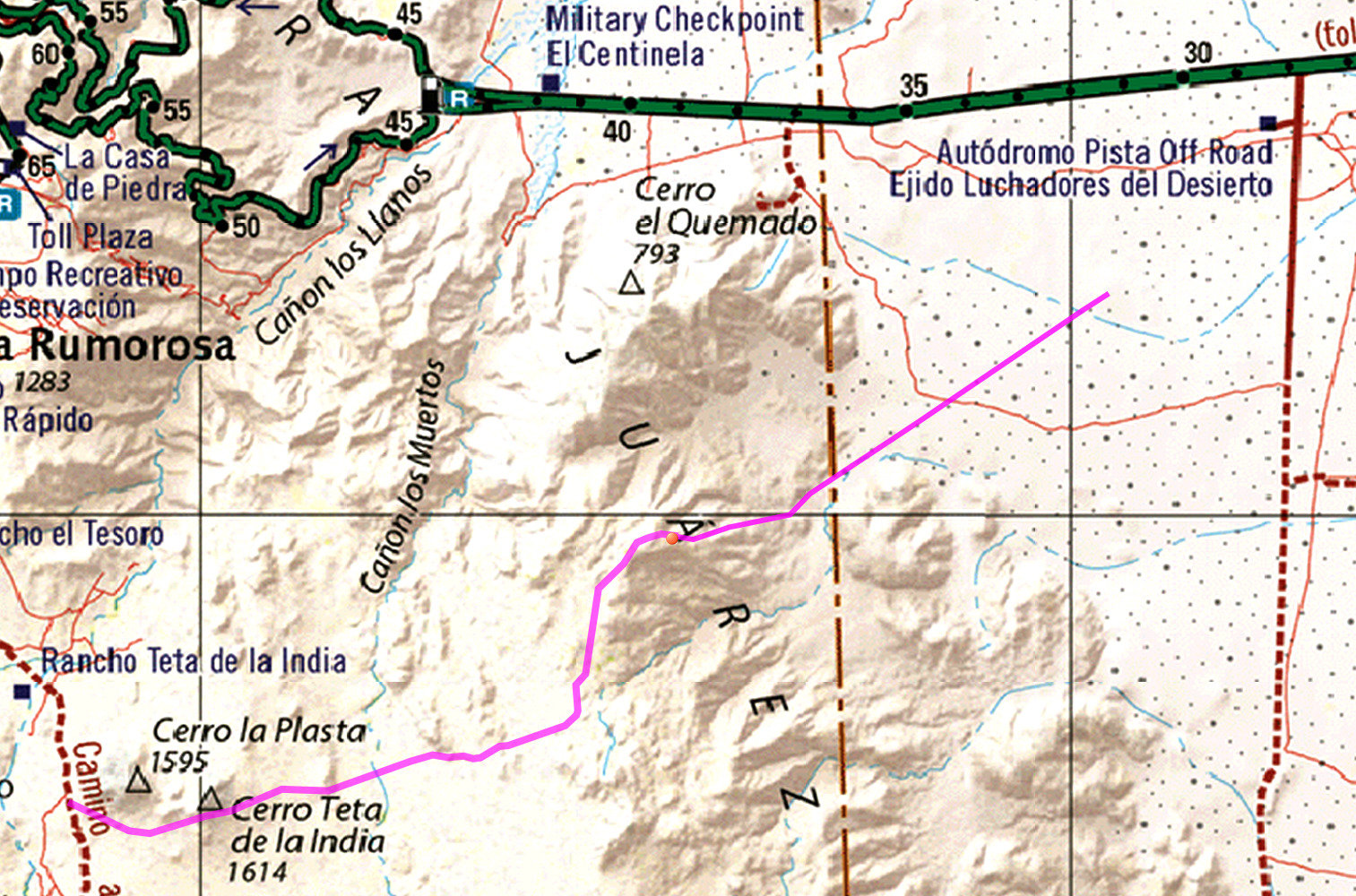
New road down Sierra Juarez into Laguna Salada?
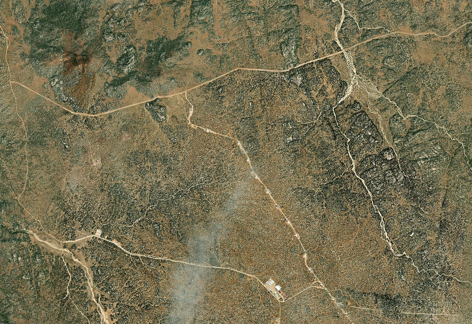
I am noticing a new road on the latest satellite images (Google Earth shows some of this, but more is on ArcGIS satellite imagery). OpenStreetMaps
also has it already mapped out.
OpenStreetMaps has it mapped almost to the north end of the Laguna Salada road where it meets highway 2

Anyone know what this is? Is it just a power line, or for wind farms? Or is it going to be a new paved highway? The grading is looking surprisingly
wide and fancy for it to be a powerline access road.

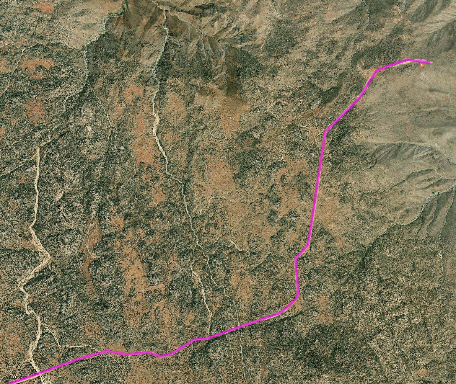
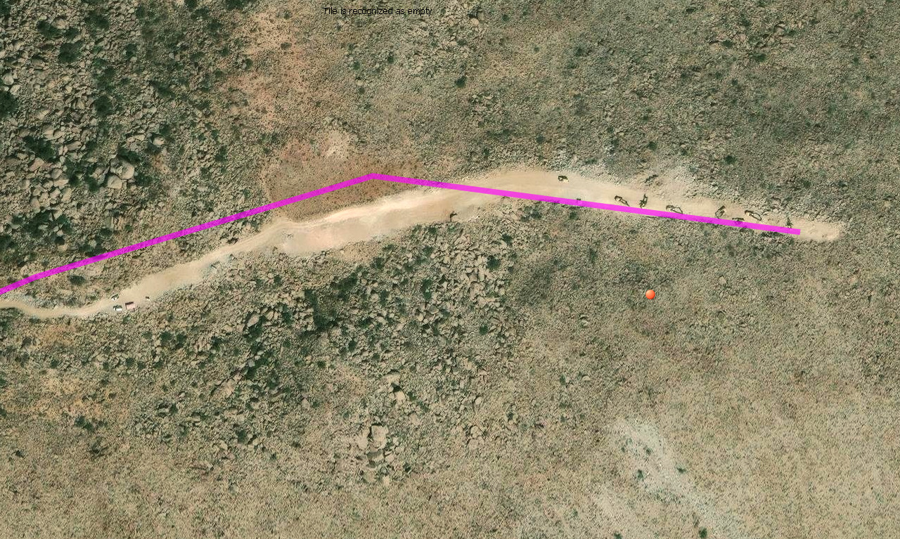
Here is the "end" of the road as of the latest ArcGIS satellite image I could find: 32.4963, -115.9085

|
|
|
geoffff
Senior Nomad
Posts: 721
Registered: 1-15-2009
Member Is Offline
|
|
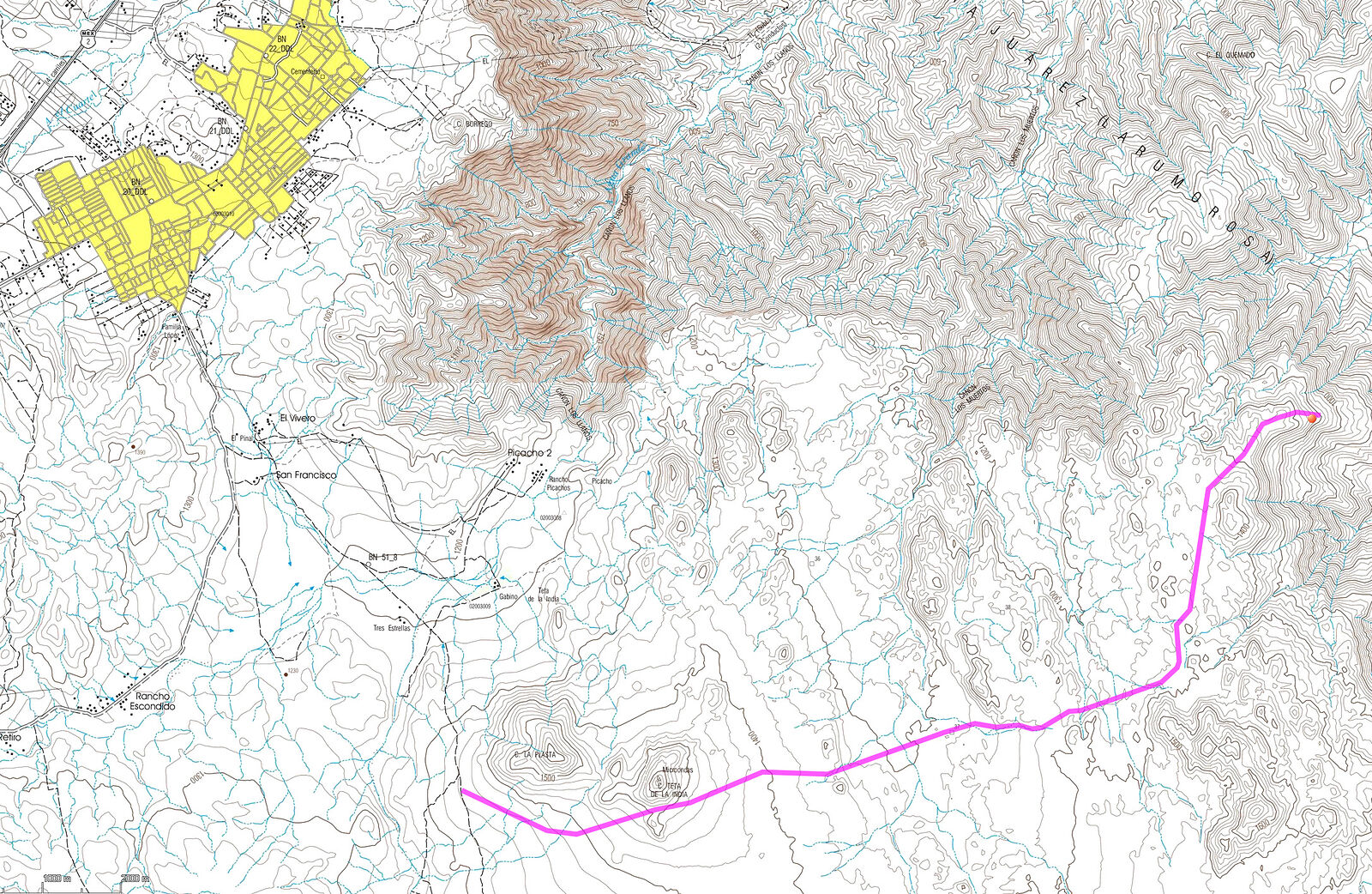
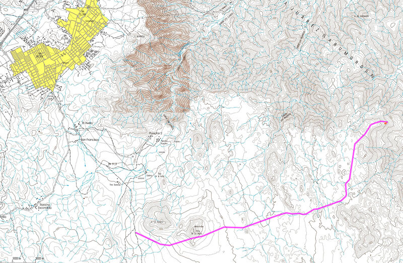
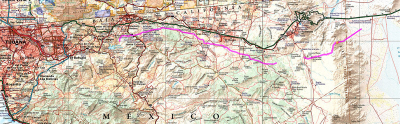
On closer inspection, it looks like this road goes all the way to Tijuana, or at least Tecate:
|
|
|
geoffff
Senior Nomad
Posts: 721
Registered: 1-15-2009
Member Is Offline
|
|
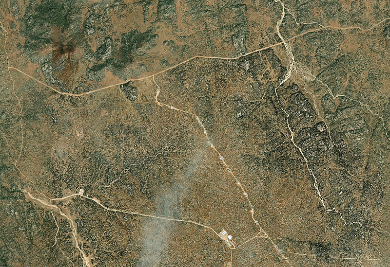
I see lots of wind farm parts on a spur road heading southeast from Cero Teta de la India.
So maybe I've answered my own question -- all this is for wind farm access and powerlines...?

|
|
|
geoffff
Senior Nomad
Posts: 721
Registered: 1-15-2009
Member Is Offline
|
|
Here is a link that gets access to ArcGIS satellite imagery. Just ignore the "login" or "credentials" or free trial stuff, and then pan and zoom over
to Baja:
https://experience.arcgis.com/experience/7b6870085b2a42568a1...
The above link is called "Cimarron" but happens to be an unrelated project in Kansas (I found searching for "Eólico Cimarrón"). But you can use this
link to then get access to the satellite imagery in Baja.
[Edited on 6-9-2026 by geoffff]
|
|
|
David K
Honored Nomad
Posts: 65591
Registered: 8-30-2002
Location: San Diego County
Member Is Offline
Mood: Have Baja Fever
|
|
Thanks for that post, Geoffff. I used ArcGIS to create my Road Guide maps, back in 2018.
|
|
|
Maderita
Senior Nomad
Posts: 705
Registered: 12-14-2008
Location: San Diego
Member Is Offline
|
|
Hola geoffff,
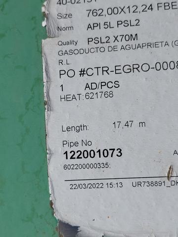
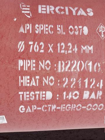
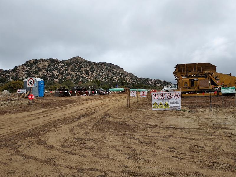
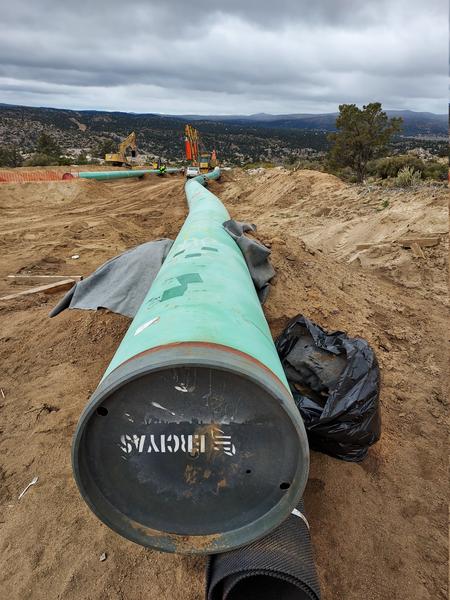
The first 3 images show the new-ish gas pipeline (gasoducto). I'm told that it runs from San Luis to Tecate and beyond. rather than follow the Highway
2 or the aqueduct, they chose to carve out a new route. I watched it being built across the Laguna Salada and across the Sierra de Juarez. It was
graded wide for heavy equipment and trenched deeply for the pipe. There is a locked gate where the pipeline intersects the Laguna Hanson dirt road at
Cerro La Plasta. Another locked gate some miles to the east with no bypass route. Fortunately, I have a local friend with the keys. We rode quads
along the pipeline "road" hoping to reach Laguna Salada, then continue a loop up the old road (Canyon Los Llanos). Didn't quite make it down to the
desert. The bulldozers had piled high berms of boulders at a few intervals to block vehicles. We made it over and around 2 or 3, but were halted by
the final one, with the desert floor clearly in sight. A dropoff to the side made it too perilous to attempt without using a rope to belay the quads.
We had to turn around and ride back up the steep bulldozed "road". Each of us flipped backward on the first attempt and relieved to ultimately reach
the top. The route can be hiked.
https://www.gasoductorosarito.com/
|
|
|
mtgoat666
Platinum Nomad
Posts: 21167
Registered: 9-16-2006
Location: San Diego
Member Is Offline
Mood: Hot n spicy
|
|
Wasn’t that gas pipeline built 15 years ago? I don't recall a new PL alignment in past decade…
Woke!
Hands off!
“Por el bien de todos, primero los pobres.”
“...ask not what your country can do for you – ask what you can do for your country.” “My fellow citizens of the world: ask not what America
will do for you, but what together we can do for the freedom of man.”
Pronoun: the royal we
|
|
|
Maderita
Senior Nomad
Posts: 705
Registered: 12-14-2008
Location: San Diego
Member Is Offline
|
|
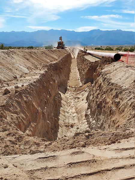
The gasoducto construction in Laguna Salada, February 2024. The view is to the west, toward the Sierra de Juarez.
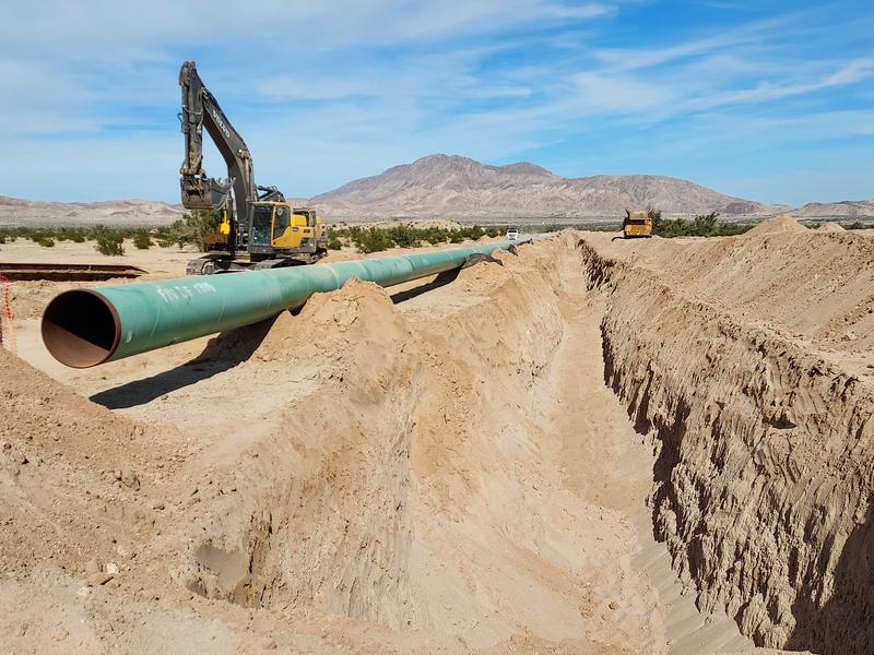
Gasoducto construction across Laguna Salada, February 2024. View toward the northeast, Cerro El Centinela (aka: Mt. Signal) in the distance.
View to the west from Laguna Salada. The graded scar up the eastern escarpment for the pipeline is clearly visible.
|
|
|
Maderita
Senior Nomad
Posts: 705
Registered: 12-14-2008
Location: San Diego
Member Is Offline
|
|
Gasoducto construction at the La Rumorosa to Laguna Hanson road, below Cerro La Plasta. Cerro Teta De La India in the background. View toward the
east.
View to the west. Notice the environmentally unfriendly scar, bulldozed across the plateau of the Sierra de Juarez.
This section of the pipeline access road is reported to have numerous gates. I drove a section of the gasoducto while it was under construction, west
from Highway 3, south of Tecate.
|
|
|
Maderita
Senior Nomad
Posts: 705
Registered: 12-14-2008
Location: San Diego
Member Is Offline
|
|
geoffff,
The structures shown in your photos are newly constructed for Sempra's Cimarron Wind Project. There are new, wide graded roads crisscrossing the
plateau south of La Rumorosa to support construction and ongoing access to the 40+ wind turbine generators. The WTGs were installed over the past two
years. Additionally, there are new, shiny steel towers for the transmission lines. Those towers and power lines stretch to La Rumorosa and west along
Highway 2D to Otay Mesa.
Construction started out with the original five WTGs at La Rumorosa, constructed by the Rumorosa Wind Project. Progress stalled for many years. The
new Cimarrón project is massive in scale, with construction at a rapid pace. Counting both sides (north & south) of Highway 2, I'd estimate there
are 75 WTGs now.
https://www.sempra.com/newsroom/press-releases/sempra-infras...
|
|
|
Ateo
Elite Nomad
Posts: 5965
Registered: 7-18-2011
Member Is Offline
|
|
Great posts Maderita!!!! I've been wondering what those new transmission lines were for headed to Otay from Blvd 2000.
|
|
|
Maderita
Senior Nomad
Posts: 705
Registered: 12-14-2008
Location: San Diego
Member Is Offline
|
|
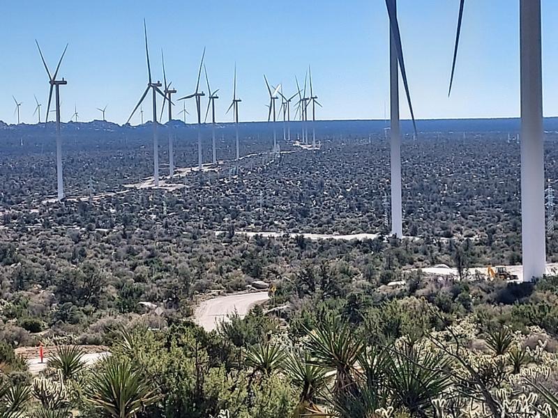
Wind turbine generators of the Cimarron wind project. View from near Cerro Teta de la India. The granite domes of the Cañón del Tajo headwaters can
be seen in the far distance.
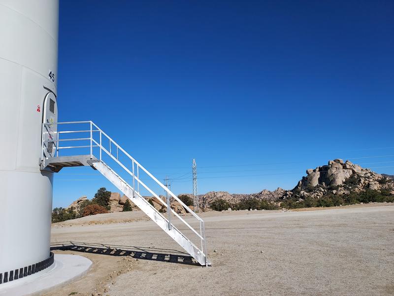
WTG #45, conveniently numbered, with "El Coyote" climbing routes in the background.
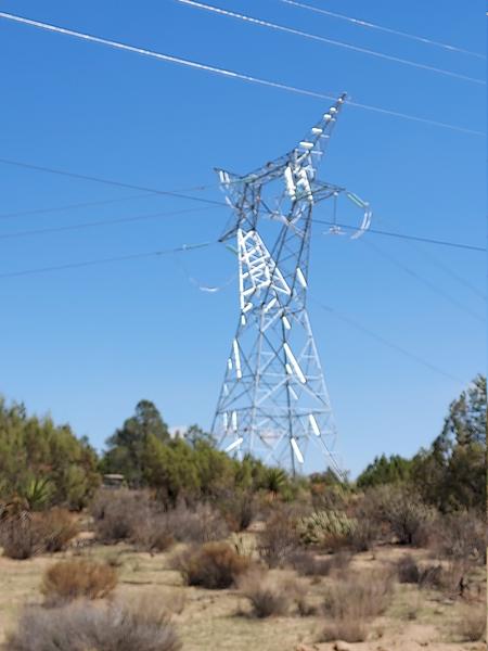
Tower and transmission lines. Sept. 2025
[Edited on 6-10-2026 by Maderita]
|
|
|
Maderita
Senior Nomad
Posts: 705
Registered: 12-14-2008
Location: San Diego
Member Is Offline
|
|

View down the gasoducto toward Laguna Salada.
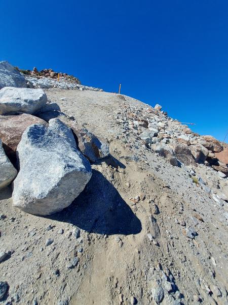
Looking back up from our forced turnaround point. A very steep bulldozed track was barricaded with boulders. The boulders were piled too high to get
the quads over the top and too dangerous to attempt going around. Riding back up the steep mountain was difficult, at the limit of the 2WD quads.
Fearing a very long hike out, we were relieved to reach the summit.
|
|
|
geoffff
Senior Nomad
Posts: 721
Registered: 1-15-2009
Member Is Offline
|
|
Thank you Maderita, for the info and your first hand experience!
I'll put away any fantasies of driving my van down that "new road". Looking at the terrain, I was thinking the road would have to be seriously steep
unless there was a switchback I wasn't seeing.
[Edited on 6-10-2026 by geoffff]
|
|
|
Aveinthebox
Newbie
Posts: 17
Registered: 10-31-2017
Member Is Offline
|
|
Did the whole thing on bikes going down
But it wasn’t finished
Had leave the bikes and hike down
Got a ride to the date farm and spent the night
Went back in the morning with manpower and hiked the bikes out
Quite the adventure
J
|
|
|
Maderita
Senior Nomad
Posts: 705
Registered: 12-14-2008
Location: San Diego
Member Is Offline
|
|
Hola J,
You guys had a gnarly adventure before the blasting and bulldozing was completed on that lower section.
Any interest in riding the route again, during the winter months?
2-wheel motos can get around that boulder barricade (shown above) with a helper and perhaps using a length of rope for security.
|
|
|