David K
Honored Nomad

Posts: 65650
Registered: 8-30-2002
Location: San Diego County
Member Is Offline
Mood: Have Baja Fever
|
|
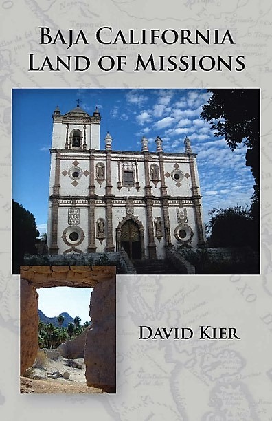
Much of my book (Baja California Land of Missions) is now online
Baja California Land of Missions was such a great project, and was so well received that it remained in print for 10 years
(2016-2026). Now that Sunbelt and Amazon has sold the last new copies, I have made most of the text available online. Used copies are available from
Amazon, AddAll.com, etc. Perhaps some book dealers still have new copies.
Each mission chapter is now in with that mission's photo album. The other chapters begin below the list of mission albums, here: https://vivabaja.com/mission-albums/
One fun chapter has its own web page: https://vivabaja.com/lost-missions/
Sample chapter:
#25 Santa Catalina Virgen y Mártir (1797-1839)
The Mission Santa Catalina story begins with the actions of Padre Juan Crisóstomo Gómez while serving as Dominican President from 1790 to 1793.
Gómez authorized three mountain missions founded to secure the inland areas of the northern peninsula and to Christianize the natives. Immediately
after the founding of the first mountain mission of San Pedro Mártir, the search for the second mission site began in the region as directed by the
viceroy.
In October 1794, Sergeant José Manuel Ruiz, and Padre Tomás Valdellón examined the place named Santa Catalina midway between the mission of San
Vicente and the Colorado River. The most important aspect of a mission site was a reliable year-round source of water that was present at Santa
Catalina. A year later, Ensign Alférez Bernal led an expedition in exploration of the same region. Governor Borica provided Bernal with a list of
“prime essentials” a mission site must possess. The list included a constant source of water, land for raising wheat and maize, nearby firewood,
and pasture, and numerous available “heathen.”
Lieutenant Governor José Joaquín de Arrillaga, traveled north from his home in Loreto. He left Mission San Vicente on September 5, 1796, to examine
Santa Catalina and the route to the Colorado River. This was but one of four expeditions that year to determine if a land route to Sonora was
feasible. Arrillaga had met hostile Indians at the Colorado River and returned to San Vicente by way of San Diego.
Arrillaga had desired to separate California into two political districts, and his 1796 expedition was to be influential in that happening. Governor
Borica also favored the plan, yet nothing came of it for several more years.
In an October 1797 letter, Arrillaga determined that a garrison of soldiers should be stationed in the delta region with a presidio at the head of the
gulf and a detachment at Sonoita and San Felipe, thus securing a sea route of escape. The first order of business, however, was to establish a mission
at Santa Catalina.
The order for a new mission was placed by the viceroy and the governor. The mission was to be strongly fortified as it was known to be in dangerous
territory. Santa Catalina would also be the last mission built on the peninsula authorized by the Spanish government. No other potential mission site
was so greatly researched by repeated expeditions than Santa Catalina.
On August 6, 1797, building was begun at the future mission site for the church (measuring thirty-three feet by seventeen feet), a priest’s house
(seventeen feet square), and a guardhouse. November 12, 1797, was the day that Mission Santa Catalina Virgen y Mártir was officially founded by
Padres José Loriénte and Tomás Valdellón. It was the seventh Dominican California mission, as well as the twenty-fifth mission founded on the
peninsula. The location was called by the natives Jaca-Tobojol, which means “place where the water falls over stones.” The elevation at Santa
Catalina is 3,900 feet above sea level.
In 1798, an adobe house with two rooms was built with each room measuring fourteen feet by seventeen feet. In 1799, another adobe house measuring
fourteen feet by twenty feet was constructed to serve as a shelter for girls and single women.
Santa Catalina had a population of 133 Indians in 1800. Another house measuring seventeen feet by seventeen feet was also built that year. In 1802, an
adobe structure with two rooms measuring fourteen feet square was constructed and may have served as a workshop.
Governor Borica died in July 1800, shortly after leaving Alta California for Durango. Arrillaga was made governor but was allowed to remain at his
residence in Loreto rather than move to Monterey. In four years, Arrillaga would finally achieve his desire for two Californias.
California was officially divided into two districts on March 26, 1804. Arrillaga was made governor of Alta California, and Captain Felipe de
Goycoechea was appointed governor of Baja California. The line that separated the two Californias was the same as that established by Padre Luis
Sáles in 1788, at Arroyo del Rosarito. It had separated Dominican founded Mission San Miguel Indians from those belonging to Franciscan Mission San
Diego to the north.
The original plan for a third mountain mission, as ordered by Padre Gómez, was abandoned. The reason was mentioned previously in the San Pedro
Mártir chapter; a letter was written in Loreto on December 23, 1808, by the Dominican Padre Ramón López. López wrote of the declining conditions
at the two mountain missions: “The two missions in the hills, Santa Catalina and San Pedro [Mártir], cannot give what they don’t have. The
minister at Santa Catalina formerly was able to send something, but now he struggles just to make ends meet.”
The population at Santa Catalina was reported as more than 600 in 1824, dropping to 250 by 1834. This would have made Santa Catalina the most populous
of the Dominican founded missions, according to the reports made.
In October 1839, the Santa Catalina mission was attacked burned, and sixteen neophytes were slain. Neither Padre Caballero, nor any other Dominican
ever returned to rebuild Santa Catalina.
The walls have melted back into the ground, leaving almost nothing to visualize the once important mission. Archeologists in recent years have
excavated to the stone foundation at a corner of a mission room and have accurately mapped the site with sophisticated equipment. The Pai-pai Indians
are still living near the mission. Their village is called Santa Catarina, which is a slightly different spelling than the mission’s name.
To reach the Santa Catalina mission site next to Santa Catarina, use the Ensenada-San Felipe highway (Mexico Three) and drive just south of Km 91, in
the town of Ejido de los Heroes de la Independencia. Go east, on a concrete-paved road. 4.7 miles from Highway Three, the road becomes unpaved. Go
downhill, then work left through the little town of Santa Catarina, soon going over a hill to the cemetery. Turn left and go up the hill, above the
cemetery. The mission site is 5.5 miles from Highway Three.
Dominican Missionaries recorded at Santa Catalina:
José Loriénte (to 1798) November 12, 1797
Tomás Valdellón 1797-1804
Jacinto Fiol 1804-1807
Manuel de Aguila 1807-1809
Antonio Fernández 1809-1810 and 1815-1817 (from San Vicente)
José Duro 1810-1811
Manuel Saiz 1811-1812
Félix Caballero 1819-1839
[Edited on 7-8-2026 by David K]
|
|
|
4x4abc
Ultra Nomad
Posts: 4466
Registered: 4-24-2009
Location: La Paz, BCS
Member Is Offline
Mood: happy - always
|
|
"California was officially divided into two districts on March 26, 1804. Arrillaga was made governor of Alta California, and Captain Felipe de
Goycoechea was appointed governor of Baja California. The line that separated the two Californias was the same as that established by Padre Luis
Sáles in 1788, at Arroyo del Rosarito. It had separated Dominican founded Mission San Miguel Indians from those belonging to Franciscan Mission San
Diego to the north."
David Kier
"In 1772, Francisco Palóu was tasked with establishing a boundary between the Franciscan and Dominican orders in the Californias.
The boundary between the Dominican Baja California missions and the Franciscan missions of Alta California was set in 1773.[3] Palou erected a large
cross on a rock called "Mesa del Descanso", which would mark the latitude towards the Colorado River, establishing the jurisdictional boundary between
the Dominican and Franciscan missionary operations. The boundary marker is located north of the Misión San Miguel Arcángel de la Frontera,
Wikipedia
https://en.wikipedia.org/wiki/Pal%C3%B3u_Line
So, Rosarito or La Mision?
Harald Pietschmann
|
|
|
|





![[*]](images/xmbforum/default_icon.gif)


