Dave
Elite Nomad

Posts: 6005
Registered: 11-5-2002
Member Is Offline
|
|
the best way to Calamajue
Can't give you directions but it makes for a very catchy song title.
Even think it could resurrect Dionne Warwick's career.
|
|
|
Pacifico
Super Nomad
Posts: 1299
Registered: 5-26-2008
Member Is Offline
|
|
I think it's closer to Coco's end of the road rather than the south end near El Crucero. Go from Coco's (he will give you directions) toward Calamajue
and you will peel off to the right after a few miles. Then you will be crossing open desert and you will drop into the canyon. You will definitely
know when you arrive in the canyon from the water and greenery! I think the mission site is real close to there....Good luck!!! I will see if I can
find some pics.....
|
|
|
Debra
Super Nomad
Posts: 2101
Registered: 10-31-2002
Location: Port Orchard Wa./Bahia de Los Angeles BC
Member Is Offline
|
|
Not to worry Amy, David will pop up soon to help you, he must be working late.
Mean people suck!
|
|
|
David K
Honored Nomad
Posts: 65589
Registered: 8-30-2002
Location: San Diego County
Member Is Offline
Mood: Have Baja Fever
|
|
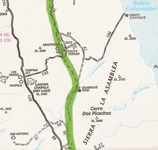
Yah... if the mission site is the main interest and not driving in a stream for a few miles... then go to Coco's Corner and take the road heading east
(vs. the one that goes north past Coco's door to Gonzaga Bay).
That will be the graded road to Puerto Calamajue fish camp... about 6 1/2 miles from Coco's you will see a branch dirt road heading off to the
right... or south... It goes about 8 miles to the edge of the Calamajue river gorge... and drops down to the bottom. Before going down the grade...
look to your left for the ruins of an ore mill used to process gold from nearby mines... They are on the side of the cliff...
Now look across the river to a bench on the opposite side... There is where the mission was located (it was a visita before becoming the first site of
the mission that was renamed Santa Maria de los Angeles... after it was moved.
At the bottom of the grade... the main road south to El Crucero (and Baja 1000 route) continues up and into the narrow gorge... However, to get to the
mission, you want to turn slightly left and cross to the other side of the river bed... a short grade takes you up to the bench on the opposite side
where ruins (just outlines) of the adobe mission buildings remain as well as some more recent stone corrals... Possibly from the mining days of 100+
years ago.
More Calamajue details: http://www.vivabaja.com/missions1/page8.html
CALAMAJUE 29º25'16.30" 114º11'42.36" Located 15.5 miles north of Hwy. 1 (Km. 261) or
14 miles east and south of Coco's Corner, on the east bank of Arroyo Calamajue.
[Edited on 3-23-2010 by David K]
|
|
|
redhilltown
Super Nomad
Posts: 1130
Registered: 1-24-2009
Location: Long Beach, CA
Member Is Offline
|
|
I agree I'd go in from Coco's. For one thing he'll have some sort of info on the road and the fish camp (he never seems too happy with the people down
at the camp). And from the south it can be a bit worse than what David K said about driving in a stream...it can be REAL wet and 4x4 necessary...plus
if you are traveling alone you won't have much back up but if adventure and some beautiful off roading is what you're looking for, go for it!
|
|
|
David K
Honored Nomad
Posts: 65589
Registered: 8-30-2002
Location: San Diego County
Member Is Offline
Mood: Have Baja Fever
|
|
Yah Amy, what RedHillTown says... There is a deep hole while driving in the creek that will surprise you, if you go south of the mission in the
canyon.
|
|
|
Jack Swords
Super Nomad
Posts: 1097
Registered: 8-30-2002
Location: Nipomo, CA/La Paz, BCS
Member Is Offline
|
|
Also, you may encounter a great deal of mud on the road about a mile from the stream. We were in 4WD and my tires (BFGs) just became slicks and had
no traction. We walked in from there. Depends on the rain. Good Luck.
|
|
|
David K
Honored Nomad
Posts: 65589
Registered: 8-30-2002
Location: San Diego County
Member Is Offline
Mood: Have Baja Fever
|
|
Here's the AAA map with the El Camino Real route highlighted...
|
|
|
ArvadaGeorge
Nomad
Posts: 358
Registered: 9-2-2003
Member Is Offline
|
|
I road it 2 weeks ago on a M/C. It's not much of a road any more;it's only used by M/C 's and serious of roaders.
|
|
|
Neal Johns
Super Nomad
Posts: 1687
Registered: 10-31-2002
Location: Lytle Creek, CA
Member Is Offline
Mood: In love!
|
|
It is many miles from the fish camp and it gets quite a bit of gringo traffic, so no worries - except for the mud south of the camp. It would make a
nice hike if you are alone and do not like the looks of the mush. From the mushy area, note the foot trail up the west side mountain that goes to a
mine a short distance - but UP. 
My 70 year old wife has driven through the mud several times with no problems, but rarely without other vehicles.
My motto:
Never let a Dragon pass by without pulling its tail!
|
|
|
El Camote
Senior Nomad
Posts: 514
Registered: 9-7-2003
Location: Above the clouds
Member Is Offline
Mood: y Blues
|
|
It's a great place to camp near the mission and take day hikes into the canyon. Bring your own drinking water though. The warm springs bubbling out
of the rocks are probably too mineralized to drink.
It is a fun ride on a moto...

Knowledge is good. - Emil Faber
|
|
|
Pacifico
Super Nomad
Posts: 1299
Registered: 5-26-2008
Member Is Offline
|
|
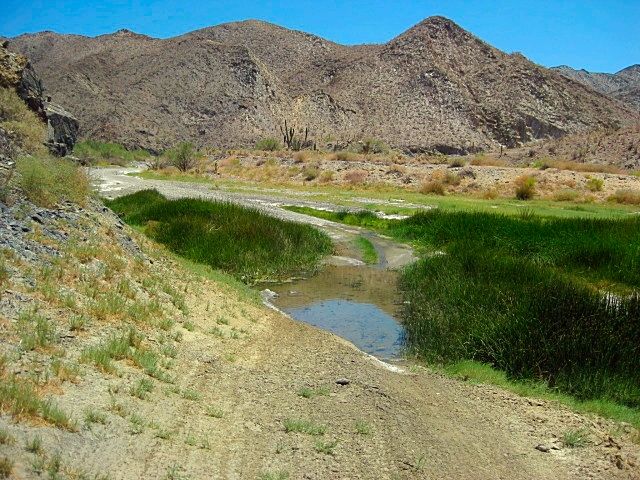
It can get really wet.....

Pretty close to where you drop into the canyon.....

Deep, stinky water and mud.....

It's a jungle in there......

|
|
|
TMW
Select Nomad
Posts: 10659
Registered: 9-1-2003
Location: Bakersfield, CA
Member Is Offline
|
|
Graham Mackintosh wrote about the fish camp in his book Into a Desert Place. Interesting experience and good read.
|
|
|
Martyman
Super Nomad
Posts: 1904
Registered: 9-10-2004
Member Is Offline
|
|
Sung to "Do You Know The Way To San Jose"
LA is a great big freeway
Put a hundred down in baja
In a week or two you'll be a nomads star
Driving to calamajue
And all the nomad, that ever were
Are drinking tequila and smokin' stash
|
|
|
David K
Honored Nomad
Posts: 65589
Registered: 8-30-2002
Location: San Diego County
Member Is Offline
Mood: Have Baja Fever
|
|
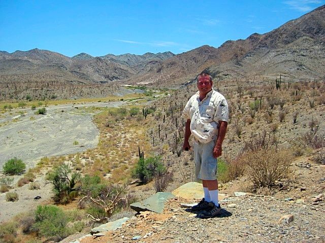
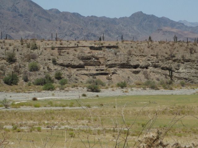
I know how much you all love my old photos of Baja! 

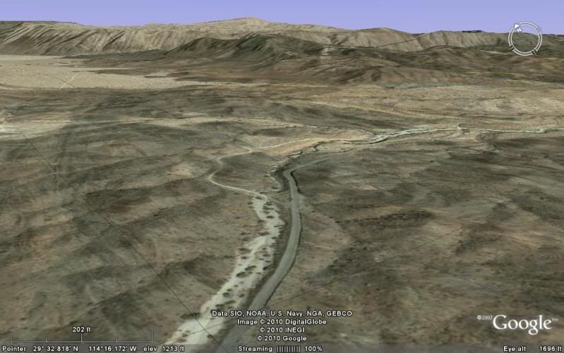
That's me in 1967 at the gold ore mill ruins on the edge of Calamajue arroyo... the road drops down to the arroyo floor just south of these ruins...
and the mission is on the opposite side of the arroyo from these ruins.... a road goes right up to the mission site. The main road south enters the
canyon (seen in the distance here)... and rides right in the stream for several miles.
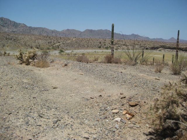
Here's a couple photos at the mission I took in Jan., 2002:


Not too much there... The site was abandoned because crops would not grow in the highly mineralized water.
|
|
|
David K
Honored Nomad
Posts: 65589
Registered: 8-30-2002
Location: San Diego County
Member Is Offline
Mood: Have Baja Fever
|
|
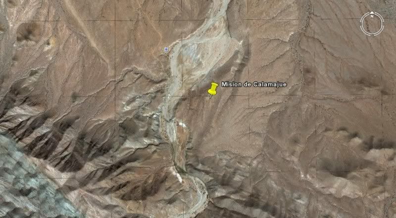
Coco's Corner to Calamajue (from space)
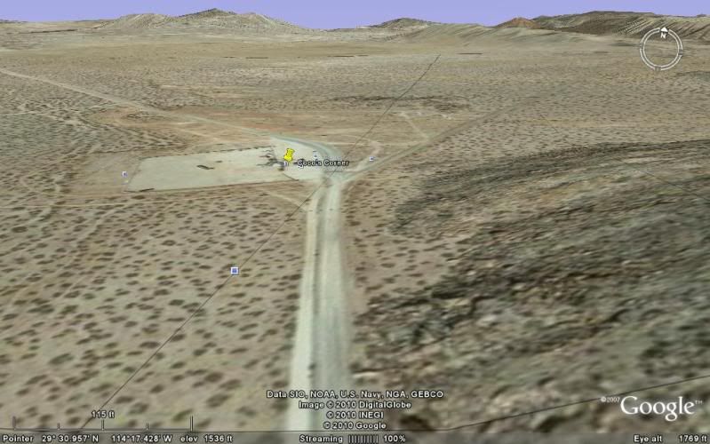
Fork to the right for Calamajue (Gonzaga is the left fork).
In 2 1/2 miles, coming through some hills, is the older road to Gonzaga from Calamajue.
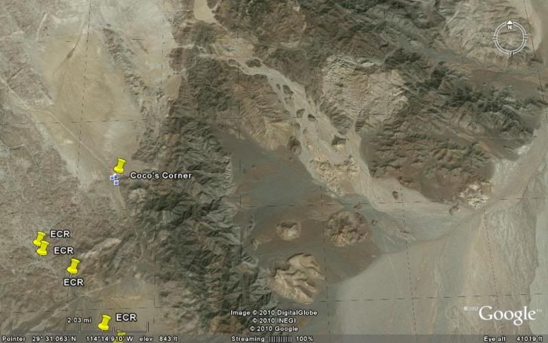
Here's a high view, straight up... north at top.

Now heading south, the road to Calamajue mission and south is the straight ahead (right) road. The graded road to Puerto Calamajue curves to the left.

Nearing Calamajue, a road heads off to the right to the canyon that is the route of El Camino Real heading north.
Getting very near the arroyo, the old Calamjue airstrip is off to the right... and between it and the road is the Camino Real. On the left are the
gold ore mill ruins, overlooking the arroyo. On the opposite bank is the mission site.
The road drops steeply down to the arroyo... at the bottom, a faint left branch is the route to the mission... main traffic continues south in the
streambed.
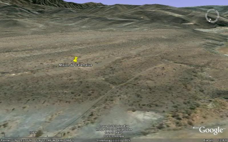
The mission road climbs up the cliff to the bench overlooking the arroyo where the ruins are.
Here is a higher look from the south, above the road in the canyon.
Have fun!
[Edited on 3-25-2010 by David K]
|
|
|
David K
Honored Nomad
Posts: 65589
Registered: 8-30-2002
Location: San Diego County
Member Is Offline
Mood: Have Baja Fever
|
|
De nada... Google Earth is pretty good at seeing the area or helping find roads to places you would like to explore.
At the mission, you might spend more time than it looks worth spending... The missionaries were established there longer than the few months it was a
mission... as it was a visita before and after the fewe months it was a mission. Then the gold miners were there for a long time... including Dick
Daggett ... You can read alot about Calamajue in Arthur North' book 'Camp and Camino in Lower California... about his visit with Daggett and others
there in 1905/6.
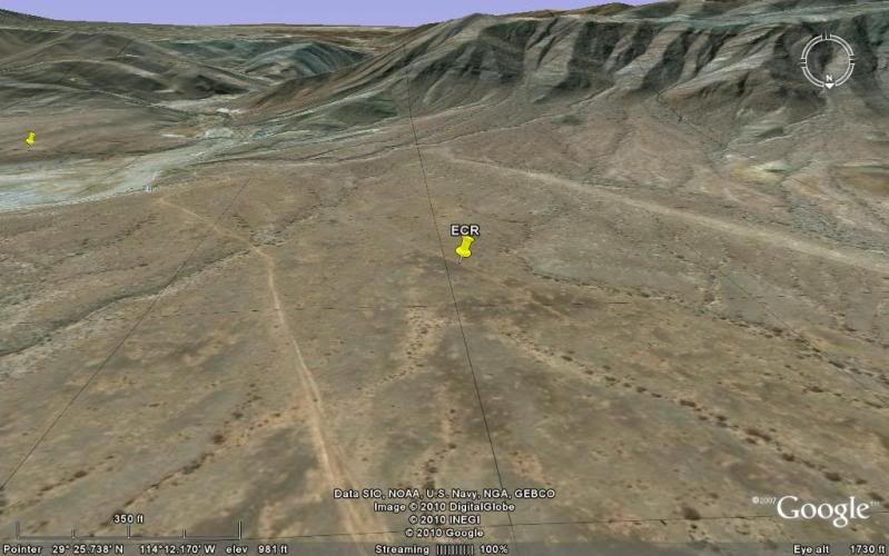
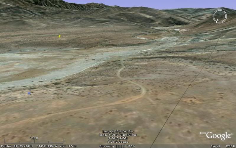
Some trails can be seen heading away from the mission to the east... on Google.
|
|
|
redhilltown
Super Nomad
Posts: 1130
Registered: 1-24-2009
Location: Long Beach, CA
Member Is Offline
|
|
Man....Pacifico NAILED it!!!! And I'm sure the one photo is the deep pool David K was talking about...it can be nasty. We kept two tires on the dry
bank and two in the water and the pitch was a bit sickening...but we made it. Have fun but try to bring some back up!
|
|
|
David K
Honored Nomad
Posts: 65589
Registered: 8-30-2002
Location: San Diego County
Member Is Offline
Mood: Have Baja Fever
|
|
A follow-up on this Calamajué info...
In July, 2012 the creek was just a trickle and that hole Pacifico shows (and I drove into in 2002) was gone or missed. The road was easy south of the
mission/ mill end of the canyon, but the last few miles to El Crucero were all whoops so a bit tedious driving.

Road north of Calamajué, southbound
Arroyo Overlook, next to gold mill ruins on side of cliff
Mission Church Outline
Looking at mill ruins from mission side of arroyo
Biggest water hazard this trip
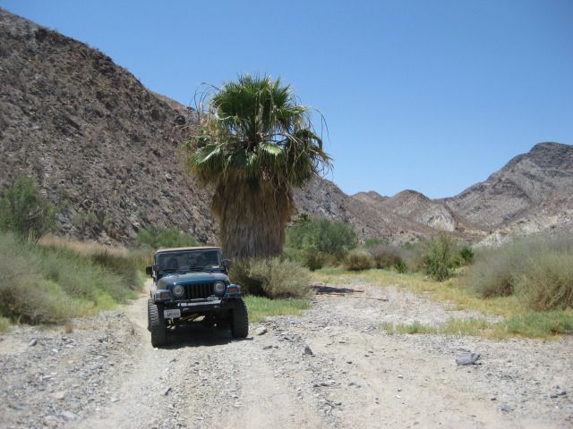
In canyon
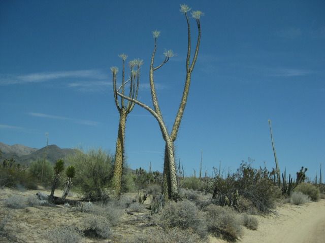
Dancing Boojums south of canyon climbout
[Edited on 11-27-2013 by David K]
|
|
|