snosk8ter
Newbie
Posts: 5
Registered: 4-20-2010
Location: Chino Hills, CA
Member Is Offline
|
|
Good Maps of Baja?
I am planing on going to san felipe to la bay to san fransquito and would like to find a good map. Any help would be appreciated!
|
|
|
capt. mike
Elite Nomad

Posts: 8085
Registered: 11-26-2002
Location: Bat Cave
Member Is Offline
Mood: Sling time!
|
|
http://forums.bajanomad.com/viewthread.php?tid=33021#pid3420...
accept no substitute!!
you can NEVER get lost with one of these.
in stock, ships today.
formerly Ordained in Rev. Ewing\'s Church by Mail - busted on tax fraud.......
Now joined L. Ron Hoover\'s church of Appliantology
\"Remember there is a big difference between kneeling down and bending over....\"
www.facebook.com/michael.l.goering |
|
|
Hook
Elite Nomad
Posts: 9013
Registered: 3-13-2004
Location: Sonora
Member Is Offline
Mood: Inquisitive
|
|
The AAA map is fine for most all applications. Even shows most dirt roads.
Besides, who wants to supply provisions for all those chicks between SF and San Francisquito??
|
|
|
capt. mike
Elite Nomad
Posts: 8085
Registered: 11-26-2002
Location: Bat Cave
Member Is Offline
Mood: Sling time!
|
|
hook - check U2U.
formerly Ordained in Rev. Ewing\'s Church by Mail - busted on tax fraud.......
Now joined L. Ron Hoover\'s church of Appliantology
\"Remember there is a big difference between kneeling down and bending over....\"
www.facebook.com/michael.l.goering |
|
|
David K
Honored Nomad
Posts: 65595
Registered: 8-30-2002
Location: San Diego County
Member Is Offline
Mood: Have Baja Fever
|
|
| Quote: | Originally posted by snosk8ter
I am planing on going to san felipe to la bay to san fransquito and would like to find a good map. Any help would be appreciated!
|
Going by land or sea?
If by land, then (as Hook said) the AAA map is the popular road map with mileages... owever, there are not a lot of route options, since there is
basically one road. The only option is the junction at Coco's Corner where serious 4WD folks may take the Baja 1000 course through Calamajue Canyon
instead of the main road to Laguna Chapala.
Captain Mike's three maps are GIANT when combined to show all of Baja and make great wall decoration.
The most detail showing topography, roads and trails can be found in The Baja Almanac... the new edition came out last Fall.
Here is the new edition next to the smaller 2003 edition:
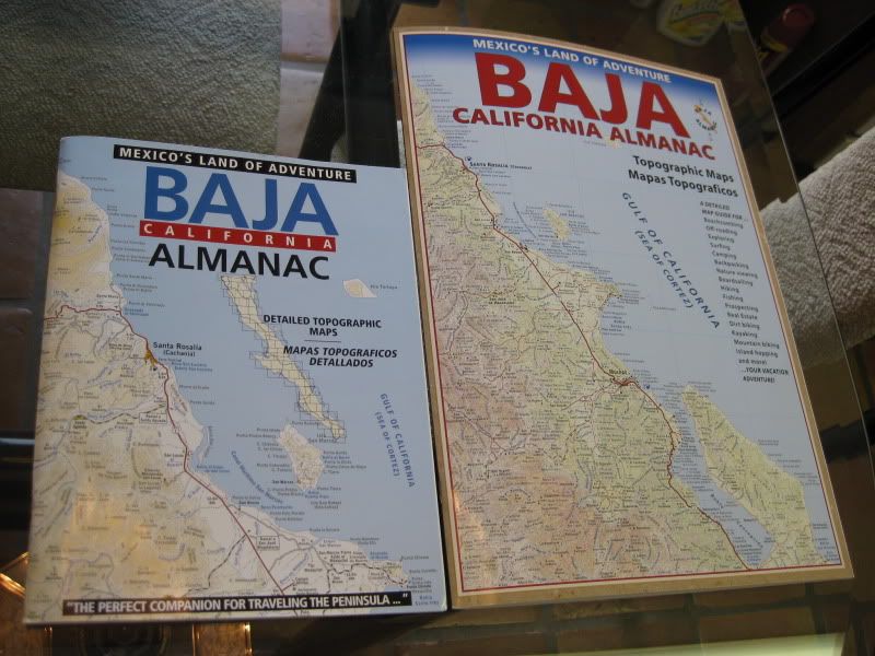
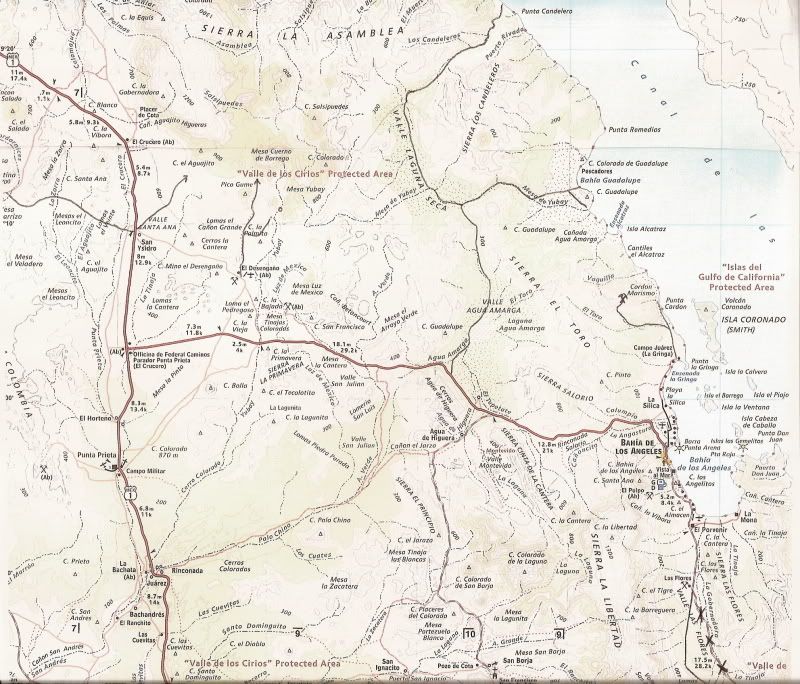
A sample map from inside... (with some other roads north of L.A. Bay added by me):
Available from Discover Baja Travel Club in San Diego or online.
There were some errors in the latitude numbers (listed in another thread), but the maps are otherwise very good for auto use.
There are also a series of boater's maps available if you are traveling by sea...
|
|
|
wilderone
Ultra Nomad
Posts: 3915
Registered: 2-9-2004
Member Is Offline
|
|
Discover Baja Travel Club in San Diego has maps for sale, as well as other books, insurance, visa services. You might want to see what they have to
offer.
|
|
|
snosk8ter
Newbie
Posts: 5
Registered: 4-20-2010
Location: Chino Hills, CA
Member Is Offline
|
|
Thank you all for the information!! I think the baja almanac by land is just what I am looking for.
|
|
|
David K
Honored Nomad
Posts: 65595
Registered: 8-30-2002
Location: San Diego County
Member Is Offline
Mood: Have Baja Fever
|
|
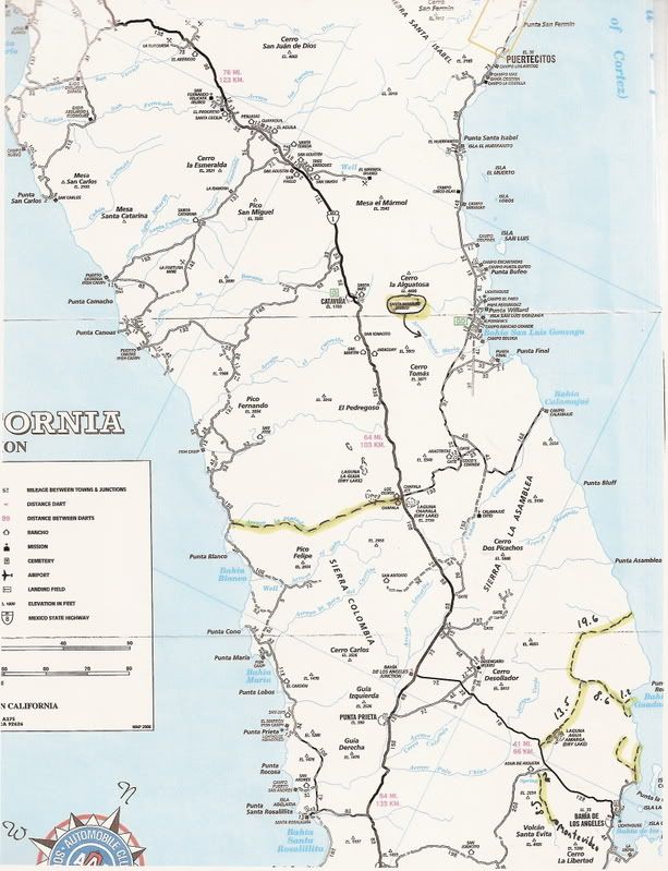
Here's a bit of the AAA Baja map from Puertecitos south to Hwy. 1 at El Crucero... The edited arrows were to show the location of the short cut that
'The squarecircle' (Roy), TW and others got through using an old mine road in La Turquesa Canyon with Roy's Land Rover LR-3 a couple years ago and
documented here.

Here's a larger area down to L.A. Bay with edited notes showing roads not on that (or any other map)...
The maps are available or were available at Discover Baja, as well.
|
|
|
yellowtail67
Junior Nomad
Posts: 42
Registered: 3-9-2008
Member Is Offline
|
|
The Almanac map is the bomb! Awesome info and detail for trekking.
|
|
|


