Bajamatic
Senior Nomad

Posts: 571
Registered: 8-31-2006
Member Is Offline
|
|
Mesa San Carlos
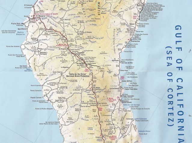
Does anyone know if there's a navigable road from somewhere near the San Antonio Mission out to the mesa? Google earth shows a pretty good looking
road but following the road on the Almanac had us doing circles around the Mission. Anyone ever been out there?
yuletide
|
|
|
David K
Honored Nomad
Posts: 65595
Registered: 8-30-2002
Location: San Diego County
Member Is Offline
Mood: Have Baja Fever
|
|
Mision San Fernando Velicata I presume... there is no San Antonio mission in Baja?
The road you want heads south from near the old Rancho El Progreso site (on the old Baja main road). It is south of the new El Progreso (signed access
to Mision San Fernando). The road makes a big arch to the west as it crosses the arroyo and then heads south, up a hill.
There is a fork in the road, beyond a closed gate. The left fork goes to the San Fernando copper mine site... the right fork heads out to Mesa San
Carlos... petroglyphs out there, too.
I have been to the San Fernando Copper mine (photos in my web site, July, 2000 trip). Neal Johns has been out past on the Mesa road... and had a big
story about it... many years ago.
Neal may have it and share, if I find it... I will post it here.
|
|
|
Bajamatic
Senior Nomad
Posts: 571
Registered: 8-31-2006
Member Is Offline
|
|
ok
right. my bad - I meant Mision San Fernando. Ok. So we were doing circles around another site marked #2 in the photo below - #1 is the Mision
according to the almanac. Any idea what we were looking at? Looks like it might be called Los Cuates?
[Edited on 7-2-2010 by Bajamatic]

yuletide
|
|
|
David K
Honored Nomad
Posts: 65595
Registered: 8-30-2002
Location: San Diego County
Member Is Offline
Mood: Have Baja Fever
|
|
| Quote: | Originally posted by Bajamatic
right. my bad - I meant Mision San Fernando. Ok. So we were doing circles around another site marked #2 in the photo below - #1 is the Mision
according to the almanac. Any idea what we were looking at? Looks like it might be called Los Cuates? |
My pics of the mission, mission nearby petros, and the copper mine are here: http://www.vivabaja.com/davidlorenzo/dlpage4.html
[Edited on 7-2-2010 by David K]
|
|
|
David K
Honored Nomad
Posts: 65595
Registered: 8-30-2002
Location: San Diego County
Member Is Offline
Mood: Have Baja Fever
|
|
In the new Almanac, Las Cuates is east of El Progreso... see the mine south of El Progreso and Mision San Fernando, called San Fernando? Also see the
mine El Gato? That is the road you want to be on...
[Edited on 7-2-2010 by David K]
|
|
|
Bajamatic
Senior Nomad
Posts: 571
Registered: 8-31-2006
Member Is Offline
|
|
yeah I see it clearly now. We were yards from reaching an intersection that would have pointed us to the mesa. We passed what I was CERTAIN was a
mission - the structure, or what was left of it, looks like the same material in your photos of mision fernando, but it was on flat ground and maybe a
little smaller. I guess we probably should have snapped a photo but we had already spent 30 minutes on a terrible road before realizing that it also
was incorrect so tension was building.... We pulled the plug on that adventure seconds too soon.
yuletide
|
|
|
David K
Honored Nomad
Posts: 65595
Registered: 8-30-2002
Location: San Diego County
Member Is Offline
Mood: Have Baja Fever
|
|
See my missions pages for more on San Fernando... The petroglyps 1/2 mile west of the mission are great, too. In your satellite map, the road you
wanted goes straight down off the bottom (south) near the middle of the page... note water flow going north towards main Arroyo San Fernando.
|
|
|
wilderone
Ultra Nomad
Posts: 3915
Registered: 2-9-2004
Member Is Offline
|
|
"We passed what I was CERTAIN was a mission"
Where was that in relation to #2? Doesn't look that far from Hwy. 1 as the crow flies (?). And 'scuse my confusion, but what mesa were you trying to
get to, and why did you want to go there?
And just for the heck of it, could you find the mission on the type of map you provided above (Google earth??), and scan a bit northwest to find the
pictograph site. I'd like to see if there is a trail connecting the mission and the pictograph site. It should follow an arroyo. A friend and I
went to the mission once to find out, but the area was 4 ft. high in weeds and brush and any old trails would have been covered. We didn't see any
anyway standing on top of dam wall and looking beyond toward the pictographs. Has stickers in our socks so we didn't proceed!!!
|
|
|
Bajamatic
Senior Nomad
Posts: 571
Registered: 8-31-2006
Member Is Offline
|
|
What I THOUGHT was Mission San Fernando is right at my #2 waypoint. Looking at the almanac, it's around Los Cuates; we thought we turned off the road
closer to el progreso. We searched for any roads heading west but found only 4 foot high weeds. We were trying to get out there just because there's
a road and we wanted to see where it ends.
yuletide
|
|
|
Mexitron
Ultra Nomad
Posts: 3397
Registered: 9-21-2003
Location: Fort Worth, Texas
Member Is Offline
Mood: Happy!
|
|
I tried getting out to the mesa in the mid-90s and the road had locked gates on it....
|
|
|
David K
Honored Nomad
Posts: 65595
Registered: 8-30-2002
Location: San Diego County
Member Is Offline
Mood: Have Baja Fever
|
|
The mission is in the Almanac... and it is at or near your #1 on the satellite image... the road goes right to it... a couple of adobe ranch houses
are across the road from it... there is a fence around the mission with a gate and a marker... it is in my photos http://vivabaja.com/missions2

The road continues WEST past the mission 1/2 mile to where the arroyo turns south... the road follows and the petros are up on the cliff face, on the
right... facing east, next to the road. More photos of the petros and mission at http://vivabaja.com/403 and http://vivabaja.com/105


[Edited on 7-3-2010 by David K]
|
|
|
TMW
Select Nomad
Posts: 10659
Registered: 9-1-2003
Location: Bakersfield, CA
Member Is Offline
|
|
The road to the mission turns off at El Progresso at the truckers cafe, well marked. At the mission there is a man (maybe family or was when I was
last there) living in the ranch house. He can guide you on whats past the mission further west. Your site 2 is an abandoned rancho.
|
|
|


