shortcut
Newbie
Posts: 14
Registered: 2-8-2010
Member Is Offline
|
|
phx to bay of la
Headed to bay of la from phx in a pick up truck. Is now quicker to go san felipe cocos then out to th highway or the long way around through ensenada
|
|
|
David K
Honored Nomad

Posts: 65595
Registered: 8-30-2002
Location: San Diego County
Member Is Offline
Mood: Have Baja Fever
|
|
On July 19, 2010... but no changes since then:
| Quote: | Originally posted by shortcut
Headed to bay of la from phx in a pick up truck. Is now quicker to go san felipe cocos then out to th highway or the long way around through ensenada
|
You decide... 135 miles and 5 hours from San Felipe to Hwy. 1 in a Tacoma(the following was posted on the Nomad Road Conditions forum and Baja Trip
Reports forum with more photos)
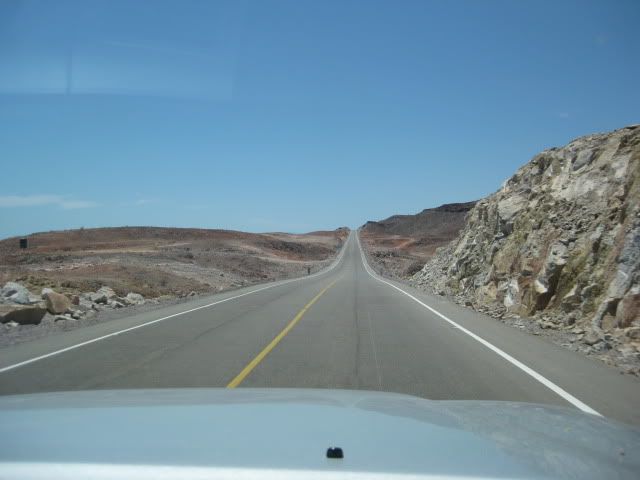
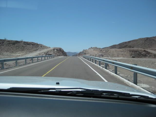
The new highway south of Puertecitos is totally different than the poor highway that runs the 55 miles from San Felipe to Puertecitos... It is built
to the new standard, wider, with shoulders that will make riding bikes safe... and designed for high speed. As of Monday, 7-19-10:
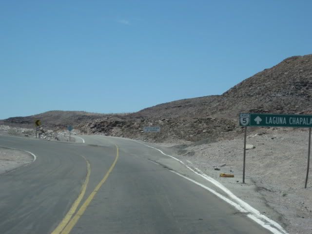
0.0 (0 min.) Puertecitos Entrance Road, sign ahead for Laguna Chapala.
5.2 (6 min.) Playa Cristina
6.2 La Costilla
17.6 (20 min.) El Huerfanito (off to east of highway, no sign)
18.5 Detour off pavement onto older road, regraded for construction traffic. Piles of sand on road mark this point, no sign. Ahead on pavement is sign
for Campo Tano at Mile 19.0. At 19.3 is a sign 'End of Pavement, 200 mtrs.'). At 19.5 is the absolute end at an unfinished bridge. No sign of road
work on the opposite side of arroyo. Road work does continue beyond, out of sight from here.
Return back to Mile 18.5, detour onto dirt... log continues from this point.
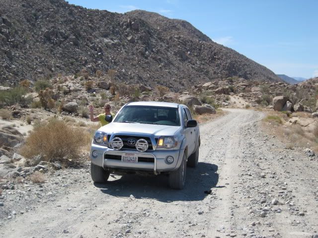
25.1 (34 min. from Puertecitos, not including run to end of pavement) End of new road construction alongside old road. Old road new grading ends...
very rough, rocky road on to Gonzaga. Motorhomes and trailers should avoid!
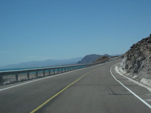
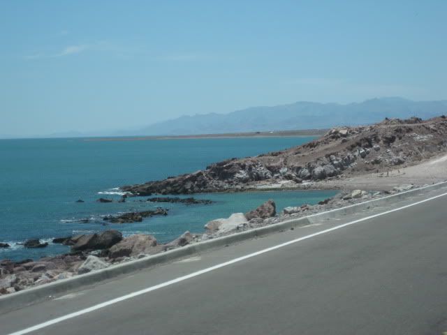
26.0 'Okie Landing' to east (note cement pads along end of gravel beach marking the fish camp of the 1960's.
33.1 (1 hr. 14 min.) Campo Delfines
36.3 (1 hr. 26 min.) Las Encantadas
37.9 (1 hr. 31 min.) Punta Bufeo
43.1 (1 hr. 59 min.) El Faro
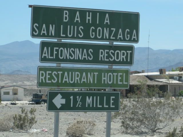
43.4 (2 hr. 1 min.) Papa Fernandez' Bahia San Luis Gonzaga
Military Checkpont is just a mile + ahead.
46.1 (2 hr. 12 min.) Alfonsina's Pemex (closed from 2-4 pm), Rancho Grande Market just ahead on right.
Clear odometer for next section... The main road south from Gonzaga is much better than the road north, but the rough surface still limits maximum
speed to ~30 mph (twice that of the north section) in a Tacoma, loaded.
0.0 Rancho Grande 'Gonzaga Bay'
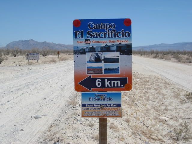
1.3 (8 min.) Road to Campo Beluga and Sacraficio
7.5 (22 min.) Road west to Arroyo Santa Maria and Las Palmitas oasis on the old mission trail 'El CaminoReal'
10.0 (28 min.) Road in from left is the south access route to Punta Final
16.7 La Turquesa Canyon road to west (green pools of water, turquoise mine, and very difficult off road and abandoned mine road shortcut to Hwy. 1
near El Pedregoso)
19.2 (52 min.) Las Arrastras site access road. Gold ore grinding mills, well, nearby waterhole of San Francisquito on the Camino Real.
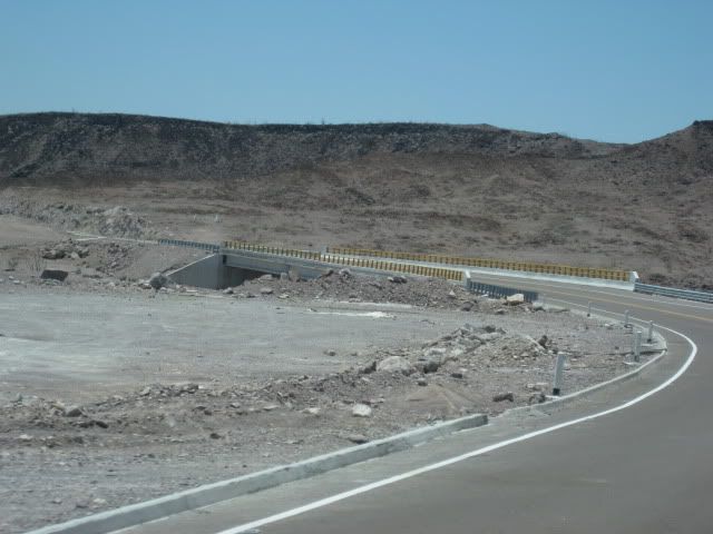
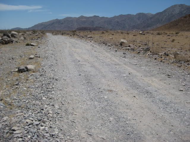
23.0 (1 hr.) Coco's Corner (cold Pacifico for sale $2) Coco in Ensenada, helper Ramón on hand.
36.1 (1 hr. 30 min. driving time) HWY. 1, Laguna Chapala. Gasoline and tire repairs advertised, 1 km. south.
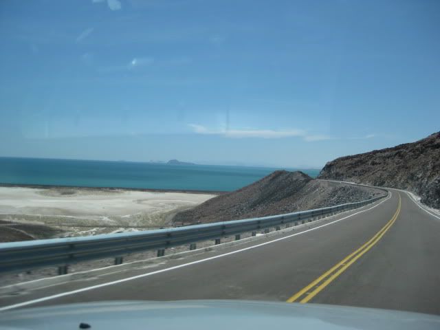
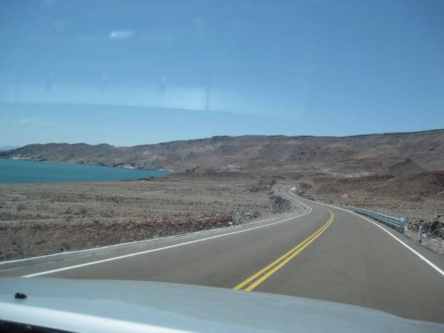
Some photos...
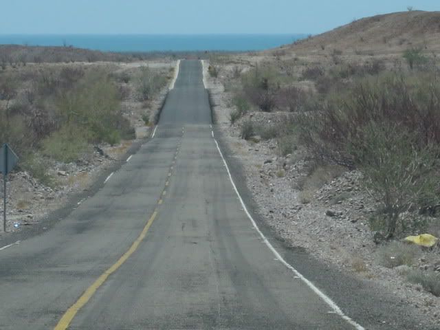
Poor hwy. north of Puertecitos
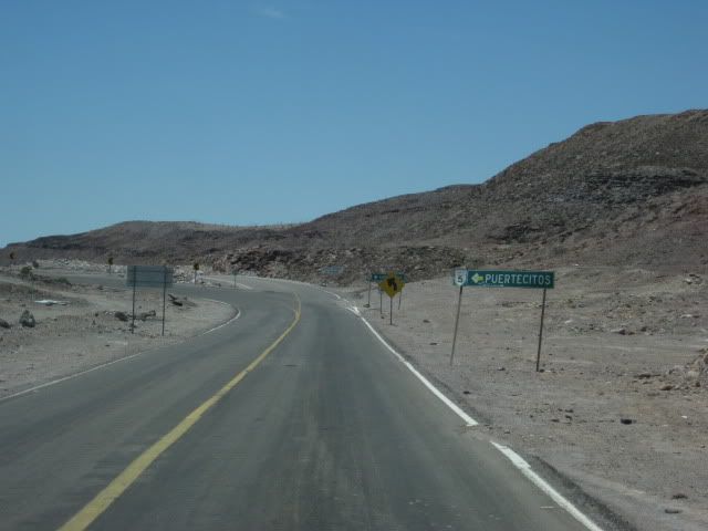
Road log above, begins here.
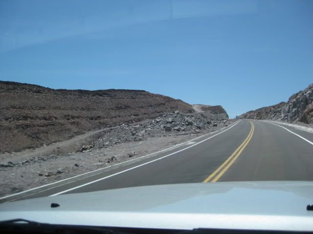
Old old road on left... looks like it was graded for detour.
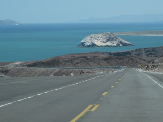
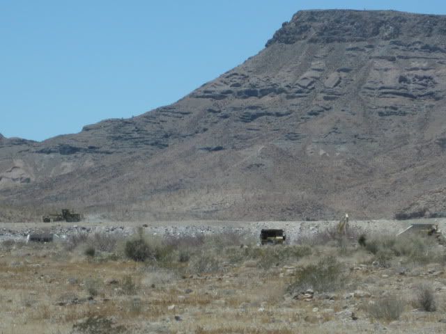
El Huerfanito Island

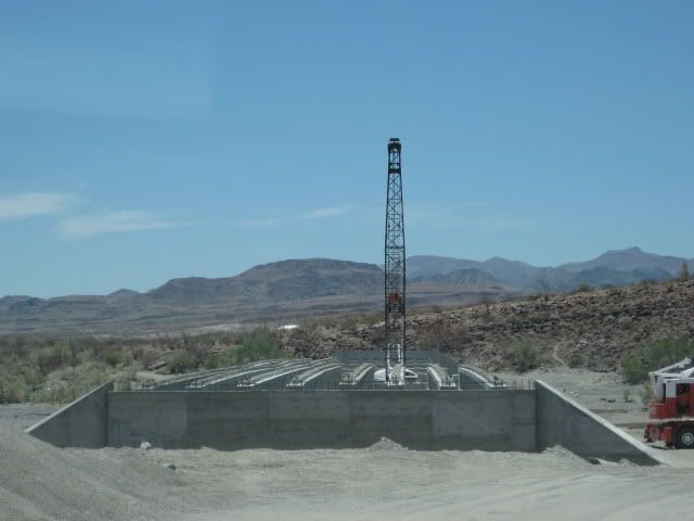
Bridge at very end of pavement
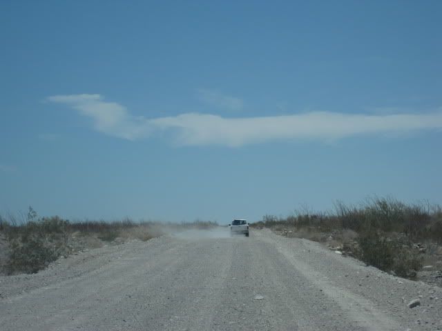
Old road, regraded along new road.
It's rougher than it looks!
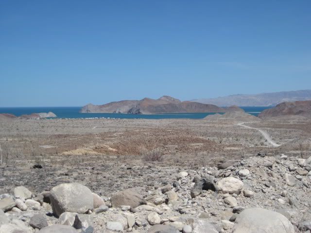
First view Gonzaga Bay
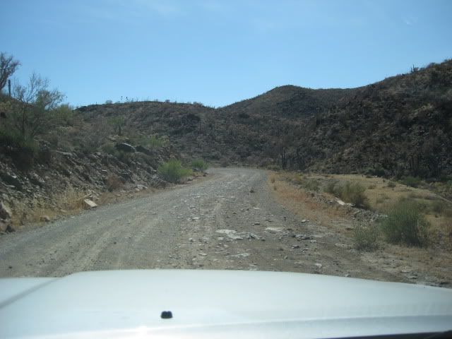
Road south of Coco's Corner.
|
|
|
rts551
Elite Nomad
Posts: 6700
Registered: 9-5-2003
Member Is Offline
|
|
I won't make you guess. From Tucson it is about the same amount of time even though it is almost 200 miles shorter. But the rough road took out all
4 shocks on our f250. The jeep fared a lot better and went a lot faster.
Big vehicle.... I would take the longer route. Smaller, better riding vehicle and you will probably make it faster taking the shorter, rougher route.
Have fun
|
|
|
mcfez
Elite Nomad
Posts: 8678
Registered: 12-2-2009
Location: aka BN yankeeirishman
Member Is Offline
|
|
Take the long way....save your teeth
Old people are like the old cars, made of some tough stuff. May show a little rust, but good as gold on the inside.
|
|
|
Ken Cooke
Elite Nomad
Posts: 8971
Registered: 2-9-2004
Location: Riverside, CA
Member Is Offline
Mood: Pole Line Road postponed due to injury
|
|
| Quote: | Originally posted by mcfez
Take the long way....save your teeth |
Tires, oil pans on low-slung vehicles, take the long route.
|
|
|
desertcpl
Super Nomad
Posts: 2408
Registered: 10-26-2008
Location: yuma,az
Member Is Offline
|
|
| Quote: | Originally posted by Ken Cooke
| Quote: | Originally posted by mcfez
Take the long way....save your teeth |
Tires, oil pans on low-slung vehicles, take the long route. |
I know about all this,, been there done that.
its an adventure to take this road.
|
|
|
BajaDanD
Senior Nomad
Posts: 745
Registered: 8-30-2003
Member Is Offline
|
|
Take the long road your car/truck will thank you
|
|
|
Ken Cooke
Elite Nomad
Posts: 8971
Registered: 2-9-2004
Location: Riverside, CA
Member Is Offline
Mood: Pole Line Road postponed due to injury
|
|
| Quote: | Originally posted by desertcpl
its an adventure to take this road. |
I couldn't agree w/you more!

|
|
|
shortcut
Newbie
Posts: 14
Registered: 2-8-2010
Member Is Offline
|
|
I think i will go the long way. Whats a couple of hours when spending a week in baja. Thanks for all the advice.
|
|
|


