| Pages:
1
2 |
wilderone
Ultra Nomad

Posts: 3915
Registered: 2-9-2004
Member Is Offline
|
|
"SOoooo, with the strong current, would it be better to go during neap tide rather than at the moons? Is there a big difference between high & low
tide?"
You need to check a tide chart to know the best time to do any distance paddling. It is easier to go south with the tide/current if that is your
destination, but a b itch to paddle back in a headwind and beating northerly swells and white caps. As you can see, it would be wise to cross over and
reach the closest point of land, i.e., Punta San Ysidro (and go north/south from there along the coast and ditto the return trip). If you find
yourself wanting to return at 2 pm and the wind is howling and the troughs are 2 feet and foaming, personally, in my opinion, for safety's sake,
speaking for myself - I would not risk a crossing in those conditions, but spend the night on the island and cross at first light when it is calm (or
should be calm). I paddled from San Evaristo to Isla San Francisco. While on Is. SF, the wind came up and had to paddle back in scary,
aforementioned foaming 2 ft. troughs with northerly swells which you had to consistently brace for (you know a bracing stroke, right?). Fortunately,
we were headed south, and the conditions pushed us south. For me, it would have been impossible to try to paddle back to a northerly destination
considering my skills and strength. As for the current, it can easily carry you too far south of your intended landing point if you're not careful.
Do what you're comfortable with.
|
|
|
elfbrewery
Nomad
Posts: 350
Registered: 12-25-2006
Member Is Offline
|
|
Very good advice. This is the kind of info only Nomads can provide. Thanks!
|
|
|
elfbrewery
Nomad
Posts: 350
Registered: 12-25-2006
Member Is Offline
|
|
I have tide info for La Paz and Loreto, but no info about the currents. Can I make a calculated guess as to slack tide times?
|
|
|
bajabass
Super Nomad
Posts: 2016
Registered: 10-4-2006
Location: La Paz,BCS
Member Is Offline
Mood: Want to fish!!!
|
|
In looking at the map, it shows the road north from the mine at San Juan De La Costa going all the way to San Evaristo. Has anyone every gone that
way? I am thinking of driving up that way this morning.
Keep your eyes on the road, and your hands upon the wheel!
|
|
|
monoloco
Elite Nomad
Posts: 6667
Registered: 7-13-2009
Location: Pescadero BCS
Member Is Offline
|
|
| Quote: | Originally posted by bajabass
In looking at the map, it shows the road north from the mine at San Juan De La Costa going all the way to San Evaristo. Has anyone every gone that
way? I am thinking of driving up that way this morning. |
That is the main road in, the only really bad spot
is the road up and over Punta Machudo. They drive the fish trucks in a few times a week so it shouldn't be too bad.
|
|
|
bajabass
Super Nomad
Posts: 2016
Registered: 10-4-2006
Location: La Paz,BCS
Member Is Offline
Mood: Want to fish!!!
|
|
Leaving now, thanks crazy one!! Hopefully, fresh mariscos for lunch!! Hopefully, fresh mariscos for lunch!!
Keep your eyes on the road, and your hands upon the wheel!
|
|
|
Martyman
Super Nomad
Posts: 1904
Registered: 9-10-2004
Member Is Offline
|
|
When I stayed at Punta Mechudo I had small biting bugs get in my inflatable kayak!. They were chewing me up while fishing. Fishing was good though,
hooked a dorado from shore.
|
|
|
GWBaines
Newbie
Posts: 11
Registered: 11-14-2007
Member Is Offline
|
|
We are now in LaPaz, came over the road from Constitucion to San Luis Gonzaga Mission, then to La Presa and on to Ean Evaristo, in December. This
road is in far worse shape than I have ever seen it before. We have been over this route at least 6 times. The fines in the road are all gone. We
spent 5 1/2 hours in low range 4x4! I highly recommend coming in from the south this year and until they repair/grade the road. Even from the south
the section coming over the Machudo headlands in very rough and slow. You will need a good clearance and a low range gear. The Dos Mares off road
race has taken a major toll on these roads, as well as a complete lack of repair. Concreted sections on the grades have caused some deep erosion at
the ends of the concrete, making for steep ups and downs there.
|
|
|
elfbrewery
Nomad
Posts: 350
Registered: 12-25-2006
Member Is Offline
|
|
bajabass
Please give us an update on the roads. Much appreciated!
|
|
|
bajacalifornian
Super Nomad
Posts: 1117
Registered: 9-4-2010
Location: Loreto/Lopez Mateos/Rosarito
Member Is Offline
|
|
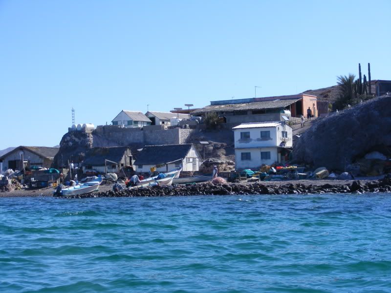
In San Evaristo, find a pangero who will take you to Islita Coyote a rock north of Isla San Francisco, midway to the low southern extension of Isla
San Jose . . . inhabited by a fishing village for hundreds of years. Fascinating.
American by birth, Mexican by choice.
Signature addendum: Danish physicist Niels Bohr who said, The opposite of one profound truth may very well be another profound truth.
Jeff Petersen
|
|
|
bajabass
Super Nomad
Posts: 2016
Registered: 10-4-2006
Location: La Paz,BCS
Member Is Offline
Mood: Want to fish!!!
|
|
The drive from San Juan De La Costa was not too bad. A couple drop offs/rises at
the ripped up concrete "helper sections". A few hairy, don't look down areas. Lots of rock in the Machudo area. That section the mighty Tundra handled
well. A couple drop offs/rises at
the ripped up concrete "helper sections". A few hairy, don't look down areas. Lots of rock in the Machudo area. That section the mighty Tundra handled
well.
There are two roads from San Evaristo, out to Hwy 1. The northern road splits 3 different ways on my map, and looked easy to get lost. I chose the
southern most route, intersecting 1 at Las Pocitas.  All I can say, is have a
solid truck, know how to drive it, and if I ever do it again, 2 spares, a winch, and a good shovel!! All I can say, is have a
solid truck, know how to drive it, and if I ever do it again, 2 spares, a winch, and a good shovel!!
I spent 8 hours making the drive from the Pemex just north of La Paz, where the road to San Juan De La Costa splits off, to San Evaristo, out to Las
Pocitas. It is no longer a road in several sections, steep loose rock uphills and downhills. Funny, after all the jagged, nasty stuff on the "road", I
had a highspeed, right rear blowout, about 15 minutes after I got back on Hwy 1. Threw the truck sideways at about 65, and I almost  soiled myself!! I'm sure I had cut a sidewall on the trail, and as soon as it got
hot, KABOOM! soiled myself!! I'm sure I had cut a sidewall on the trail, and as soon as it got
hot, KABOOM!
All said, I saw some beautiful, awesome stuff you will never get to see from the pavement! The rock formations and different red and green rock are so
pretty you get distracted, which can be dangerous. The entire coast is postcard material. Some of the best views are as you are cresting ridges as you
leave the coast and head inland, and look back to the sea!
Oh, a truck full of nice kids who pointed out the right road from San Evaristo, and I gave an old farmer and his wife three antifreeze jugs of gas,
as they had ran out about 10 km from home.
It was a long, dusty day, cost me a 2,950 peso tire, and I was late for dinner! I can't wait to do it again!!! 
Keep your eyes on the road, and your hands upon the wheel!
|
|
|
BajaRat
Super Nomad
Posts: 1304
Registered: 3-2-2010
Location: SW Four Corners / Bahia Asuncion BCS
Member Is Offline
Mood: Ready for some salt water with my Tecate
|
|
I've caught some great waves in the gulf, especially mainland side. I know people who fly in when everything comes together. You would be surprised
how far up you can surf, but watch out for man eating islanders. I'll leave the maps in my coffin. 
|
|
|
elfbrewery
Nomad
Posts: 350
Registered: 12-25-2006
Member Is Offline
|
|
bajabass - Thanks for the facts. Sounds like something we could handle, if in the right/wrong frame of mind. It always helps to know ahead of time
what lies ahead and what can be avoided. Getting up-to-date experience from you helps so much. Thanks again!
|
|
|
| Pages:
1
2 |


