roverdude
Junior Nomad

Posts: 74
Registered: 10-1-2005
Location: Garden Grove
Member Is Offline
Mood: No Bad Days, Mornings Maybe...
|
|
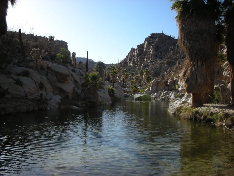
Diving hole near Mission Santa Maria
I've been to the mission a few times. Even found this place off the side of the trail (see truck in background)...
LINK
But have not found this one yet...
VIDEO
Any hints? Thanks
|
|
|
David K
Honored Nomad
Posts: 65591
Registered: 8-30-2002
Location: San Diego County
Member Is Offline
Mood: Have Baja Fever
|
|
Yes, down the canyon towards Gonzaga Bay... Don Jorge talked about it in 2003 after our and his hike up the Camino Real towards the mission from
Gonzaga.
The first link looks like the oasis spot where we (in a Tacoma) camped with Roy (The Squarecirce) and Blanche in an LR3, back in 2007... a mile
downstream from the mission.*
* Thanks to BajaTripper I now see a vehicle above the pool, so that would make the pool the boys are jumping into just below the Widowmaker, one mile
before the mission.
[Edited on 4-27-2011 by David K]
|
|
|
roverdude
Junior Nomad
Posts: 74
Registered: 10-1-2005
Location: Garden Grove
Member Is Offline
Mood: No Bad Days, Mornings Maybe...
|
|
DK
Looking at a map. Any guess on proximity between Gonzaga and the Mission? I've hiked from past the mission along the running water bouncing along the
granite boulders a ways. But turned back when it got dark.
[Edited on 4-27-2011 by roverdude]
|
|
|
David K
Honored Nomad
Posts: 65591
Registered: 8-30-2002
Location: San Diego County
Member Is Offline
Mood: Have Baja Fever
|
|
| Quote: | Originally posted by roverdude
DK
Looking at a map. Any guess on proximity between Gonzaga and the Mission? I've hiked from past the mission along the running water bouncing along the
granite boulders a ways. But turned back when it got dark.
|
Sure, in the canyon... If you take the bulldozed road to the rim (where the petroglyphs are), an Indian trail (also was the Jesuit Camino Real,
replaced by the Franciscan one on the top near the north ridge) drops down into the canyon...
Don Jorge or another Nomad would need top tell you how far from the bottom of the Indian trail to that swimming hole, but not more than a mile I would
say...
Here are some satellite images:
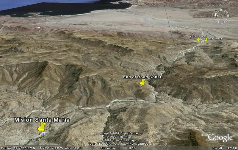
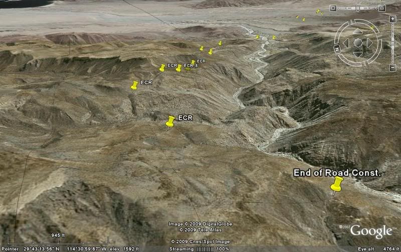
Again, the Indian trail gooes down to the canyon floor from the 'end of road const.' Franciscan El Camino Real marked 'ECR' stays out of the canyon to
the north...
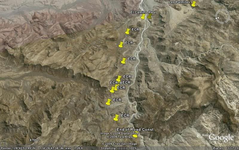
On map, arrows point out the Camino Real where I have saved a Google Earth image of it. The trail between msm 3-4 and msm 5 is above the north rim of
the canyon. The big pools you seek is in the canyon between these two arrows:
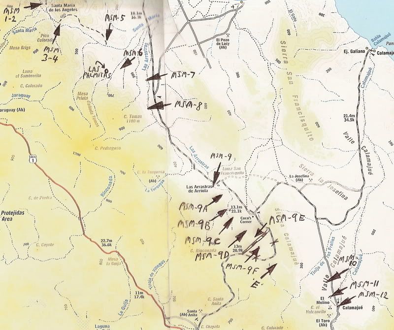
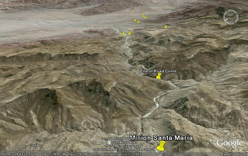
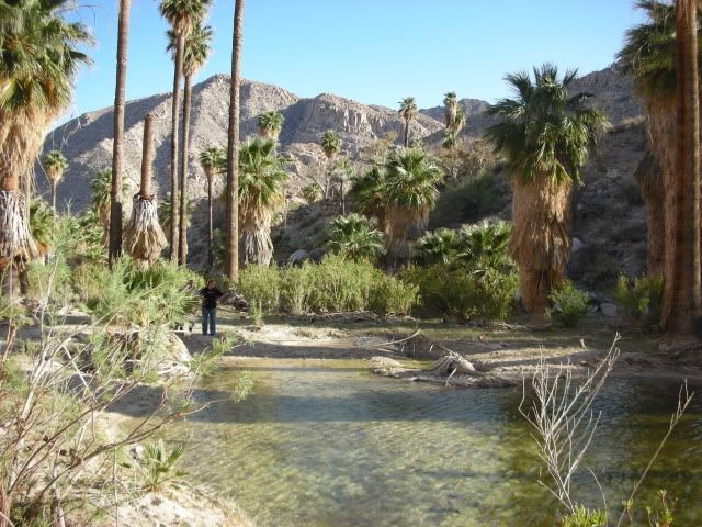
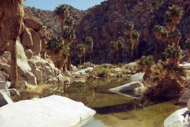
From the Gonzaga Bay side, about a mile walk up into the canyon from where the road ends (west of the Las Palmitas fork):

Soon the pools were deep enough to take a dip, in May:

We flew over the canyon for a view of where we hiked and beyond to the mission, view north over the area with the pools of water. The bigger pool in
the video is a bit further up the canyon:
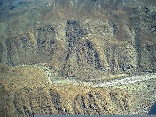
Below, looking east... you can see the end of the road construction on the canyon rim, and the Indian trail continuing down into the canyon:

|
|
|
Bajatripper
Ultra Nomad
Posts: 3152
Registered: 3-20-2010
Member Is Offline
|
|
| Quote: | Originally posted by David K
The first link looks like the oasis spot where we (in a Tacoma) camped with Roy (The Squarecirce) and Blanche in an LR3, back in 2007... a mile
downstream from the mission. |
I'm pretty sure that first link is right at where we gathered after pulling Neal John through the swamp, at the base of the Widowmaker. You may
remember, David, I had a bit of mud on me when we got there. But I was clean as a whisle before heading up the grade. I'd taken a quick dip in that
hole and changed. The truck in the photo fits my recollection.
|
|
|
David K
Honored Nomad
Posts: 65591
Registered: 8-30-2002
Location: San Diego County
Member Is Offline
Mood: Have Baja Fever
|
|
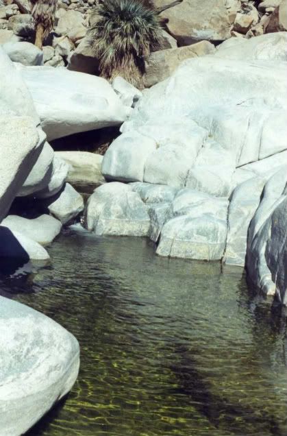
OK, 10-4 on that...
Here are some photos at the oasis, a mile below the mission (May 2007):
|
|
|
BajaRoadrunner
Junior Nomad
Posts: 59
Registered: 6-15-2009
Member Is Offline
|
|
| Quote: | Originally posted by roverdude
DK
Looking at a map. Any guess on proximity between Gonzaga and the Mission? I've hiked from past the mission along the running water bouncing along the
granite boulders a ways. But turned back when it got dark.
[Edited on 4-27-2011 by roverdude] |
"La Poza de la escuadra"
I'm almost sure is around 1.5miles after the end of the road in the sandy arroyo. Been there 3 times. Click for larger image


[Edited on 4-28-2011 by BajaRoadrunner]
[Edited on 4-28-2011 by BajaRoadrunner]
|
|
|
David K
Honored Nomad
Posts: 65591
Registered: 8-30-2002
Location: San Diego County
Member Is Offline
Mood: Have Baja Fever
|
|
Very nice!
|
|
|
wilderone
Ultra Nomad
Posts: 3915
Registered: 2-9-2004
Member Is Offline
|
|
All kinds of swimming holes if you pick your way down to the river from the top of the bulldozed trail. These were in the canyon right after you hike
into it - follow the ducks. Taken in January dont know what it would look like in July! You asked how far from there to Gonzaga? Almanac map
shows an intermittent stream to the coast about 10 miles if you were to follow that. I know its doable, but dont know the route.
|
|
|
roverdude
Junior Nomad
Posts: 74
Registered: 10-1-2005
Location: Garden Grove
Member Is Offline
Mood: No Bad Days, Mornings Maybe...
|
|
Found It!
LINK TO PIC
|
|
|
David K
Honored Nomad
Posts: 65591
Registered: 8-30-2002
Location: San Diego County
Member Is Offline
Mood: Have Baja Fever
|
|
| Quote: | Originally posted by roverdude
Found It!
LINK TO PIC |
Very cool!

|
|
|
Vince
Nomad
Posts: 448
Registered: 10-17-2006
Location: Coronado
Member Is Offline
|
|
This looks just like the pool we had to belay our packs across when we climbed Picacho del Diablo mountain in the late '50's. What a great time we
had swimming after hiking up out of the desert.
|
|
|


