JZ
Select Nomad

Posts: 14924
Registered: 10-3-2003
Member Is Offline
|
|
Bahia de Los Angeles islands
Going down soon. Anyone want to share any details about the best spots on the islands to explore by water and maybe hike on land?
I'll have a dinghy and a kayak.
How far out is Smith Island? I was looking at it on Google Earth, what's the body of water like that goes way into the middle of the island?
|
|
|
woody with a view
PITA Nomad
Posts: 15940
Registered: 11-8-2004
Location: Looking at the Coronado Islands
Member Is Offline
Mood: Everchangin'
|
|
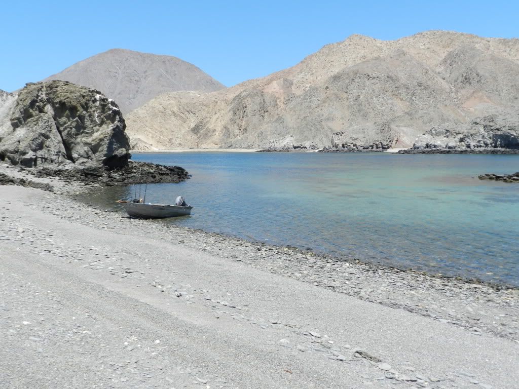
down towards the middle of Smith i found this cove that turned into an island. we were there at lowish tide and it was make able. we came in from the
north and at the south of the cove it was 2 feet deep over the reef. maybe at negative low tide it might be dry. cool place to clean the fish! it
looks VERY different from the water. that cove you talk about i drove right past and didn't see it from the water. something for next trip i guess.
[Edited on 6-25-2012 by woody with a view]
|
|
|
bkbend
Senior Nomad
Posts: 695
Registered: 11-27-2003
Location: central OR or central baja
Member Is Offline
|
|
The channel Woody shows separates Smith from a smaller island and would be interesting in a kayak. There are coves on the east and west sides of the
Smith toward the south end that are separated by a gravel bar and would also be an excellent destination and not far from the channel above. It's
about 2 miles from the outer edge of La Gringa to Smith.
Ventana and several smaller islets are also about 2 miles out from several access points north of town and interesting to explore by kayak. No really
long deserted beaches but a lot of small coves with beach or cobble to run up on.
Pay attention to the wind forecast http://www.sailflow.com/windandwhere.iws?regionID=130&si... and you can get some good tidal surge around some islands. Also be sure to get
your island permit at the Parque office in town.
|
|
|
JZ
Select Nomad
Posts: 14924
Registered: 10-3-2003
Member Is Offline
|
|
Thx guys. Anyone know what the going rate to go out on a Panga is?
|
|
|
Oggie
Nomad
Posts: 312
Registered: 6-16-2009
Location: Carlsbad, CA/BOLA
Member Is Offline
Mood: Missing Baja
|
|
You will need an Island permit(wrist band) to explore or hike on the islands. They are available, in town, by the park, in a Double wide trailer. I
think they are 50 pesos/day/person. Depending on the time of year some islands are restricted because birds are nesting.
A man never stands as tall as when he kneels to help a child.
Knights of Pythagoras
Funny how falling feels like flying
for a little while - Bad Blake
|
|
|
woody with a view
PITA Nomad
Posts: 15940
Registered: 11-8-2004
Location: Looking at the Coronado Islands
Member Is Offline
Mood: Everchangin'
|
|
+/- $200
|
|
|
Hook
Elite Nomad
Posts: 9013
Registered: 3-13-2004
Location: Sonora
Member Is Offline
Mood: Inquisitive
|
|
200.00 would be for all day, and that's a fishing rate. You should be able to do better than that. No need to stay on an island all day, anyway,
especially this time of year.
The currents on the inside of Smith can really get going. I wouldnt do a kayak unless you and the kids are strong paddlers. Besides, you'd have to
drive out towards La Gringa and then your vehicle is exposed in a remote area while you are out kayaking. That area USED to be the subject of much
theft of vehicles and camps but that was long ago; maybe it's changed.
Isla Ventana has a nice cove on the west side; very protected and there is some hiking.
Just be aware that no-see-ums can be a problem around many of the islands around sunrise and sunset.
Gotta do Puerto Don Juan, too, for the clamming.
Yeah, I know, it's illegal..................
|
|
|
Alm
Ultra Nomad
Posts: 2756
Registered: 5-10-2011
Member Is Offline
|
|
You don't need panga for BOLA islands if you have a kayak. From camps Daggets or Archelon all these islands are within 2-2.5 hours paddling.
Isla Smith - hike to the top if you are glutton to punishment. Extinct volcano, but there isn't much to see on the top. A lot of coves on the West
side, and a couple on the East. Big body of water in the middle is one of West coves, with narrow mouth.
Isla Ventana - the closest to shore camps. Relatively short hike (1 mile?) through the "crack" from North to South bay. There are just 2 bays. Don't
get lost in arroyos, the trail isn't marked well.
Isla Angel de la Guardia - too far for a novice kayaker or sit-on-top kayak. If you camp overnight and are prepared for weather change, there are
coves there too.
Other islands in the bay are small, basically rocks.
Islands are clean because are protected - it is a national park. Didn't need no stinky permit, though I was there in winter. Guys in official-looking
panga came up in the morning when noticed my tent in Ventana, then realized that one meager kayaker couldn't possibly have nets or a lot of garbage,
and waved me and turned away without landing.
Other places to explore with overnight stay are to the South-West, realistic to explore if you camp overnight:
Puerto Don Juan - muddy and shallow in low tide, but sheltered from wind. There can be strong current before the Puerto in low tide.
Isla Pescador - island is tiny and useless, but the beach in the bay is nice. 2 years ago gringos with summer cabins (not houses really) put 2 palapas
in the North end of the bay where kayakers used to camp. See, there are no cabins at this end, but with palapas it looks sort of "private" for those
who don't know. Besides, you don't want to camp only to wake up to some loud picnic next to you.
Punta Soldato - not the punta itself, but the cove to the South. It is actually the beginning of bigger Las Animas bay.
[Edited on 6-26-2012 by Alm]
|
|
|
JZ
Select Nomad
Posts: 14924
Registered: 10-3-2003
Member Is Offline
|
|
Thanks for the info guys. How bad/dangerous are the tidal currents around the islands. Going out with the kids (8 and 10).
We won't paddle out to the islands.
[Edited on 6-26-2012 by JZ]
|
|
|
Alm
Ultra Nomad
Posts: 2756
Registered: 5-10-2011
Member Is Offline
|
|
I forgot to ask - what kayak, but I think I know now. Sounds like it's not a fast and narrow sea kayak, so I wouldn't suggest paddling farther then
Isla Ventana from shore camps North of the town. Guys do paddle wide and slow sit-on-top kayaks as far as Isla Smith from camps Daggets or Archelon,
but they have no kids to look after.
Currents can be strong enough to slow you down when you paddle or ride heavily loaded dinghy with a tiny motor. I don't think they are strong enough
to cause any problems when you paddle around the island, staying close to island. Having said that, Puerto Don Juan is NOT an island but it is same
far if not farther than Isla Ventana, and the current before the Puerto can slow you down too.
As a bottom line... With a slow kayak or slow dinghy you can go to Ventana or Don Juan. Wind can be more pain than current. To Isla Smith... from
Daggets... with 2 kids and woman... better take panga.
[Edited on 6-26-2012 by Alm]
|
|
|
JZ
Select Nomad
Posts: 14924
Registered: 10-3-2003
Member Is Offline
|
|
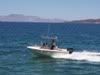
Thanks Alm. We have a well powered 11 foot dinghy, an inflatable paddle board, and an inflatable kayak.
http://www.ebay.com/itm/New-11-Long-2-Person-Inflatable-Kaya...
|
|
|
Alm
Ultra Nomad
Posts: 2756
Registered: 5-10-2011
Member Is Offline
|
|
In a well powered dinghy you can go to Isla Smith or Ventana or Puerto Don Juan from pretty much any shore camp. This type of kayak is sure for very
short trips and in sheltered bays.
[Edited on 6-26-2012 by Alm]
|
|
|
bkbend
Senior Nomad
Posts: 695
Registered: 11-27-2003
Location: central OR or central baja
Member Is Offline
|
|
I wouldn't get too far from shore in an inflatable kayak, they ride high on the water and wind will blow them all over the place. It'll be OK for
looking at sea life along the shoreline when not windy. The tides shouldn't be a problem in a well powered dinghy, just be aware around some island
points at mid-tide during full or new moon times.
|
|
|
Hook
Elite Nomad
Posts: 9013
Registered: 3-13-2004
Location: Sonora
Member Is Offline
Mood: Inquisitive
|
|
There are some "wash rocks" in the BOLA area. Get the Fish N Map of the northern Sea of Cortez. It has them. Good maps for fishing, too.
I have seen currents on the inside of Smith that were AT LEAST four knots. Strong.
|
|
|