| Pages:
1
2
3
4
5
6 |
David K
Honored Nomad

Posts: 65549
Registered: 8-30-2002
Location: San Diego County
Member Is Offline
Mood: Have Baja Fever
|
|
| Quote: | Originally posted by Barry A.
David-------on your map of Isla Angel de la Guarda, is that location "este ton"?? |
No, it is quite a ways north of Este Ton as well, as north of his first camp site 'Humbug Bay'... New territory!
[Edited on 2-11-2013 by David K]
|
|
|
Bob H
Elite Nomad
Posts: 5867
Registered: 8-19-2003
Location: San Diego
Member Is Offline
|
|
David, this is good stuff man! I love the labeling of the rocks to compare the two photos. It's amazing to me that they have not moved at all. And,
the cactus has not grown that much either.
The SAME boiling water that softens the potato hardens the egg. It's about what you are made of NOT the circumstance.
|
|
|
David K
Honored Nomad
Posts: 65549
Registered: 8-30-2002
Location: San Diego County
Member Is Offline
Mood: Have Baja Fever
|
|
| Quote: | Originally posted by Bob H
David, this is good stuff man! I love the labeling of the rocks to compare the two photos. It's amazing to me that they have not moved at all. And,
the cactus has not grown that much either. |
Thanks, this was back on New Years, 2009... It was the Las Animas reference that had me flash back. A couple of Nomads have visited the mystery walls
that Choral and other believed were the aborted mission of Santa María Magdalena. Click on the link in my signature to read the Discover Baja magazine
article on finding a lost mission...
|
|
|
Barry A.
Select Nomad
Posts: 10007
Registered: 11-30-2003
Location: Redding, Northern CA
Member Is Offline
Mood: optimistic
|
|
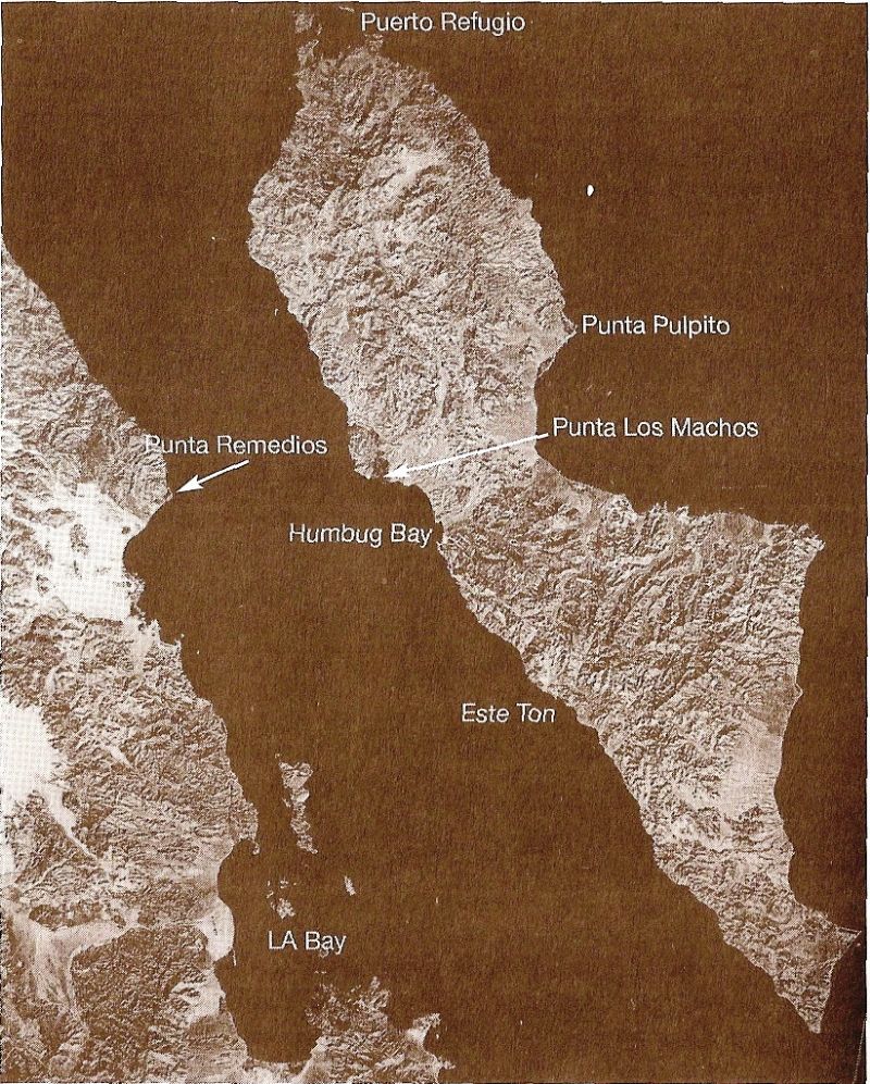
David (or anybody in the know) -----
I have laminated copies of all of Gary Cunningham's "cruising charts" but unfortunately the charts of Isla Angel de los Guarda only shows details of
the north-end bays (Refugio), and the east coast baylets, and este ton on the west coast, but not details of the west coast entirely-----do you know
where there are any detailed maps on line for the Island? I could not find any decent maps on line.
Barry
On edit-------oooops, I just had your aerial maps come on line-----had not seen them before------very good!!!! Barry
[Edited on 2-11-2013 by Barry A.]
|
|
|
David K
Honored Nomad
Posts: 65549
Registered: 8-30-2002
Location: San Diego County
Member Is Offline
Mood: Have Baja Fever
|
|
I edited my reply to you, above... added two maps (one from Graham's book and one from SPOT, today).
The 2009 Baja California Almanac includes the island, and has 'Estaton' included. The 2003 Almanac has the island, but not much else.
|
|
|
Barry A.
Select Nomad
Posts: 10007
Registered: 11-30-2003
Location: Redding, Northern CA
Member Is Offline
Mood: optimistic
|
|
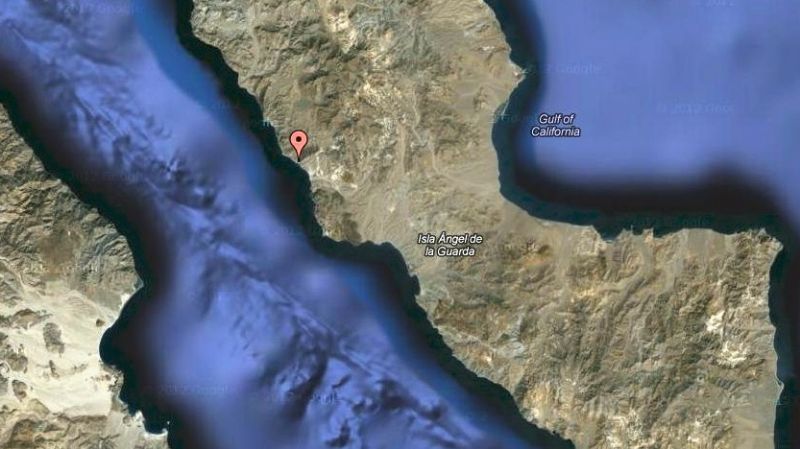
I scanned the west coast of the Island at high resolution on google-earth and found many baylets one could use, and even found a pretty good size
ship-wreck about 1/3 of the way down the west coast from Refugio. The whole coast looks fascinating!!!
barry
|
|
|
Pompano
Elite Nomad
Posts: 8194
Registered: 11-14-2004
Location: Bay of Conception and Up North
Member Is Offline
Mood: Optimistic
|
|
I've dropped my old cruiser's hook in Refugio many times. Like the name says, it's a great refuge.... from high winds especially!
I do what the voices in my tackle box tell me.
|
|
|
David K
Honored Nomad
Posts: 65549
Registered: 8-30-2002
Location: San Diego County
Member Is Offline
Mood: Have Baja Fever
|
|
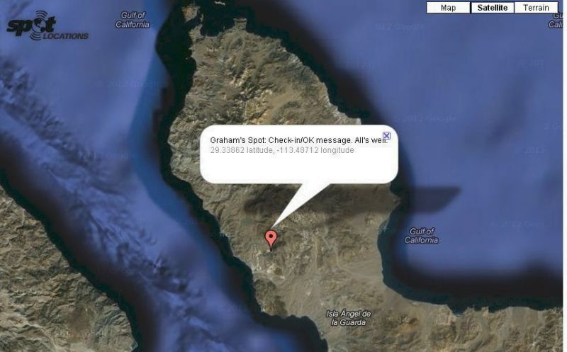
Graham on the island, new satellite images
Here from high to low, with a final 3-D side view:
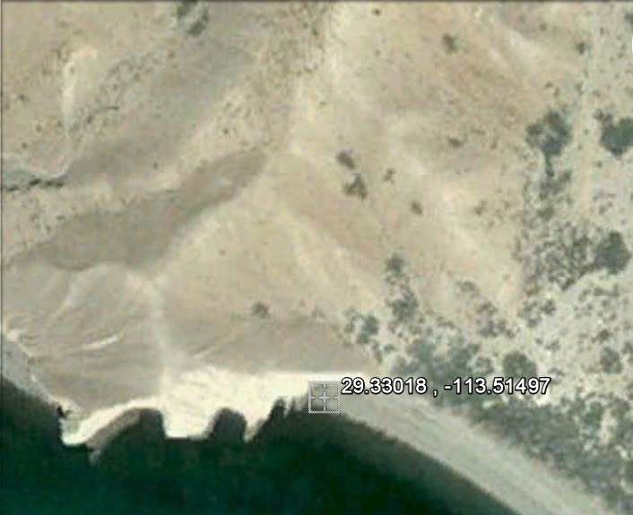
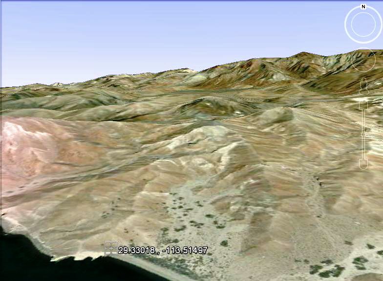
Guests bringing beer are always welcome!

|
|
|
OCEANUS
Nomad
Posts: 139
Registered: 10-11-2008
Location: Dana Point; L.A. Bay
Member Is Offline
|
|
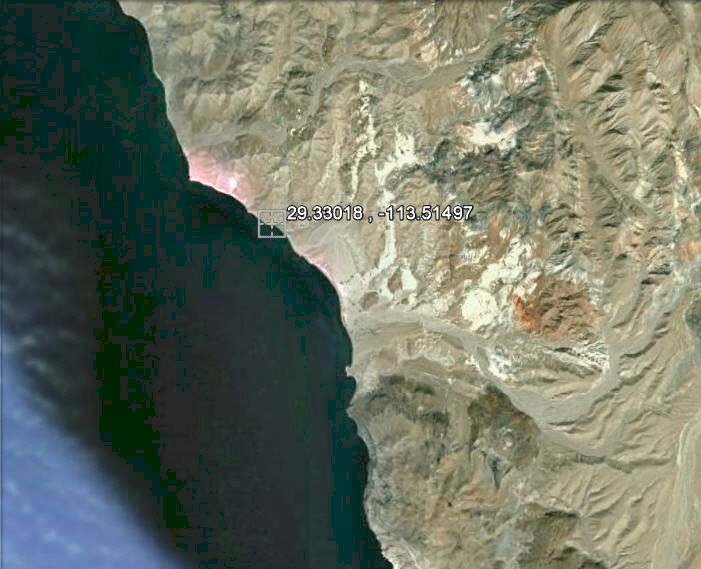
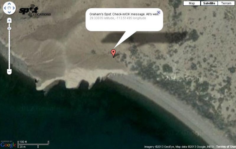
This south facing beach is a good spot for Graham to camp and escape the strong north winds that are forecasted for the next couple of days (according
to sailflow)
|
|
|
Barry A.
Select Nomad
Posts: 10007
Registered: 11-30-2003
Location: Redding, Northern CA
Member Is Offline
Mood: optimistic
|
|
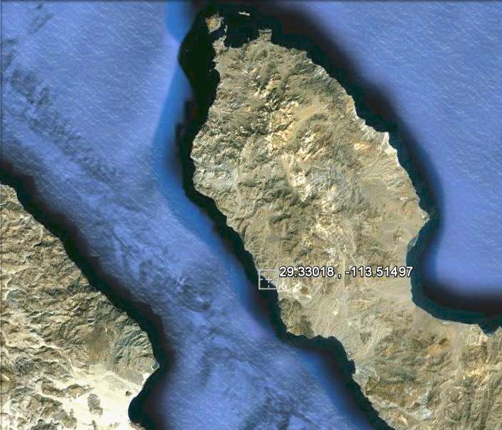
That is certainly an unusual beach in DavidK's last photo------those deep scollops-------don't think I have seen that before. Wonder what causes
that?
Barry
|
|
|
David K
Honored Nomad
Posts: 65549
Registered: 8-30-2002
Location: San Diego County
Member Is Offline
Mood: Have Baja Fever
|
|
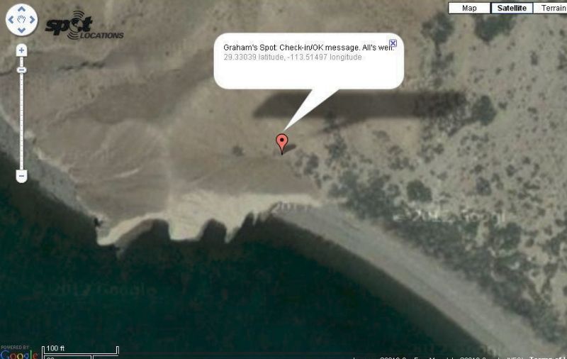
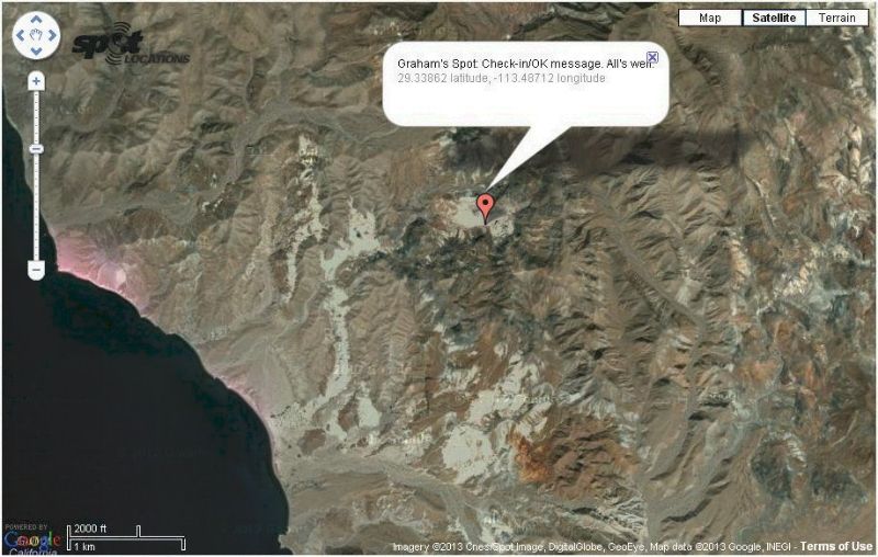
Feb. 13, 2013 Spot 3
Graham sent another A-OK signal, and the spot is just inland from the beach. Perhaps where he is constructiong a shelter?
|
|
|
BajaGeoff
Super Nomad
Posts: 1727
Registered: 1-11-2006
Location: San Diego and Campo Lopez
Member Is Offline
Mood: Heading To Baja!!!
|
|
Thanks for the update DK!
|
|
|
David K
Honored Nomad
Posts: 65549
Registered: 8-30-2002
Location: San Diego County
Member Is Offline
Mood: Have Baja Fever
|
|
Spot Signal 2-16-13: A-OK
Same location on Angel Island...
|
|
|
David K
Honored Nomad
Posts: 65549
Registered: 8-30-2002
Location: San Diego County
Member Is Offline
Mood: Have Baja Fever
|
|
Graham has moved!
About 2 km. inland from his seaside previous spot.
Looks like a big sandy area?
|
|
|
David K
Honored Nomad
Posts: 65549
Registered: 8-30-2002
Location: San Diego County
Member Is Offline
Mood: Have Baja Fever
|
|
Graham has walked south to the top of a huge cliff facing Bahia de los Angeles
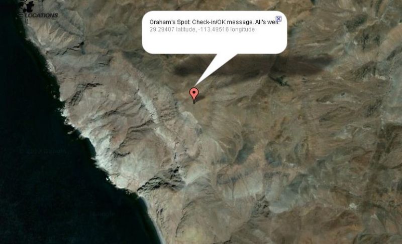
A-OK on Feb. 21, 2013
|
|
|
MikeYounghusband
Nomad
Posts: 213
Registered: 8-27-2008
Location: Loreto, Baja Cal. Sur
Member Is Offline
Mood: Always ready for more
|
|
He's on a hike and showing us where he is hiking, I'll bet.
|
|
|
David K
Honored Nomad
Posts: 65549
Registered: 8-30-2002
Location: San Diego County
Member Is Offline
Mood: Have Baja Fever
|
|
Yup... beach to inland, down to cliff... wandering about.
|
|
|
David K
Honored Nomad
Posts: 65549
Registered: 8-30-2002
Location: San Diego County
Member Is Offline
Mood: Have Baja Fever
|
|
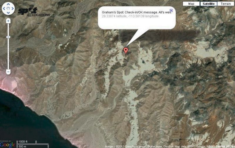
A-OK on 2-24-13
Here is Graham's 7th SPOT location... He is just over a mile inland from his first location on the island... northeast from the coast.
|
|
|
desertcpl
Super Nomad
Posts: 2407
Registered: 10-26-2008
Location: yuma,az
Member Is Offline
|
|
Did Graham bring his dogs with him
|
|
|
David K
Honored Nomad
Posts: 65549
Registered: 8-30-2002
Location: San Diego County
Member Is Offline
Mood: Have Baja Fever
|
|
| Quote: | Originally posted by desertcpl
Did Graham bring his dogs with him |
I didn't see any mention of taking any dogs in our email exchanges. I don't think so, as he was going to do some kayaking.
|
|
|
| Pages:
1
2
3
4
5
6 |


