| Pages:
1
2 |
AKtundra
Junior Nomad

Posts: 26
Registered: 11-1-2011
Member Is Offline
|
|
Suggest some challenging drives in BCS ?
Planning our second trip to BCS. We live in AK, and will fly into Cabo....and get out as fast as we can !! Last time I had so many places to visit,
roads-to-drive I was disappointed we only made it North to Mulege, before we had to turn back.
Hoping to fondle whales at Laguna San Ignacio this time.
Just starting my research in the Forum, but looking for suggestions on some difficult roads that might deliver good people and great country. We are
experinced off road drivers, with stock, fully imsured jeeps we don't own (thank you Avis), but limited recovery equipment due to baggage weight
limits.
Last time we really enjoyed:
Loreto to the Pacific via San Javier
Aqua Verde
San Evaristo to Ciudad Constitucion (my favorite)
Naranjas Road (Rancho Nuevo to Mex 1)
Going to pull some more info from the forum on the San Juan de la Pila to Mulege, and La Purisima to Loreto.
Can anybody reccomend some good threads on these routes?
Other good country or otherwise favorite drives ?
Any missions, hot springs, fossils or other points of interest in this area that we can feel like jr explorers and try and find ? ( not asking for
your secret cave of petroglyphs, just things it would be a shame to miss if you are in the area, and might drive by if not looking for)
As always, thanks to the forum for the help in planning our adventures
[Edited on 1-15-2014 by AKtundra]
[Edited on 1-15-2014 by AKtundra]
[Edited on 1-15-2014 by AKtundra]
|
|
|
David K
Honored Nomad
Posts: 65589
Registered: 8-30-2002
Location: San Diego County
Member Is Offline
Mood: Have Baja Fever
|
|
Use the Search in the top left corner of Nomad... type in the subject place and choose the forum (Baja Trip Reports is probably the best). Leave
anything blank and it just will show more posts. TW has posted a lot of Baja Sur back country trips recently. The mountain country between Mulege and
San Ignacio, along El Camino Real has many possibilities except last years hurricane/ chubasco action destroyed roads, like the one between San Jose
de Magdalena and ex-Mision de Guadalupe.
Looking forward to your adventure trip reports!
|
|
|
TMW
Select Nomad
Posts: 10659
Registered: 9-1-2003
Location: Bakersfield, CA
Member Is Offline
|
|
Here are three trip reports I did. The first was in Nov. the second was last April and the third was in May 2012. Maybe they will give you some
ideals. The Timbabichi and the Comondu roads may be more to your liking as would the Guajademi road from La Purisima/San Isidro to Mulege in the last
trip report.
http://forums.bajanomad.com/viewthread.php?tid=70830
http://forums.bajanomad.com/viewthread.php?tid=66863
http://forums.bajanomad.com/viewthread.php?tid=60000
[Edited on 1-15-2014 by TW]
|
|
|
BajaBlanca
Select Nomad
Posts: 13247
Registered: 10-28-2008
Location: La Bocana, BCS
Member Is Offline
|
|
You might consider Santiago and look for SOL DE MAYO. Santiago is a sleepy Mexican village that is really beautiful and has a bar/restaurant that John
Wayne used to hang out at.
SOL DE MAYO is a natural spring water pool with a waterfall.....take a picnic lunch and some swimsuits. The cost is around $5 pp or something like
that. It has a short hike down to the pool.
|
|
|
BajaBlanca
Select Nomad
Posts: 13247
Registered: 10-28-2008
Location: La Bocana, BCS
Member Is Offline
|
|
and for some pictures of the Palomar hotel where John Wayne stayed, check out this post by motoged:
http://forums.bajanomad.com/viewthread.php?tid=69497#pid8479...
|
|
|
El Jefe
Super Nomad
Posts: 1027
Registered: 10-27-2003
Location: South East Cape
Member Is Offline
|
|
To get warmed up take the Naranja Road over the Laguna mountains. The turnoff from hwy 1 is just north of the airport is after you pass Santa Anita
and after the propane plant. Look for a well traveled dirt road going off to your left. Straight as an arrow towards the mountains. It gets
interesting at the top, and the views to the Pacific are awesome. You will hit pavement again just south of Playa los Cerritos on the Pacific side.
No b-tchin\' in the Baja.
|
|
|
AKtundra
Junior Nomad
Posts: 26
Registered: 11-1-2011
Member Is Offline
|
|
OK . . . thats it . . . no more checking the forum at work.
Now I'm useless, and still have 7 hours to go !!!
thanks for the links & suggestions.
(I guess its a good thing I didn't bring my maps to work . . . )
|
|
|
tiotomasbcs
Super Nomad
Posts: 1837
Registered: 7-30-2007
Location: El Pescadero
Member Is Offline
|
|
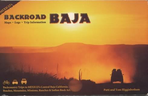
I'm working on a few special Backroads myself! Do you have the Baja Almanac? Available in San Jose w/ Baja Judy. I love the old book by Tom &
Patti Higginbotham--Backroad Baja concentrates on Central Baja. Cold up there now; when you coming? Buen viaje. Tio
|
|
|
David K
Honored Nomad
Posts: 65589
Registered: 8-30-2002
Location: San Diego County
Member Is Offline
Mood: Have Baja Fever
|
|
| Quote: | Originally posted by tiotomasbcs
I'm working on a few special Backroads myself! Do you have the Baja Almanac? Available in San Jose w/ Baja Judy. I love the old book by Tom &
Patti Higginbotham--Backroad Baja concentrates on Central Baja. Cold up there now; when you coming? Buen viaje. Tio |
They both are great to have in central Baja. Tom and Patti's book covers many dirt roads from San Borja to Agua Verde.
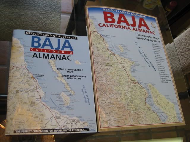
2003 and 2009 Almanacs
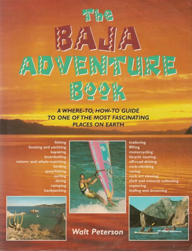
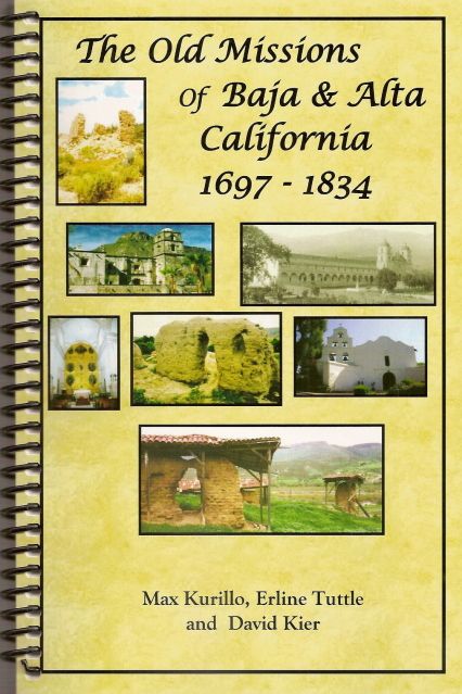
Other books that are great to have along on a Baja back country trip include:
and for when you come to any of the 27 Spanish missions at many more than 27 locations...

Directions and GPS for all mission sites and more.
Oh, and this one fits in the glove box and contains the basic data of all 48 California missions... 
|
|
|
AKtundra
Junior Nomad
Posts: 26
Registered: 11-1-2011
Member Is Offline
|
|
Kind of surprises me, how many of those books i already have!
DavidK, which book has the best maps to help locate the missions ?
|
|
|
David K
Honored Nomad
Posts: 65589
Registered: 8-30-2002
Location: San Diego County
Member Is Offline
Mood: Have Baja Fever
|
|
Maps? The Almanac.
GPS and directions in Dave Werschkul's 'Saints and Demons' book.
My book has directions to the missions, but no GPS.
Most sites are well known but I have Google Earth and GPS on my web page http://www.vivabaja.com/bajamissions on the end page, here: http://vivabaja.com/missions4/
Do you have an idea of what sites you want to see?
[Edited on 1-16-2014 by David K]
|
|
|
wilderone
Ultra Nomad
Posts: 3915
Registered: 2-9-2004
Member Is Offline
|
|
Your drive to Bahia San Ignacio will be entertaining, and then go beyond 50 miles or so. Or turn right at El Alamo on the return trip - go to Rio San
Ignacio, then on to town. Rio San Ignacio has some pools with snakes, turtles, birds and fossils in the cliffs. You can also get to Rio San Ignacio
by turning off Mex. 1, before San Ignacio, just across from the Microndas (see it on the hill). There's a big turnout at that point.
|
|
|
AKtundra
Junior Nomad
Posts: 26
Registered: 11-1-2011
Member Is Offline
|
|
Wilderone, can you help me locate Rio San Ignacio ?
(I decided to bring my maps to work, rather than stop checking BajaNomad at work !!)
Your directions to turn right/left...before/after... not sure the direction of travel for your point of refernce. Is Rio San Ignacio a village or do
you just mean the river?
Using my Baja Almanac, seems you might be referring to the road that runs south from San Ignacio, runs along the Rio San Ignacio, just to the West of
the main road to the lagoon. The two roads combine at El Alamo.
Right?
[Edited on 1-16-2014 by AKtundra]
[Edited on 1-16-2014 by AKtundra]
|
|
|
wilderone
Ultra Nomad
Posts: 3915
Registered: 2-9-2004
Member Is Offline
|
|
I'm using the Baja Almanac map book, but El Alamo, is on most Baja maps. Rio San Ignacio is not a town. But rough roads go to it, and, as I
described, is a cool place to spend the night or a whole day exploring. I also found a very cool matate there.
If you were en route to see whales at Laguna San Ignacio, you will pass El Alamo. Only one way to turn - North, and in about 18 mi. or so, you will
come to an oasis and the pools. Instead of leaving the same way we went it, we went through the river, and connected with a road that initially went
west, circles around to hit Mex. 1 - and right across the street you can see the microwave tower. This point is about 11 miles before you get to
Pardones (usually on a map), just before San Ignacio. There is also a big canyon with a bridge over it just past the Microwave tower point - if you
get on the bridge you've gone too far. Going in from that point, you cross a mesa - fairly easy going. Approaching closer to the river might be
really torn up, but you don't have to cross it and come out El Alamo - return the way you came in. It's all on Page S7 in the Baja Almanac book.
The red road going south out of San Ignacio is the road you'd be on to get to Laguna San Ignacio to see the whales. I've never been on the road that
emanates from San Ignacio, seemingly following the river, and branches off near Cerro la Puerto. I wanted to go that way a couple years ago, stopped
in town at the plaza, showed some people the map book, told them where I wanted to go, pointed to the road out of town and said how do I get on that
road, and nobody knew what I was talking about. They all told me to get on the road that goes to Laguna San Ignacio. When I went to El Alamo and
asked the guy at the rancho there, showing him my map, he didn't look at the map at all. He just told me it was a bad road because of water damage.
I would love to go back there again. I settled for 3 nights at Laguna San Ignacio, about a mile past the airport, camped on a bluff on the water. You
can see whales spouting at the mouth of the lagoon - really great beachcombing, and the water is shallow enough to wade out and wander around.
Bedrock lava with embedded shells is interesting, sea birds, quiet.
|
|
|
David K
Honored Nomad
Posts: 65589
Registered: 8-30-2002
Location: San Diego County
Member Is Offline
Mood: Have Baja Fever
|
|
AAA Maps: El Alamo from San Ignacio
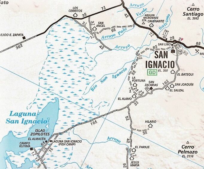
The map road data is probably 10 years old, so the pavement towards the lagoon is not shown. El Alamo is shown on the west side of the road south of
San Ignacio.
|
|
|
AKtundra
Junior Nomad
Posts: 26
Registered: 11-1-2011
Member Is Offline
|
|
aahhh....
I see it now. There is now a connection that is blank in David K's old map, and you went west at the river, and the road makes a big switch-back to
Mex 1 @ the Tower.
However, they said the road east directly to San Ignacio was bad huh ? hmmm . . . .
thanks so much for the background on this area.
[Edited on 1-17-2014 by AKtundra]
|
|
|
David K
Honored Nomad
Posts: 65589
Registered: 8-30-2002
Location: San Diego County
Member Is Offline
Mood: Have Baja Fever
|
|
Bad roads bring good people!
The AAA map removes any roads that the cartographers believe will cause a member grief. The AAA maps used to have a LOT more dirt roads on it. Then
some whiney member complained and they just removed any tough road from their maps. I was told this by one of their cartographers.
Today, we have Google Earth and you can just swoop down from the sky and see the roads you may want. Naturally, there could be washouts or changes
since the satellite took the photo... but it is a great way to explore or know where to try and explore.
|
|
|
durrelllrobert
Elite Nomad
Posts: 7393
Registered: 11-22-2007
Location: Punta Banda BC
Member Is Offline
Mood: thriving in Baja
|
|
A challenge?
This is somewhere down south and I think it was posted by Ken Cooke that drives the tricked out Rubicon. Send him a U2U and ask him for
recommendations in BCS.

Bob Durrell
|
|
|
AKtundra
Junior Nomad
Posts: 26
Registered: 11-1-2011
Member Is Offline
|
|
Researching routes in BCS over the past couple of months, and I have seen specific routes highly recommended, but they are often referred to as a this
"road" was better than that "road". Could folks help me with the village-to-village route on the Baja Alamanc, If somebody said they really liked
__________, they were most likely referring to this village-to-village route on the Baja Alamanc
San Juan de Las Pilas Road
San Jose de Magdalena Loop
Paso Hondo Trail (La Purisma to Mulege)
[Edited on 2-1-2014 by AKtundra]
|
|
|
David K
Honored Nomad
Posts: 65589
Registered: 8-30-2002
Location: San Diego County
Member Is Offline
Mood: Have Baja Fever
|
|
Last report... and it has been a couple of months, I think... on the San Jose de Magdalena loop is that the road from there to 'ex-Mision' de
Guadalupe, was blocked after last season's chubasco.
|
|
|
| Pages:
1
2 |