| Pages:
1
..
10
11
12
13 |
4x4abc
Ultra Nomad
    
Posts: 4454
Registered: 4-24-2009
Location: La Paz, BCS
Member Is Offline
Mood: happy - always
|
|
David,
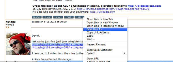
on my Mac I would hold down the control key before clicking on the link (if no download window would open) - then I would chose "Save Link As..." to
save the file to my computer.
Don't know what you would do on your dinosaur Windows machine.
Harald Pietschmann
|
|
|
4x4abc
Ultra Nomad
    
Posts: 4454
Registered: 4-24-2009
Location: La Paz, BCS
Member Is Offline
Mood: happy - always
|
|
the grade is nasty. It has a slight right hand side slope. With too much gas and only traction control (even though LR-3 traction control is quite
good) I see future roll overs on ascent.
Originally we had planned a downhill excursion to minimize damage to the grade - but things worked out differently that day (in Baja it's very likely
that the unexpected happens).
The G500 walked straight up without a spec of dust.
The Nissan needed a second run, kicking up some dust (remember, it has no front locker and no traction control)
The TJ walked almost as uneventful as the G500.
All 3 drivers are seasoned (40+ years) Rubicon veterans. 2 live in cabins on the trail. For us a little dirt hill like this isn't worth much fuss.
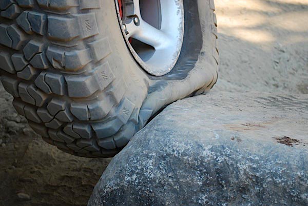
Here is the veteran tip: On steep inclines the CG of the truck changes dramatically (the front carries almost no more weight). To even out traction,
the rear tires get 14 psi (33' to 35" tires), the front gets 5-7 psi. No bead locks needed. Bead locks are for bad drivers.
With more traffic I see the grade completely destroyed in a couple of years by too much gas and too much air (too much air not only in the tires).
Harald Pietschmann
|
|
|
David K
Honored Nomad
        
Posts: 65433
Registered: 8-30-2002
Location: San Diego County
Member Is Offline
Mood: Have Baja Fever
|
|
Thank you Harald.
|
|
|
Ken Cooke
Elite Nomad
     
Posts: 8970
Registered: 2-9-2004
Location: Riverside, CA
Member Is Offline
Mood: Pole Line Road postponed due to injury
|
|
| Quote: | Originally posted by TW
Ken, you and your jeep friends should give La Turquesa a try. |
I would really like the challenge! My new set of BFG KM2 Mud-Terrains would also like the challenge!
|
|
|
David K
Honored Nomad
        
Posts: 65433
Registered: 8-30-2002
Location: San Diego County
Member Is Offline
Mood: Have Baja Fever
|
|
Bump for turquoise discussion.
|
|
|
4x4abc
Ultra Nomad
    
Posts: 4454
Registered: 4-24-2009
Location: La Paz, BCS
Member Is Offline
Mood: happy - always
|
|
one of the easiest drive in Baja - go!
Harald Pietschmann
|
|
|
bajatrailrider
Ultra Nomad
    
Posts: 2520
Registered: 1-24-2015
Location: Mexico
Member Is Offline
Mood: Happy
|
|
I have been up it on dirt bike 3 times.Nasty is the word,Dirt bikers call it.Fred's Tractor trail.The hardest part,first hill climb out of wash.
|
|
|
4x4abc
Ultra Nomad
    
Posts: 4454
Registered: 4-24-2009
Location: La Paz, BCS
Member Is Offline
Mood: happy - always
|
|
of course you could go downhill
if you must go uphill (4x4)
low range
both lockers
front 5 psi
rear 8 psi
walk in the park
if you don't have lockers, go downhill
https://carlosnpainter.smugmug.com/Events/Manly-Men-Baja-201...
Harald Pietschmann
|
|
|
Pappy Jon
Nomad
 
Posts: 494
Registered: 8-27-2003
Location: Wrong side of the Continental divide.
Member Is Offline
Mood: Temp rising.
|
|
Just FYI. The construction has messed up the entrance to the canyon. There is a bypass, but 4x4 is required, and I needed the ARB locker to get up.
It's steep and loose.
"The association of flowers and warm-blooded love is more than a romantic convention; it is based upon one of the great advances in the evolution
of life." Ed Abbey
|
|
|
Ken Cooke
Elite Nomad
     
Posts: 8970
Registered: 2-9-2004
Location: Riverside, CA
Member Is Offline
Mood: Pole Line Road postponed due to injury
|
|
How difficult is it to find your way towards the Turquoise springs from the Hwy 1 region? Traveling west (uphill) towards the grade, I could see the
route, but couldn't find the road to get there.
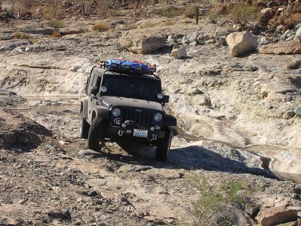
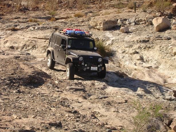
Baja Grande 2007 drove upstream from the Gonzaga Bay area where we had been camping the night before. It was a good time!
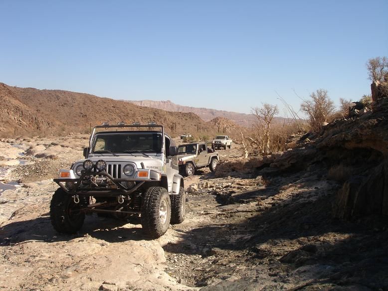
[Edited on 11-21-2015 by Ken Cooke]
|
|
|
TMW
Select Nomad
      
Posts: 10659
Registered: 9-1-2003
Location: Bakersfield, CA
Member Is Offline
|
|
"How difficult is it to find your way towards the Turquoise springs from the Hwy 1 region?"
The turn off for the Turquesa mine road is at Hwy 1 KM213/214. There is a bunch of trees there. Look for a road going east. It's about 4 miles to the
top of the mountain where it starts down to the wash. About another mile +/- to wash and 2 miles to mine.
|
|
|
Ken Cooke
Elite Nomad
     
Posts: 8970
Registered: 2-9-2004
Location: Riverside, CA
Member Is Offline
Mood: Pole Line Road postponed due to injury
|
|
I tried 2x to find the route past the onyx springs up towards the hill. You can easily see the switchbacks going down the steep hillside, but with
bushes everywhere, it was a challenge maneuvering past the mining area near the springs.
|
|
|
TMW
Select Nomad
      
Posts: 10659
Registered: 9-1-2003
Location: Bakersfield, CA
Member Is Offline
|
|
When Roy did it we walked the route the day before he did it. We walked to the run out of the wash then on our way back Roy and Richard marked it with
ribbons. He followed the motorcycle route mostly and it stayed near the north side of the wash most of the time as I recall. Once out of the wash the
road is obvious, just have to move a few rocks.
|
|
|
TMW
Select Nomad
      
Posts: 10659
Registered: 9-1-2003
Location: Bakersfield, CA
Member Is Offline
|
|
The last time I was at the mine was April 2014. The road into the wash was at the mine.
|
|
|
Ken Cooke
Elite Nomad
     
Posts: 8970
Registered: 2-9-2004
Location: Riverside, CA
Member Is Offline
Mood: Pole Line Road postponed due to injury
|
|
I just downloaded the waypoints that appear near the beginning of this thread.
|
|
|
David K
Honored Nomad
        
Posts: 65433
Registered: 8-30-2002
Location: San Diego County
Member Is Offline
Mood: Have Baja Fever
|
|
Ken, use the km post. It is at a low spot and a gravel pit was by it. This is just south of the boulder mountain El Pedregoso on Hwy. 1. See http://vivabaja.com/207
|
|
|
PaulW
Ultra Nomad
    
Posts: 3113
Registered: 5-21-2013
Member Is Offline
|
|
I forgot about this thread
But if someone wants to look on Google earth the road is mostly visible. The east start is pretty close to 20 34.365, -114 22.012. Latest report is
the new highway has erased the beginning and requires going over a big bank to get to the road.
The west end is at Hwy1 KM213.5 at 29 31.486, -114 30.185.
And if you have a decent background map for your GPS the road will be shown
|
|
|
David K
Honored Nomad
        
Posts: 65433
Registered: 8-30-2002
Location: San Diego County
Member Is Offline
Mood: Have Baja Fever
|
|
Thanks Paul. It is sad that paved roads destroy so much of what once was. The other barrier is the fence they add on both sides with no openings for
existing roads. They eventually get openened as we have seen north of San Felipe.
|
|
|
rts551
Elite Nomad
     
Posts: 6700
Registered: 9-5-2003
Member Is Offline
|
|
Damn Mexicans. Paving their roads. And then fencing them off to keep critters on privates land.... what is the world coming to.
|
|
|
4x4abc
Ultra Nomad
    
Posts: 4454
Registered: 4-24-2009
Location: La Paz, BCS
Member Is Offline
Mood: happy - always
|
|
Here is the April 2014 GPS record: http://rubicon-trail.com/Rubicon.Trail.GPS/la.turquesa.GPX
Harald Pietschmann
|
|
|
| Pages:
1
..
10
11
12
13 |

