| Pages:
1
2
3
4 |
bajaamy
Newbie
Posts: 23
Registered: 10-29-2008
Member Is Offline
|
|
Here's what Robert Hardy had to say about Magdalena, whichever site it was. This was written about 1826, while Hardy was passing through Mulege
(which he spells Molexe):
"About six or eight leagues from Molexe is the mission of La Madalena (sic), established about the same period as the former; but by whom is not
known. Its productions are the same as those of the Molexe; but the quality of the spirits which are made from the mezcal, growing wild about the
mountains in its neighborhood, is said to be the best of any made in Lower California. Its population is about equal to that of Loreto."
Not much to go on, but there it is! Would six or eight leagues be about right for either of the two potential visita sites?
Amy
|
|
|
David K
Honored Nomad
        
Posts: 65430
Registered: 8-30-2002
Location: San Diego County
Member Is Offline
Mood: Have Baja Fever
|
|
A league is 2.6 miles...
|
|
|
bajaamy
Newbie
Posts: 23
Registered: 10-29-2008
Member Is Offline
|
|
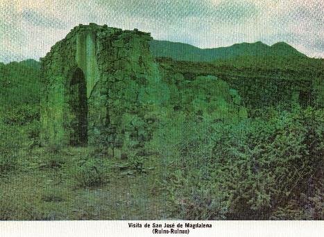
Here's another snippet about the stone chapel from Michael Mathes' book (Misiones de Baja California), and a scanned photo.
“The site of the Visita de San Jose de Magdalena, seventeen miles to the northwest of Mision Santa Rosalia de Mulege on the south bank of the Arroyo
de Magdalena, was first considered as an alternative site for that mission by Father Fray Francisco Palou in 1771, following the extensive flooding of
the Rio Mulege during the preceding year. The visita was not established, however, until 1774 when a stone and adobe chapel, stone irrigation works
and corrals were built to serve the Dominican Mission Santa Rosalia de Mulege. The visita was permanently abandoned in 1828 with the closing of the
mission.”
[Edited on 3-13-2009 by bajaamy]
[Edited on 3-19-2009 by bajaamy]
|
|
|
bajaamy
Newbie
Posts: 23
Registered: 10-29-2008
Member Is Offline
|
|
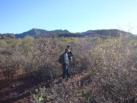
Now compare this photo, looking in the same direction, taken with the visita behind me. You can see the same mountain in the distance.
|
|
|
David K
Honored Nomad
        
Posts: 65430
Registered: 8-30-2002
Location: San Diego County
Member Is Offline
Mood: Have Baja Fever
|
|
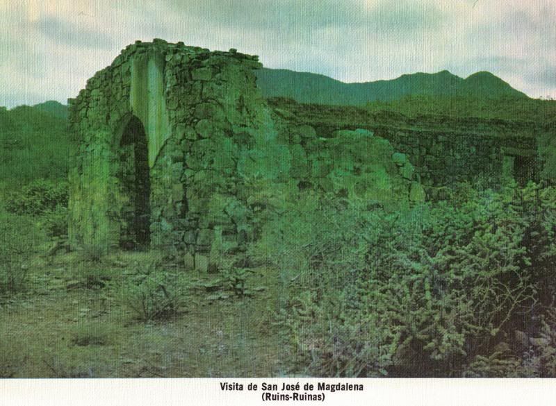
| Quote: | Originally posted by bajaamy
Here's another snippet about the stone chapel from Michael Mathes, and a scanned photo of the San Jose de Magdalena chapel from Mathes's book.
“The site of the Visita de San Jose de Magdalena, seventeen miles to the northwest of Mision Santa Rosalia de Mulege on the south bank of the Arroyo
de Magdalena, was first considered as an alternative site for that mission by Father Fray Francisco Palou in 1771, following the extensive flooding of
the Rio Mulege during the preceding year. The visita was not established, however, until 1774 when a stone and adobe chapel, stone irrigation works
and corrals were built to serve the Dominican Mission Santa Rosalia de Mulege. The visita was permanently abandoned in 1828 with the closing of the
mission.” |
[Edited on 3-20-2009 by David K]
|
|
|
David K
Honored Nomad
        
Posts: 65430
Registered: 8-30-2002
Location: San Diego County
Member Is Offline
Mood: Have Baja Fever
|
|
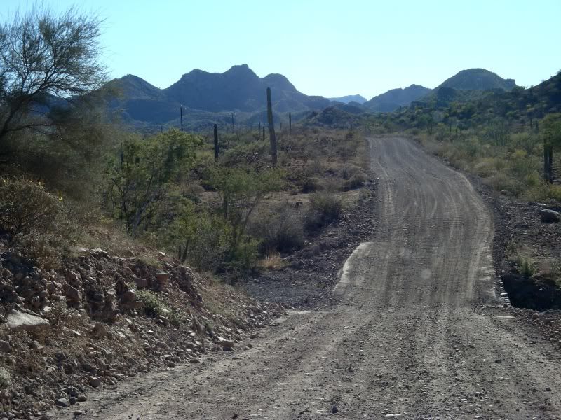
BajaAmy's photos enlarged, captions above each
the road to the town of San Jose de Magdalena
--------------------------------------------------------------------------------
overlooking the arroyo, driving west toward the town.
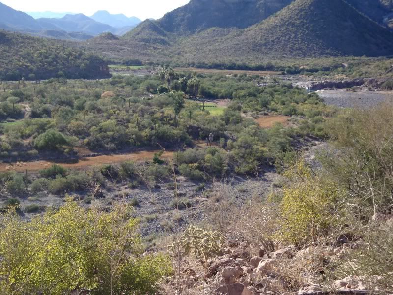
---------------------------------------------------------------------------------------
another shot from the road, coming into town (heading west). You can see the palm-filled arroyo down below.
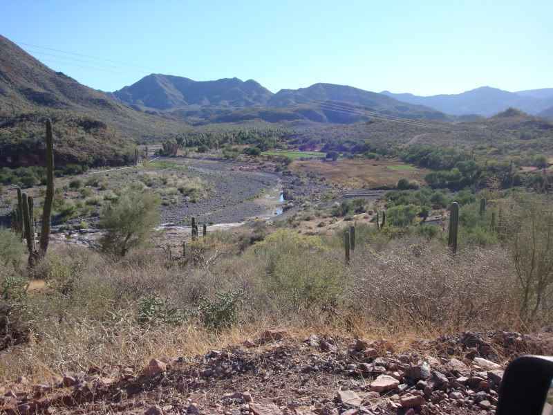
--------------------------------------------------------------------------------------
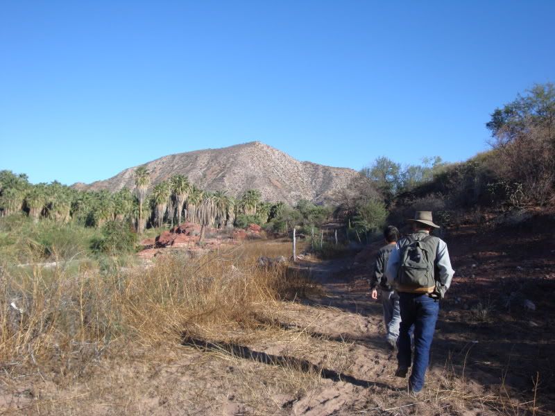
----------------------------------------------------------------------------------------
looking backward as we’re walking toward the ruins on the south side of the arroyo.
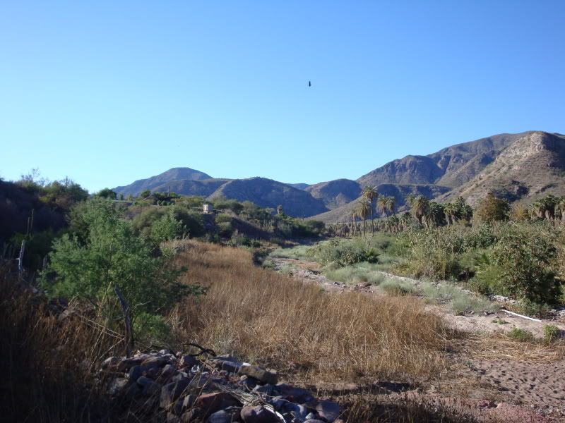
-----------------------------------------------------------------------------------------
looking across the arroyo to the panteon on the north side.
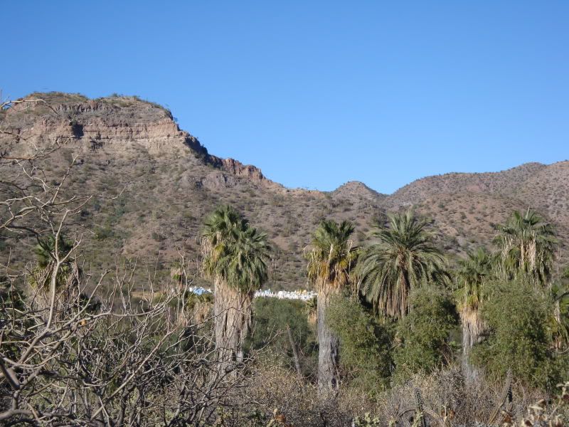
------------------------------------------------------------------------------------------
looking back westward, this wall makes up the rear of the chapel. The chapel interior is of course filled with cacti!
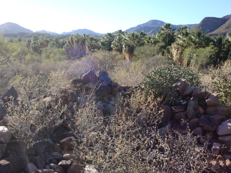
-------------------------------------------------------------------------------------------
Bill examining what I believe was the wooden arch support that appears in earlier photos.
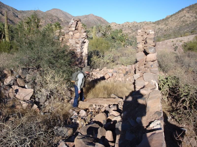
-----------------------------------------------------------------------------------------
You can see the wooden arch support more clearly now.
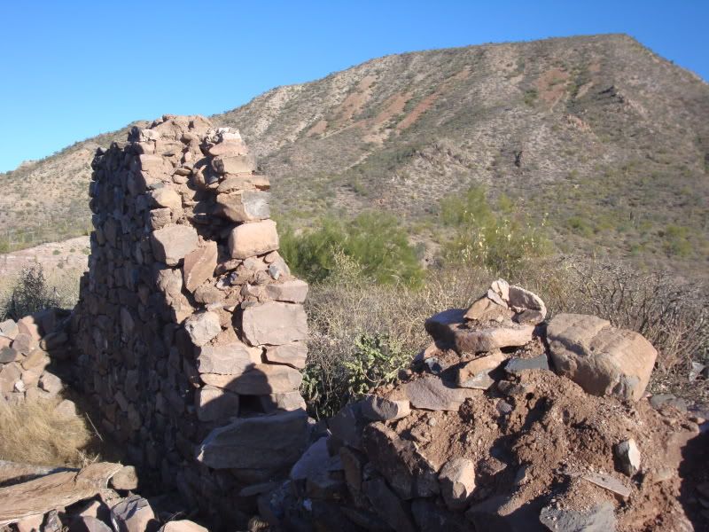
------------------------------------------------------------------------------------------
side view, looking north. This is probably the wall that once held the window?
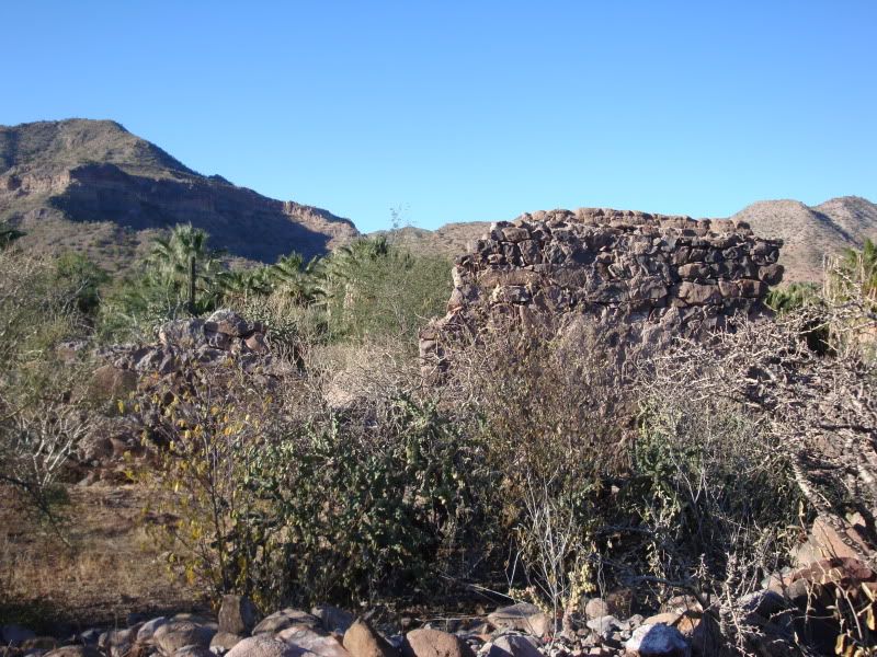
to be continued...
|
|
|
David K
Honored Nomad
        
Posts: 65430
Registered: 8-30-2002
Location: San Diego County
Member Is Offline
Mood: Have Baja Fever
|
|
closeup, looking north. This is the front doorway (now collapsed).
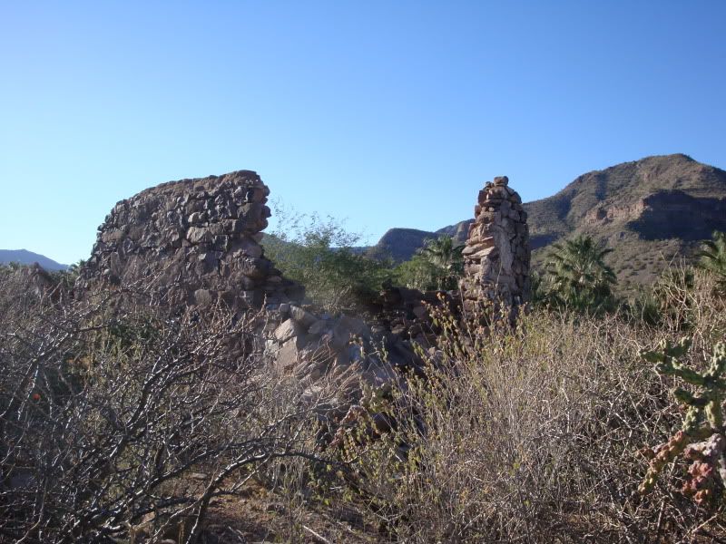
---------------------------------------------------------------------------------------
looking southwest-ish . . . Isaac and Bill chatting
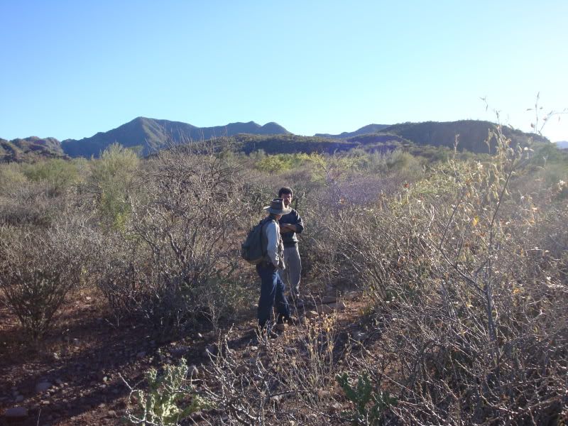
---------------------------------------------------------------------------------------
closeup along the north wall. The arroyo is to the right of the photo. The camera looks west.
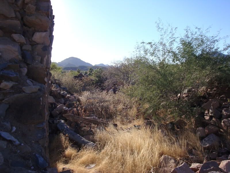
-----------------------------------------------------------------------------------------
more closeups
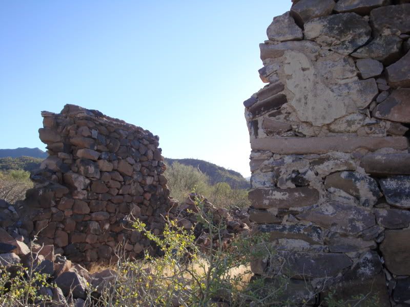
------------------------------------------------------------------------------------------
shows some of the attached walls. I think Ed Vernon describes these as padre’s quarters.
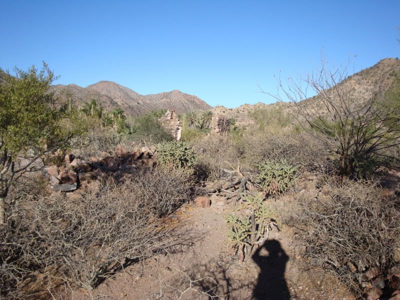
------------------------------------------------------------------------------------------
more of the nearby wall ruins
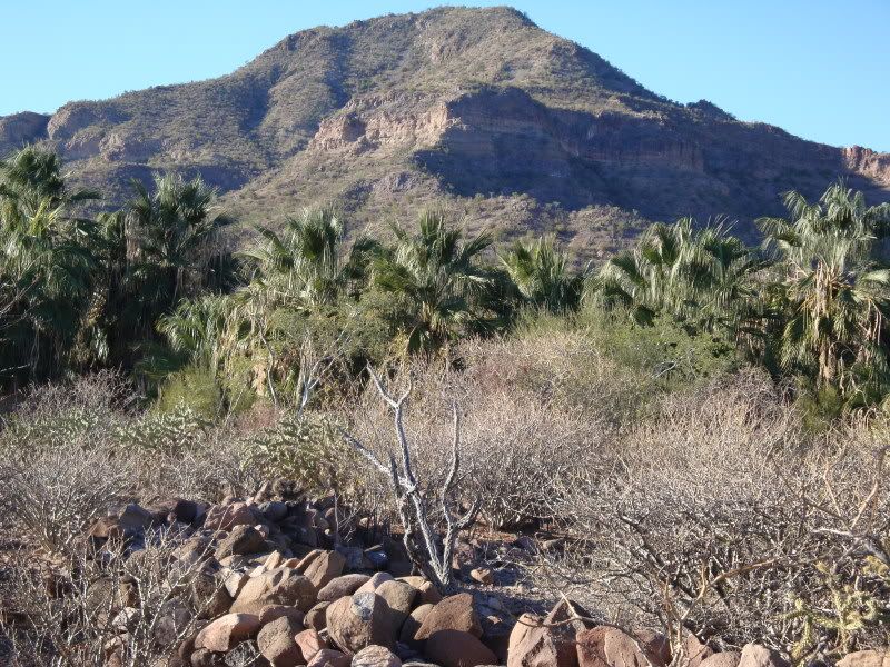
------------------------------------------------------------------------------------------
THANK YOU BAJA AMY!
|
|
|
David K
Honored Nomad
        
Posts: 65430
Registered: 8-30-2002
Location: San Diego County
Member Is Offline
Mood: Have Baja Fever
|
|
With this dialog and renewed interest, I think we are learning a lot about the two sites of Magdalena!
It very well could be that the ruins near San Jose were not seen, and that is why the ruins near Boca de Magdalena (at the end of the aqueduct) were
the only ones mentioned by North and Gulick... McDonald may have been talking about another chapel, closer to town... ? Or, the locals were mistaken
about the age of it being 70 (in 1950)... ?
Last night, online, I purchased the two major mission books I did not have: Zephyrin Engelhardt's 'The Missions and Missionaries of California',
Volume 1 (1908, revised in 1929)... and Peveril Meigs' 'The Dominican Mission Frontier of Lower California' (1935). This well help me have more
details on the many interesting sites in Baja, that I can share with you...
(I rewarded myself after finishing an irrigation job Friday... finally, no rain and the sun is shining, and my phone is ringing!)
|
|
|
David K
Honored Nomad
        
Posts: 65430
Registered: 8-30-2002
Location: San Diego County
Member Is Offline
Mood: Have Baja Fever
|
|
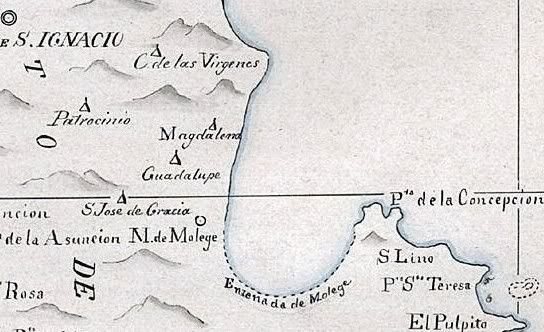
1823 Map
Here is a close up of the area around Mulege in 1823... and Magdalena is included...
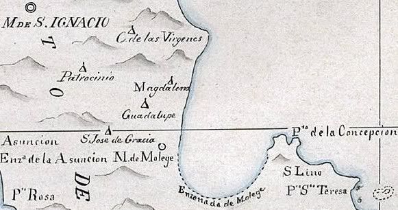
Two missions were active that year in that part of Baja (Santa Rosalia de Mulege and San Ignacio)... the Guadalupe mission had closed, but is shown as
a visita... as are others, by triangle symbols.
[Edited on 3-15-2009 by David K]
|
|
|
David K
Honored Nomad
        
Posts: 65430
Registered: 8-30-2002
Location: San Diego County
Member Is Offline
Mood: Have Baja Fever
|
|
Well, my copy of Engelhardt's 1929 Missions and Missionaries of California Vol. 1 (it's huge) arrived... and still studying it!
I have had more email exchanges with Ed Vernon, as well....
So far, we are pretty well convinced that the ruins by the pila at the end of the aqueduct (by Boca de Magdalena) were NOT the mission visita chapel,
but just some ag related activity as part of the visita.
The ruins photographed by BajaAmy, Ed Venon, and Michael Mathes, close to San Jose de Magdalena, up the canyon by the palms, IS the visita chapel.
The mis-identification started by Arthur North in 1905, calling it the mission of Santa Maria Magdalena... from the Jesuit map and records of that
'started' mission... far to the north was followed through many years... and even appears on today's AAA map and the latest publications from INAH in
Mexico!
It was part of 'Magdalena, but San Jose de Magdalena, not Santa Maria de Magdalena as North called it... and McDonald, too. 
|
|
|
David K
Honored Nomad
        
Posts: 65430
Registered: 8-30-2002
Location: San Diego County
Member Is Offline
Mood: Have Baja Fever
|
|
FIVE MONTHS LATER...
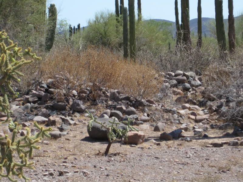
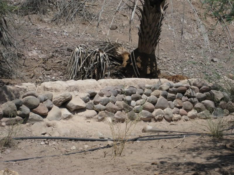
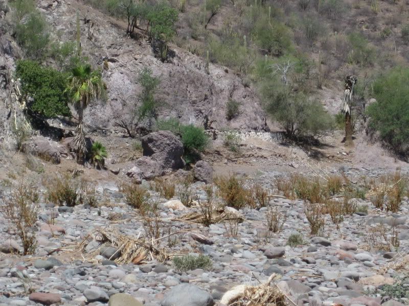
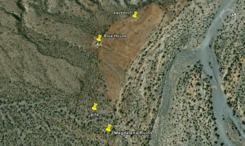
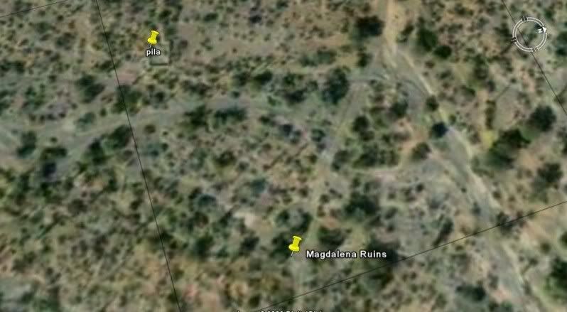
Back from the Magdalena desert site, which was more extensive than I thought from the small amount of writing about it. There are several buildings/
rooms made from cut and natural rock on both sides of the road. We did not see or hike to the pila... just plain hot and this was interesting enough
after a fun off road drive.
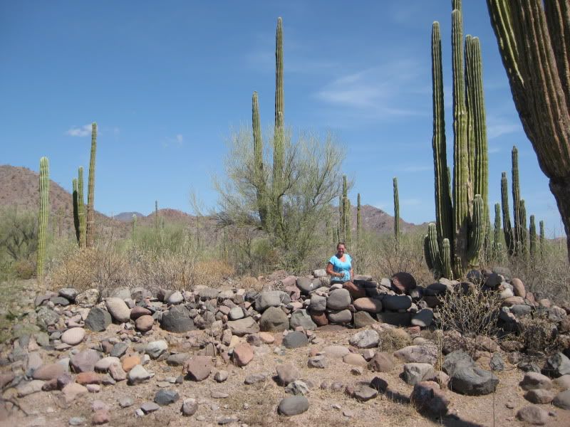
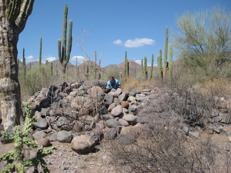
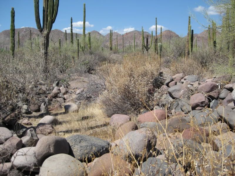
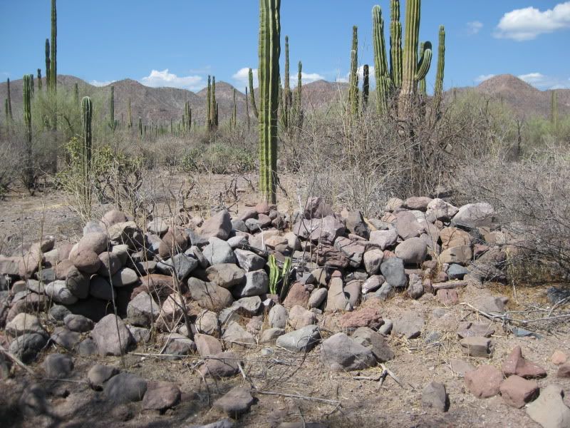
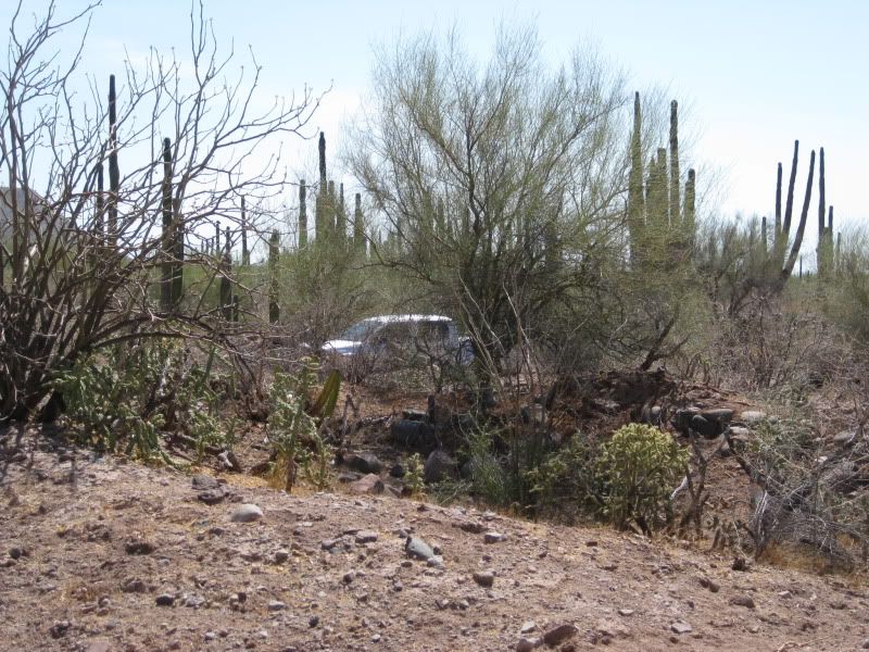
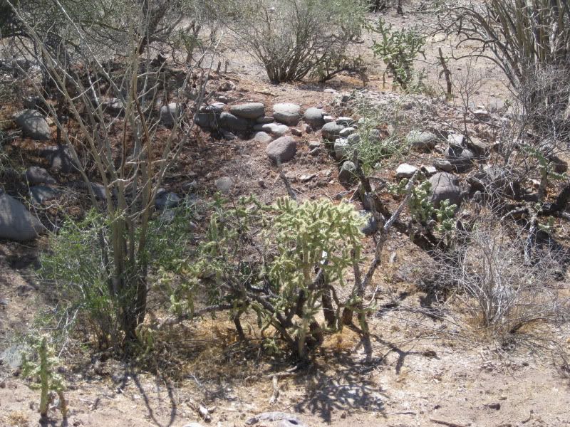
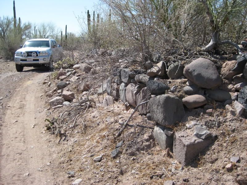
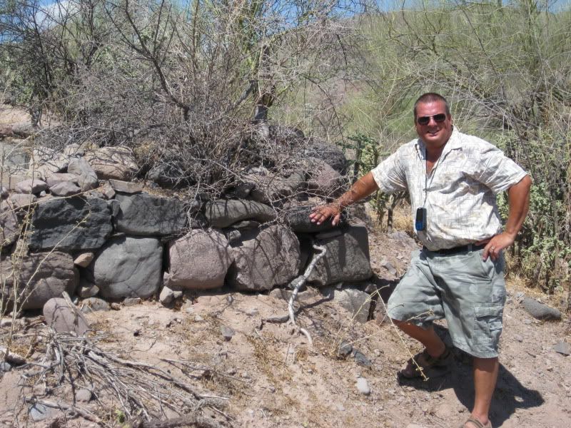
The aqueduct, 0.6 mile from the ruins:

[Edited on 8-16-2009 by David K]
|
|
|
David K
Honored Nomad
        
Posts: 65430
Registered: 8-30-2002
Location: San Diego County
Member Is Offline
Mood: Have Baja Fever
|
|
From Space! Looking WNW
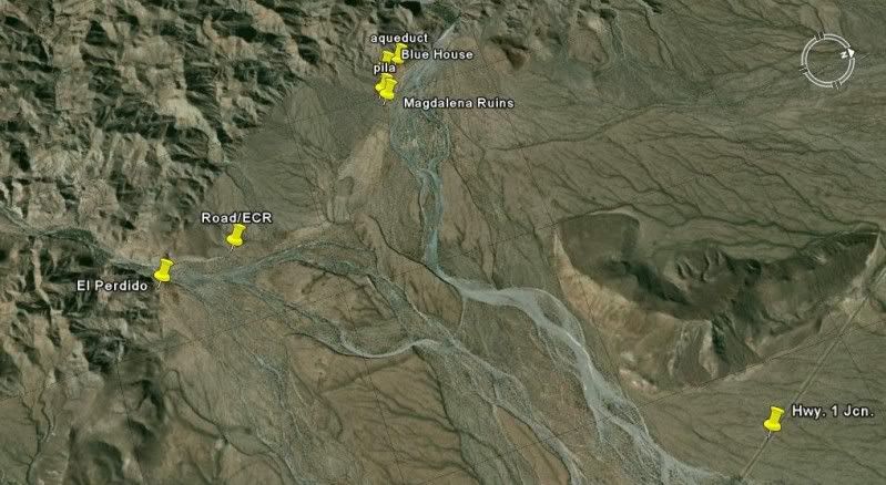
|
|
|
bajalera
Super Nomad
   
Posts: 1875
Registered: 10-15-2003
Location: Santa Maria CA
Member Is Offline
|
|
What a great thread!
\"Very few things happen at the right time, and the rest never happen at all. The conscientious historian will correct these defects.\" -
Mark Twain
|
|
|
David K
Honored Nomad
        
Posts: 65430
Registered: 8-30-2002
Location: San Diego County
Member Is Offline
Mood: Have Baja Fever
|
|
Thanks Lee... I would appreciate if you find anything in your Jesuit/ Franciscan/ Dominican records about Magdalena, to please let me know.
Why build out in the desert with a aqueduct many miles long bringing water? Is the church next to San Jose de Magdalena the visita (as Mathes states)
or the rock ruins in the desert as Gulick & Gerhard state?
If Mathes is correct, then why an aqueduct going away from the visita to the desert site? If G&G is correct, then is the church ruin in San Jose
de Magdalena post mission era construction...?
Baja Mysteries are Great!
|
|
|
David K
Honored Nomad
        
Posts: 65430
Registered: 8-30-2002
Location: San Diego County
Member Is Offline
Mood: Have Baja Fever
|
|
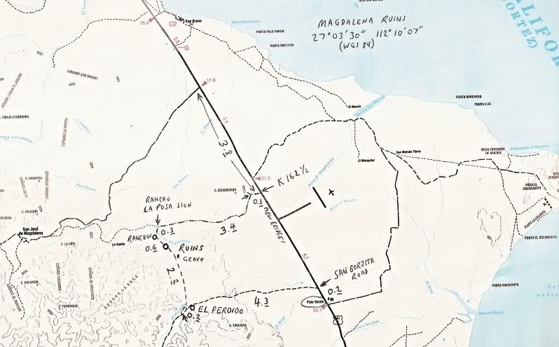
Map
The roads we took to get to (and out from) the Magdalena desert ruins... have mileages:
|
|
|
Cypress
Elite Nomad
     
Posts: 7641
Registered: 3-12-2006
Location: on the bayou
Member Is Offline
Mood: undecided
|
|
Been all over that country. You'll meet some neat folks at those isolated ranchos. You can sit back , eat some homemade cheese, some cracklins, and
swap some stories. It's a whole different world when you get 20+ miles back in the boonies.
|
|
|
David K
Honored Nomad
        
Posts: 65430
Registered: 8-30-2002
Location: San Diego County
Member Is Offline
Mood: Have Baja Fever
|
|
Magdalena on maps over the years...
1823
1871
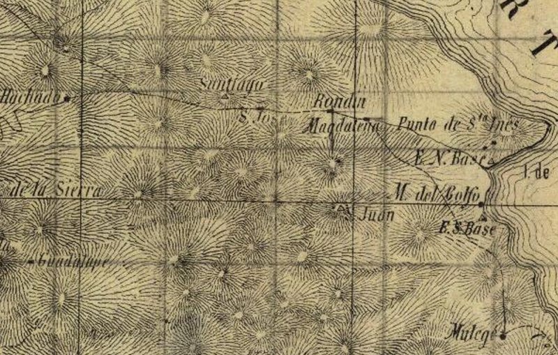
1907
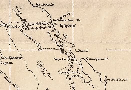
Map by Arthur North who was the first to add 'Santa Maria' to the name Magdalena, in his book... Mistaking these Magdalena ruins for the proposed
mission far to the north on the 1757 Jesuit map.
1930
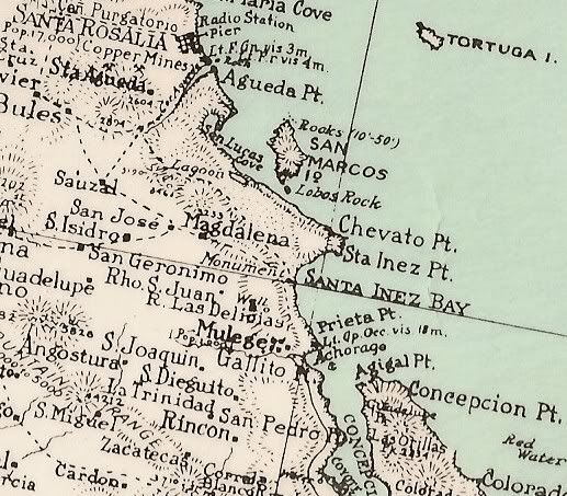
This 1930 map shows the Magdalena site east of the village of San Jose (de Magdalena)... Perhaps the clearest evidence that the church ruins by San
Jose were not the mission era Magdalena ruins!
1941
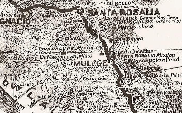
Here the title of 'Mission' added... The Auto Club continued this error on their early Baja maps, but put 'Santa Maria' in front.
1958
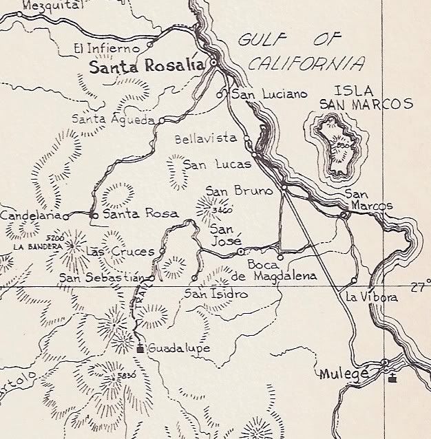
Gulick shows Boca de Magdalena and in the book gives the village a population of 40. He notes the 1774 Dominian ruins of Magdalena being 0.8 mile away
and the village of San Jose de Magdalena (pop. 370) is 4.6 miles up the arroyo.
~1965
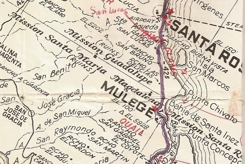
1975
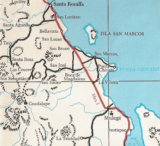
2003
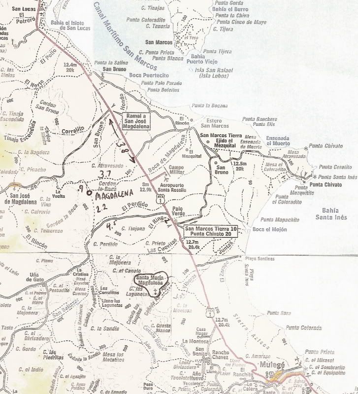
I pieced together 4 pages of the Almanac to make this map. The incorrect location of Santa Maria Magdalena is circled, about 8 miles southeast of the
true location.
[Edited on 11-2-2021 by David K]
|
|
|
Neal Johns
Super Nomad
   
Posts: 1687
Registered: 10-31-2002
Location: Lytle Creek, CA
Member Is Offline
Mood: In love!
|
|
Coming from a visit to abandoned Mission Guadalupe, one of our guys snatched a raw fresh garlic out of a field in San Jose de Magdalena (the garlic
capital of Baja), ate it, and it sure woke him up!
My motto:
Never let a Dragon pass by without pulling its tail!
|
|
|
David K
Honored Nomad
        
Posts: 65430
Registered: 8-30-2002
Location: San Diego County
Member Is Offline
Mood: Have Baja Fever
|
|
The mystery of the correct visita location and the mistaken name (Santa Maria Magdalena) has us looking at the several possibilities for the error...
1) In 1905/6 Arthur North camped at the Magdalena desert ruins... Locals rode by, returning to San Jose de Magdalena from Mulege, and told him those
were the 'Magdalena' ruins.
2) North knew of the Jesuit map (1757) and mission list (1745) that both mentioned a mission called 'Santa Maria Magdalena', to the north... the map
showed it far beyond San Ignacio and south of Bahia de los Angeles.
3) "Magdalena" to North was the mission site he was at, so he documented this site near Mulege as being the Jesuit mission of Santa Maria Magdalena.
4) Marquis McDonald photos and documents the site in 1949 calling it Santa Maria Magdalena. He also mentions the old church in San Jose de Magdalena
looking like mission-era construction, but learns from locals it is about 70 years old (~1879). That makes it a post mission period church.
5) Howard Gulick/ Peter Gerhard in the mid 1950's describe the desert ruins as the Dominican 'Magdalena' visita built in 1774. No mention is made of
the old chapel in San Jose de Magdalena. Gerhard & Gulick are very careful with their facts and details in the Lower California Guidebook.
6) Michael Mathes in 1967 photographs the chapel in San Jose de Magdalena and calls it the Dominican visita from 1774. He doesn't mention the desert
ruins.
7) Ed Vernon in 2002 also photographs the same chapel and doesn't visit the desert ruins.
8) Dave Werschkul in 2003 visits both the desert ruins (calls it Santa Maria Magdalena) and the San Jose de Magdalena chapel.
CONCLUSION:
It seems it was Arthur North who applied the proposed mission name to the north 'Santa Maria Magdalena' to this site... Authors and map makers have
since called the desert site by this wrong name.
So, is the derert ruins the true Dominican visita (as stated in Gerhard & Gulick) or is it the site in the valley by San Jose de Magdalena per
Michael Mathes? Why did Mathes not mention the desert ruins, 5 miles away? Did he not find them or ignored them?
If the desert site is the true visita location, then why there? Why build a 5 mile long aqueduct to bring water there when the location up the canyon
in the valley (where San Jose de Magdalena is) has water and is so appealing compared to the cactus coverd location?
A TRUE BAJA MYSTERY!
|
|
|
David K
Honored Nomad
        
Posts: 65430
Registered: 8-30-2002
Location: San Diego County
Member Is Offline
Mood: Have Baja Fever
|
|
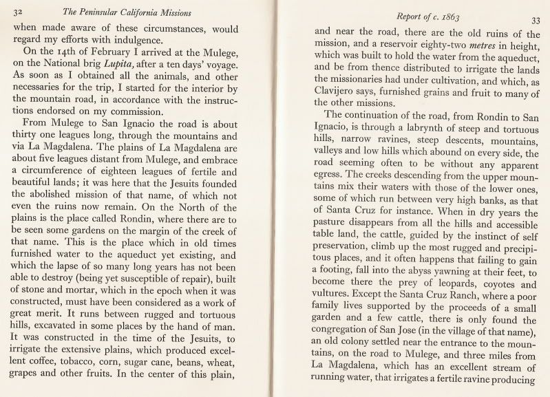
More on Magdalena from 1863
Found this in Francis Weber's 'The Peninsular California Missions 1808-1880' pages 32-33... from an 1863 report by Sebastian Viosca, the United States
Consul at La Paz.
To counter the claim that the site is of Jesuit origin, a letter from the Franciscan Padre in 1772 makes the first statement about developing
Magdalena with irrigation having just learned of it from the Indians (Palou's letter added below).
Here is the two pages from Weber's book...
[Edited on 8-16-2009 by David K]
|
|
|
| Pages:
1
2
3
4 |

